
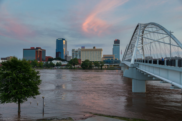
This is a shot of the swollen Arkansas River, at the base of the Clinton Presidential Library in downtown Little Rock. The small bridge here usually connects to a small island, which was completely underwater. This was taken before most of the flood waters made it to Central Arkansas. When the river crested yesterday in Little Rock, that bridge was fully submerged.

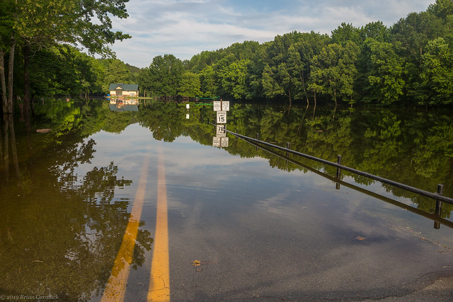
Flooding didn't just occur along the Arkansas River, other streams and rivers that flow into the Arkansas were flooded with back-flow. The Little Maumelle River was flooded, and completely inundated Pinnacle Mountain State Park. This calm lake is actually usually a field, along with a parking lot and playground. Everything was under several feet of water.
The Little Maumelle River also flooded a few other places in west Little Rock, including the football field at the Arkansas Baptist Preparatory School.

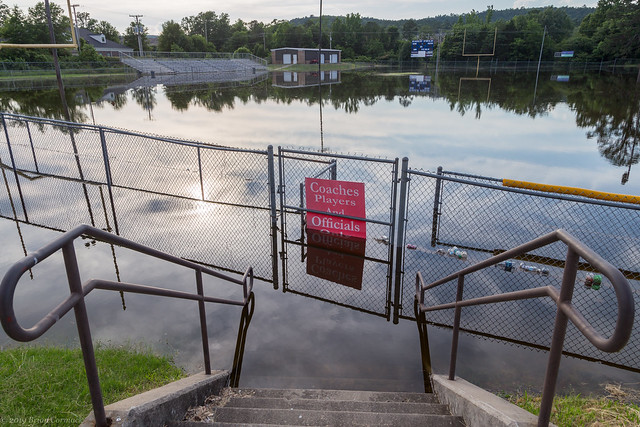
And the baseball fields, also completely flooded:

The flooding was strange, in that it is a statewide disaster but one so closely and narrowly confined. Last weekend I took Jonah to visit the Funland Amusement Park at Burns Park in North Little Rock, which was open despite over half of Burns Park being closed due to the flooding. It's weird to see a disaster, but then once you get to higher ground there doesn't seem to be anything wrong.
In downtown North Little Rock, the river was taking over Riverfront Park (which wasn't really riverfront anymore, I guess it should be River-under Park).
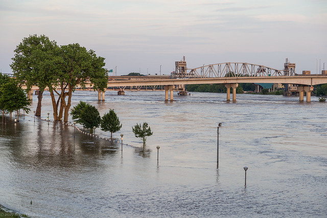

This is the view looking towards the Little Rock skyline by the Broadway Bridge.

And for a comparison, here's a shot taken from about the same spot a few years back, when the river wasn't as high:

And a closer view of the muddy waters passing under the bridge:

There was a pretty nice sunset, as the sun dropped below a large thunderstorm off in the distance (but unfortunately, the storm was actually over the Dardanelle area, where a levee along the river had breached a few days before).

The sunset lit up the sky above the downtown skyline, with a soft pink that was reflected in the muddy floodwater.
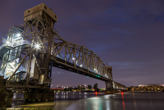
The Junction Bridge remained open during the flooding, which provided a great and up-close view of the flood waters. It was a little unnerving having the river be that high and that close to the bridge. You could definitely hear a dull roar coming from the swiftly flowing water.

For another comparison, here's a shot taken in April from the bridge. The river was much calmer back then.

The high waters rushed by the USS Razorback submarine, which looks slightly blurry in this shot since it moved so much during the long exposure.
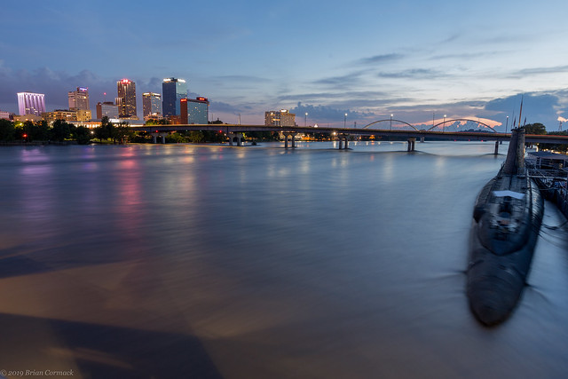
The submarine is part of the Arkansas Inland Maritime Museum, which was obviously closed as it was slowly engulfed by the river. The foreground of this shot is the parking lot, which was under several feet of water. It was reassuring to see that the seawall in North Little Rock was keeping the floodwater from stretching further into Argenta.

A few nights later, I headed back downtown to get a few shots right before the river crested. I drove behind Little Rock City Hall and went by the Broadway Bridge again.

And for another comparison, a view of the Broadway Bridge back at normal river levels:

And a wider shot, as the flood waters swamped the trees that grow along the riverbank.

And then a view of the floodwaters at the Junction Bridge, taken just after sunset.

And for comparison, a shot taken from nearly the same spot last year. The barge bumpers by the bridge are completely submerged, with the red lights on the far bumpers still shining even though they are nearly underwater now.

And another view of the bridge, which was not showing a light display during the flooding.
And another comparison view, of a shot taken a few years ago. You can see the barge bumpers here which are still underwater.

And one last shot - of the trees along the riverbank. They are usually rooted in solid ground, but were being immersed in floodwater. I got a few pictures while being attacked by mosquitoes, which unfortunately were not carried away by the floodwaters.


No comments:
Post a Comment