Thursday, November 3, 2022

Fall In The Ozarks - Part 1

A few weeks back I made a trip to the Ozarks with my nephew J.T. He wanted to get some senior portraits done, and being the smart kid that he is, decided to have them taken in one of the most photogenic places in the state. So we drove up into the mountains, stopping at a few favorite spots. The first was Haw Creek Falls, which was just a sad trickle since we've barely had any rain for awhile. But we managed to get a few portraits done along the creek, and headed over to the old Fort Douglas school. The school was built in 1946 and sits along the Ozark Highlands Trail.

Untitled

Just down the road is the old Hwy. 123 bridge over Big Piney Creek. The narrow one-lane bridge was built in 1931.

Big Piney

From there we followed a nice little dirt road that runs alongside the Big Piney. It was sunny, so I tried a few shots with the infrared camera:

Untitled

Untitled

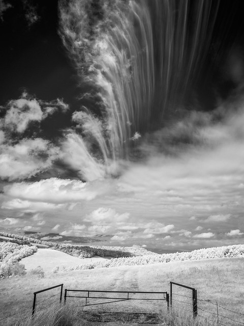
We got back on the paved roads but soon made a quick stop by this field, which had some fall colors and interesting clouds.

Untitled

PA220030

From there we followed Hwy. 123, which might just be one of the curviest roads in the state. The curves and switchbacks are the most notable around Sam's Throne, a great overlook deep in the Ozark National Forest. It is a great spot, and was unusually crowded that day. I know it was a Saturday and people were out to look at fall colors, but I had never before seen that many people there.

IMG_0648

IMG_0655

PA220040

One of the reasons that it was crowded was because a couple decided to get married right there at the overlook. It is a beautiful spot, and definitely provided a wonderful backdrop to their nuptials. The only downside was that it was incredibly windy that day. The gusts were so strong that it seemed like they could easily push someone over the edge of the bluff. Luckily neither the bridge or groom were blown away during their wedding. This shot was taken while all the other hikers and rock climbers politely stood off to the side, so as to not disturb the wedding.

IMG_0767

Sam's Throne was actually named after someone named Sam Davis. According to legend, back in the 1820s Sam claimed that his sister had been kidnapped. In his anger, he would climb out onto this rocky outcrop and give fiery sermons to all his neighbors within earshot. Legend also states that Sam also buried some gold on Sam's Throne, although nothing has ever been found in the years since (that we know of).

IMG_0768

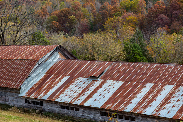
We got back in the car and headed towards the Buffalo River. Along the way I stopped to get pictures of this old and rusty structure. I'm guessing it was once a chicken house?
IMG_0774

We drove through Jasper and then headed towards Erbie. Along the way we stopped again to get a picture of a neat old barn.

PA220051-2

In contrast to the crowds at Sam's Throne, there weren't very many people at Erbie. Just a handful of people were at the campground, which sits above the Buffalo River.

IMG_0781

Erbie is home to the Parker-Hickman Farmstead, a collection of old buildings that has been preserved by the National Park Service. The old house here is actually the oldest structure still standing within the boundaries of the Buffalo National River. It was built sometime between 1847 and 1849. The lean-to on the side was added in the 1920s and served as a country store. The home was occupied until 1978.

IMG_0798

PA220070

From there we crossed the Buffalo River at the Erbie low-water bridge, and then headed to our campsite. After getting tents and hammocks set up, we headed back to the Buffalo River for a few more pictures. We went to the Steele Creek put-in, and then started the hike to an overlook atop Roark Bluff. I've done this hike a few times before, and it is somewhat short but steep in places. But this was the first big hike I've taken since I caught Covid a few months ago. I haven't completely recovered, and still have some long-Covid symptoms like fatigue, shortness of breath and chest pains. It was rough, I'm sad to admit. I had to make many stops to rest as we headed uphill (my nephew, bless him, was kind and patient as I had to stop and constantly catch my breath).

It didn't help that we ended up missing the overlook and hiked way up the hillside. We had to backtrack and finally made it to the overlook just after sunset. There was just barely enough light to get a few pictures. I managed to get a few portraits of J.T. (which thankfully turned out and were in focus!) and then got a few pictures of the view before we lost all the light. After this, we hiked back to the car in the dark (luckily we did have flashlights with us). 

IMG_0827

Wednesday, October 26, 2022

An Abandoned House on Kanis

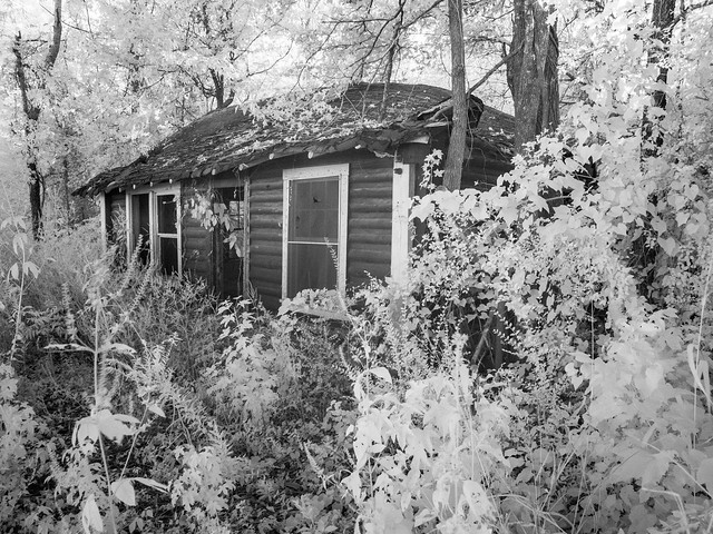
I drive down Kanis Road in far west Little Rock quite often, since it's the most direct path that connects my work to Elliott's daycare. There are a few abandoned buildings that still sit along the road, which has gotten more and more traffic as the city is expanding and adding more lanes to it. There is one house, right by Baker Elementary, that looks like it's been abandoned for years. I don't know much about the house, but it will probably be torn down soon to make way for a new car wash, gas station or apartment complex.

PA140014

Tuesday, October 18, 2022

Colorado - Part 4

Later that day we drove back across Colorado, heading towards Estes Park. It ended up being a long drive, thanks to construction and traffic. But we finally arrived at the YMCA of the Rockies, a sprawling camp on the edge of Rocky Mountain National Park. We stayed at a cabin there, and for the record, yes it was fun to stay at the YMCA.

The next morning we loaded up the kids and headed into the park. Luckily we heard in advance that you need a permit to enter the park, and we were able to get one before they were all gone. Our permit was only for part of the park - we didn’t get the Bear Lake Road permit (I guess it’s the most popular part of the park). We weren’t able to spend a lot of time in the park, since we had a 6 and a 2 year old with us, but we still managed to see some neat stuff there.

We drove in and made a quick stop at the Beaver Ponds Trail, a short and kid-friendly walk along a wooden boardwalk that passes by wetlands that were created by beaver dams on Hidden Valley Creek (the information signs didn't mention if any salad dressings were found here in this Hidden Valley).

IMG_0438

Rocky Mountain National Park is known for its wildlife, and on a visit you can see elk, bears, moose, mountain lions, coyotes and pikas. We stopped to get a picture of this elk (from a respectful distance), before it got tired of all the paparazzi and headed deeper into the woods.

IMG_0455

We also made a few stops to try to get pictures of the great fall colors. The aspens were beautiful there...

IMG_0461

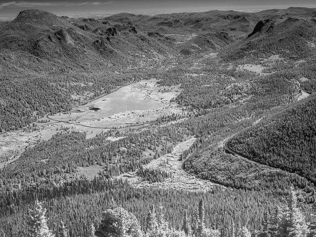
We then started driving along Trail Ridge Road, which runs for about 50 miles through Rocky Mountain National Park. But for being a short drive, it definitely has some amazing scenery. We stopped at the Many Parks Curve Overlook, which sits on a hairpin curve on the road. The overlook sits at an elevation of 9,691 feet and provides an expansive view of Horseshoe Park, Moraine Park, Estes Park, the Fall River Pass, Bighorn Mountain, Deer Mountain, and Longs Peak (the highest mountain in Rocky Mountain National Park). It was bright and sunny during our visit, so I tried a few shots with the infrared camera.

P9260017

P9260019

P9260021

Further down the road was the Rainbow Curve Overlook, which sits at an elevation of 10,829 feet feet. From this viewpoint was a breathtaking view of the Hidden Valley, Horseshoe Park, Alluvial Fan, Fall River, the Beaver Ponds, and several prominent mountain peaks. The tall mountain in this shot is Bighorn Mountain, with an elevation of 11,463 feet.

IMG_0493

And the view in infrared:

P9260026

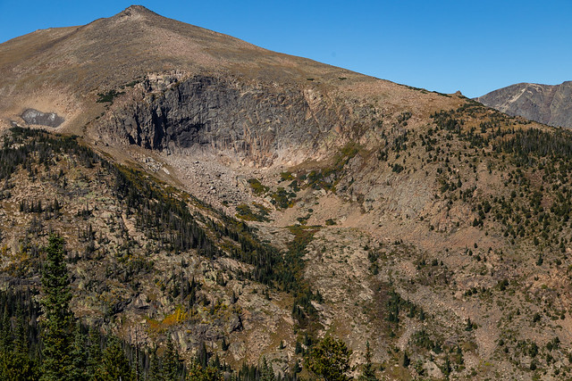
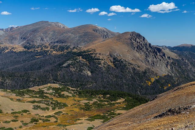
Trail Ridge Road has the distinction of being not just the highest road in any national park in the US, but also the highest paved road in the country. The road climbs to an elevation of 12,183 feet, high above the tree-line where the landscape resembles more of an arctic tundra. The views from the road were literally breathtaking - thanks to a combination of the scenery, the elevation and those pesky post-Covid symptoms.

IMG_0504

This was the view from the Lava Cliffs Overlook, which sits at an elevation of 12,080 feet. For a comparison, I live in Little Rock which sits at an elevation of only 335 feet. The tallest point in Arkansas is Mount Magazine, at 2,753 feet.

IMG_0510

We made it to the Alpine Meadow Visitor Center, which sits at an elevation of 11,796 feet and is the highest visitor center in the National Park system. At this point, we were all kinda struggling with altitude sickness. Especially the little kids, so from here we decided to turn back and head back to our cabin in Estes Park. But along the way we made one last stop at an overlook for a few pictures...

IMG_0517

This would be the end of the trip. We all woke up before sunrise the next morning and drove into Denver to make our flight home. Which would prove to be an interesting adventure. Our original flights were with Frontier airlines, which does offer a direct service between Little Rock and Denver. But they cancelled our return flight, and instead booked us on a flight that would go from Denver to Las Vegas, and then after a five hour layover we would fly home to Little Rock. That would have meant that we arrive at home around 9 PM, which didn't seem that great since we were traveling with a toddler. We managed to find another flight with American Airlines, which did have a connecting flight with a much shorter layover in Dallas.

So we got to Denver and made it through security with enough time to make our flight to Dallas. But of course that flight was delayed, so we landed in Dallas just as our connecting flight was boarding. We literally ran across the airport and just barely made it. Both kids did great on the flights, and we finally arrived in Little Rock. But the drama wasn't over. After finally getting to our car, we found the battery was dead. Luckily the Little Rock airport provides a service that will jump start your car for you if you are stranded. After that we made it home safe and sound. Thank you Little Rock airport!

Monday, October 10, 2022

Colorado - Part 3

Early the next morning, my Aunt and I snuck out of the place we were all staying in Buena Vista (hopefully without waking up any kids) and headed out before sunrise to try to take a few pictures. We managed to make it to the nearby Collegiate Peaks Overlook to catch the apenglow on the 14,204 foot Mount Princeton.

IMG_0211

Mount Princeton is part of the Collegiate Peaks, a section of the Sawatch Range that contains some of the highest mountains in the Rockies. It gets its name because several of the mountains are named after famous universities (like Princeton, Yale and Harvard). I looked to see if any mountains were named after my alma maters (the University of the Ozarks and UALR) but had no luck. But we drove back on the same road that went to St. Elmo to get a few pictures of some waterfalls and aspen trees. This was the view as we approached Mount Princeton.

IMG_0232

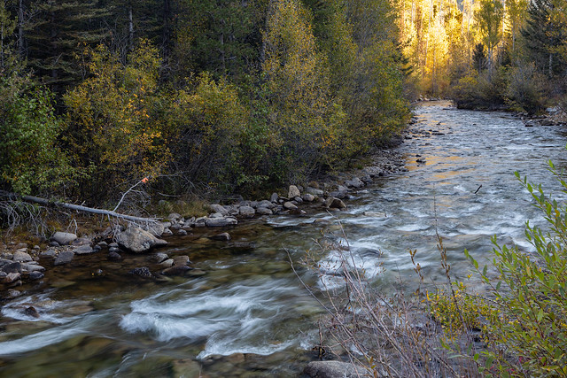
The road follows Chalk Creek, a stream that starts out at the Continental Divide and then flows 27 miles between Mount Princeton and Mount Antero before flowing into the Arkansas River. Along the way the creek tumbles over Cascade Falls. We stopped to get a few pictures of the creek as it tumbles down the mountain.

IMG_0252-3

IMG_0255

The road ran paralell to the clear water of the creek, and it was hard to not constantly stop every five feet to take pictures...

IMG_0317

IMG_0321

It is a scenic little stream, especially with the aspens trees that were growing along the way.

IMG_0332

We needed to head back to our rental place because we had to check out that morning, but it was hard to turn back. The creek was scenic, and aspen trees with vibrant fall colors lined the road. We made one last stop at this large stand of aspen.

IMG_0346

IMG_0353-2

IMG_0356

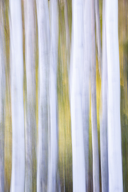
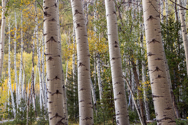
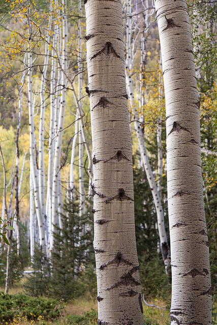
Aspen trees are really beautiful and unique when seen up close. I wish we could grow them in our backyard at home.

IMG_0364-2

A stand of aspens like this are actually one giant organism, all connected together through their roots. In fact, scientists believe that the largest and oldest organism in existence is a stand of aspens in Utah.

IMG_0371

IMG_0376-2

Thursday, October 6, 2022

Colorado - Part 2

The Arkansas River gets its start near the town of Buena Vista in Colorado, starting from snowpack in the Sawatch and Mosquito Mountain ranges. It was kinda neat to drive by the river when it was just a stream, small enough that you could jump over it if you wanted. From here it flows for about 1,400 miles towards the Mississippi River, where it definitely gets too big to jump across. We spent the next few days in Buena Vista, which sits along the Arkansas River and is a popular place for whitewater rafters.

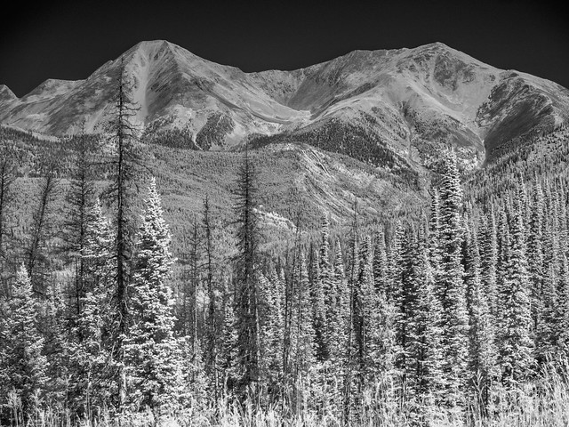
We didn’t go rafting this trip, but the next day we went out and tried to do a little sightseeing. We drove over to Monarch Pass, which sits at an elevation of 11,312 feet along the Continental Divide. The plan was to ride the gondola to the top of the mountain with Jonah, but unfortunately it had already closed for the season (we missed it by just a few days). So to make up for it he got to pick out a souvenir from the gift-shop. This was the view from the parking lot, taken with the infrared camera:
P9240002

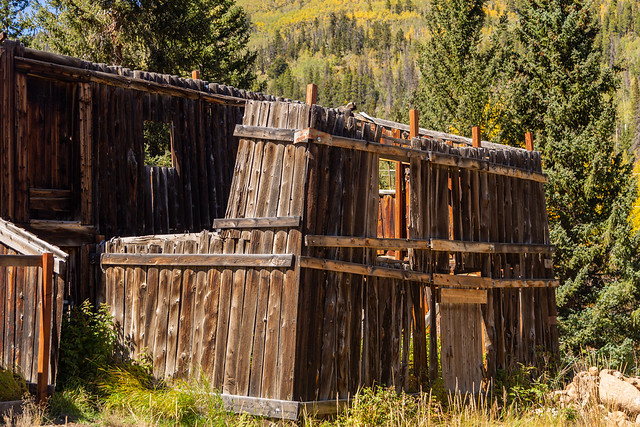
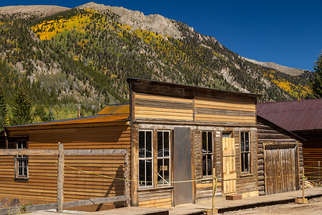
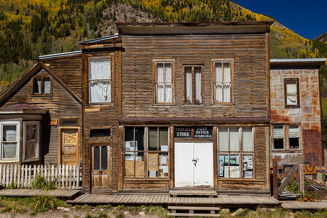
From there we headed downhill and drove to the ghost town of St. Elmo, which was founded in 1880 and at its peak had a population of about 2,000 people. Most of the people who lived here worked in the nearby gold and silver mines. But in the 1920s, the mines began to close and the town’s population began to dwindle. A few people still live here, but most of the buildings are empty (although mostly well-preserved). There are even a few shops open that cater to tourists during the summer.
IMG_0030-2

For being a ghost town, it was surprisingly busy and crowded there. I guess because there was a festival in Buena Vista that weekend? The dirt road that went through town was crowded with parked cars. We joined them and had a look around. This is the St. Elmo town hall and jail, which is a restored version of the original building that was built in the 1890s but was burned in a fire in 2002.

IMG_0034-3

St. Elmo is considered to be the most well-preserved ghost town in Colorado.

IMG_0039

IMG_0041

P9240007

Having two young kids means that we've spent many hours watching children's television. Luckily both kids have loved Sesame Street. So I couldn't help but think about Elmo's World while we were there. I wonder if Mr. Noodle lived in any of these houses?

IMG_0062

IMG_0066-2

There is a small fire station there, and whoever named it must have had a good sense of humor (or at least some good 80's nostalgia).

IMG_0070

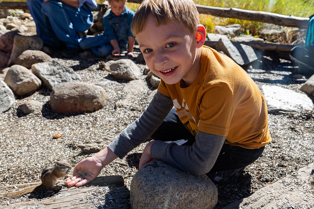
Jonah didn't seem too interested in looking at old buildings, but he did love one of the main attractions in St. Elmo - the chipmunks! The general store sells seeds for just 50 cents, and there is a designated feeding area where if you stand still, chipmunks will run up and eat the seeds out of your hands.

IMG_0079

IMG_0085

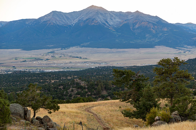
After that it was time to head back to Buena Vista so we could get ready for the big wedding that evening. My cousin and his bride had picked out a beautiful spot for their ceremony, which was at an overlook that provided an expansive view of the Arkansas River Valley and Mount Princeton.

IMG_0190-2

IMG_0201

And someone was even nice enough to leave an old sofa out there!

IMG_0186