Showing posts with label Ghost Town. Show all posts

Wednesday, August 7, 2024

Road Trip: Cuervo

Sadly, we were nearing the end of our road trip. We packed up the car and left Durango, driving back into New Mexico. We drove through Albuquerque (resisting the urge to stop and visit Los Pollos Hermanos), and then started heading east on I-40.

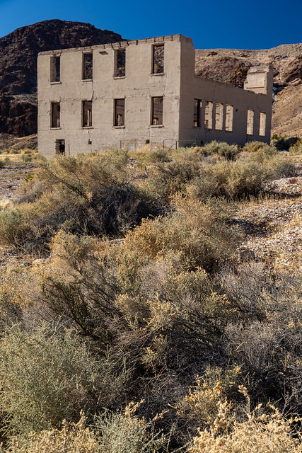
In New Mexico, I-40 runs along the same path that Route 66 used to take. The freeway exits now lead to small towns that were once bustling stops for drivers traversing the Mother Road. One of those small towns is Cuervo, which is now nothing more than a ghost town. The town was established in 1901 as a stop along a railroad route that connected Texas to California. When Route 66 passed through Cuervo, the town grew and added a few gas stations, churches, hotels and schools. The town's population would peak at around 300 people.

Most Route 66 cities began to decline when they were bypassed by I-40. But in Cuervo, the interstate was built right through the middle of town, dissecting it in half. Cuervo's population dwindled, and most of the buildings were abandoned. They still stand, in view of the constant stream of indifferent traffic that speeds by on the freeway.

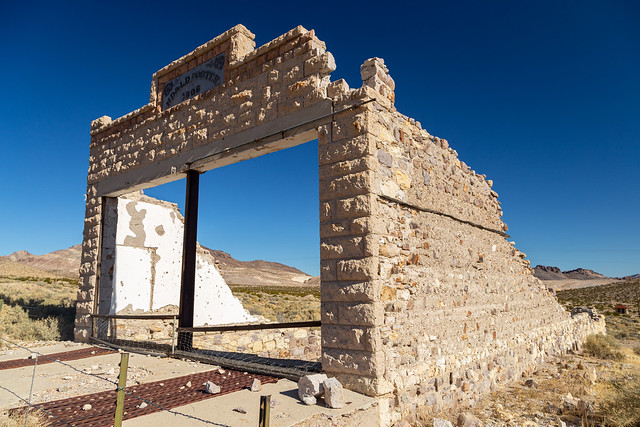
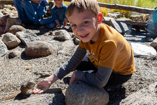
I've been through Cuervo three times before, on road trips in 2007, 2010 and 2015. I looked back at what I wrote on this blog about those visits, and there was one word that was used to describe Cuervo in each of those posts: creepy. There is a weird vibe in the town, like you're being watched or that something nefarious is lurking around nearby.

Here's a shot of Cuervo from 2007, of the odd collection of junk left behind in an abandoned house.

Creepy

In 2010, we stopped and went inside the old abandoned school:

Recess

And in 2015, I peeked inside this abandoned house: 

Cuervo

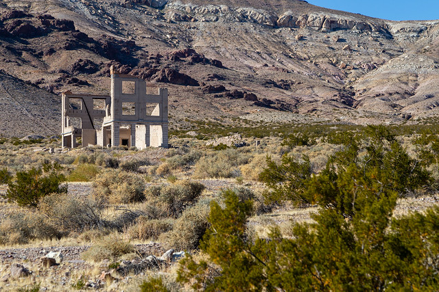
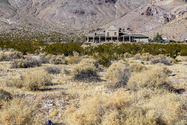
There is an old catholic church in Cuervo, which was built during World War I. Somehow it's still in decent shape (the roof looks like it was replaced recently). I quickly got out to take a few pictures:

IMG_6642

P7020233

Right next to the church is an abandoned house (it's the one in the photo from 2007 that had the random hairdresser chair). I've taken lots of pictures of that house in the past, like this one from 2015:

Cuervo

But I didn't take any pictures this time. The old house was completely covered with graffiti and vandalism. It seemed like the entire shell of the old house was covered with spray paint. I got an uneasy feeling about it, and didn't want to linger too long. So I hurried back to the car, and then headed onto the freeway. We quickly put Cuervo in the rearview mirror, joining the rest of the traffic on the freeway that passes apathetically through the remains of this sad old town.

Thursday, August 1, 2024

Road Trip: Alta

The ghost town of Alta sits deep within the San Juan Mountains, at a lofty elevation of 11,800 feet. Hundreds of people used to live here, but only a few scattered buildings remain. Most of them are barely standing, their wooden boards bleached and weathered. Many of the buildings have collapsed, leaving behind nothing but piles of wood and debris.

Alta was established in 1878, and was the company town for the Gold King Mine. At one point, Alta had a general store and a school, along with several homes. This building, which looks like it could collapse at any moment, was once the mining company office and store.

IMG_6254

P6300176

IMG_6281-2

Looking through the window, you have a great view of Mt. Wilson.

IMG_6282

IMG_6287-2

P6300180

P6300184

Next to it is the old boardinghouse. It looks like it has been renovated recently because it is in much better shape than the other structures here. It was built in 1939.

P6300178

IMG_6255

The mines operated until 1945, when a fire in one of the shafts ceased operations. The town started to wither away after that, the buildings left behind as a weary and fragile reminder of the San Juan's mining history.

IMG_6312-2

P6300191

It must have been hard to live here back in the olden days. But it would have been totally worth it, for sure. The views from Alta are breathtaking. Here you have a grand view of Mt. Wilson, which stands at 14,252 feet.

IMG_6297-Edit-2

The mountain is named after A.D. Wilson, a topographer who was among the first to reach the summit of the mountain (and not named after the neighbor from Home Improvement or the volleyball from Cast Away, apparently).

IMG_6310

If it looks familiar, Mt. Wilson is the mountain shown on the logo for Coors beers.

P6300187-Edit-2

After that it was about time to start heading back to Durango. Luckily the drive was just as scenic and amazing on the way back.

Untitled

P6300201

Sunday, December 31, 2023

Rhyolite and Vegas

After we crossed into Nevada, we were just a few miles from the ghost town of Rhyolite. After gold was discovered by the nearby Bullfrog Mountain, the town quickly sprung up in 1905. But by 1916, it was all but dead.

But at its peak, Rhyolite boasted a population of about 7,000 people. And it also featured "concrete sidewalks, electric lights, water mains, telephone and telegraph lines, daily and weekly newspapers, a monthly magazine, police and fire departments, a hospital, school, train station and railway depot, at least three banks, a stock exchange, an opera house, a public swimming pool and two formal church buildings."

IMG_0530

This was the former school building, which was built in 1909 and had room for 250 students. The school would close in 1911 after most families moved away after the gold mines began to decline.

IMG_0538

IMG_0540

Nearby was the ruins of the old Porter Brothers' Store, which was built in 1906. According to the sign in front of the building, "it was the go-to destination for Christmas shopping. This was due in part to its amazing displays that rivaled those of the department stores in major cities. In fact, the store was the largest employer of people in Rhyolite aside from the mines. Unfortunately, even the popular store was not immune to the downturn that would decimate Ryholite's businesses; it closed in 1910."

IMG_0551

One of the most prominent buildings in Ryholite was the Cook Bank Building, which was built in 1908. The three-story building cost more that $90,000 to build (which would be about $2.9 million in today's dollars) and featured marble staircases and mahogany accents. But it was shortlived, the bank closed in 1910.

IMG_0566

The best preserved building in Rhyolite is the train station, which was built in 1908 for the Las Vegas & Tonopah Railroad. But the station opened right at the time that the town began to decline, and within months of its completion the station saw more people leaving than it saw arriving.

IMG_0614

The railroad ceased operations in 1919, but the station got new life in the 1930s when it was used as a casino and brothel for a few years. In the 1960s, it opened as a museum and gift shop. It was empty on our visit, surrounded by a tall fence that made it hard to take pictures.

Untitled

Untitled

We followed the dusty dirt road to more remnants of Rhyolite's past. Here is what is called the "Miner's Cabin," although no one is sure what it was once used for. It was built around 1906, and due to its proximity to the railroad tracks and the old red-light district, it could have been used as a brothel or as offices for the railroad.

IMG_0651

Nearby were the ruins of the former jail, built in 1907. Shame that it's been marred by so much graffiti.

IMG_0690

From here was a good view looking back at the old bank building, and the tall mountains that surround it.

IMG_0668

And the old train station...

IMG_0721

Next to Rhyolite is the Goldwell Open Air Museum, an outdoor sculpture park and artist's workspace. The most prominent sculpture here is The Last Supper, which features life-size replicas of the figures from da Vinci's Last Supper. It was created in 1984 by Albert Szukalski, who draped plaster-soaked burlap over live models in order to create the ghostly figures.

IMG_0740

The same technique was used to create this piece, called Ghost Rider.

IMG_0733

And another large sculpture there was Lady Desert The Venus of Nevada by Dr. Hugo Heyrman, made out of cinderblocks.

IMG_0743

The sculpture collection was a good choice, I guess, to help us get acclimated back into the strange landscape of Las Vegas. We gassed up the car in the nearby town of Beatty and drove off.

The drive back to Las Vegas is strange. There are lost of empty stretches of desert (and as they said in Casino: "A lot of holes in the desert, and a lot of problems are buried in those holes"). Then you see some random army bases in the distance. Was it Area 51? Perhaps, the alien-themed gas stations certainly suggest it might be. We could never tell for certain, since Area 51 doesn't show up on Google Maps for some reason. But then all of a sudden you hit city, and Las Vegas looms ahead of you.

We checked into our hotel, which was in the old downtown section of the city by the Freemont Street Experience. And it is an experience. And after days of quiet solitude in Death Valley, it was a culture shock. It was loud, crowded and busy.

Untitled

Untitled

Untitled

We walked around until we saw someone dancing on the street as a "naked Trump" waving a sign saying "Make America Sexy Again." That, and the fact that we had an early flight home the next day, meant that it was time to head back to the hotel for the night. There are some things that happen in Vegas that need to stay in Vegas.

Thursday, October 6, 2022

Colorado - Part 2

The Arkansas River gets its start near the town of Buena Vista in Colorado, starting from snowpack in the Sawatch and Mosquito Mountain ranges. It was kinda neat to drive by the river when it was just a stream, small enough that you could jump over it if you wanted. From here it flows for about 1,400 miles towards the Mississippi River, where it definitely gets too big to jump across. We spent the next few days in Buena Vista, which sits along the Arkansas River and is a popular place for whitewater rafters.

We didn’t go rafting this trip, but the next day we went out and tried to do a little sightseeing. We drove over to Monarch Pass, which sits at an elevation of 11,312 feet along the Continental Divide. The plan was to ride the gondola to the top of the mountain with Jonah, but unfortunately it had already closed for the season (we missed it by just a few days). So to make up for it he got to pick out a souvenir from the gift-shop. This was the view from the parking lot, taken with the infrared camera:

P9240002

From there we headed downhill and drove to the ghost town of St. Elmo, which was founded in 1880 and at its peak had a population of about 2,000 people. Most of the people who lived here worked in the nearby gold and silver mines. But in the 1920s, the mines began to close and the town’s population began to dwindle. A few people still live here, but most of the buildings are empty (although mostly well-preserved). There are even a few shops open that cater to tourists during the summer.

IMG_0030-2

For being a ghost town, it was surprisingly busy and crowded there. I guess because there was a festival in Buena Vista that weekend? The dirt road that went through town was crowded with parked cars. We joined them and had a look around. This is the St. Elmo town hall and jail, which is a restored version of the original building that was built in the 1890s but was burned in a fire in 2002.

IMG_0034-3

St. Elmo is considered to be the most well-preserved ghost town in Colorado.

IMG_0039

IMG_0041

P9240007

Having two young kids means that we've spent many hours watching children's television. Luckily both kids have loved Sesame Street. So I couldn't help but think about Elmo's World while we were there. I wonder if Mr. Noodle lived in any of these houses?

IMG_0062

IMG_0066-2

There is a small fire station there, and whoever named it must have had a good sense of humor (or at least some good 80's nostalgia).

IMG_0070

Jonah didn't seem too interested in looking at old buildings, but he did love one of the main attractions in St. Elmo - the chipmunks! The general store sells seeds for just 50 cents, and there is a designated feeding area where if you stand still, chipmunks will run up and eat the seeds out of your hands.

IMG_0079

IMG_0085

After that it was time to head back to Buena Vista so we could get ready for the big wedding that evening. My cousin and his bride had picked out a beautiful spot for their ceremony, which was at an overlook that provided an expansive view of the Arkansas River Valley and Mount Princeton.

IMG_0190-2

IMG_0201

And someone was even nice enough to leave an old sofa out there!

IMG_0186