Friday, March 7, 2014

Oregon - Bridal Veil Falls, Multnomah Falls, Wahkeena Falls and Horsetail Falls

From Latourell Falls, we headed to the next waterfall along the Columbia Gorge Scenic Highway. Which is a great stretch of road. I think I would become very spoiled if I lived in Portland, since it's unfair to have a string of beautiful waterfalls along a short stretch of road that are incredibly easy to reach. We drove down the road and stopped at Bridal Veil Falls, which requires only a short walk down the hill to the creek and falls.

P2206228

There used to be a large mill here that diverted water from the creek, effectively draining all of the water from the waterfall. The mill ceased operation in 1930, but you can still see remnants of it in a few places around the falls. This is the view of Bridal Veil Creek, from a bridge along the trail to the falls.

P2206249-2

And a closer view of the base of the falls, taken while a light rain fell on us.

P2206266

Our next stop was the mighty Multnomah Falls. This is the tallest waterfall in the state of Oregon, with a total height being somewhere around 620 feet. It is also claimed to be the second tallest continually flowing waterfall in the country, but waterfall people will debate you on that one. No matter what, it's an amazing waterfall to see in person.

P2206312

The historic Benson Bridge, which was built in 1914 and stands above lower tier of the falls, was closed. Apparently someone or something dropped a massive boulder on it, punching a hole through the bridge. The Forest Service closed it until they can figure out how to repair it. I walked up the trail to the bridge to take a closer look. The hole in the bridge was big enough to swallow up a person, so I guess it was a good idea for them to block access.

It started pouring down rain while we were there, which combined with the considerable spray from the falls made photography a wee bit difficult. I bought an umbrella from the gift shop and feebly tried to block the rain (which didn't work. All I really accomplished was getting pictures that were partially obscured by a blurry umbrella). This is one view of the falls, taken when I just about gave up trying to battle the elements. What looks like an Instagram filter is really about a minute's worth of water on the polarizing filter.

P2206271

From there we headed to yet another waterfall, Wahkeena Falls. The name Wahkeena is a native American word, meaning "most beautiful." The falls are 242 feet tall, and the creek bounces and plunges down the side of the mountain.

P2206336

I walked up the steep paved trail that went up the hill to an old stone bridge that crossed the falls (it's about in the middle of the falls in the above picture). The spray from the falls soaked me and the camera, and none of the pictures turned out.

The next and final stop we made that day was Horsetail Falls. This is an incredibly easy waterfall to reach, since it's just about 30 feet away from the road. The 192 foot tall waterfall is aptly named since it does resemble a horsetail. But while it was easy to reach, it wasn't easy to photograph. The spray from the falls swept out like a curtain, quickly enveloping everything nearby (including my poor camera). I did manage this shot, in the one place that was safe from the mist and water (I think the tree was blocking it).

P2206377

After that it was beginning to get dark so we headed back into Portland. I know we didn't see all of the waterfalls in the Columbia River Gorge, but luckily we did have some free time later on in the trip to make a return visit.

Tuesday, March 4, 2014

Oregon - Latourell Falls

Last week, Caroline and I took a quick vacation to Portland, Oregon. It's a city that I've been wanting to visit for awhile. The city is surrounded by waterfalls, and the coast is about an hour away. Portland is also home to more breweries than any other city on the planet. So after sitting on the plane for several hours, I was more than eager to get there.

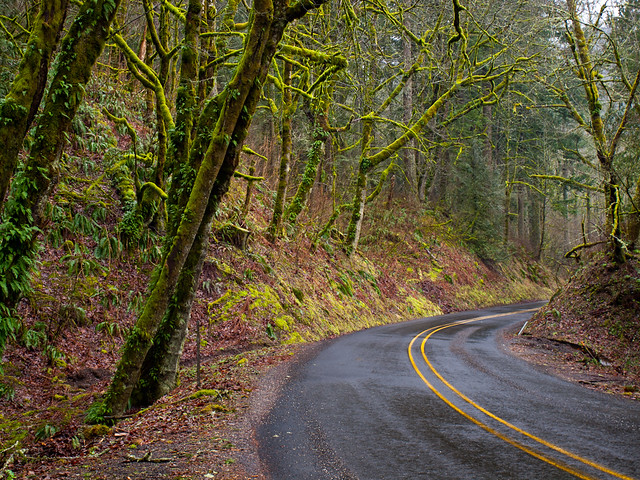
We got in late at night, but the next morning was perfect for waterfalls. A steady rain fell as we drove east from downtown towards the Columbia River Gorge. We left the freeway and then drove the Historic Columbia River Highway, which runs for 75 miles from the Sandy River to The Dalles. The road was built between 1913 to 1922, and curves and snakes through deep forests that are covered in layers of moss.

P2206129-2

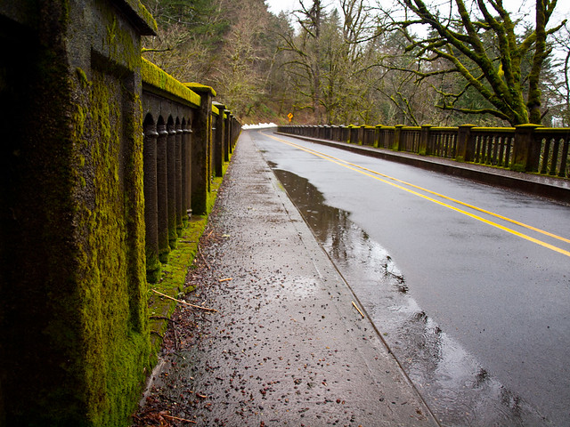
Our first stop was Latourell Falls, which you can see from the road. This is the bridge over the stream, downstream from the falls. There was moss everywhere. I'm surprised moss didn't start growing on the car while we were parked near the falls.

P2206159

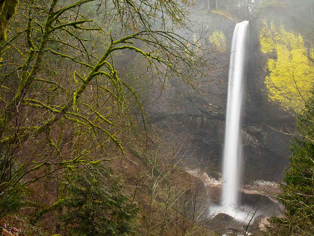
The falls are amazing, dropping almost 250 feet.

P2206162

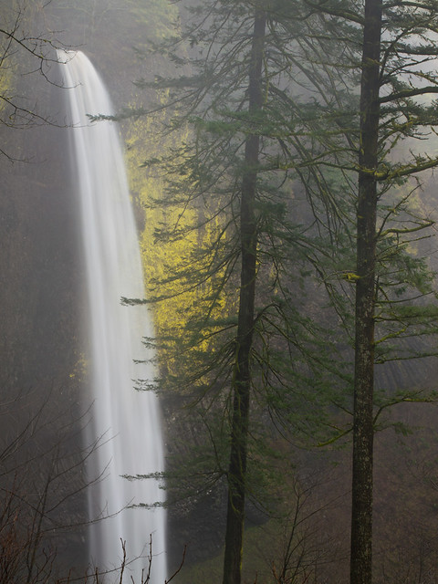
We hiked a trail that went uphill for a bit, which provided this view of the falls and the swirling fog and mist that surrounds it.

P2206182

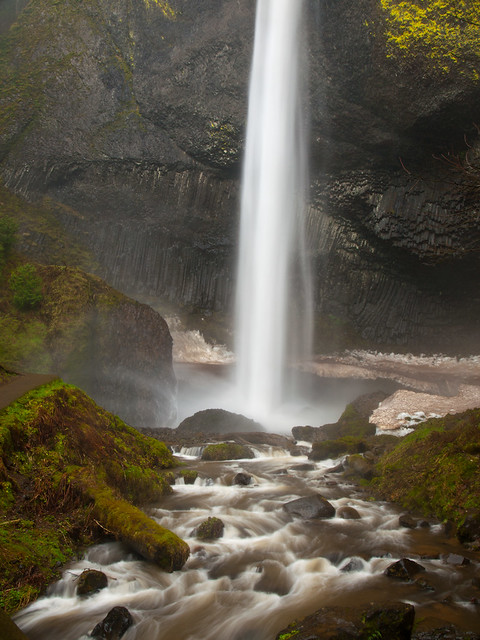
I followed another trail that went along the creek and to the base of the falls. The trail was being bombarded by mist from the falls, soaking everything. It wasn't the first time that day that I'd be thankful that my camera bag is waterproof.

P2206196

Tuesday, February 18, 2014

Snow in the Ouachitas

I'm not traditionally a fan of mornings, so I wasn't too happy to meet up with Matt and Zack. It was well before sunrise, long before any sane person should be awake on a weekend. But we were heading out into the Ouachita Mountains, which still had a few inches of snow from the recent storm. It was painfully early, but I was happy to get a few pictures of the snow before it melted. Especially since this will probably be our last bout of winter weather for awhile.

So we drove west from Little Rock, and eventually hit the Ouachita National Forest. The roads were mostly clear of ice and snow in the city, but here there were still a few slick patches. When we turned onto the Winona Scenic Drive, the road was a solid sheet of ice. I was glad I wasn't driving, since my car struggled to get up a small incline in the snow a few days before.

P2095776-2

There were several downed trees along the road that we had to drive around, the pines and oaks bent under the weight of the ice and snow. There were a few tire tracks on the road, so someone else was crazy enough to drive out there.

P2095785-3

After a few miles, we were blocked by a large tree that had toppled across the road. It was too big to move, so we had to turn back. The other tire tracks, we noticed, reached this same point and also turned around. It was still amazingly beautiful out there, the woods were coated with snow and shrouded by a thick fog.

P2095787

P2095795-3

P2095799

One last shot from along the Winona Scenic Drive...

P2095807-2

We got back onto paved roads and went to visit a nearby lake. It had gotten above freezing, and the snow was melting. Huge chunks were sliding off the trees and crashing onto the frozen lake.

P2095877
No swimming that day...

This is along the fence by the lake...

P2095909-2

We drove further on, and I was surprised to see a few other people out driving around too.

P2095949-2

We did a lot of driving, so there are a lot of snowy road shots from this trip...

P2095963-2

We decided to visit a nearby waterfall. There aren't many waterfalls in the Ouachitas, and this one is really more of a small cascade. It is not considered to be a very beautiful or noteworthy waterfall, in fact the Tim Ernst waterfall guidebook says it "will be a big disappointment to most waterfall chasers." But since we were nearby we drove to the falls. After dodging more fallen trees on the road, we made the short hike to the falls. It definitely isn't the most exciting waterfall, but the snow did add a nice touch. This is Brown Creek Cascade:

P2095994

After we headed back to Little Rock. I wanted to stop along the way to get a shot of a small covered bridge that I found while looking around on Google Maps. It's right outside of the city, actually only about ten minutes from where I work.

P2096022

And one more waterfall shot. This was taken near the covered bridge, and we couldn't resist stopping for a few more shots.

P2096049

After that it was time to head home. I was looking forward to taking a nice nap after dragging myself out of bed so early.

Sunday, February 16, 2014

Snow in Little Rock

After taking pictures at The Old Mill, I drove back towards Little Rock. The snow from the night before had melted off the roads, but there was still a few inches on the ground. I tried to think of a few places in town that would be good places for pictures of the city in the snow. I ended up driving through Riverfront Park in North Little Rock, to get a shot of the snow and the downtown skyline.

Little Rock

Somebody decided to build a little snowman in the park...

P2085640

I drove over the river into Little Rock and ended up at the Old State House. This is the first state capitol for Arkansas, built in the 1830s and 40s. The gate here was closed and the snow on the lawn wasn't trampled, except for some prints from squirrels.

P2085693

The next stop was MacArthur Park, and the old Little Rock Arsenal Building.

P2085745

This is one of the oldest buildings in the city, and the snow around it was untouched except for a few prints around the trees from birds.

P2085771

Tuesday, February 11, 2014

Snow at the Old Mill

We had a little bit of a snow storm pass through Little Rock on Friday night. It wasn't much, only 2 or 3 inches or so, but it was enough to effectively shut down the entire city of Little Rock. I would stand back and laugh at the silly southerners who can't handle a bit of snow on the ground. But then I was stuck in the middle of it, unable to drive my car up any hills.

We went out to eat Friday night, and walked out of the restaurant to find that the streets were already beginning to get clogged with abandoned cars. Fortunately we weren't too far from home, but the neighborhood has a lot of hills and I couldn't get the car to go up any sort of incline. We ended up parking the car in a church parking lot and walking home in the snow.

But the next day it warmed up again and the snow, which so menaced Little Rock the night before, had started melting. The roads cleared enough so I could rescue my poor car, and then head out to take some pictures. I drove to the Old Mill in North Little Rock, and hoped that it would be open. I've taken probably thousands of pictures here, but never in the snow. Every time I drove there after a snow, the gates would be locked. But luckily, some kind city worker opened up the gates of the park that day.

The Old Mill

I was amazed at how empty the park was. Usually there are throngs of people at the Mill. But for most of the time I was there, I had the place to myself.

P2085593