Showing posts with label Lost Valley. Show all posts

Thursday, April 7, 2022

Back To The Buffalo

A few weeks back we headed up to the Buffalo River to do some camping over Jonah's Spring Break (his very first, as a kindergartner). And even with it storming and being cold, it seems like he had a good time. At least he had ready access to s'mores. We also camped with my Sister-In-Law and our three nephews, who I took hiking one day to Lost Valley.

Lost Valley is one of the most popular trails within the Buffalo River, and maybe even Arkansas. It's short, and incredibly scenic. We were there before the storms hit, so there wasn't much water in the creek. But there was enough for a bit of flow at the 53-foot tall Eden Falls.

IMG_7224

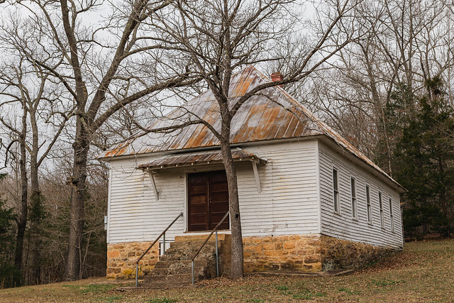
Later on we headed back into Boxley Valley, one of my favorite places in the state. It's an incredibly scenic and photogenic spot filled with many old barns and churches. One of those churches is the Beechwoods Church, which was built in 1918.
IMG_7233-2

The cemetery by the church is actually the oldest in the Valley, with graves dating back to 1842.

IMG_7236-4

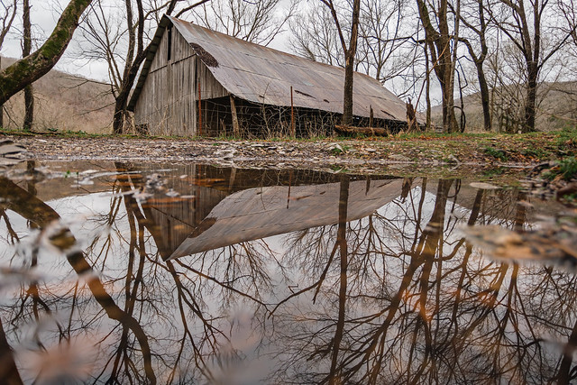
This was taken the morning after some heavy storms dropped huge amounts of rain (which quickly extinguished our little campfire). The rain got the Buffalo River running high and muddy, and also left behind some big rain puddles. This puddle was by an old barn in Boxley Valley.
IMG_7329-6

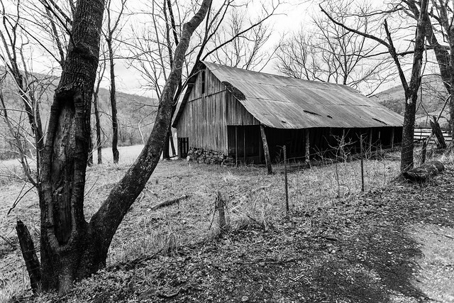
The barn was built way back in the 1920s.
IMG_7336

Nearby is this old structure, which may have once been used as an old root cellar:

IMG_7342

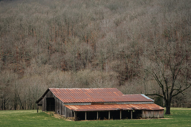
It was fairly quiet in the Valley that morning, considering it was Spring Break. Which was nice since there wasn't too much traffic while I stopped constantly to take pictures of old barns:
IMG_7348-2

IMG_7355-3

IMG_7410-2

IMG_7441-2

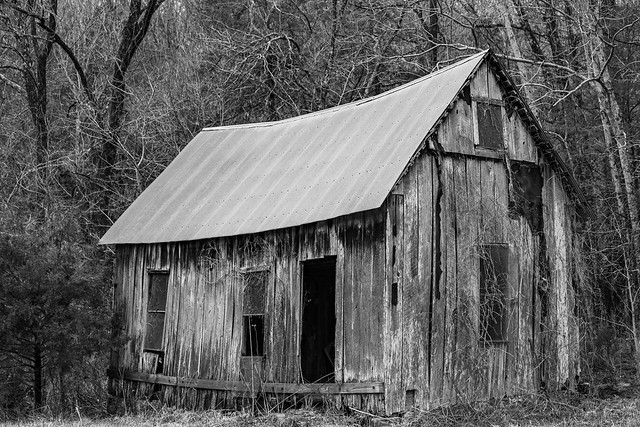
This old building near the trailhead to Lost Valley may have once been used as a school:
IMG_7456

And down the road is another great old barn, which was built in 1915:

IMG_7464-4

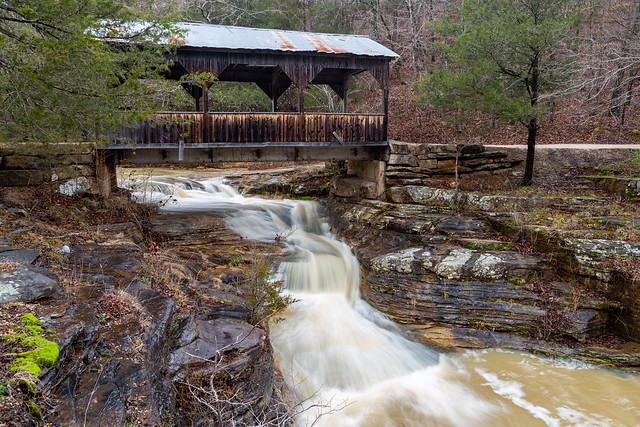
While heading back to our campsite we passed through Ponca and stopped again at this covered bridge, where the creek below was running high after the storms.
IMG_7479-3

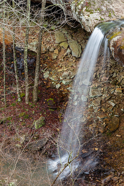
The big storms left behind plenty of rain to get waterfalls going, so my oldest nephew J.T. and my Brother-In-Law Casey decided to do the hike to Hideout Hollow to see the waterfall there. The hike was short and fairly easy. Unfortunately, it was a bit tricky to get down to the bottom of the falls. The only way there involved crossing the creek right above the 37-foot waterfall, and then making your way across a slick and narrow bluff to a spot where you can drop down. It seemed a little sketchy, so we just enjoyed the view of the falls from the top:
IMG_7495

There were a few small waterfalls along the creek above the falls, including this one that had an overhanging bluff with enough room to crawl back inside for a few pictures:

IMG_7508

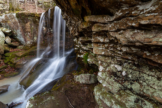
After finishing that hike, we decided to hit another waterfall nearby - Sweden Creek Falls. The falls are located just outside of the Buffalo River boundary, but are protected by the Arkansas Natural History Commission. The trail to Sweden Creek falls runs downhill and then soon meets up with a small creek that has several neat smaller waterfalls.
IMG_7534

The waterfalls are along a smaller creek that runs into Sweden Creek. As far as I can tell, none of these waterfalls are named.
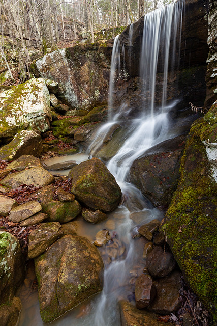
IMG_7541

But since the creek runs into Sweden Creek, I recommend that these falls be named either Norway or Finland Falls.
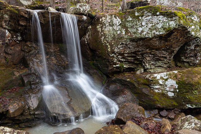
IMG_7548

I actually tried to do some research into who named this area Sweden Creek Falls. I didn't have much luck, so I'm guessing it was named by this guy:

via GIFER


But we made the short hike to the base of the falls, which are over 80-foot tall.

IMG_7553

The falls are scenic, but they are difficult to photograph. There are lots of trees around the base, so it's hard to get a clear view of the entire waterfall. And it also started pouring rain while we were there.
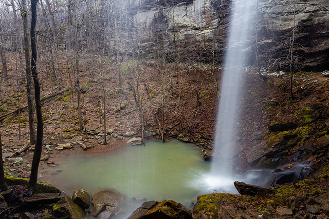
IMG_7560

IMG_7572

We hiked back to the car in the rain, and started to drive back to the campground. Along the way we passed by this old truck, which seems to have been parked here for quite awhile.
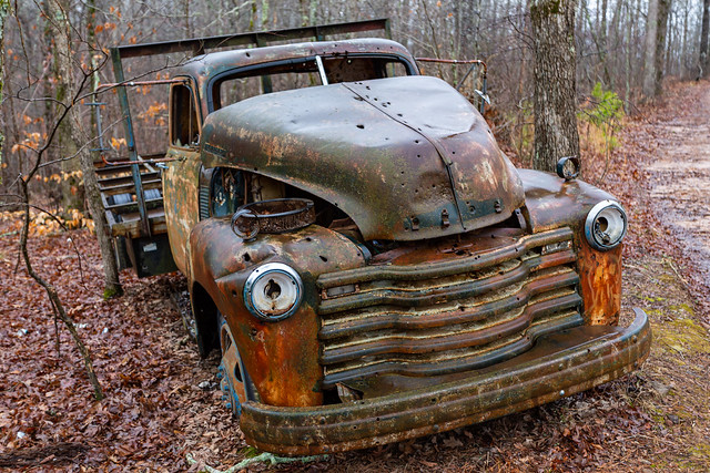
IMG_7580

I've gotten a few pictures of this old truck over the years, and not much has changed (besides some unfortunate vandalism). The first picture I have was taken 15 years ago - back in 2007:

Fixer-upper

We took the scenic route back to the campground and went through Boxley Valley again, and made one last stop to get a picture of the resident elk herd out in the fields.
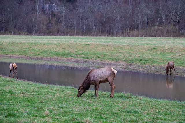
IMG_7604-2

Sunday, March 29, 2020

Lost Valley

So things have been a bit wacky lately, right? My work has been kind enough to let me start working from home, so I'm not going to be coughed on from any sick co-workers (and also not sitting in traffic in the mornings). We had plans to go to a concert in Memphis, which was of course cancelled. But I thought I might take advantage of the day I scheduled to take off work and try to get a few pictures out before things would be shut down. I decided to visit Lost Valley, which is a pretty trail and one that I hadn't been to in a few years. I assumed that since there was a pandemic, and it was a weekday, that I would have the trail to myself. But I was shocked to see a few cars in the parking lot - they were mostly from out of state (Texas, Missouri, Oklahoma and even one from New Jersey). I forgot that it was Spring Break in a lot of places.

It wasn't too crowded and I tried to my best to social distance from any other hikers. It was easy to keep distance when you can make lots of stops to get pictures along the creek, which was flowing well after some recent heavy rains.

Ozarks

Lost Valley

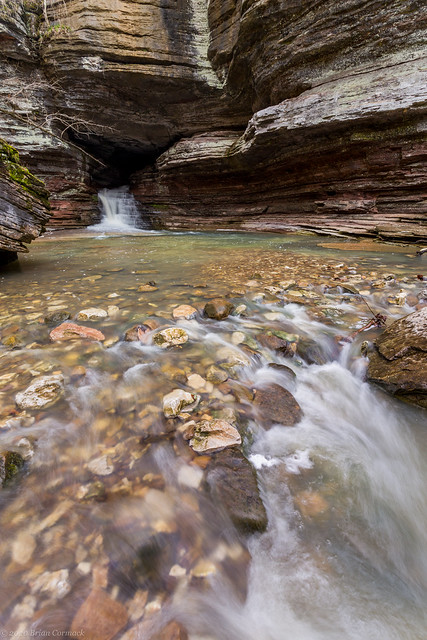
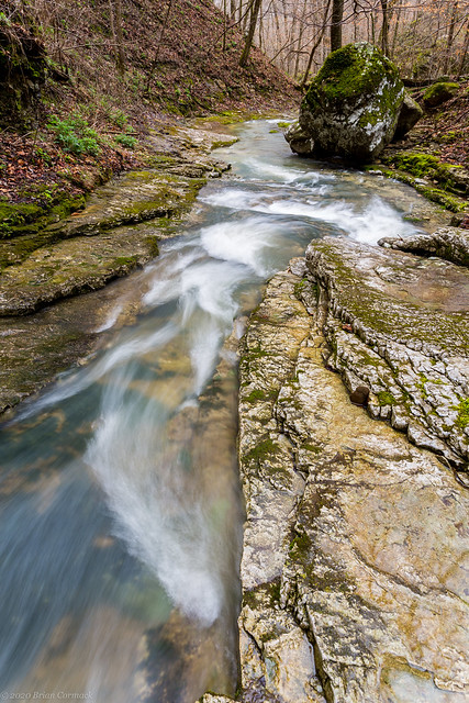
The trail at Lost Valley is short, but it is compact. It passes by several waterfalls and caves (and even a waterfall inside a cave). For the most part, the trail runs alongside Clark Creek as it passes through the collapsed remains of an old cave system. Lost Valley was once a cave, but the roof collapsed many eons ago. What remains is this small valley and one of the most popular trails in the Buffalo National River.

Lost Valley

Lost Valley

Lost Valley

Clark Creek

Although it was Spring Break, Spring was just about to start settling in at Lost Valley.

And I — I took the one most traveled by...

A few wildflowers were beginning to pop up amongst the fallen leaves on the ground, I think this is an Ozark trillium.

In bloom

Usually when you're hiking and you pass by another hiker, you let out a polite "hey." But since most of the other hikers were from Texas, there were lots of people who said "howdy."

Finders Keepers

Further down the trail is the Natural Bridge, which isn't really a bridge but is actually the mouth of the collapsed cave. The falls drop into a small pool that is surrounded by limestone boulders and bluffs.

Lost Valley

The creek flows below the base of Cob Cave, which is actually the base of a massive bluff shelter that got its name from century-old corn cobs that are believed to have been left by Native Americans (maybe the Osage).

Lost Valley

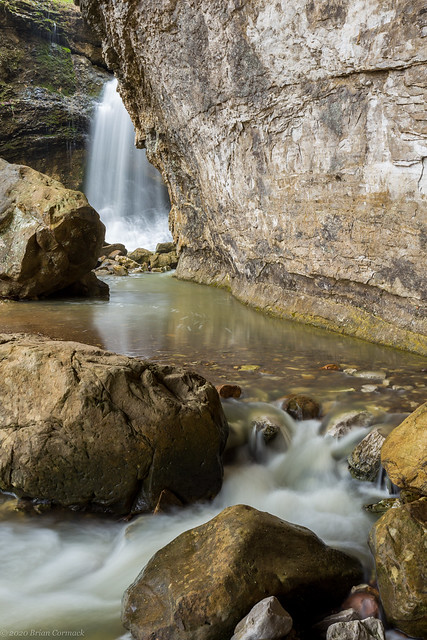
At the edge of the bluff sits Eden Falls, the crown jewel of Lost Valley. The falls are about 53 feet tall.

Eden Falls

Eden Falls

The trail runs uphill and visits a cave, where there was a family about to go in (which I didn't head in because of social distancing and because I didn't have a flashlight). I then headed back, but did make one last stop at this small but scenic waterfall.

Lost Valley

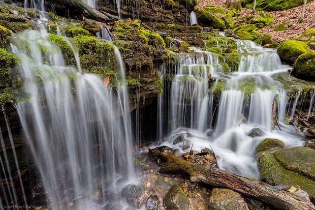
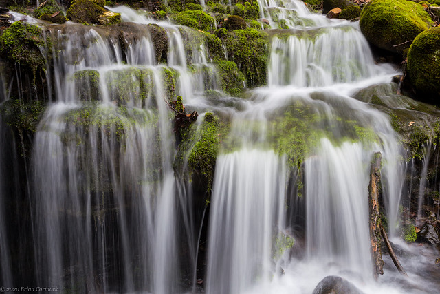
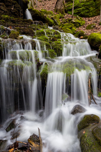
There was a carpet of moss around the falls, which was nice because I had been going through a bit of a mossy waterfall withdrawal after our visit to the Pacific Northwest last month.

Lost Valley

Lost Valley

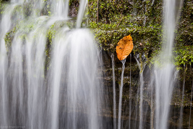
Next to the waterfall was this leaf, which had been caught against the moss. There was a stream of water cascading off the leaf, creating a tiny waterfall (I did not place the leaf there!).

All That You Can't Leaf Behind

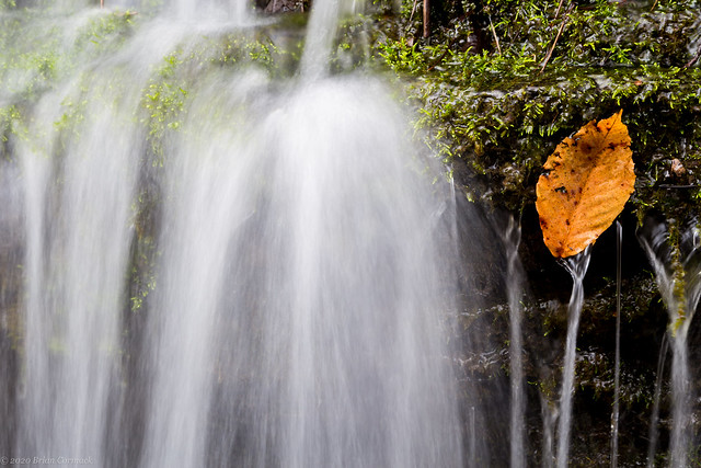
And one last shot, a bit of close-up shot of the leaf. This was a bit tricky because water from the falls was splashing against the camera lens.

Lost Valley

Tuesday, April 15, 2008

A sunny day at Boxley Valley

Weather has been a bit wacky around here the past few weeks. Flooding, tornadoes, then more flooding, and then more tornadoes. And as of this writing there might be a frost tonight. But the benefit of all the rain is that the waterfalls are running full-tilt, so I've been trying to find a good time to make a run up to the Ozarks for some waterfall pictures.

The other week it rained just about every day. The downside of this is that I had to work, so I looked forward to the weekend when I could try to make it out there. I tried to make some plans to head up to the Ozarks, trying to hit a few waterfalls around Boxley Valley on Saturday. I tuned into the news on Friday night and saw, to my horror, that the weather was going to be sunny. This was bad news for waterfall pictures, since you want cloudy weather. But it was also good news for the people here in Little Rock, since it gave them some nice weather to clean up from the tornadoes the day before.

I cursed the sun for wanting to break out, then tried to decide if I should head out anyways. I woke up the next morning, and saw that it was still cloudy outside! Yay! I grabbed my camera gear and ran out to the car. As I drove west the clouds began to break up, but it was still mostly cloudy. I thought that if the clouds hung around a bit more I might be able to salvage some waterfalls out of the day. It was cloudy until I hit Russellville and started driving up Highway 7. As soon as I headed north, all the clouds vanished, as if by magic. I was a bit annoyed, and considered turning around. I'm glad I didn't, since Boxley Valley is a great place no matter what the weather.

My first stop was to visit Steel Creek, which is one of the best spots on the river. I was there around noon, so the light was harsh. But it was still quite scenic. The river was running high, and it was amazing to see some of the damage from the recent floods. This is a view looking in at where Steel Creek flows into the Buffalo River.
Steel Creek

I hiked on a little trail that follows Steel Creek, which was also next to the horse stables there.
Steel Creek horse

I wondered what they did with the horses when it flooded. Where I stood to get this shot, there was debris in a tree a good eight feet above me. It must have been really crazy in this valley when the river flooded.

There are some awesome bluffs at Steel Creek, and I went by the campground to see what they looked life from there. I was really surprised to see a large waterfall running down from the bluff.
Steel Creek Falls

This isn't all that great of a shot, since it was taken in direct sunlight. But the falls were awesome. According to one of his picture books, Tim Ernst said that "This towering waterfall only comes alive when there is a big flood, and then it becomes one of the tallest waterfalls in the state."

From there I headed on towards Boxley Valley. The first stop was the low-water bridge at Ponca. I went across the bridge to an old homestead site, featuring a barn and an old house dating from the late 1800's. Here are a few shots of the old barn:
Hooked

Old barn

And here is a shot of the Buffalo River from the low-water bridge at Ponca. It's hard to believe that a few days before the river was running 10-15 feet above where I stood...
Buffalo River

There were a lot of people kayaking the river, and it would have been a good day for it.

My original plans for the day including hiking down to a neat waterfall, but since it was sunny I decided to skip that and spent my time looking around Boxley Valley. That would actually turn out to be a good idea, turns out the dirt road leading to the waterfall was washed out from all the rain a few days before.

One place I had seen pictures of in Boxley was an old springhouse, which has a cascade of water flowing beside it after heavy rains. Apparently the springhouse is right on the side of the road, but I had managed to miss it everytime I had been to Boxley. I got some directions on where to find it, but managed to drive by it several times before finally seeing it tucked back in the trees. There wasn't much water flowing past it when I was there, but it is a neat old building.
Boxley Springhouse

With it being sunny I decided to wait until it began to get dark, and then try to get a few waterfall shots. To pass the time I went to one of my favorite trails in the state, Lost Valley. I took the tripod along with me, even if I didn't think I could get any good waterfalls shots with it being sunny.

The trail is wonderful, there were flowers blooming along the trail and the creek was filled with water. I reached the "natural bridge," with its neat waterfall. But it was in full sun and none of the pictures turned out. There was a new bizarre feature along the trail, and all the hikers were laughing at it. For some odd reason, a large bra was hanging from a tree along the trail. I didn't stop to get a shot of it, but now I wish I did. It was so amazingly random.

I continued on the trail, finally making it to Eden Falls. Then I was amazed to see that the falls were running quite well, and they were in shadow. Yes! I hurried down there and started taking a lot of pictures.
Lower Eden Falls

Lower Eden Falls

There are actually three waterfalls all next to each other on this creek. The other two are a bit harder to reach. It involves walking along a narrow ledge, then scrambling down a steep eight foot drop. I made my way down there, with some help from a few other people who must have taken pity on me while I tried to make my way there without dropping the camera. It isn't that scary or difficult to reach, and the views are amazing. The Middle and Upper Eden Falls both meet up in this little area, just above the top of the Lower Eden Falls in the above pictures.

Middle Eden Falls:
Middle Eden Falls

And Upper Eden Falls:
Upper Eden Falls

Both of these falls are close together. I thought it was cool that you could get both in the same shot...
Middle & Upper

And a close-up view of Middle Eden Falls:
Middle Eden Falls

Middle Eden Falls is formed from the waters that exit out of a nearby cave. The Lost Valley trail ends at the mouth of the cave, and you can crawl back about 100 feet and find a 30-foot waterfall inside the cave. I didn't bring a flashlight with me, so I didn't go through. It is really neat inside there...

I followed the trail back, which goes by one of my favorite waterfalls in Lost Valley. Tucked in the hill is Moss Falls, a series of small waterfalls over mossy rocks. The sun was a bit of a problem here, so I had to focus on just a few of the falls...
Moss Falls

Moss Falls

Moss Falls

Moss Falls

After that I finished the hike and got back to the car. I took one more drive around the Valley, stopping at this neat old barn. I thought it was interesting how they built the barn into the hill.
Boxley Barn

At Lost Valley, I was talking to another photographer about nearby waterfalls. I thought I might try to hit Triple Falls by Camp Orr on my way home. She said the road down there might be rough now, after all the flooding, but that I should try and hit some other falls instead. The falls were at Broadwater Hollow, a few miles north of Boxley. The way there was easy, just take a dirt road a few miles and the waterfalls will be right alongside the road. So I headed up there and started driving down the dirt road. But that road was also rough. There were huge culverts carved out by the rain, and my car bounced around on the way there. I got nervous, just having spent a few hundred dollars repairing my car. I didn't want to press my luck going down another dirt road so I sadly turned around and headed back to the safety of paved roads. Apparently dirt roads in the Ozarks didn't fare that well against all the rain.

So the trip didn't turn out exactly as planned, but it was still an enjoyable day out in the woods. Lost Valley and Boxley Valley are amazing places, definately worth visiting no matter what the weather is like...