Showing posts with label Arkansas Delta. Show all posts

Monday, November 9, 2026

Dagmar

The Dagmar Wildlife Management Area sits just west of Brinkley and contains over 10,000 acres of protected swamps, bayous, forests, lakes and sloughs. It's a popular area for hunting and fishing, and for a glimpse at what most of the Delta looked like before most of the land was drained and converted to farmland. I headed out that way to see how the fall colors were looking. The first stop was at Apple Lake, which is officially called the "Apple Lake Waterfowl Rest Area" (which makes it sound like a place where there are duck bathrooms and places for them to buy snacks).

IMG_8452-1

This is around the area where the Ivory-Bill Woodpecker was supposedly spotted back in 2004. And sure enough, I did hear some sort of woodpecker making some noise deep in the woods. But instead of looking for the woodpecker, however, I was more worried about snakes. Despite it being November it was warm and muggy, and I was sure that snakes were lurking under all of the fallen leaves and along the water.

IMG_8462-1

The Dagmar WMA is filled with thousands upon thousands of cypress and tupelo trees, with some being over 1,200 years old. These two massive bald cypress trees, with their forest of knees, were growing along Bayou DeView.

IMG_8484-1-2

IMG_8489-1-2

And despite it being November, there were still mosquitoes out and about. They quickly attacked while I was trying to get a few pictures of these cypress trees along Bayou DeView.

IMG_8509-1

IMG_8532-1

Then I walked back to the car and headed over to Hickson Lake.

IMG_8572-1-2

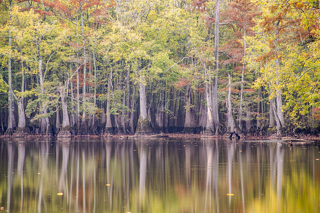
It is a really beautiful area, the still waters capture great reflections of the trees. And it looks especially pretty when there are some fall colors.
IMG_8631-1-2

IMG_8640-1

It was starting to get dark, which meant I had to use longer exposure times for the pictures. You can tell this was a long exposure (30 seconds) from the streaks left in the water from some fallen leaves.

IMG_8673-1-2

And one last shot before it was time to head home:

IMG_8675-1

Saturday, November 7, 2026

Brinkley

Brinkley is both the largest town in Monroe County and the largest city along I-40 between Little Rock and Memphis. It was established in 1872 as a railroad town and was originally called "Lick Skillet" (shame they didn't keep that name). It soon became a major transportation and agricultural hub for the area. The railroad still passes through town today, passing right by the old historic core of the city. These old silos sit near the tracks:

PB010050-1

Also near the tracks is this old bar/club, that has now been abandoned for many years. Painted on both sides is the warning: "NO-DRINKING-ON-OUT-SIDE-ThAT-ThE-LAW-YOU-CAN-BE-ARRESTED-BY-POLICE." I think this might be the most photographed building in Brinkley (or at least tied with the big bridal gown store), because of how charming that little painted warning is.

IMG_8292-1

IMG_8308-1

Crossing over the railroad tracks takes you to the old section of the city, with buildings dating back to the 1800s. Sadly most of them look abandoned, and many are in a significant state of disrepair.

IMG_8314-1

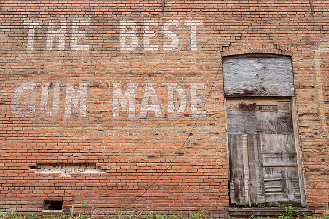
Painted on the side of this building is a massive ghost sign for Kis-Me Gum. The gum was the first fruit-flavored gum, and had the slogan "Far Better Than A Kiss."

IMG_8334-1

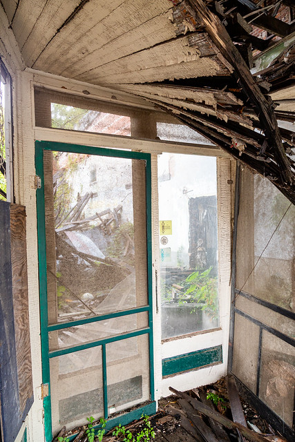
Nextdoor is the old Monroe County Bank Building, which was built in 1889 and almost destroyed by a tornado in 1909. The building housed the town's first major bank, and also an opera house on the top floor. But it is abandoned now, with ivy and vines growing wild on the back wall.

IMG_8336-1

IMG_8361-1

IMG_8348-1

And just down the block, right by the train tracks, is this old building that once housed the Langley's Food Warehouse. It was apparently a discount grocery store, and before that the building was used as a bakery. From what I can find, there was a fire and the building has been empty and crumbling away ever since.

IMG_8374-1

PB010071-1

PB010060-1

IMG_8370-1

And on the side of the building is this old ghost sign for the grocery store, the paint faded and worn.

IMG_8399-1

IMG_8418-1

I got back in the car and started to head out of town, but made one more stop at another old building. Parked beside it was this car, covered with a thick layer of dust and rust.

IMG_8435-1

The year on the license plate shows 1997.

IMG_8432-1

And that was enough pictures of old buildings for the day, it was time to head off to find some fall colors. More on that on the next post...

Thursday, November 5, 2026

Back To The Delta

One of my least favorite drives in the state is I-40 between Little Rock and Memphis, and I will always opt to take Hwy. 70 over the crowded freeway. And as an added benefit, there are always some side roads with a few things to photograph.

IMG_8228-1

PB010010-1-2

The fall colors were starting to come along out there, which was nice to see after the long dry summer.

IMG_8242-1

Except that it didn't feel like fall yet. It was warm and muggy outside, definitely not what you'd expect for November.

PB010035-1

From there I headed further east, towards Brinkley. More from there on the next post....

Thursday, October 15, 2026

Cotton Plant

The rain continued to fall as I headed further east. The farms and fields seem to have mostly been harvested, and the grasses and vegetation had already started turning an autumn-like golden hue. Along the way I passed by this old tractor, collecting rust beside a field.

IMG_7694-1-2

IMG_7699-1

PA027367-1-2

And then down the road was this old farm building, surrounded by a wall of overgrown grass.

IMG_7710-1-2

PA027378-1-2

And then I made it to the small town of Cotton Plant. The town dates back to the 1840s, and there was even a small Civil War skirmish fought nearby. And as the town's name suggests, the town grew and prospered due to cotton. By the 1900s, Cotton Plant was home to several cotton gins, sawmills and factories. It was considered to be the "cultural center" of the area, with the town even having an opera house. Cotton Plant is best known now as the birthplace of Sister Rosetta Tharpe, the "Godmother of Rock and Roll."

Like many Delta cities, Cotton Plant's population began to decline after the mechanization of farming meant fewer workers were needed to pick cotton. And in the 1960s, many white families left the town to avoid desegregating the schools. Cotton Plant peaked with a population of about 2,000 people in the 1950s. Today the population is around 500 people. And also like many other Delta cities, the town has struggled. Most of the old buildings on Main Street are abandoned and falling apart. The roof of one building, which used to be a store, has finally collapsed.

IMG_7720-1-2

Here's the same spot, taken on a previous visit in 2019:

20 - Cotton Plant, Woodruff County

I wonder whatever happened to that dust-covered merchandise that had been sitting there on display?

IMG_7725-1-2

IMG_7727-1-2

And then a few other buildings in Cotton Plant:

IMG_7733-1-2

IMG_7751-1-2

IMG_7759-1-2

It was time to start heading home, so I turned south towards the interstate. But before joining the slow traffic on I-40, I stopped by this old sharecroppers cabin. There must have been thousands of these old cabins across the Delta, but not too many of them are still standing.

IMG_7770-1-3

I tried to get a few pictures while wiping raindrops off the lens.

PA027395-1-4

PA027410-1-2

PA027417-1

Monday, October 12, 2026

A Rainy Day In The Delta

I have finally reached that part of being in your 40s where (and sorry if this is too much personal information) I hit the recommended age to have a colonoscopy. And so I did, and luckily all went well. But to make up for the indignity of the "prep," I treated myself to an extra day off from work. And since it was raining, I headed out to get a few pictures.

I headed east into the Delta, and soon stopped at the old Johnson Chapel Methodist Church, which was built in 1871. Services were held there for nearly 100 years, and the old building still looks nicely maintained.

PA027294-1

It had rained heavily overnight, which gave the drought-parched landscape a good soaking.

IMG_7599-1

PA027322-1

IMG_7622-1

The road headed further east into the small town of Des Arc, which is the home to the Lower White River Museum State Park. Next to the museum is this historic dogtrot cabin.

PA027326-1

IMG_7632-1

There were a few other old building scattered around the grounds:

IMG_7639-1

Des Arc is an old city, established in the 1850s along the White River. And the oldest building in Des Arc is the old Frith-Plunkett House, which was built in 1858.

IMG_7649-1-2

Due to its strategic location along the White River, Des Arc was a busy spot during the Civil War. Which meant that over the course of the war, most of the buildings in town were burned or destroyed. But the Frith-Plunkett House was spared, since it served as a hospital for Union troops.

PA027339-1-3

PA027337-1-2

The old house is empty and quiet, its windows and doors hidden behind plywood boards. There is a faded sign in the yard asking for donations to help restore the old home.

IMG_7656-1-2

A few blocks down the road is the Prairie County Courthouse, which sits on a low hill above the river. The courthouse was built in 1913.

PA027355-1

And just a few blocks away was this old home, which also seemed to look empty and disused. The yard was covered with a carpet of pine needles. I got a few pictures before heading out, crossing the bridge over the river and heading further east into the Delta.

IMG_7679-1

*** So my apologies to anyone from Des Arc who might be stumble upon this blog while doing something innocent like looking for pictures of their hometown. Sorry you had to first read about a colonoscopy **