
In my defense, I wasn't the one driving. But I had just driven the same road last month, so I should have known better. As we passed by the tiny towns along the road, I did think to myself "that's weird, I don't remember driving through here before, oh well." That should have been a warning sign, but I just thought that I had forgotten about those towns in the past month or so. Whoops.
I was starving at this time, so the bright side is that we were able to stop and get some snacks for the rest of the trip. Now with a map (needed, apparently) and some good trail food (Doritos and Funyuns), we drove the 40 miles back to the road we needed to be on.
So after taking a "scenic" detour for about an hour or so, we finally made it to the trailhead. It was packed, with every available space taken. Zack nearly donated his bumper to the Ozark National Forest while trying to squeeze into a spot. But we were there, and ready to hike.
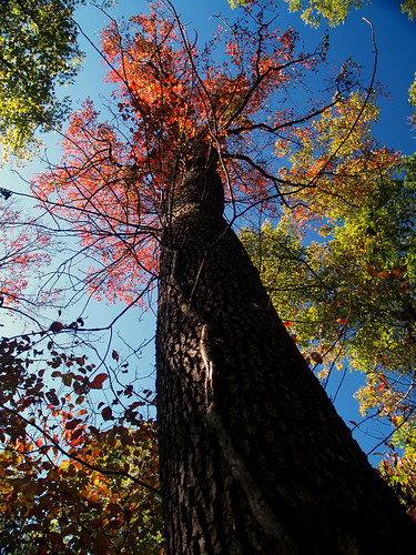
There are really two separate trails here, which both start out from the same spot. One loops around and visits Kings Bluff, the other looping around the Pedestal Rock area. Both hikes total to about four miles in length. We started out on the trail to Kings Bluff. For the parking lot to be so busy, the trail to was amazingly void of other people. We pretty much had the entire trail to ourselves. The trees along the trail hadn't managed to change as much as I had hoped. They were mostly green, with a few renegades showing some good color.
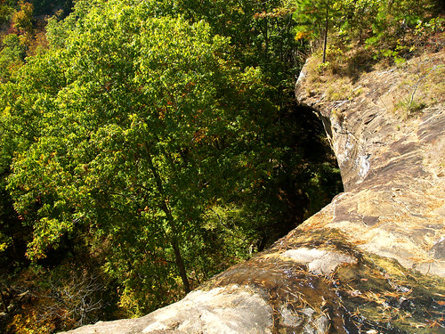
The trail heads through the woods and eventually reaches Kings Bluff. The bluff is about 115 feet tall, and even has a waterfall on it. Of course the falls only run when there has been a lot of rain. Although we did have a few days of rain earlier in the week, the falls were mostly a trickle. When they are running they are one of the tallest falls in the state. The place where there should be waterfall can be seen here:
It was really sunny that day, perfect hiking weather. It wasn't the best photography weather though. I would have killed for some clouds, or even better, fog. Maybe not rain - it would lead to slick rocks, which probably wouldn't be the best when standing on the top of really tall bluffs.
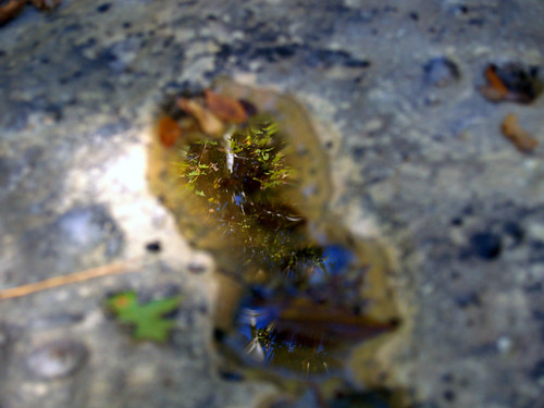
Following the stream bed that feeds the waterfall, I found many small pools formed as the water eroded away the rock. Here is a shot of one of the pools, taken while attempting to be artsy.
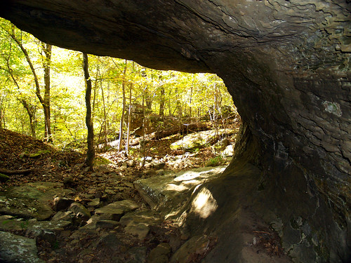
There is a short but steep trail that leads to the bottom of Kings Bluff. We walked and slid down there and explored the area at the base of the bluff.


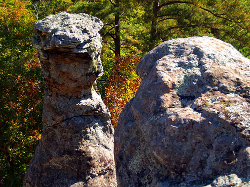
We got back onto the main trail, which hugged the bluff and revealed some interesting weathered rocks sticking out over the wilderness.

The trail is great, a lot of interesting stuff to see. There are a lot of sandstone formations and hoodoos along the bluff.


Dang, I just wish the light was better!
We had the trail to ourselves for nearly the entire length of the Kings Bluff hike. Near the end we ran into an older man, who made us feel much better about our accidental 80 mile detour. The poor guy walked up and said, "you haven't happened to see a set of car keys laying on the ground, have you?" Turns out that somewhere along the four miles of hiking trails there, he and his wife dropped their keys. I hadn't noticed them, but of course hadn't been looking either. He said that his wife needed to make a bathroom stop along the trail (gross - and there are bathrooms at the trailhead!), and may have dropped them there. So we should keep an eye out to the left side of the trail just in case. He gave me his cellphone number to call in case we found the keys. The area code wasn't a local one, I looked it up and the area code is for Alabama.
That is actually my biggest fear, to head out on some remote trail and then lose a wallet or car keys. Or also to be stuck in the middle of nowhere with a flat tire. But when we finished the hike I didn't see them in the parking lot, so I guess they found the keys and made it out ok.
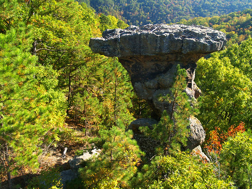
We finished the Kings Bluff trail and started on the trail to Pedestal Rock. The trail goes through the woods and comes out to another bluff, with more rock formations. The highlight is of course, Pedestal Rock. It is where the rock has eroded away to look like, well, a pedestal.
From here you can scramble down and explore some caves in the bluff. But the unfortunate detour had eaten into our hiking time. And we also managed to find out where the huge crowd was, the trail was packed. At one point we passed by a huge group of maybe 40 people. There are a few more places that you can explore out there, but they were crowded with people. No surprise really, being a nice sunny day at one of the more popular trails in the National Forest.
But we thought our time would be better spent elsewhere, and quickly headed back to the car. The next destination would be a waterfall, which would hopefully be running and by this time be in the shade...

No comments:
Post a Comment