Sunday, July 28, 2013

Flower Power

I heard about a field nearby that was filled to the brim with sunflowers, so the other day I made the short drive to the small town of Roland to take a look. And indeed, there was a field that was just absolutely packed with flowers.

P7218969-4

P7219015-2

And of course, with this many flowers around you're bound to attract a few bees...

P7218978-4

The field is located along Hwy. 300 near the town of Roland, or about 10 miles or so from Pinnacle Mountain State Park. It's right along the side of the road and very easy to get to.

P7219077-2

Tuesday, July 23, 2013

Helena

While still driving in Arkansas, we left the Louisiana Purchase Historic State Park and then drove towards the Mississippi River. Our last stop was Helena, which sits perched along the river. Like most places in the Delta, Helena has fallen on hard times. But it is an interesting city, with a lot of things to take pictures of...

P7138742

Helena is an old town. It was incorporated in 1833, and it grew and prospered thanks to its location on the Mississippi River. Located about halfway between Memphis and Vicksburg, Helena became a major steamboat stop. When the Civil War started, Helena was the largest city in Arkansas along the Mississippi River.

P7138750

This is an old abandoned hotel, near downtown Helena...

P7138753

The Union Army captured Helena in 1862. There was a battle in 1863, when Confederate troops attempted to attack the city in order to divert Union forces during the siege of Vicksburg. It didn't work too well for the Confederate troops, and Helena remained under federal control for the rest of the war.

P7138758

After the war, Helena continued to grow as levees opened new lands for farming and timber harvesting. The city was severely damaged by a major flood of the Mississippi River in 1927.

P7138777

In 1941, a radio station in Helena started airing a show called King Biscuit Time, which made Helena an important starting ground for many blues singers. There is a blues festival in Helena every year still.

P7138806

P7138816

Helena began to decline in the 1960s, thanks to some economic hardships and continuing racial turmoil.

P7138830

P7138875

P7138867

When we visited, there were several empty buildings in Helena's downtown. But it seems like things are getting better there. There is a nice walkway along the levee, and part of downtown was blocked the day we visited for a little outdoor festival. Helena might not be at the place that it'd like to be, but you can tell that they are trying to bring in some new life and renovate some of the buildings downtown.

P7138887

After that, we headed back home to Little Rock. I was tired and ready to get back home. But that was because I would soon find out that I had bronchitis, which isn't an ideal condition to have while out driving and taking pictures.

Friday, July 19, 2013

Louisiana Purchase Historic State Park

The Louisiana Purchase Historic State Park is a neat place to visit if you like swamps, history and mosquitoes. Here you can walk to a stone marker that commemorates the initial point from which all land surveys of the Louisiana Purchase began. The marker sits in a deep swamp, which makes you wonder why anyone would trudge through murky water in 1815 to get there.

The park is much easier to get to now. It's located just off of Hwy. 49, about 30 miles from Helena. Although it's right by one of the major roads in the area, the park feels isolated and a bit lonely. There were no other people there when we visited. Just swarms and swarms of mosquitoes.

P7138680

Time moves slowly in the swamps. The US bought the Louisiana Purchase from France in 1803, but it took a few years for the government to head out to explore and survey the lands. In 1815, President Madison ordered a survey, in order to establish a system to distribute the lands to veterans of the War of 1812. So after traveling by stage coach from Washington, two teams of surveyors set out in the swamps of Arkansas. I don't claim to be an expert in the art of surveying, so I'll let this article explain the rest:
Land surveys are conducted by first setting a starting point. That's done by surveying a north-south line, called a meridian, from a familiar landmark, and doing the same with an east-west line, called a base line. Where those two lines intersect is the starting point of the survey. 

The lands east of the Mississippi had already been surveyed, of course, and in the process, four meridians had been established. Robbins and Brown split their men into two parties to establish the two lines. Robbins established the Fifth Meridian by surveying due north from the confluence of the Arkansas and Mississippi Rivers. Brown set out from the mouth of the St. Francis River to survey the base line. 

 Both parties passed through extremely rough territory, but their notebooks, which survive and are preserved at the state land commissioner's office in Little Rock, reveal a stoic attitude toward the hardships of the trek. "This land would be good," reads one of Brown's entries, "if it were not subject to inundation."

 That was a pretty mild description for a man who was up to his waist in a swamp. Later, his patience possibly wearing thin, Brown wrote in his notebook that the area which they were passing through consisted of "briers and swamps and briers aplenty."

The two parties did not meet at the point of intersection; that would have been a coincidence of epic proportions. Each passed the intersection point sometime in November, and each party then backtracked until they found each other some time between the dates of November 4 and November 24, 1815. 

The two groups then determined the point of intersection and hacked blaze marks in two gum trees to mark it. From that point, the survey of the Louisiana Purchase lands began, with the two imaginary lines extending as far as the land itself. (Base Line Road in Little Rock is so named because it follows the original base line laid down by Joseph Brown.) 

All township boundaries were drawn from lines that originated there, and from those, subdivisions and even city lots were drawn. Before they were done, Robbins and Brown and their crews had surveyed land in the future states of Louisiana, Arkansas, Missouri, North Dakota, South Dakota, Nebraska and Oklahoma - and most of five more - Kansas, Colorado, Wyoming, Montana and Minnesota.

The swamp then sat forgotten for more than a century.  Until some more surveyors showed up.  There had been a dispute over the county line separating Lee and Phillips counties in 1921, and a survey team went in to find the county line that ran along the old base line.  In doing so, they happened to find the two witness trees that had been marked way back in 1815.  So in 1926, a stone marker was set in the swamp, which still sits there today.

P7138683

It's amazing to me that the swamp is still preserved today, when most of the land around it has been converted to farms and fields. The swamp at the state park is actually a headwater swamp, and is the largest of its kind in the Lower Mississippi River Valley.

P7138733

While taking pictures out there, I accidentally banged my tripod against the railing of the walkway. Which somehow caused the handle of the tripod to come loose and then shoot up and away. I heard it go into the swamp with a splash. Since there were signs talking about local wildlife (snakes and alligators), I didn't head into the waters for a rescue mission.  

Wednesday, July 17, 2013

Eastbound & Down

Last weekend, the fiancĂ© and I decided to get out of the city and make a little road trip out into the country.  It was a nice day for it, as it was surprisingly cool outside (only in the upper 80s, which is nearly freezing for Arkansas in July).  So we left Little Rock and headed east, driving towards the small town of Scott.

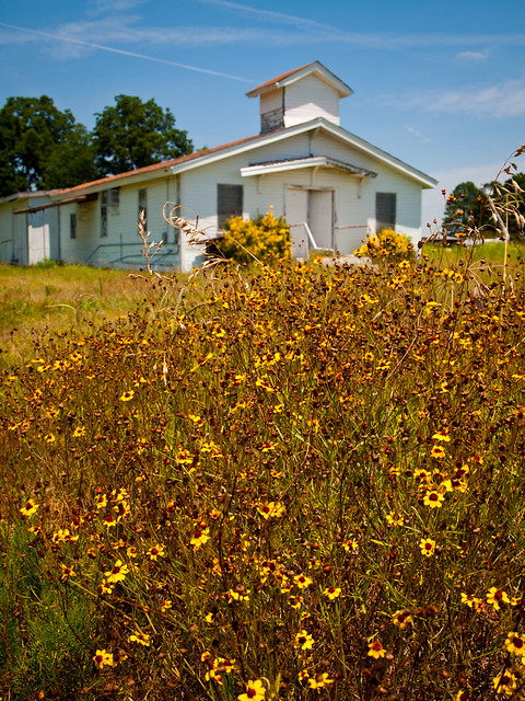
Scott is only 15 miles or so from Little Rock, but it feels a lot farther out. The town, with a population of only 72 people, is also home to numerous old homes, barns, plantation homes, churches, gins, and an awesome burger place. We drove through town and stopped at this old church. It seems like it's been empty for many years, with only a congregation of flowers to keep it company.

P7138497

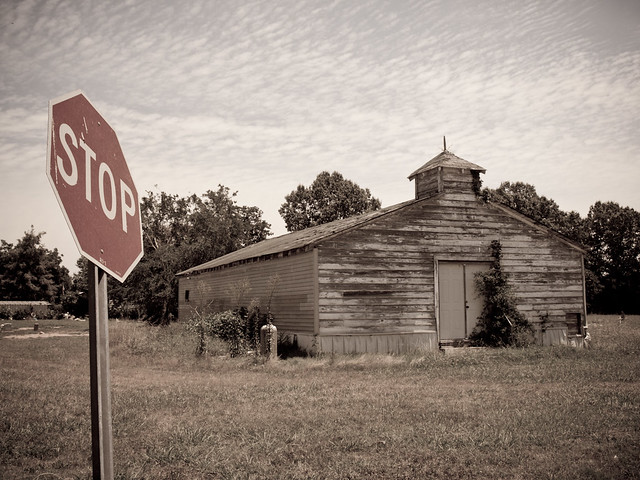
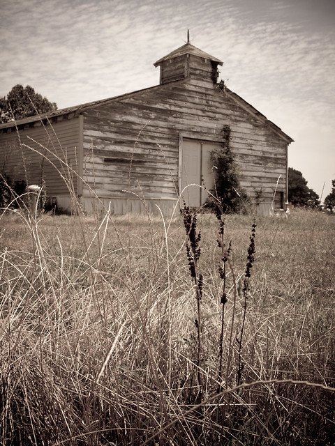
We drove further on, heading towards the town of England. Along the way, we drove by another old church that appears to have been abandoned long ago.

P7138502-2

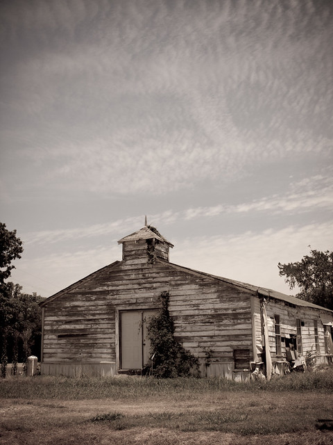
I drove by this same church last year and took a few pictures. The only difference between now and then is more ivy (or some other sort of plant) growing up by the front door.

P7138505

P7138512-2

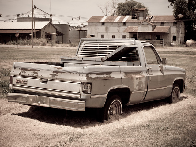
We made it to England, which also contains a good number of cotton gins and other assorted antique farm buildings.

P7138530

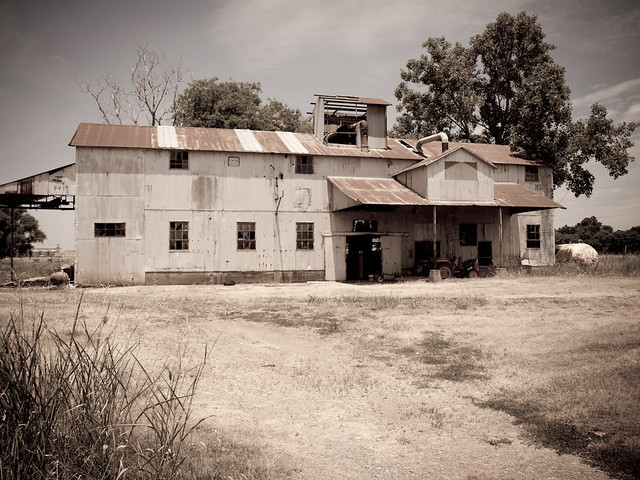
The antiquated building is being guarded by this old truck, which keeps sentry in a field across the street.

P7138531

We headed out of England and drove further east, deeper into the Delta. The land is as flat as paper, with rice and wheat fields broken up by dusty dirt roads and the occasional swampy creek.

P7138553

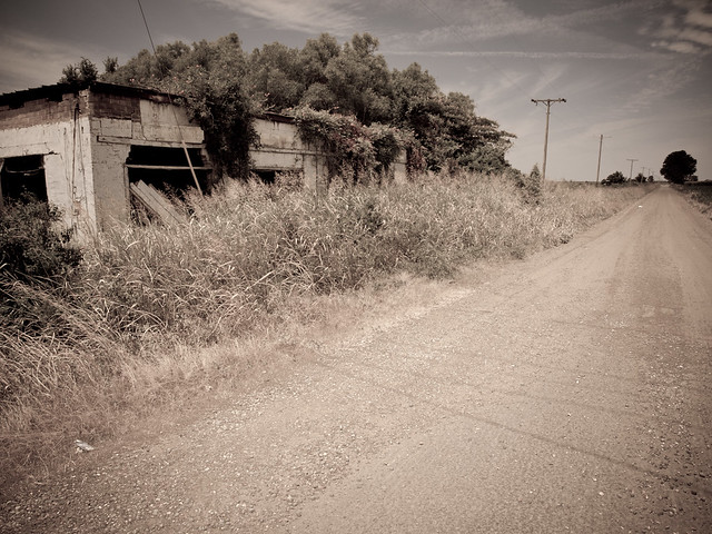
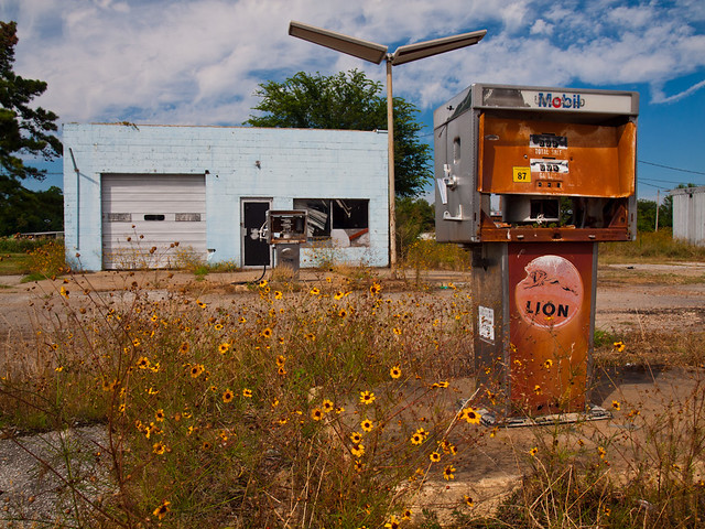
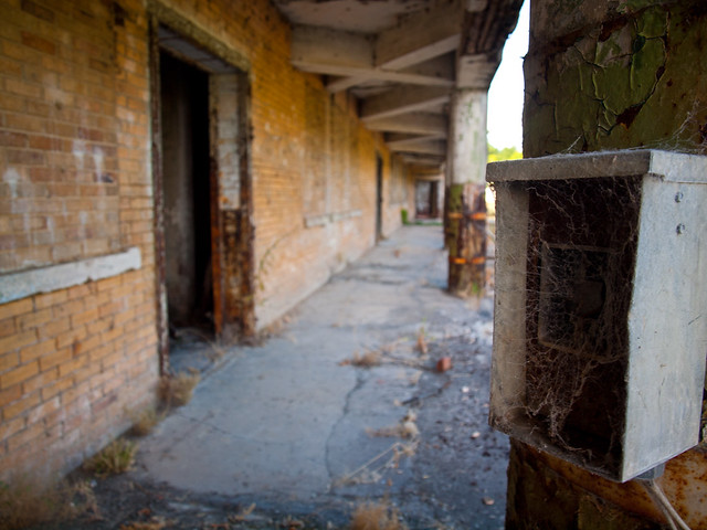
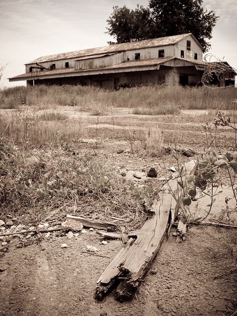
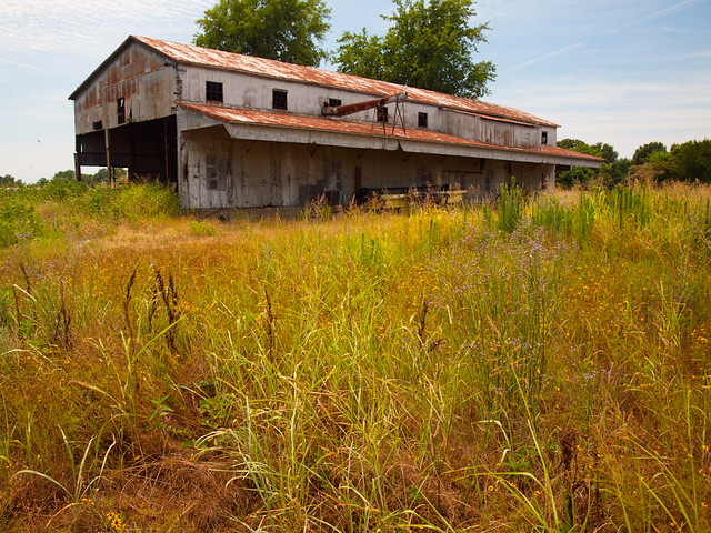
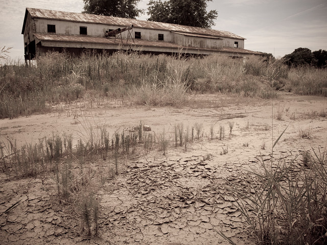
We drove east along Hwy. 165 towards Stuttgart. I somehow got distracted and turned down a bumpy dirt road that went by this old cotton gin, abandoned and empty except for the overgrown weeds that surround it.

P7138565

P7138578

P7138582

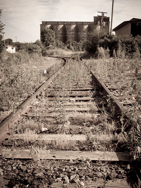
Back in the car, we headed east again. We drove through the towns of Ulm, Humnoke, and Stuttgart. It's always interesting to drive towards Stuttgart. The grain elevators there resemble skyscrapers from a distance, which makes it appear as if you're driving towards a much larger city.

After passing through Stuttgart, we headed northeast on Hwy. 79 through more fields and then over the White River at Clarendon. There is a neat old courthouse in Clarendon, which is the county seat of Monroe County.

P7138599

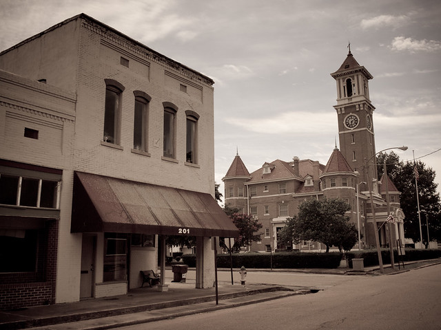
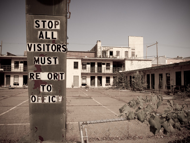
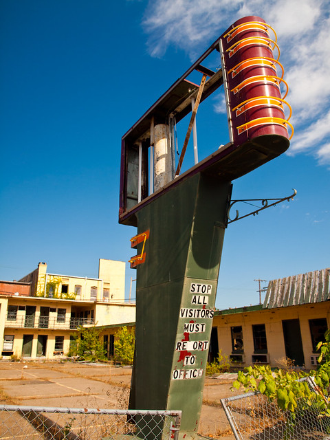
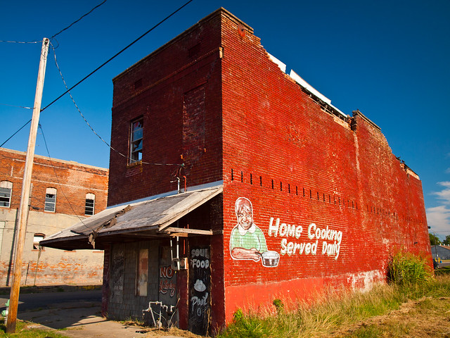
Today, only 1,920 people live in Clarendon. The city is old - it was originally founded in 1859, but people have lived at the site of the town since the 1820s. The city sits at the intersection of the White River and the old Military Road that connected Little Rock and Memphis. Clarendon was burned during the Civil War, but prospered in the early 20th century thanks to the popularity of the shells and pearls harvested from freshwater mussels. But like most of east Arkansas, it looks like the town has fallen on hard times. This is one of the buildings, down the road from the courthouse...

Untitled

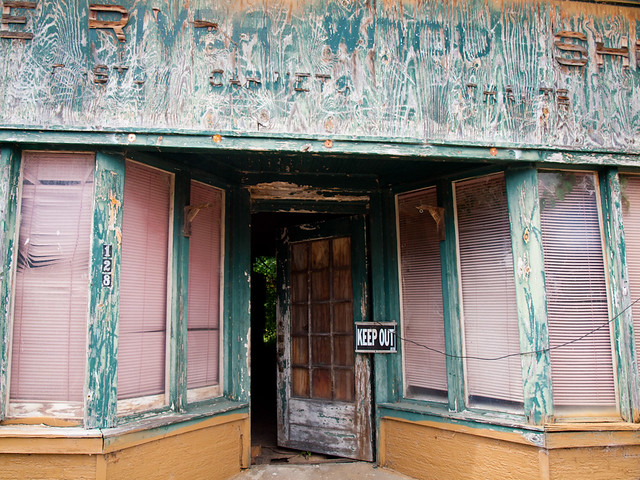
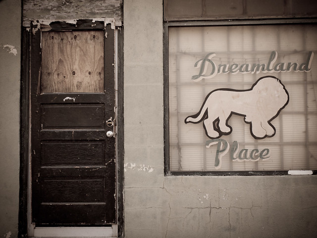
And the back of another building, also located by the courthouse:

P7138619

We stopped to get some snacks and cokes in Clarendon, and then headed further east again....

Wednesday, July 10, 2013

Blanchard Springs

Blanchard Springs is an ideal place to visit in the summer. The springs run year-round, so there is a waterfall there even in the driest of times. And also, the caverns there stay a cool 58 degrees. So last weekend I was able to escape the heat and dropped down below the surface for a tour of the caverns.

P7068451

Blanchard Springs Caverns are filled with stalactites, stalagmites, columns, and flowstones. It wasn't the easiest place to take pictures in, since it was fairly dark.

P7068469

The Forest Service operates the cavern tour, along a trail that was opened in 1973. This was just a few decades after the cavern was explored, it had remained hidden for centuries. Although there was evidence of humans there, a 1,000 year old skeleton was found in the cave. The poor guy got stuck down there, and this was before the Forest Service paved a path and lit the place.

P7068480

We didn't make it to the springs, which is ok since it was sunny and the light wouldn't be right for taking pictures. So instead here's a shot from last year:

Blanchard Springs

Sunday, July 7, 2013

4th of July

Things have been pretty busy the past few weeks (including a work trip to Dallas), so I haven't had much time to take many pictures recently.  But last week I was able to dust off the camera and head out to take a few pictures. 

Last Thursday was Independence Day, so the fiancĂ© and I headed to downtown Little Rock to try to get some pictures of the fireworks show over the Arkansas river.  We ended up at Riverfront Park in North Little Rock, along the levee.  I was surprised that there wasn't a large crowd there, but it was a Thursday night.
 
P7048285-3

It was surprisingly pleasant outside, considering it was Arkansas in the summer. It wasn't unbearably hot outside, which was a big change compared to last year when it was over 100 degrees and in the middle of a drought. The fireworks started around 9:30, and lasted about 40 minutes.

4thofJulypano (1 of 1)-3

And one last shot from the night, with some fireworks and the downtown skyline:

4thofJulypano (1 of 1)-6