
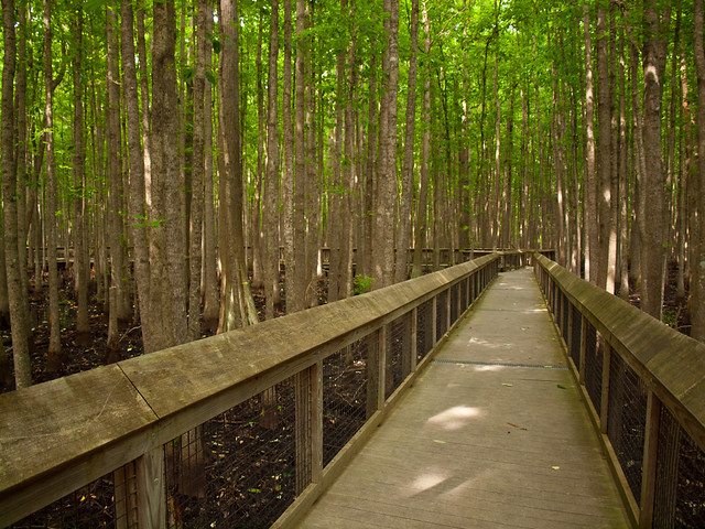
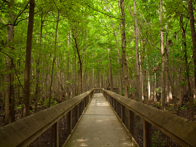
The park is much easier to get to now. It's located just off of Hwy. 49, about 30 miles from Helena. Although it's right by one of the major roads in the area, the park feels isolated and a bit lonely. There were no other people there when we visited. Just swarms and swarms of mosquitoes.
Time moves slowly in the swamps. The US bought the Louisiana Purchase from France in 1803, but it took a few years for the government to head out to explore and survey the lands. In 1815, President Madison ordered a survey, in order to establish a system to distribute the lands to veterans of the War of 1812. So after traveling by stage coach from Washington, two teams of surveyors set out in the swamps of Arkansas. I don't claim to be an expert in the art of surveying, so I'll let this article explain the rest:
Land surveys are conducted by first setting a starting point. That's done by surveying a north-south line, called a meridian, from a familiar landmark, and doing the same with an east-west line, called a base line. Where those two lines intersect is the starting point of the survey.
The lands east of the Mississippi had already been surveyed, of course, and in the process, four meridians had been established. Robbins and Brown split their men into two parties to establish the two lines. Robbins established the Fifth Meridian by surveying due north from the confluence of the Arkansas and Mississippi Rivers. Brown set out from the mouth of the St. Francis River to survey the base line.
Both parties passed through extremely rough territory, but their notebooks, which survive and are preserved at the state land commissioner's office in Little Rock, reveal a stoic attitude toward the hardships of the trek. "This land would be good," reads one of Brown's entries, "if it were not subject to inundation."
That was a pretty mild description for a man who was up to his waist in a swamp. Later, his patience possibly wearing thin, Brown wrote in his notebook that the area which they were passing through consisted of "briers and swamps and briers aplenty."
The two parties did not meet at the point of intersection; that would have been a coincidence of epic proportions. Each passed the intersection point sometime in November, and each party then backtracked until they found each other some time between the dates of November 4 and November 24, 1815.
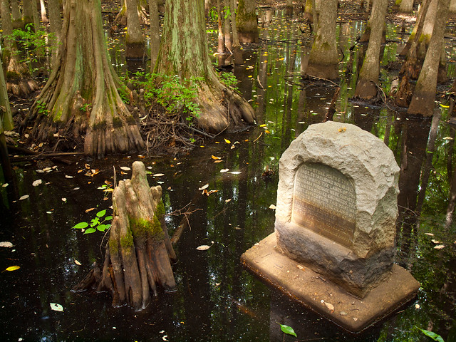
The two groups then determined the point of intersection and hacked blaze marks in two gum trees to mark it. From that point, the survey of the Louisiana Purchase lands began, with the two imaginary lines extending as far as the land itself. (Base Line Road in Little Rock is so named because it follows the original base line laid down by Joseph Brown.)
All township boundaries were drawn from lines that originated there, and from those, subdivisions and even city lots were drawn. Before they were done, Robbins and Brown and their crews had surveyed land in the future states of Louisiana, Arkansas, Missouri, North Dakota, South Dakota, Nebraska and Oklahoma - and most of five more - Kansas, Colorado, Wyoming, Montana and Minnesota.
The swamp then sat forgotten for more than a century. Until some more surveyors showed up. There had been a dispute over the county line separating Lee and Phillips counties in 1921, and a survey team went in to find the county line that ran along the old base line. In doing so, they happened to find the two witness trees that had been marked way back in 1815. So in 1926, a stone marker was set in the swamp, which still sits there today.
It's amazing to me that the swamp is still preserved today, when most of the land around it has been converted to farms and fields. The swamp at the state park is actually a headwater swamp, and is the largest of its kind in the Lower Mississippi River Valley.
While taking pictures out there, I accidentally banged my tripod against the railing of the walkway. Which somehow caused the handle of the tripod to come loose and then shoot up and away. I heard it go into the swamp with a splash. Since there were signs talking about local wildlife (snakes and alligators), I didn't head into the waters for a rescue mission.

No comments:
Post a Comment