Tuesday, May 31, 2011

Riverfest Fireworks

The largest fireworks display in the state is set off each Memorial Day weekend in downtown Little Rock, marking the end of Riverfest. It's always a great opportunity to get some good pictures, if you don't mind dealing with the thousands upon thousands of people all crowding together downtown.

This was the first Riverfest weekend in recent memory where it didn't storm, or even threaten to rain. So on Sunday, before the fireworks, a massive throng of people were descending on the usually quiet streets of downtown Little Rock. As it started to get close to dusk, just about every single available parking space was taken. But still, long lines of traffic were snaking their way through.

I got there early, and luckily had already snagged a good spot. I had met up with my friend John, who managed to find an awesome spot for us to get some pictures. It was on the top of one of the buildings in downtown, and it did provide a nice view of the Main Street bridge (where the fireworks are shot from).

We got there just at sunset, and were rewarded with some amazing views of the city.
P5292749x
Just look how many cars are packed down there, which made me glad I was safely about 20 floors above the packed streets.

The fireworks finally went up around 9:15, and even though we were a few blocks away, it was still loud enough to make my ears ring.
Riverfest fireworks

P5292833x

When the show was over, I tried to get a few more pictures to show off the great view up there. This was taken looking towards the River Market area.
P5292891x
Note the line of traffic still trying to get onto Second Street from the freeway.

And a view looking down towards the Pulaski County Courthouse:
P5292898x

And the view looking west towards the Metropolitan National Bank Building, the Regions Building, and the state capitol off in the background.
P5292905xx

Thursday, May 26, 2011

Cornelius Falls & Bridal Veil Falls

Last Friday, another big storm passed through Arkansas and dumped several inches of rain. It would be more than enough to get some good waterfalls going, and I thought that it would be criminal to miss out on what might be the last good weekend of Spring to get pictures.

I didn't want to use up too much gas, or put too many miles on my car, so I opted to try to hit a place that was fairly close to home. I finally decided to drive up to Heber Springs and visit Bridal Veil Falls and Cornelius Falls. I knew that there would be plenty of water in the falls, but I just hoped that the sun and clouds would cooperate with me.

When I left Little Rock it was mostly sunny, with a few big fluffy clouds floating around. Since you really need cloudy weather for waterfall pictures, I thought that my day would be spent waiting for clouds to block the sun. I wasn't in a hurry, so I took my time on the drive up there (always being mindful of the speed limit in the town of Guy), and lazily stopped for a few pictures along the way.

This was taken along the side of the road, where a pond sits below a few neat old barns...
P5212471

When I finally drove into Heber Springs, it was still bright and sunny out. So I went through a few more gallons of gas and lazily drove around the countryside. Along the way, I stopped over and visited Collins Creek. There was a good amount of water coming in from one of the side streams that flows into the creek, which meant that this area did see some heavy rain the previous day. But it was sunny, and I didn't bother trying to take any pictures.

Eventually I decided to just head over to Bridal Veil and Cornelius Falls. And somehow, my timing miraculously worked out. Some clouds drifted over, and I ended up with great light for the remainder of my time there.

As far as I know, both Bridal Veil Falls and Cornelius Falls sit on land owned by the city of Heber Springs. The falls had once been a popular park, but vandalism had led the city to close the park. When I visited there last year, a locked gate blocked access to the parking area. But now the city has apparently been working to open the park back up. There is even a new viewing platform that provides a nice overlook of Cornelius Falls.
P5212493x
And you can tell it's new - in that it's not yet completely covered with graffiti.

From there it's a very short hike down to Cornelius Falls. The trail is steep in parts, but easy to follow. After just a few minutes of hiking, you are right at the base of Cornelius Falls, which is probably about 40 feet tall.
P5212514

It's a scenic little spot, and really easy to get to as well. I'm glad that the trail here has been opened back up.
P5212534x

There was a lot of water coming over the falls - much more than when I was here in 2010. But with the extra water meant a lot of wind and spray from the falls. I tried to get a shot of the creek just below the falls, but had to battle with drops of water hitting the lens.
P5212572

A few more shots of Cornelius Falls:
P5212594

P5212608

From there I hiked back up the hill and then headed over to Bridal Veil Falls. The trail here wasn't as easy to follow, I don't think Bridal Veil sees as many visitors as it's neighboring waterfall does. I slipped down the hill and crossed the creek, just next to this neat little spot:
P5212638

After crossing the creek I ended up wading through a thick mess of undergrowth (which was mostly poison ivy). There wasn't much of a trail here, or at least one that I could find. But it didn't matter since the falls were just a few yards away.

Bridal Veil Falls is a pretty little waterfall, and is maybe about 20 feet tall.
P5212651x

The creek runs over these rocks just below Bridal Veil Falls...
P5212653

And a view of the falls, with a mossy rock...
P5212686

And one last shot of Bridal Veil Falls.
P5212689x

Tuesday, May 24, 2011

Carwash Falls

After visiting Sweden Creek Falls, it was sadly time for us to head back home. The conditions were still perfect for waterfall conditions, so we tried to think of a good waterfall that we could visit as we made our way south. Having just hiked over five miles that morning, we both quickly agreed that it would be one that wouldn't involve a lot of walking to reach. So we decided to take the long way home, and visit a waterfall that you not only drive right up to - but actually drive right under.

Carwash Falls isn't very tall, but it is pretty unique. It's where the creek tumbles over a bluff, and lands right along a country dirt road. You can drive your car right under the falls - hence the name. It's a waterfall that I've been wanting to visit ever since seeing a picture of it a few years ago. I really wanted to get an awesome shot of the Vibe under the falls, but would instead have to settle for a picture of Zack's Jeep (which is a shame, my car does need a good carwash).
Carwash Falls

To get there, we turned onto a forest service road in Deer and headed south. The road passed through miles of forest, before eventually running along the top of a high ridge. It then dropped down and began to run parallel to the Big Piney Creek. Eventually we found Carwash Falls and stopped for a few pictures. From there we continued on south, and then forded Hurricane Creek (which the Vibe would have failed at crossing). There was a family camping right at the spot where the road fords Hurricane Creek. As Zack's Jeep pushed it's way through the water, the entire family headed out and stared at us in disbelief and looked at us like we were crazy.

Monday, May 23, 2011

Sweden Creek Falls

When we got up to the Centerpoint Trailhead, it was cloudy with a light drizzle coming down. In other words, it was perfect conditions for some waterfall photography. There are several amazing waterfalls nearby, but we decided to pay a visit to Sweden Creek Falls, which is located only a few miles north of Boxley Valley.

I had been up at Sweden Creek Falls a few months ago, but it was in the dead of winter and there wasn't much water going over the falls. I was eager to see the falls now that it's spring. And we both hoped that the falls would have a decent amount of water going over them, since it had rained there a few days before.

We parked at the trailhead and began the hike. It's only a 1.8 mile long hike to the falls and back. This was relatively easy compared to the three miles we had just hiked heading back uphill to the Centerpoint Trailhead. Well, it was easy except that my legs were already starting to get sore from the previous hike.

The trail runs downhill along an old road, and passes by an abandoned home. From there the trail drops down and runs along the base of a bluff. Shortly after that, you reach the falls. I think both Zack and I were happy to see that the falls were running quite well.

And the falls are awesome - they are over 80 feet tall. The only problem with this spot is that it is tricky to get a good picture there. Trees line the trail, which makes it hard to get a good unimpeded view of the falls. This shot was taken after crossing the creek and then heading up the side of the bluff, over slick rocks.
P5142332

After taking a few pictures, I crossed the creek and went back to the trail. This was taken along the opposite bluffline from the previous shot. The area was covered with a thick layer of ferns.
P5142399

And then we started back towards the trailhead. But first I stopped one last time for a shot of the falls, seen through the dense screen of trees that surround the waterfall.
P5142405

We made it back up the hill to Zack's Jeep, and started back towards the main road. Along the way we stopped at this old truck, left to rust in the woods.
P5142420

I have gotten a few different pictures of this particular truck over the years. This was taken at my last visit, on March 13:
Fixer-Upper

And then another visit, back in November of 2007:
Fixer-upper

From there we opted to visit another waterfall on the way home. This is a waterfall that wouldn't require any long hikes to visit. In fact, it was one that you could actually drive up to (or actually, drive under) the falls.

Thursday, May 19, 2011

Goat Trail on Big Bluff

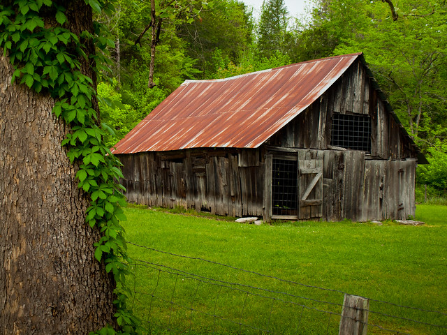
Last Friday, I was toiling away at the office and slowly counting down the hours until closing time. But around 10:00, I got a message from Zack asking if I'd be interested in going on a camping/hiking adventure with him up in the Ozark Mountains. He wanted to hike the Goat Trail, which sits high above the Buffalo River.

I requested, and got, the rest of the day off and just a short time later we were driving north towards the Buffalo. To reach the Goat Trail, you have to hike three miles along the Centerpoint Trail. We were going to camp along the trail that night, so we also had to bring along tents, sleeping bags, food and various assorted pieces of camera equipment.

The hike down was quick and easy, thanks to it being mostly downhill. We made good time, and finished the three mile hike in about an hour or so. We only passed four people on the hike, all of them coming back up the trail. One group said that they had hiked the three miles down, and then just turned around and came back up without going out onto the Goat Trail. We both thought it was somewhat strange to make that hike without visiting the trail's star attraction. But as odd as that was, seeing other people made bizarre hiking choices on that trail would turn out to be the theme for the weekend.

After three miles, you pass through a wide clearing that marks the spot where the Goat Trail branches off from the Centerpoint Trail. It is a perfect camping spot, and it came already equipped with some fire rings. We quickly set our camping gear aside and headed down the Goat Trail. It felt a lot lighter to just be carrying the camera equipment...

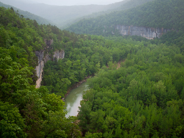
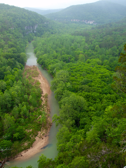
The Goat Trail runs for about a mile out to Big Bluff. At first the trail runs through the woods, but it quickly meets up with a bluff line. Trees block your view for most of the hike, but once you get out on the bluff the trees are gone and you are greeted with a panoramic and breathtaking view of the Buffalo River.
P5132146
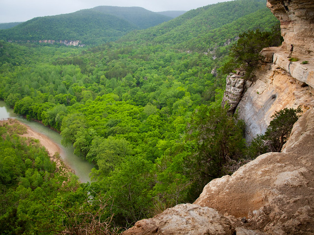
A view of the Buffalo River from the trail - note Zack in the picture for scale.

The Goat Trail runs along a natural ledge, which is almost as if someone put in a sidewalk along the bluff. Big Bluff is about 560 feet tall, one of the tallest on the Buffalo River (depending on which source you trust, the tallest is the 590 foot-tall Ludlow Bluff near Rush). The Goat Trail runs about 340 feet above the river. It's definitely high enough to make you a little scared of heights.
P5132170x

The Buffalo River curves around a large bend here, passing by a few (relatively) small bluffs.
P5132204x

The Goat Trail reminded me of the time I visited the Grand Canyon. The view here is so vast, so impressive, that it is difficult to really capture it with a camera. It's really something you have to see in person, since the sheer size and scale of the bluff doesn't translate well in a picture.

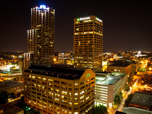
And the Big Bluff, like it's name suggests, is massive. At 560 feet it towers high over the landscape. For a bit of comparison, the tallest building in Little Rock is only 546 feet tall (the 40-story Metropolitan National Bank Building). The Goat Trail, at 340 feet, is taller than the fifth tallest building in Little Rock (the 331 foot-tall Union National Bank Building).
Downtown Little Rock
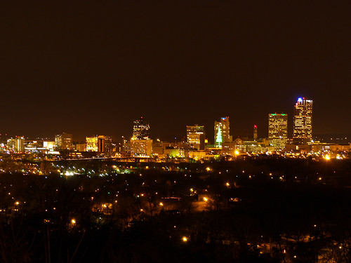
Now just imagine a bluff that is taller than every building in this picture....

Actually if you were able to magically scoop up the Arkansas State Capitol and drop it down along the Buffalo River at the base of Big Bluff, you would still have 110 feet of empty space between the Goat Trail and the top of the dome. It's seemed almost impossible to grasp the size of the bluff. The views were still awesome though.
P5132207x

As the Goat Trail makes it's way along the bluff, it is blocked by a foot-thick buttress of rock. To get around it, you have to either crawl through a hole in the rock, or bypass it by taking a trail that runs close to the edge of the bluff. The hole isn't a natural one, it was actually carved out of the rock around 1910, in order to make a somewhat safer trail for area school kids to take while walking to the Centerpoint School. Seriously, kids walked along the 340 foot tall bluff every day to get to school.

The Goat Trail runs past a few alcoves, which were claimed by several buzzards. They got angry when we approached, and they took off and flew in circles high above us. But speaking of animals, the Goat Trail did actually get named because of goats. Apparently in the 1950s, a few goats escaped from a nearby farmstead and wandered around the ledge. The stench from their droppings, it was said, lingered for many years. And on that pleasant note, let's return to our story...

As we were up there taking pictures, two kayakers appeared on the river. We waved at them, even if they looked like tiny dots on the horizon. When they got closer they waved back, and then pulled up to camp across the river from the bluff.
P5132225

When I left Little Rock earlier that day, it was warm and sunny. But up at the Buffalo it was cold with a light rain/drizzle. There was a touch of fog drifting along the tops of the mountains.
P5132271x

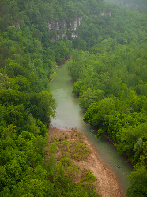
We probably spent about two hours up there taking pictures and soaking in the scenery. But since it was starting to get dark, we reluctantly headed back to our campsite. I got one last picture before we left...
P5132292x

I bought a new tent that I was eager to try out. It's one of those one-person tents, which was light enough to make it a nice thing to have on a 3 mile hike. So I attempted to get it set up and no surprise, started having some difficulties. One of the things that I hate about camping are tent pegs. Those damn things never work right, and it's always nearly impossible to get them to go into the ground. I gave up on them, the ground there had maybe a half-inch of dirt before you hit solid rock. I tried banging the pegs with a rock, which only helped to bend them, before they would just lamely fall over.

I was ready to give up and just sleep in the tent without it being put up. But with Zack's help we were able to rig it up - using some nearby rocks to tie the guy lines onto. He only called me a noob a few times during this...

After that, we set out to build a campfire. It had rained the day before, and it was drizzly all of that day. So any firewood that we found was a little wet. It took awhile to get a fire going, but eventually we had a pretty good one blazing away. We sat back to relax, have a few drinks, and lazily look at the fire.

Occasionally, I heard some animals off in the distance. Coyotes! I could easily imagine them attacking the campsite and trying to eat my tent.

We were planning on going back out onto the bluff early the next morning, eager to catch an awesome sunrise. So by about 11:00, it was about time to call it a night. But suddenly, in the distance, I saw some lights. I immediately thought it was the light of the campfire reflected in the eyes of some blood-thirsty coyotes. Oh crap, here they are!

But no, the lights were from flashlights. It looked like someone was hiking down the trail towards the campsite. I logically assumed that it would be one of the following:
1). Sexy lady hikers who needed to warm up by the campfire.
2). A murderer.
3). Coyotes, who somehow learned how to operate flashlights.
4). A bizarre combination of the above.

It seemed like it took forever for the hikers to make it down into the clearing by the campsite. As they got close enough, one of them yelled out a "hello!" and we hollered back. It turned out to be about 15 teenagers, part of a church youth group from Tulsa. For some reason, known only to them, they decided to start hiking the Centerpoint trail at night. They didn't know where they were going, or what was on the trail. They seemed to be equally surprised to find out that they had hiked three miles, and that they were this close to the Goat Trail. They did also seem startled when we told them of the probable proximity of coyotes...

They came in and crowded around our campfire to warm up (it was about 45 degrees that night). They told a few ghost stories, and then turned around and began to hike the three miles back to the trailhead. It was about 11:30 when they left, so they probably got back well after 1 am.

I couldn't imagine hiking that trail at night, or just heading off into the woods without knowing what you were getting into. It was really bizarre.

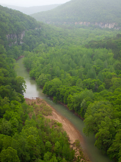
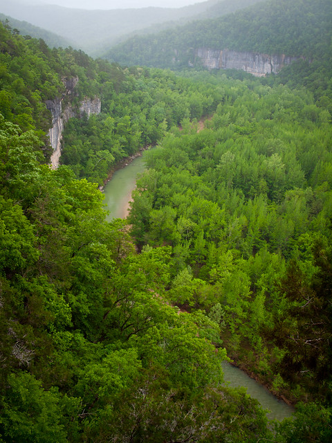
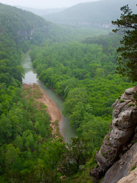
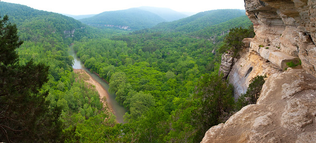
The next morning we woke up before dawn and headed back out onto the Goat Trail. The hope was that we would catch some cool fog along the river, or at least a nice sunrise. But neither of these things happened. We did stay awhile and enjoy the nice view again. I did try to do a panoramic shot from there - this is three shots stitched together:
P5142313-P5142315

Then we hiked back up the hill and started to gather all of our camping equipment. With everything packed and ready to go, it was time for the long hike up back to the trailhead. What had been a deceptively easy hike the day before was now a long slog up the hill (with the added fun of the weight from the backpacks!). But we made it back to the car after about an hour and a half or so. We didn't see our friends from Tulsa out there still, so at least they made it back safely.

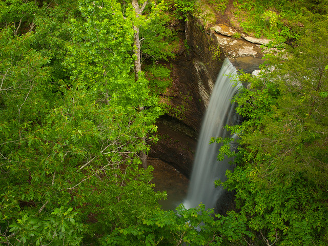
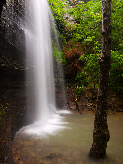
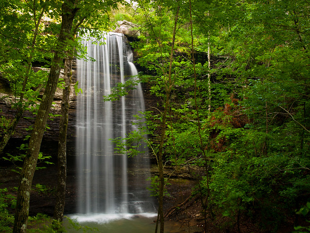
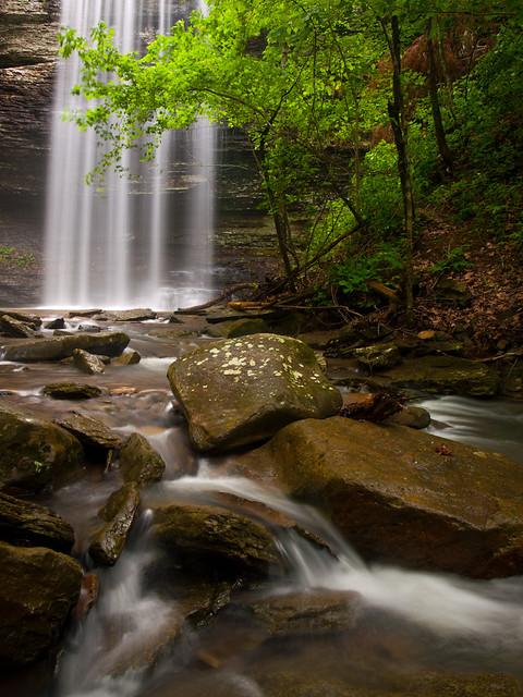
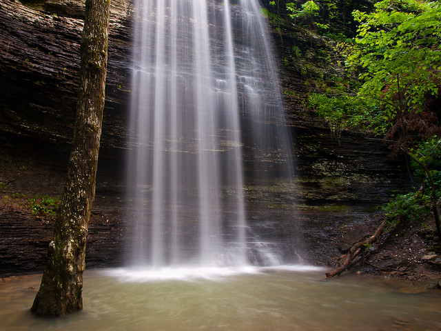
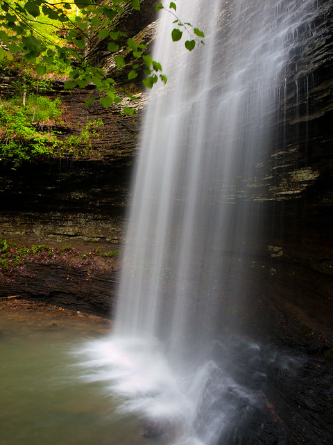
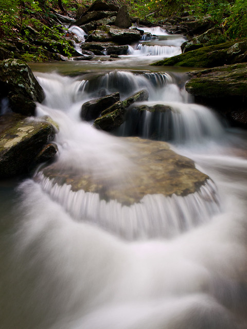
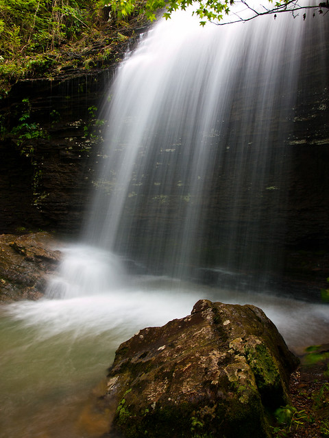
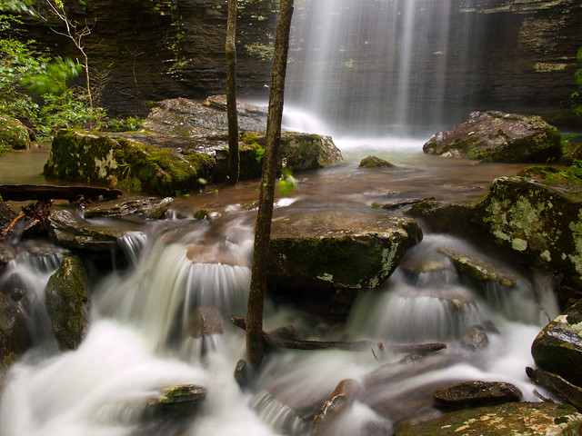
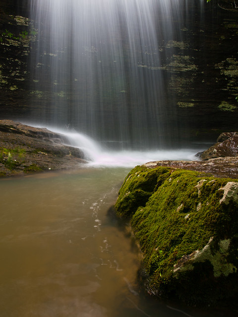
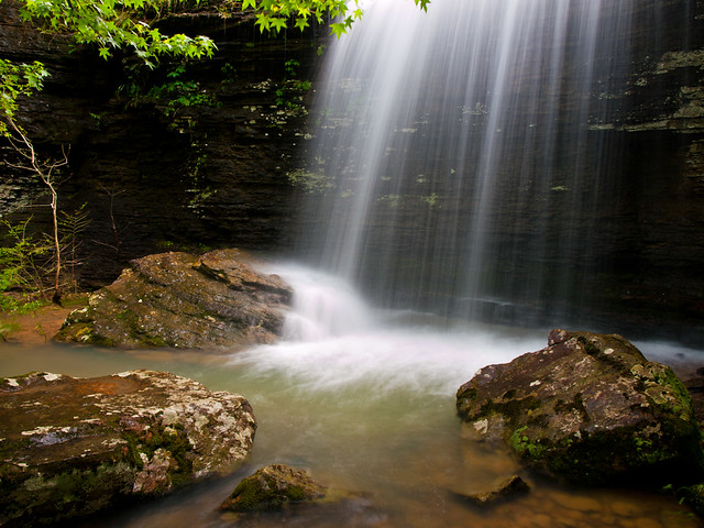
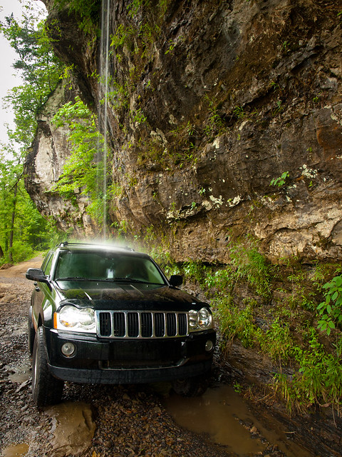
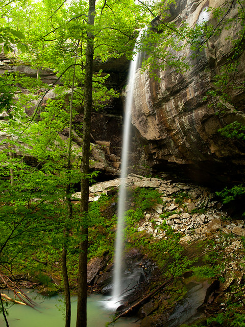
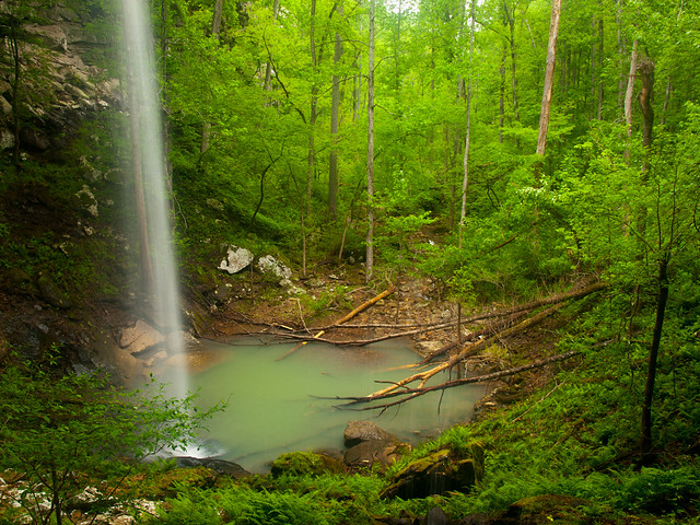
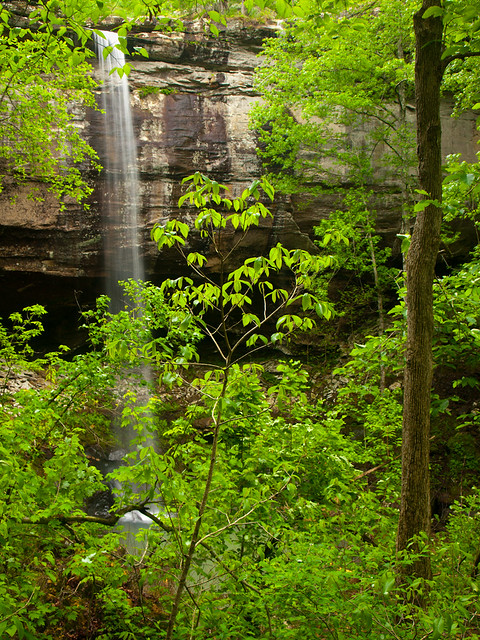
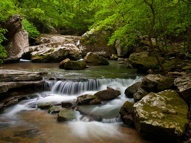
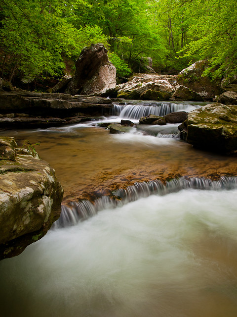
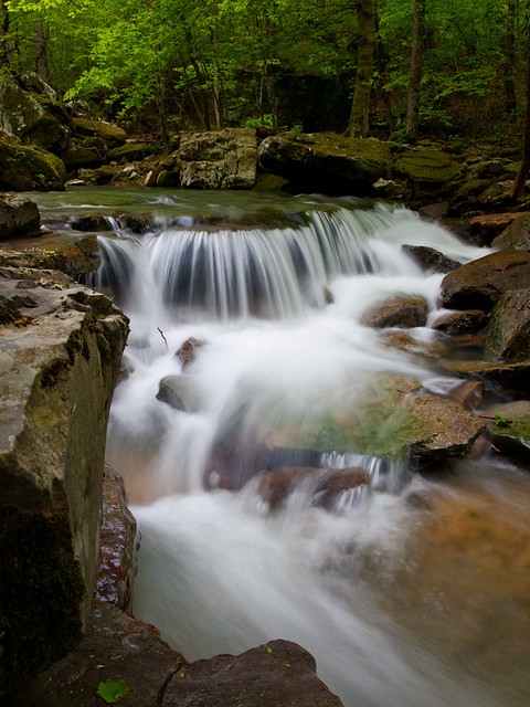
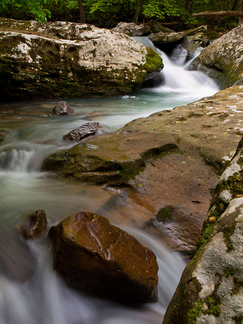
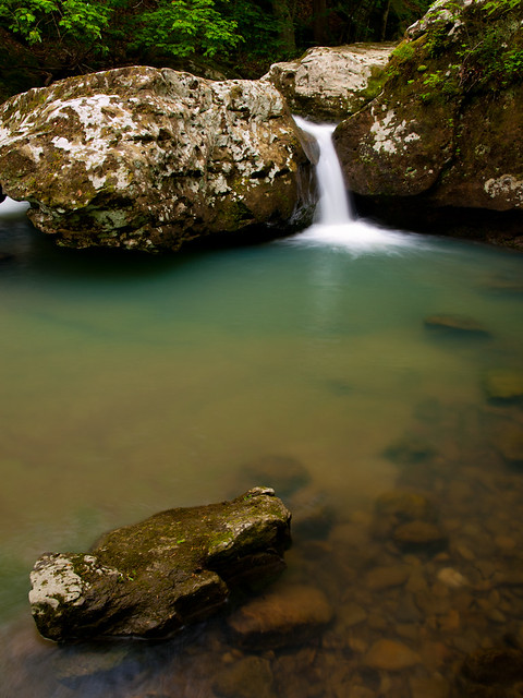
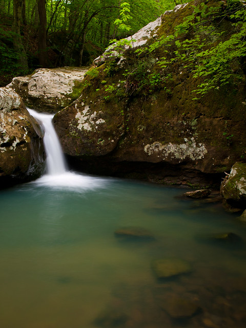
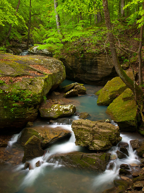
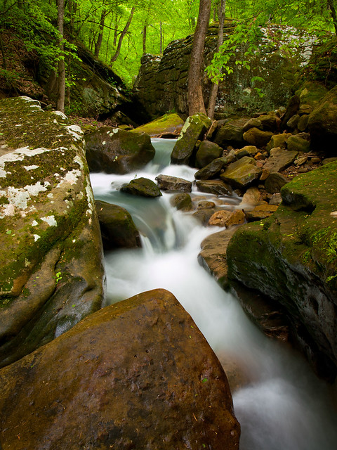
But the morning was cloudy and rainy, which was perfect conditions for waterfall photography. So after happily discarding the packs in the back of Zack's jeep, we headed out to visit a nearby waterfall...

Sunday, May 15, 2011

Erbie

We apparently didn't get our fill of old barns while we were in Boxley Valley. So we drove east, heading towards another spot with a plethora of old buildings. On the way, we stopped to get a picture of this barn that sits along Hwy. 74.
P4301853

The road was covered in a thick fog. This is along Hwy. 74 where the road curves around Horseshoe Canyon.
P4301859

Our next stop was the Parker-Hickman Farmstead, near the Erbie campground. This old farmstead is a collection of several well-preserved buildings. All of the buildings sit far enough away from the Buffalo River that they escaped any damage from the recent floods. But the heavy rains did wash out the area around a low-water bridge over Webb Branch, so it was only passable with high-clearance vehicles.

It takes a few miles of driving along a dirt road to reach the farmstead. Luckily the road was in good shape, and it passes by some neat barns along the way. We stopped at one for a few pictures...
P4301876

Eventually, we made it to the farmstead. We didn't want to press our luck driving across the low-water bridge. The rain had scoured the dirt from both ends of the low-water bridge, leaving deep ruts. So we parked and walked across the bridge, which had about 6 inches of water running over it from the creek.

The farmstead is comprised of an old home and several barns. The old home was built sometime between 1847 and 1849. It is the oldest structure within the boundaries of the Buffalo National River.
P4302012
The lean-to on the side of the building was added in the 1920's, and served as a country store.

The last family to occupy the home was the Hickman family, who started living there in 1912. They built most of the barns and other buildings in the farmstead.
P4301948x

Gradon Hickman was the last person to call this place home. He lived here until 1978, just a few years after the land surrounding his home was protected as the Buffalo National River. In 1982 the Park Service purchased the property and in 1984 the buildings were stabilized and preserved. The house is still open for anyone to go inside and have a look around.

Another view of the old home, with a small stream that cuts through the property:
P4301971
I had some difficulties getting this picture. I decided to shoot this angle, trying to get the creek and and the house all together in the shot. But I realized I should probably use a polarizing filter, which I had left in my camera bag. And of course, I had stupidly left the camera bag in the car. So I had to walk through the 6 inches of water on the low-water bridge to retrieve the filter.

I grabbed a filter out of the bag and crossed back through the water and went back to the camera. Only then did I realize that I ended up grabbing the wrong filter - I got a neutral density filter instead of the polarizer filter. So back I went, crossing back across the creek. This time I just grabbed the camera bag so I didn't need to make any other trips through the water.

And one last shot of one of the several barns at the farmstead:
P4301996

From there we drove back to Hwy. 7 and went north into Harrison for dinner. We dined at a Thai restaurant, which was actually pretty good. I felt bad though, since my soaked shoes left wet footprints all over the dining area.

Saturday, May 14, 2011

Boxley Vallley

From Smith Creek, we drove down the hill and into one of my favorite place in the state. Boxley Valley is just an amazing spot - there is a perfect combination of history, natural beauty, and wildlife. It's all located along what has to be the most interesting stretch of road in Arkansas.

I've been here dozens of times, but I never tire of stopping to take pictures of the old barns and homes that line the road through Boxley. Our first stop on this visit was the Edgmon barn, which was built around 1920.
P4301691

The conditions were perfect too - the light rain had left some fog drifting through the valley, hugging the tops of the mountains. The light was perfect for taking a few more pictures...
P4301672

P4301714

P4301732

A few cows, grazing in the fog:
P4301806

And the same cows, with the old Boxley Church (built 1899) in the distance.
P4301808

After that we drove over to the Lost Valley trailhead, just to see how things looked. The campground and trail at Lost Valley saw some significant damage after the floods. The wooden footbridge over Clark Creek was destroyed. The flood waters actually ripped the middle section of the bridge out, carrying it downstream a few hundred feet.
P4301825x

At the time we visited, Lost Valley was still open. People were camping there, and hikers were going in and out of the trail. But that wouldn't last for long, sadly. As of this writing, Lost Valley is closed until further notice. Along with the destroyed footbridge, there was considerable damage to the trail itself. According to the National Park Service, it's going to cost $250,000 to get everything back to normal. And to make matters worse, the Park Service is going to permanently close the campgrounds at Lost Valley. Hopefully the trails can be quickly rebuilt...

Tuesday, May 10, 2011

Smith Creek

The other weekend I drove up to visit an Aunt, who lives deep in the Ozarks. On Saturday, we set out with the cameras to do some exploring. Our first idea was to visit a state park in Missouri. But the floods of the week before washed away those plans. A storm dumped about a foot of rain across the Ozarks, causing some severe flooding. The place we that thought about visiting saw some damage.

But then again a lot of places saw some damage. The Buffalo River in Boxley rose to over eleven feet, which is about 8 feet higher than normal. The heavy rains around there managed to wash out the historic covered bridge in Ponca, the wooden footbridge at the Lost Valley trailhead, and damaged several roads and river put-ins.

We ended up heading through Boxley Valley anyways, and saw some evidence of the recent floods. As we drove across the bridge over the Buffalo River, we spotted this poor canoe. It must have been caught up in the flood waters and ended up wrapped around this sign. Mind you, this sign sits about 20 yards from the river. It's a testament as to how high the river was, and to how strong that sign is.
Up the creek, without a paddle

We decided to pay a visit to Smith Creek, which flows through Boxley Valley and empties into the Buffalo River. It is a very scenic little area. The creek runs and tumbles over some huge mossy boulders, creating a few nice waterfalls.
P4301449

Smith Creek isn't part of the Buffalo National River, instead it's a preserve that is maintained by the Nature Conservancy. The previous owner of the property (who also owned the Crescent Hotel in Eureka Springs) had intended to build a house there. But instead the land was given to the Nature Conservancy, which now preserves the creek and a large underground cave system. About three million bats are said to hibernate in the 3-mile long cave during the winter.

The creek is easy to get to, just a short (but steep on the way out) hike. This is one of the neater stretches of the creek...
P4301493

P4301511x

There are some other waterfalls just above here, which are blocked by the boulders in the creek. This is a view of one of the falls. To get this shot meant climbing up the side of a large boulder.
P4301549

And another waterfall, along this same small stretch of creek:
P4301573

And a few more views of the falls. You can barely just see the white from another waterfall, under the boulder on the left-hand side of the picture.
P4301582

P4301588

We got back on the trail and went around to the next really scenic stretch of Smith Creek. It's where the creek rounds a bend, rushing past a massive house-sized boulder.
P4301611

And a view from creek-level. The huge boulder in the previous shot can still be seen in the background here.
P4301619
The rocks were extremely slippery around there.

It had started to rain, so we decided to head back to the car. We visited just a few of the neater things to see in Smith Creek (there are several other waterfalls out there). As we made our way up the steep hill back to the trailhead, we heard an elk doing a bugling call. When the Buffalo River flooded, it must have forced the resident elk population in Boxley to head for higher ground. The river must have still been too high for them to get across, and they were still hanging out along the side of the hill nearby.