Saturday, April 28, 2018

Waterfall Weekend

We have entered peak waterfall season in Arkansas, so last weekend I met up with Zack and Matt for a little trip up into the Ozarks. It looked like ideal conditions, with cloudy and rainy weather predicted. Spring had fully hit in Little Rock, and all the trees had greened up with bright leaves. But as I started heading north from Russellville, it seemed like Spring hadn't quite reached the Ozarks yet. The further north I went, the leaves got smaller and smaller until there was one point where the leaves hadn't come out at all yet. In just a short drive, it went from Spring all the way back to Winter.

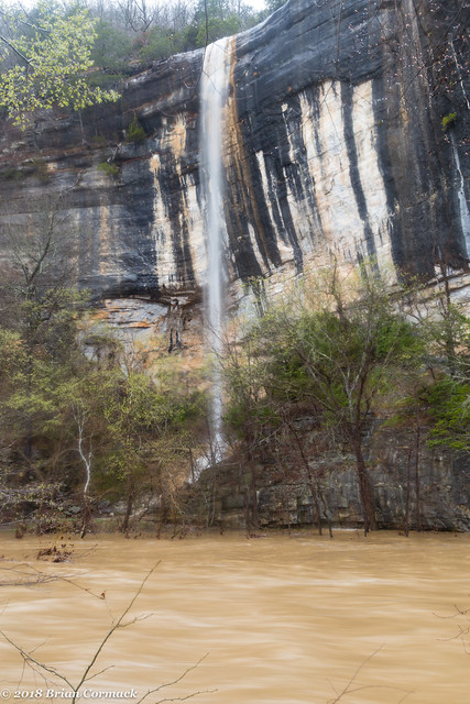
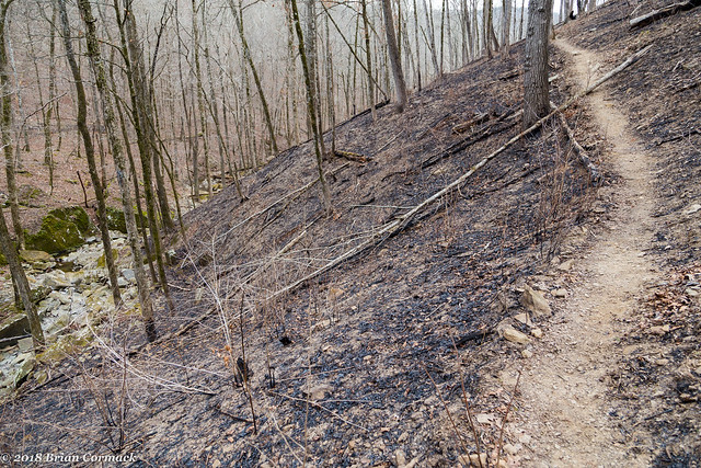
It was still green in the lower elevations, so we went to camp at a spot along Big Piney Creek. After getting everything set up, we then started our first hike along Rock Creek, which is a tributary of Big Piney. The hike probably wasn't all that bad if you're in good shape. But I was quickly reminded of how woefully out of shape I am. It seems like my legs and knees began to ache just as soon as we headed out into the woods. This area is really popular with rock climbers thanks to some tall bluffs, and there was a trail to follow for a bit. The trail ran below the bluffs, and eventually went by Rock Creek Bluff Falls (which are about 47 feet tall). But the sun was out, so none of the pictures really turned out.

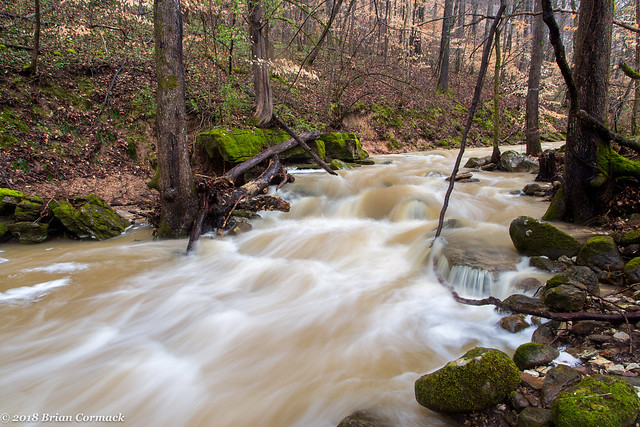
The trail ended at the bluff, so we started hiking out into the woods after that. After hiking about a mile or so, we finally made it to this waterfall - Rock Creek Falls. The creek does live up to its name, at least here at the waterfall. Here the waterfall tumbles down onto a large boulder sitting in the middle of the creek.

Rock Creek

As soon as we got here, after hiking two miles, we heard loud engines roaring through the woods. A large group of country guys riding 4-wheelers and side-by-sides appeared out of nowhere and drove into the middle of the creek right above the waterfall. They got out, and stood around talking and drinking beer. We sat at the waterfall and waited, which was a little frustrating but to be honest I wouldn't have minded if one of them gave us a ride back to our car so we didn't have to hike all the way back.

Rock Creek Falls

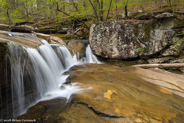
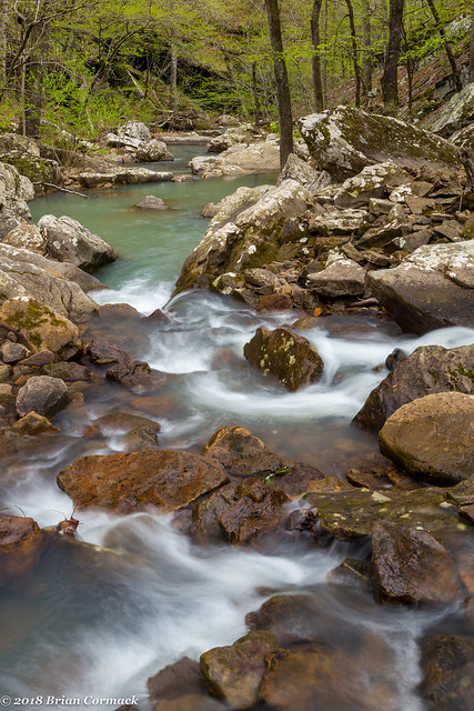
And looking up at the falls, taken while sitting on a rock in the middle of the creek. There are definitely a lot of rocks in Rock Creek.

Rock Creek Falls

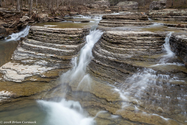
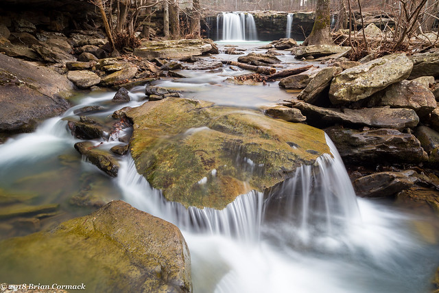
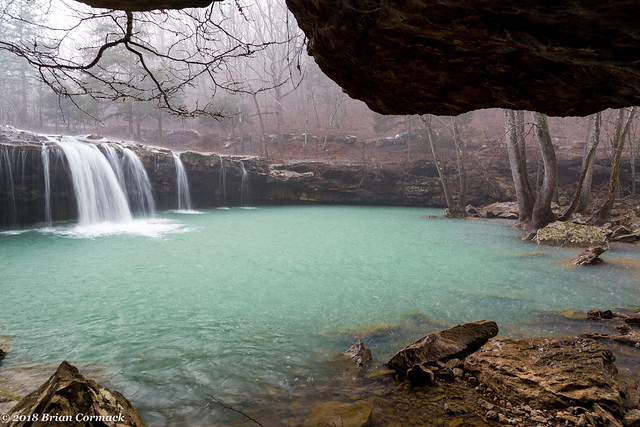
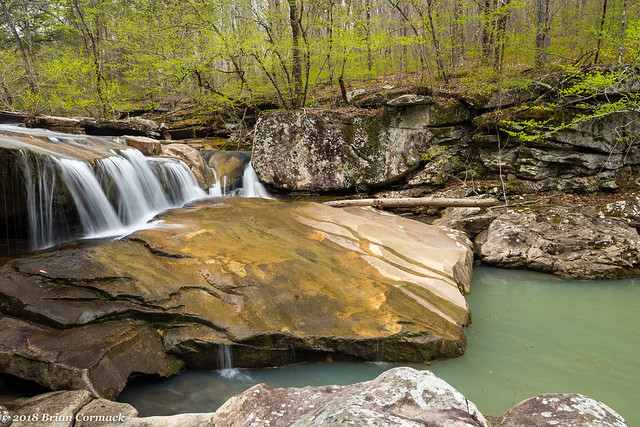
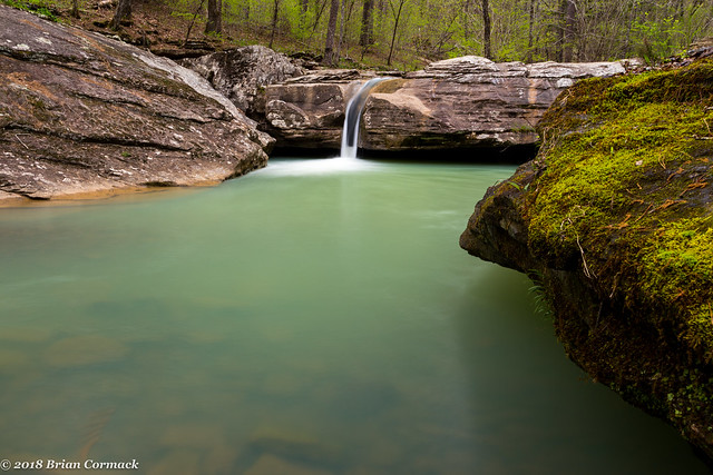
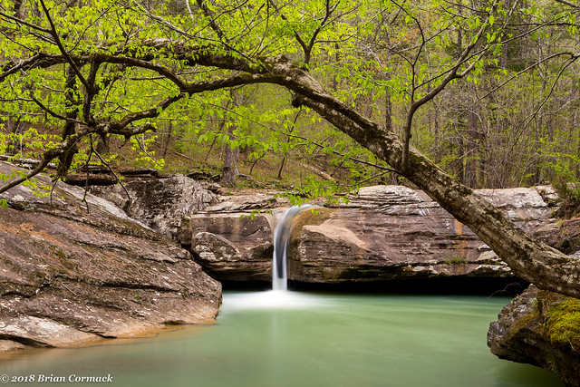
Just downstream is another waterfall - Ava Jane Falls. It's interesting how the water changes color from looking greenish in the pool below the falls and then into more turquoise in the creek.

IMG_6048-3

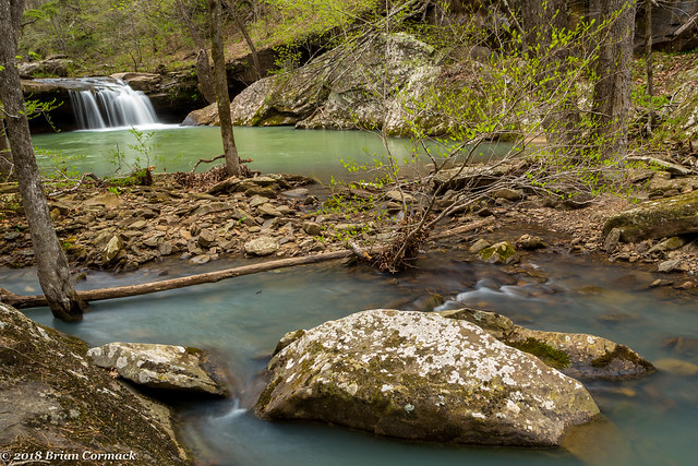
And a closer view of the falls:

IMG_6054-2

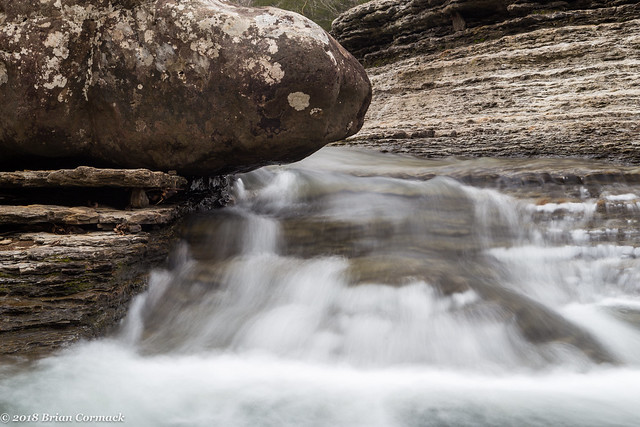
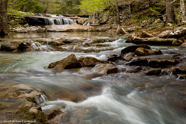
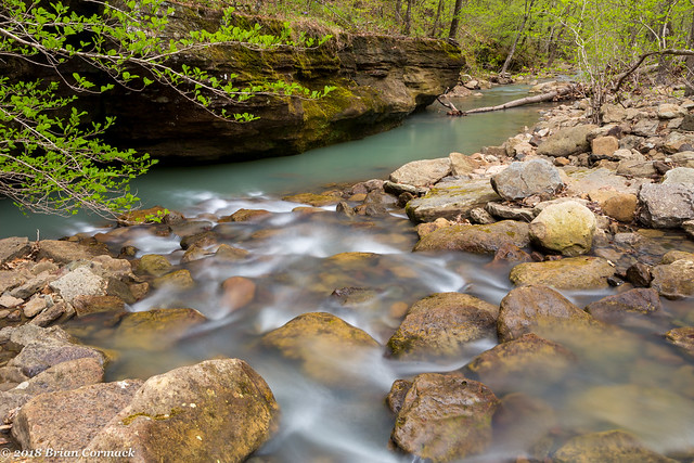
And then looking downstream from Ava Jane Falls, as the creek passes heads through the forest towards its eventual confluence Big Piney Creek.

IMG_6070-2

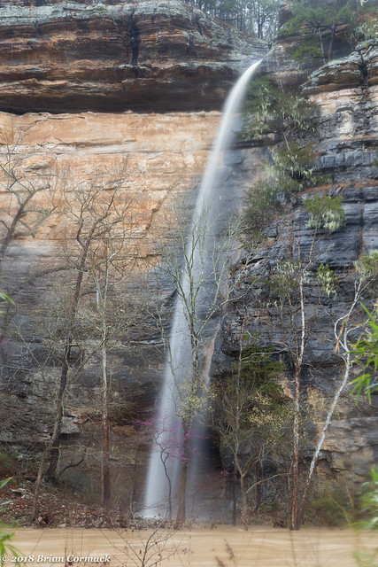
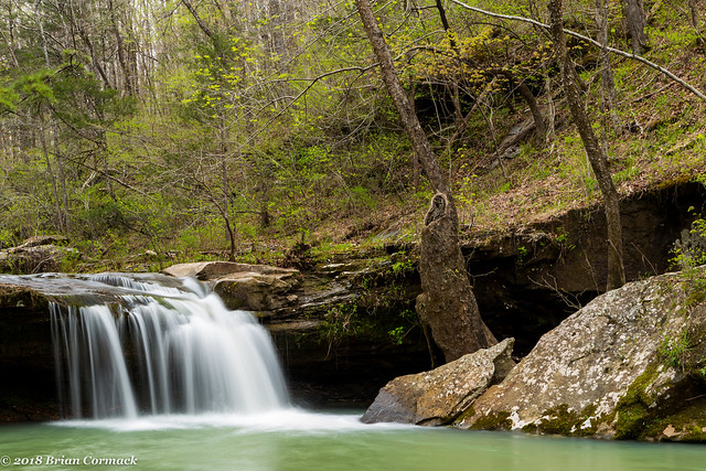
After that we began the hike back to the car (unfortunately none of the 4-wheeler guys volunteered to shuttle us back). After finally reaching the car, we decided to hit one more waterfall before it got dark. We decided to visit Slot Rock Falls, which is on the amusingly named Lick Creek. The waterfall can be reached by hiking the Ozark Highlands Trail, or if you're lazy you can drive right up to it. Since we had already hiked four miles that day, we decided to be lazy. Luckily we were in Matt's Xterra, and after some driving (which required being in a 4-wheel drive) we were able to get to the falls.

IMG_6099-2

It is a really neat waterfall - the creek has carved a deep groove in the rock, creating a narrow slot for the waterfall to pour over. The pool below the falls is apparently a good swimming hole too (especially if you've been hiking the OHT, it'd be a nice place to stop to rest).

IMG_6105-3

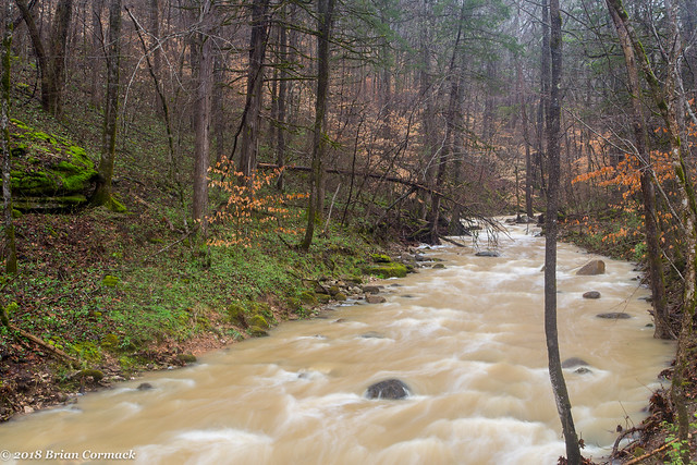
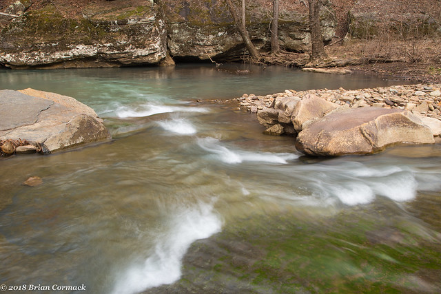
And here's the view of Lick Creek has it flows downstream from the waterfall.

IMG_6076-2

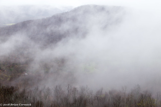
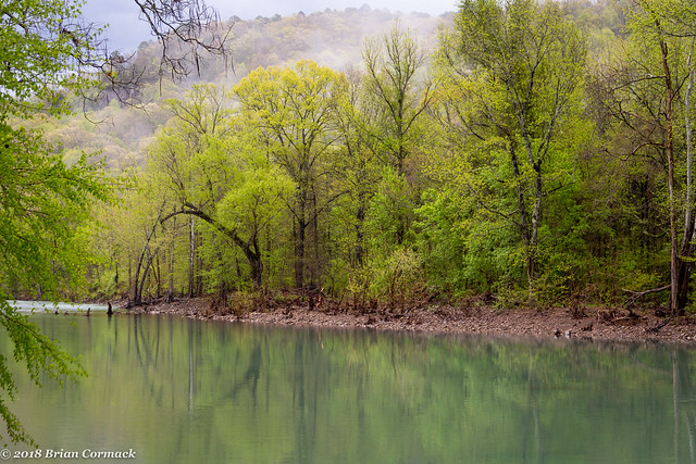
It started to rain and it was getting dark, so we headed back to the campsite. It ended up raining fairly heavily overnight, so the next morning there was some fog drifting along the hills above the creek. This was our view of Big Piney Creek from our campsite, which was a great spot to spend the night.

IMG_6144-2

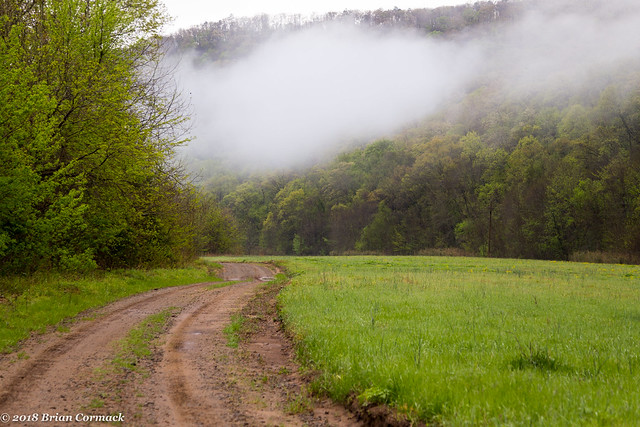
And another shot of the fog clinging to the hillsides above a field near our campsite.

IMG_6133-2

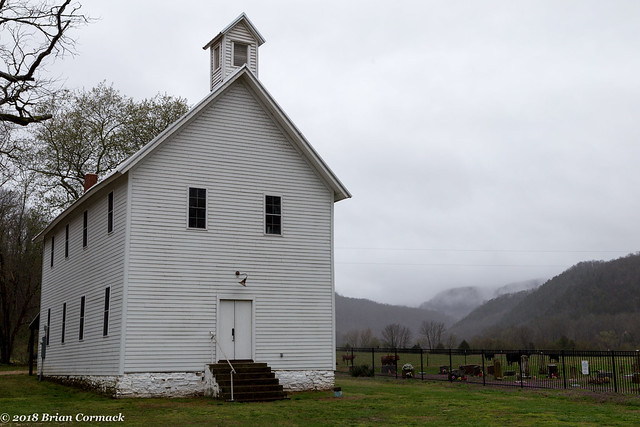
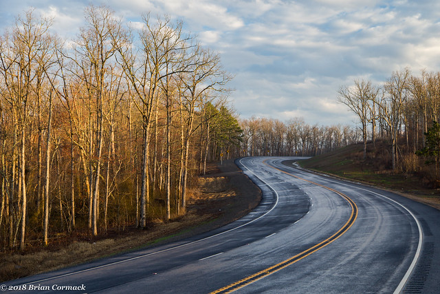
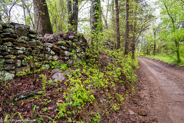
The field was marked by a stone wall, which ran for a bit alongside the road.

IMG_6124-2

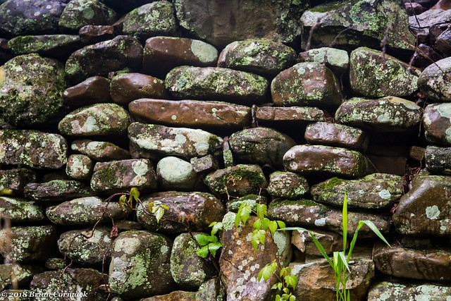
Wonder how old the wall is? It seemed like it was still in pretty good condition.

IMG_6127-2

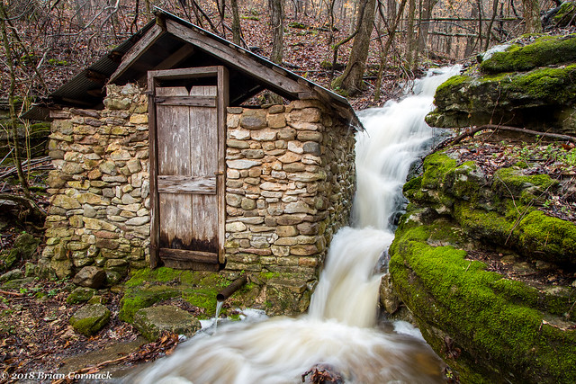
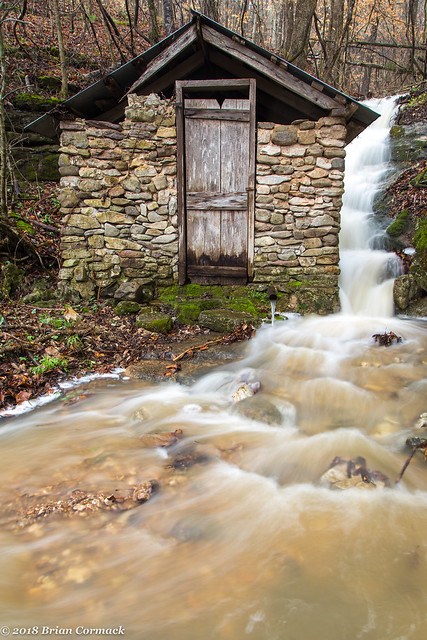
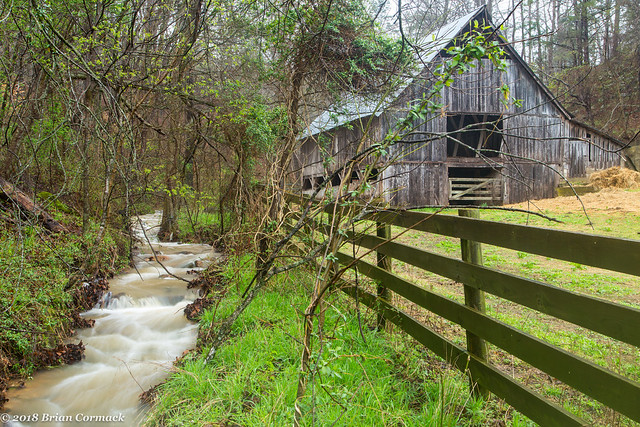
We decided to try one more waterfall - Mill Creek Falls. The falls are reachable from a hike that has been rated as an "easy bushwhack." Which I do question, mostly because I'm 38 and out of shape so I don't think there are very many easy bushwhacks anymore. The hike was fairly level, but there were a lot of sharp briars and thorns lurking dangerously along the creek, and I ended up being scratched up enough to look like I just barely survived a knife fight.

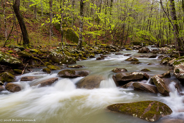
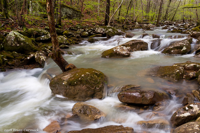
The creek is very pretty though, and reminded me a bit of Smith Creek up by the Buffalo River.

IMG_6156-2

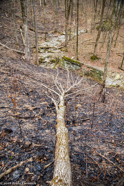
We also saw some evidence of bears in the area - mostly some torn up trees and lots of bear scat (so to answer the question - yes, bears do crap in the woods). We didn't actually see any bears out there, which is for the best since I was worn out after all the hiking and would have not been able to outrun any bears.

IMG_6197-2

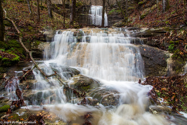
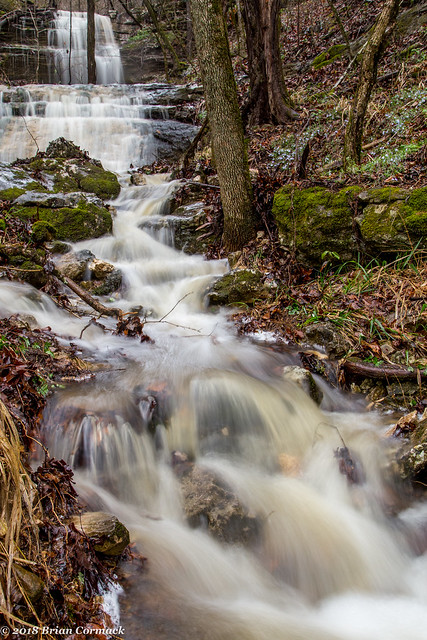
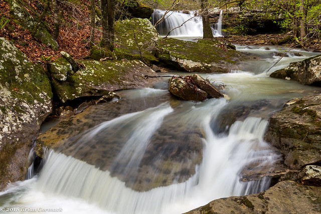
And a shot of Mill Creek Falls, which is about eight feet tall.

IMG_6216-2

I was only able to get a few shots from here before the sun came out, and after some rest we started the hike back to the car. It was a good weekend and I can't wait to get back up to see a few more waterfalls this Spring!

Thursday, April 19, 2018

The Old Mill

The Old Mill in North Little Rock is probably one of the most popular photo spots in the state, especially in the Spring when the azaleas and dogwoods are blooming.

IMG_5955-3

I know it's one of those cliché places to take pictures now, but I've always been fond of The Old Mill. I grew up in North Little Rock, so I've made countless trips here over the years. My Grandparents used to own a house a few blocks away, and my cousin got married here.

IMG_5923-3

I'm not the only one in my family who has taken pictures here. My Grandfather lived in Park Hill in the 1930s when The Old Mill was built, and he took his Kodak Six-16 Brownie camera there one day to take a few pictures (I'm guessing sometime around 1934). This was the shot he got, which has the mill and his truck in it.

1174166814_XgzLB-O

I managed to inherit a few things from my Grandfather (most notably, I got his hair - cowlicks and massive widow's peak). But I'm also happy to have gotten his love of photography (along with my cousin Jon, who is an actual professional photographer). Before he passed away in 2007, my Grandfather gave me the old Brownie camera that he used to take this. That camera is one of my most prized possessions, and I always think of him and my Grandmother when I visit The Old Mill.

Wednesday, April 11, 2018

Boxley Valley

There is one spot that has been high on my Arkansas photo bucket list for several years - the old spring house in Boxley Valley when the waterfall is running beside it. I've taken several pictures here in the past, but I've never been lucky enough to be there when the waterfall has been running. You have to be there when the conditions are just right (like after a huge rain).

So a few weeks back, a huge storm system was predicted to move across the Ozarks. So I left work early, and headed up towards the Buffalo River with the hopes that the storm would dump enough rain to get the waterfalls flowing up in the hills. At first, things didn't really look too promising. There wasn't any rain falling for the first half of the drive, just some gray clouds off in the distance.

The rain finally hit when I was in Russellville, a sudden and drenching downpour that hit when I was getting gas before heading up Highway 7. It was one of the rains that old timers would call a "gulley-washer" or even a "toad strangler." I ended up getting soaked because the wind blew the heavy rain under the gas station awning. It was a lot of rain, but was it enough to get the water in Boxley going? I hoped I wasn't about to drive three hours only to find a dry waterfall.

After the rain, fog began to develop along the mountains. I stopped at one of the overlooks on Hwy. 7 and got a few pictures.

IMG_5182-3

I continued north on Hwy. 7, and was getting slightly worried. The ditches and creeks along the road didn't have much water in them. But when I headed down the hill into Jasper, conditions drastically changed. The creeks in Jasper were overflowing, and the Little Buffalo River was flooded.

So it had definitely rained here. Every creek and stream was high and spilling over its banks and there were tons of waterfalls running down the sides of the mountains. The Buffalo River was high and muddy at the bridge in Boxley Valley, rushing well over the low-water bridge in Ponca. I eagerly headed over to the old spring house, and there was of course plenty of water there. Water was pouring down the hillside, and the ditch along the road was overflowing with water. I had to cross the ditch to reach the spring house, and I had planned ahead by bringing my waterproof hiking boots. But those don't do much good when the water is up to your calf. But the soaked shoes and socks were worth it to finally catch the spring house with the waterfall running beside it:

IMG_5252-5

I haven't been able to find any information on the history of the spring house. It sits near the Boxley Mill (which was built in 1870) and a house that was built in 1940. I'm guessing that it was probably built sometime in the early 20th century, and it is pretty good shape considering the waterfall that is pounding the side of the old stone walls.

IMG_5208-2

There was so much water that there were tons of huge waterfalls tumbling down the sides of the mountains that ring the valley. I stumbled up the hillside to get a few shots of this waterfall, which tumbled and fell in several different levels.

IMG_5285-Edit-2

And another shot of the cascade below the falls. I've been here dozens of times but have never noticed this creek before. There were so many waterfalls and cascades tumbling down the hills that day.

IMG_5298-3

The road through Boxley Valley is one of the most scenic drives in the state. There are tons of old historic buildings in the valley, including the old Boxley Baptist Church (which was built in 1899).

IMG_5262

I drove over to Lost Valley, with the hopes of hiking the trail that passes by several beautiful waterfalls. But to start the trail, you have to cross Clark Creek and it was overflowing with some swift and muddy water. There was no way to safely cross (without being rushed downstream to the Buffalo River), so I just took some pictures along the road of the creek instead.

IMG_5320-4

IMG_5333-Edit

I stopped again at this old barn (which was built around 1915) with a small creek next to it. I had never noticed this creek before, but it was easy to spot that day since it was nearly filled with water.

IMG_5353-3

And across the road from the barn was a field with a few elk trying to graze in a soaked and sodden field.

IMG_5371-2

From there I headed over to Ponca and made the short drive to see the old covered bridge that sits just above a small waterfall. The bridge is on private property, and leads to a rental cabin. The bridge itself is old, but has had to be replaced several times when high water has washed it away.

IMG_5391-2

From there I made the short drive over to the Steele Creek campground on the Buffalo River. The river was running high and muddy here, and there were several tall waterfalls going over Roark Bluff and emptying into the river.

IMG_5411-2

This waterfall is probably about 100 feet tall, and you can only see it after a really heavy rain.

IMG_5419

I headed over to the river to get a closer view of the waterfall. The muddy river was chocolatey brown, and I expected to see Augustus Gloop float by.

IMG_5434-2

I had an umbrella and was trying my hardest to keep rain off the camera, but it was a losing battle since the lens would quickly get coated with rain drops. I took a few more pictures and then headed to the car, I wanted to get home to Little Rock in time to see Jonah before he went to bed (and to also change into some warm and dry clothes).

Monday, April 9, 2018

On Broadway

I recently tried to get a few shots of the new Broadway Bridge, which spans the Arkansas River between Little Rock and North Little Rock. I went after work, and realized I probably should have at least changed out of my work clothes since I had to climb over some muddy rocks to get to this vantage point along the river.

IMG_5016-2

The new bridge opened last year, replacing an older bridge that dated back to 1923. That bridge was deemed to be structurally deficient, so like so many other old things in Little Rock it was torn down. I didn't like that the old bridge was demolished, but I have to admit that the new bridge is growing on me.

IMG_5037

IMG_5048-Edit-2

And a pano shot, taken from one of the ramps that connects the bridge to Riverfront Park in North Little Rock.

IMG_5071-Pano-2

Before heading home, I made one last stop at the State Capitol Building. I parked in a parking spot that was marked reserved for a state senator and hurried to get a quick shot. This is the capitol reflected in the hood of my car. Luckily it was dark so you can't tell how badly my car needed to be washed.

IMG_5120-2

Friday, April 6, 2018

Bridges of Pulaski County

The covered bridge in North Little Rock's Burns Park has to be one of the most popular photo spots in central Arkansas. In fact, I think all residents of North Little Rock are contractually obligated to have their Wedding, Engagement or Senior picture taken either here or at The Old Mill (I say this as a native son of Dogtown). So here is one more shot of the bridge, taken a few weeks ago...

IMG_4999-2

Wednesday, April 4, 2018

Falling Water Creek

From Annie's Chapel, I drove up Highway 7 and then visited Falling Water Creek. It is a beautiful area, and the creek lives up to its name by featuring several different waterfalls. It is also a popular spot, and can get really busy on the weekends (I just hope it's not going to be loved to death, like a few other places).

The main reason this is such a busy spot is because most of the waterfalls along the creek can be seen from the road, or by a short hike. The most popular waterfall along the creek is the aptly named Falling Water Falls, which sits right by the road. When I arrived, there was a long line of cars, pickup trucks and 4-wheelers parked along the dirt road, and the waterfall was crawling with people. I didn't bother stopping to get pictures since there were lots of big redneck guys walking around shirtless (which I didn't think anyone wanted to see captured in a photo).

So I headed further down the road, and stopped at this quiet spot on the creek for a few pictures. The creek was lower than I had hoped it would be, the rain that the weather forecasters predicted hadn't made it through the area yet.

IMG_4704-2

And then further down the road is this old mailbox, which used to actually say "HILLARY CLINTON" but it looks like its been recently repainted. I've assumed that the land here wasn't owned by the famous Hillary Clinton but who knows, it is Arkansas after all.

IMG_4716-3

Further down the road is another waterfall - Six Finger Falls. The falls get their unusual name because of the fact that when you look at them from above, they look like a hand with six fingers. This is looking at three of the six fingers.

IMG_4774-2

And a closer view of one of the fingers (the middle finger?).

IMG_4751-2

There is one large waterfall here that I am ashamed to admit that I've never been to before - Keefe Falls. So I decided to do the short hike to the falls, which was a bit anticlimactic because there was barely any water in the falls. But it does look like the area around the trail had recently burned, which I'm guessing was probably a controlled burn and not from a wildfire?

IMG_4800-2

And a fallen tree, with the dry creek in the background. I bet this will be an amazing spot when there is actually water flowing!

IMG_4813-2

It was getting late in the day, so I started to head home. But first I made another stop at Falling Water Falls. It was much less crowded than before, with only two people at the falls. They had set up a hammock and were busy taking selfies while trying to look like they were relaxing by the falls. By now it finally started raining, and I hurried to get a few pictures.

IMG_4834-Edit

And then suddenly it just started pouring down rain, a sudden deluge that quickly soaked the landscape (and any photographers dumb enough to be out there). I hid under a bluff but at least managed to get a few pictures during the downpour.

IMG_4844

I needed to get home, so I headed back onto Highway 7 and began heading south back towards the freeway. The sun had managed to break through the storm clouds, and was basking the trees along the road with a soft golden light. I was tempted to stop every few feet to take pictures (but had to at least wait until there was a safe spot along the curvy road).

IMG_4850-2

Tuesday, April 3, 2018

Annie's Chapel

While heading up to the Ozarks one Saturday, I took a quick detour to visit a neat old church (which might be a good spot for star trail pictures). The church is called Annie's Chapel, and is located between Clarksville and Russellville. The church was built way back in 1886, and was originally a Methodist church.

IMG_4628-2

I wasn't able to find out much information on the old church, other than when it was built. There is a small cemetery across the street with graves dating back to the 1800s.

IMG_4684-3

Inside, there are still many old pews and a pulpit. It does clearly look like the church is maintained and looked after, even if there haven't been any services here in many years. Just to the side of the pulpit is an old piano, which was worn down and was coated with a layer of dust.

IMG_4648-2

IMG_4659-2