Wednesday, July 30, 2014

Around the Ozarks

From Hawksbill Crag, we drove around on a few different dirt roads that ran across the hills north of the Buffalo River. I was glad I wasn't driving since I would have gotten us immediately lost on a dusty back road, but we did travel by a few neat spots.

P7192212

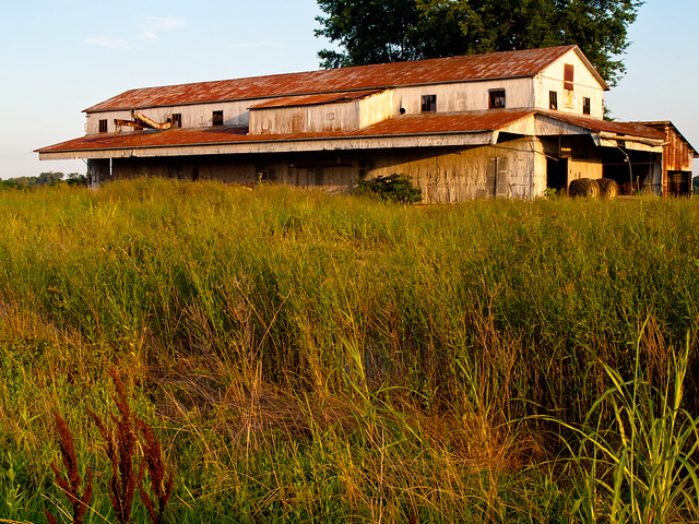
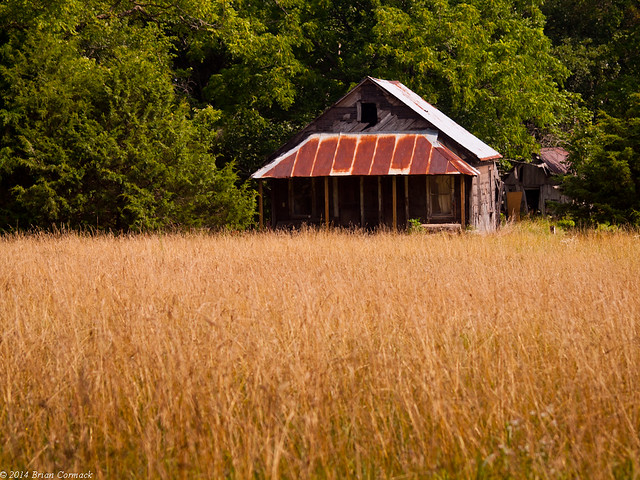
And we drove by this old home, which looked like it was abandoned a long time ago (except for a few washing machines being stored inside).

P7192244

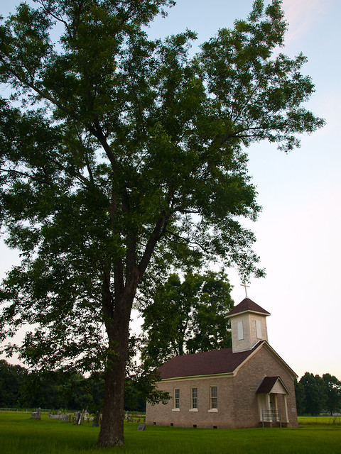
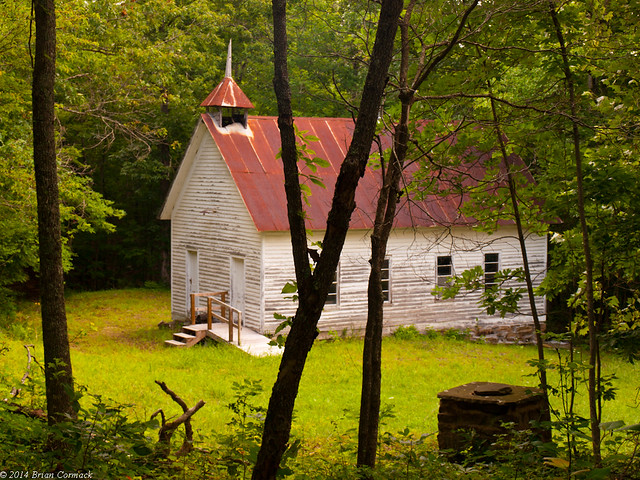
And tucked away in a clearing in the woods was this old church, which has a wheelchair ramp so it must be used occasionally still.

P7192255

P7192265

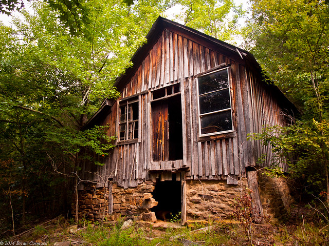
We went by this old place, which had a sign saying it was the Loy Community Center. I tried to do a Google search for Loy, Arkansas, and got no results. Well nothing except for info about a crazy politician from Arkansas named Loy Mauch who got in trouble a few years ago for saying that slavery was good. Luckily he was voted out of office and hasn't been heard from since.

P7192361-2

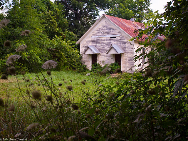
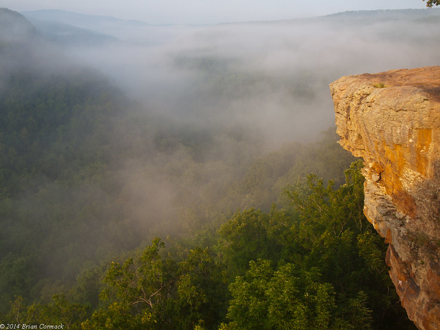
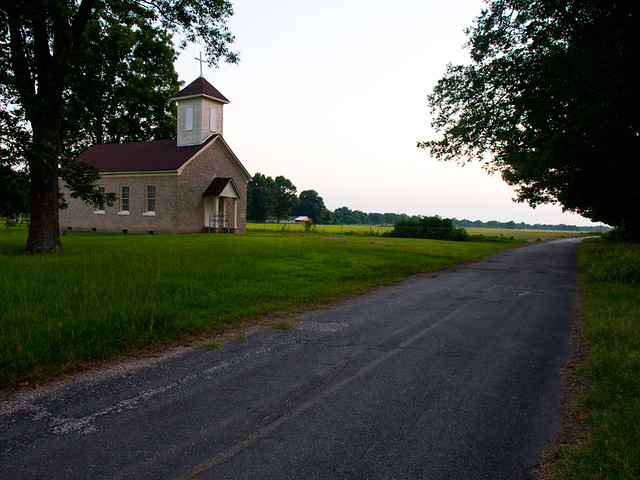
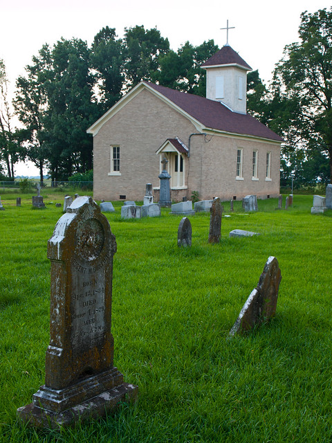
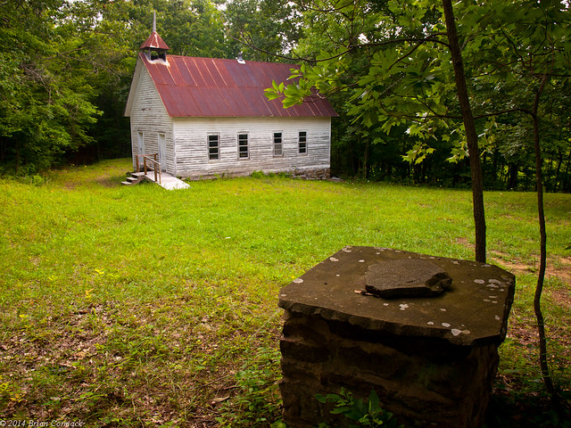
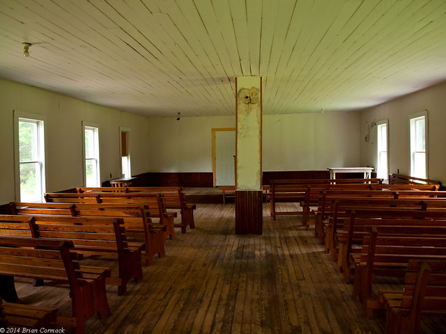
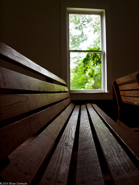
From there we dropped down to Boxley Valley, along the Buffalo National River. We stopped at the old Beechwoods Church, which sits back in the woods near Lost Valley. It's a place that you would never expect to find, the road leading in looks like the driveway to someone's house. But it leads to an old church, built in 1918. The cemetery in front of the church holds graves of some of the oldest families in Boxley.

P7192450

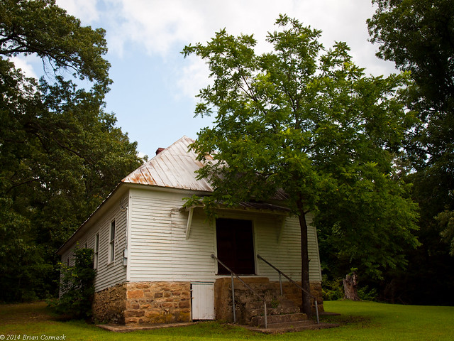
The door was open so we went inside for a look. Now the church is only used for special occasions, but still has a pulpit and pews.

P7192415

P7192435

And from there we headed to Jasper for the traditional lunch at the Ozark Cafe, before heading back home.

Sunday, July 27, 2014

Hawksbill Crag

Summers in Arkansas usually suck - it's hot, muggy and disgusting to be outside. But this year has been different, it's been unseasonably cool (I don't think we've even hit 100 yet). Last week a cold front passed through, causing highs in the 80s. So last weekend I wanted to take advantage of the great temperatures and go out hiking somewhere. It had been rainy, so there would be a good chance that it would be foggy in the morning. Perfect conditions to take a few pictures in the hills.

So after work on Friday, Matt Kennedy and I drove up to the Ozarks. We decided to hike into Hawksbill Crag, which sits in the Ozark National Forest near the Buffalo National River. We camped overnight, and then started hiking on the trailhead at 5:00 AM. The plan, we hoped, was for there to be some fog in the valley below the crag. We would get there in time for the sunrise to hit the fog and look really neat in pictures. It was about 60 degrees as we started our hike in the dark.

I needed a flashlight to make sure I didn't tumble over any tree roots or rocks, but the sky began to quickly brighten. The trail runs downhill, crosses a creek and then heads to the edge of the bluff. Along the first view of the valley I was a little saddened to see that there wasn't any fog drifting around. Maybe there would be more at the crag?

There would be! A little bit further down the trail there was another view, this time with a few bands of fog drifting through the valley.

P7192033

After hiking for 1.5 miles, we finally reached the Crag. Hawksbill Crag shoots out about 100 feet above Whitaker Creek, and is probably one of the most popular views in the state. There was indeed fog at the Crag, a wall of it that steadily moved through the valley

P7192053-2

I walked out onto the Crag, which isn't as scary as it looks. You do have to watch your step, since a fall from here is going to be fatal.

P7192069

I had hoped that we would beat the crowds by hiking in at 5:00, but other hikers began to arrive just after we did. Who else is crazy enough to hike at 5 in the morning?

P7192083

And a view of the other side of the Crag, after the sun had risen...

P7192141

We stayed out there for awhile, waiting for the sun to break through the fog. But the fog was too much, and just formed a solid barricade that screened the distant hills from view. We gave up on the fog lifting, figuring that when it finally did the Crag would be in direct sunlight. So we hiked up hill, back to the car. I was amazed to not see anyone else on the trail, and to find the parking lot there empty. We got to the car and headed out to check out a few other places...

Wednesday, July 23, 2014

Plum Bayou

From Pine Bluff, I drove north across the Arkansas River. The drive quickly went from the city to the country, with miles of flat farmland and ramshackle houses. I drove through the small community of Coy (population 116, one of the smallest incorporated cities in the state). Located right in the middle of Coy is an old cotton gin, which is being overrun by the weeds surrounding it.

P7121861

I was in this area because there was an old church I wanted to check out. St. Mary's Church, in Plum Bayou, is the oldest Catholic church in the state. It sits on an unassuming road, far from the beaten path.

P7121999

In 1789, the church was founded on a barge in Arkansas Post. Since Arkansas Post wasn't the most desirable place to live (with the territorial capitol moving from there to Little Rock in 1821), the barge moved upriver in 1832 to Jefferson County.

P7121972

In 1869 the church moved to it's current home in Plum Bayou. In 1927 the brick exterior was added. The cross on the church is thought to be original, and was covered in copper to protect it from woodpeckers.

P7121985

It's a neat old church, and in great condition considering its age. I don't think it sees a regular service, but it is open for special occasions (if I'm reading the website right). The church and surrounding farmlands were empty when I was out there, no other cars drove by. I wasn't entirely alone, a congregation of mosquitoes swarmed in and tried to have me for communion.

And one last shot, of the sun setting over the lonesome country road by the church.

P7121922-2

Monday, July 21, 2014

Pine Bluff

The city of Pine Bluff, which sits about 45 minutes from Little Rock, is an interesting place to take pictures.  It's an old city, first founded in 1819 and incorporated in 1839.  As the name suggests, the city was built on a low hill along the Arkansas River that was covered with pine trees.  Now the city has a population of around 50,000 people.

Pine Bluff's "Golden Age" was the 1880s, when the river and cotton attracted many industries to the city. In 1890, it was the third largest city in the state. But the following decades haven't been as kind to the city. Pine Bluff is routinely ranked as one of the most dangerous cities in the country in terms of crime, and the population has steadily fallen.

I drove through Pine Bluff on a warm summer afternoon last week, passing through downtown. It was quiet, there was only one business open (a clothing store). Otherwise the buildings seemed to be mostly empty and abandoned, slowly being taken over by vines and weeds. One building, across the train tracks, looked like it had recently collapsed.

P7121631-2

P7121637

P7121678

I headed over to the old train station, which is one of my favorite buildings in Pine Bluff. It's a museum now, and it looks like it hasn't changed at all in several decades.

P7121710-2

Across the street is the old Masonic Temple, which was built in 1902 and is on the National Register of Historic Places. Like many of the buildings around it, it appears to be empty and unused.

P7121824

When it was built, this was the tallest building in the city. Hopefully the grand old buildings here that are empty won't have the same fate of the old Majestic Hotel in Hot Springs. It would be nice if all these old buildings can be saved and restored before they are lost. Don't ask me how to do it though...

P7121845

Wednesday, July 16, 2014

Little Rock Lightning

A big storm moved through Little Rock last week, dropping lots of rain and a few stray bolts of lightning. Instead of sitting inside with a scared dog, like I probably should have been doing, I drove out into the storm to try to take a few pictures. I ended up below the I-30 bridge, which I foolishly assumed would be enough to protect me and the camera from the rain. This was what the sky looked like when I got there...

P7081319-3

I set up the camera and started taking pictures. It poured rain, with the wind whipping the rain under the bridge and soaking me and the camera. I would wipe the rain of the lens, take a picture, and then clean the lens again. Now getting any picture of lightning is a matter of luck. You have to hope the camera is pointing in the right direction in the second or so that the lightning flashes, and then hope that the camera was actually in the process of taking a picture when it strikes. I took 241 pictures out there, over the course of two and a half hours. Just about every lightning bolt would pop out just out of frame, or hit with perfect timing when I wasn't actually taking a picture. Out of all those pictures, I only managed to get one shot with lightning in it. But it did hit right above the city...

P7081521-2

Tuesday, July 15, 2014

Nashville

We traveled to Nashville a few weeks back for a wedding, which also put us there right in time for the Fourth of July. After doing some research on the best places to set up for photos of the downtown skyline and the fireworks show, we ended up on the top of a parking deck by a hospital.

P7041112-2

It did provide a great view of the city, and wasn't anywhere near as crowded as the riverfront (something like 250,000 people were gathered there). This is a wider view, with the Tennessee State Capitol on the left.

P7041121-2

The show started around 10:00, with the fireworks exploding right behind the skyline.

P7041191-3

The Nashville fireworks show was actually ranked as the second best show in the country, and it was really quite impressive. It was also nice that we were able to get out of the parking deck within a few minutes of the show ending and avoided all the traffic.

P7041199-3

And one last shot from Nashville, from above a park along the river. The bridge in the foreground is the Shelby Street Pedestrian Bridge.

P7061285-2

Friday, July 11, 2014

Forrest City

We went to Tennessee last weekend for a wedding, and along the way got stuck in the construction traffic along I-40. I exited off the freeway and started driving east on Hwy. 70. Along the way, I drove through Forrest City, the county seat of St. Francis County. Like Forrest Gump, the city is named after Confederate Civil War General Nathan Bedford Forrest. The city got that name because Forrest, after the Civil War ended, somehow became involved in helping build the railroad between Memphis and Little Rock. He helped fund a commissary in a settlement that was being formed along the rail route, which was later incorporated as Forrest City in 1870.

Forrest City sits along the low hills of Crowley's Ridge, and has a population around 14,000 people. I drove through town and got some pictures of these old buildings, just off of Hwy. 70.

P7030995-3

P7031007

Tuesday, July 1, 2014

Little Rock

There was a good number of people out on the River Trail in North Little Rock last night. A few people sitting on the park benches, looking at the skyline. A lot of people out biking or skating, and also one woman who was just randomly dancing. And then there was me, standing by the river trying to take pictures of something. Although it was hot and muggy, there was a nice breeze on the river that actually made it comfortable to be out there.

I ended up trying to get a shot of the Little Rock skyline and the new lights on the Main Street Bridge. This is actually four shots stitched together.

P6300961-2-P6300964-2