Wednesday, September 30, 2009

Boxley Valley & Sam's Throne

After leaving Kings River Falls, we drove off towards Boxley Valley. We had just been here a few weeks before, so neither Zack or I were really planning to stop (especially since we were looking forward to lunch at the Ozark Cafe). But we ended up stopping by this old barn, which just happened to have some of Boxley Valley's resident trumpeter swans strolling past.
P9268490

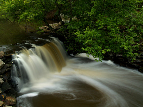
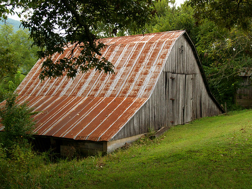
Zack pulled over to the side of the road, and I went to get my camera out from the backseat of his car. I thought to myself, "I wonder how long it'll be until someone else stops here to take pictures?" I was about to make that comment to Zack, until I turned around and saw that there was already someone else there taking pictures.

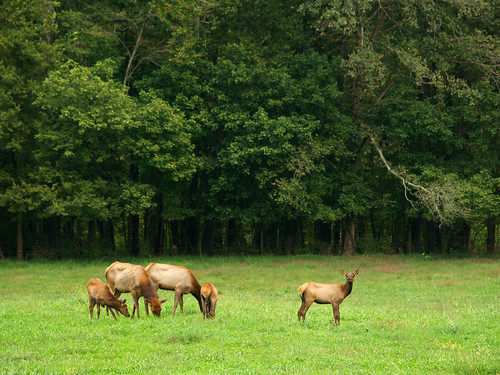
We drove a bit further down the road, before stopping yet again. This time it was to get some shots of the elk that call Boxley home.
P9268502

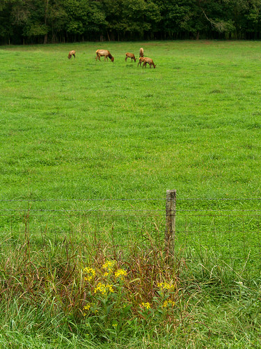
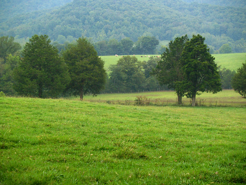
The road here was lined with cars that had pulled over to see the elk - which were just off in the field eating grass. One of the elk here seems a bit weary of the paparazzi hanging out, photographing her every move...
P9268508

We quickly drove through the rest of Boxley, and headed towards Jasper. Once there we joined about thirty bikers for a nice lunch at the Ozark Cafe. The potato salad I had with my lunch was delicious, by the way.

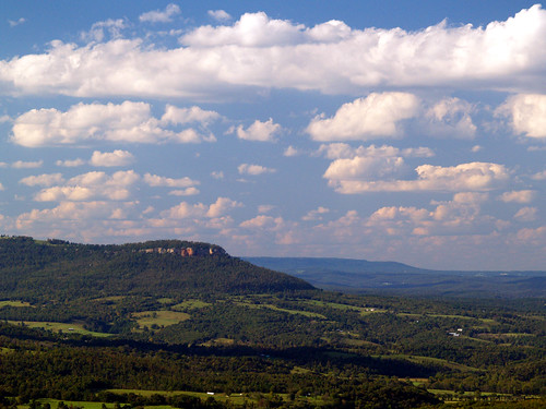
After a satisfying meal, we drove to the east along Hwy. 123. Our destination was Sam's Throne. Located in the Ozark National Forest, Sam's Throne provides some dramatic views of the Ozark Mountains. It is also a hugely popular spot for mountain climbers as well. I think Zack's car was one of only two cars there with Arkansas plates, the rest were from out-of-towners. There are several climbing areas at Sam's Throne, all with names like "The Outback," "Northern Exposure," "Hero Maker," "Valley of the Blind" and "Deliverance." I know any attempt of rock climbing would result in a certain long and tragic fall, so I'll leave all that stuff to the pros.

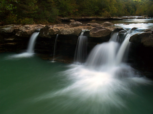
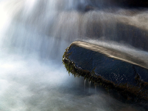
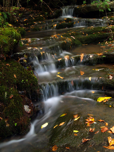
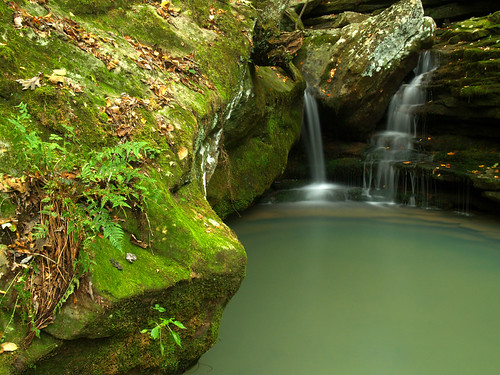
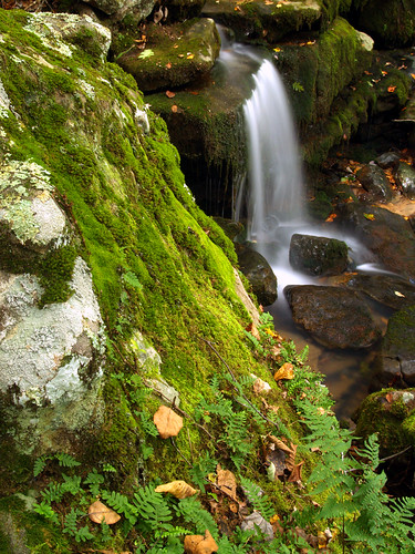
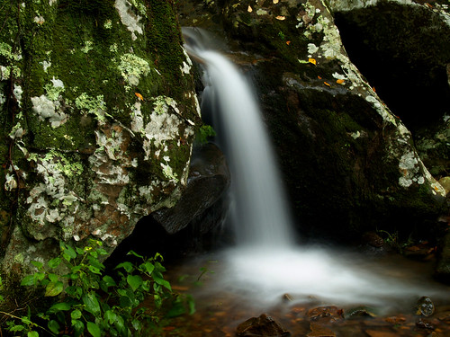
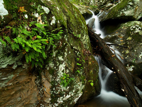
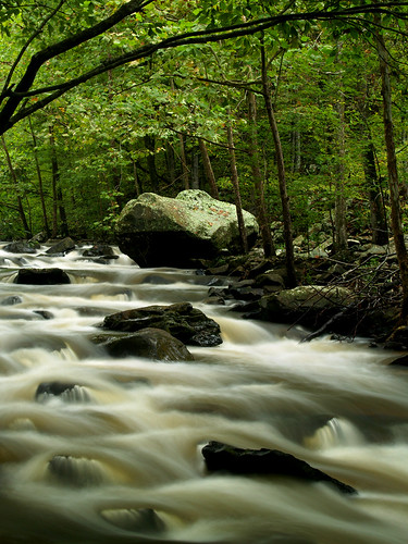
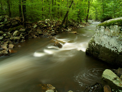
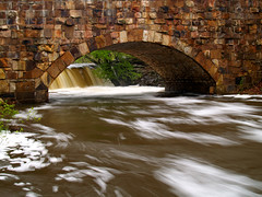
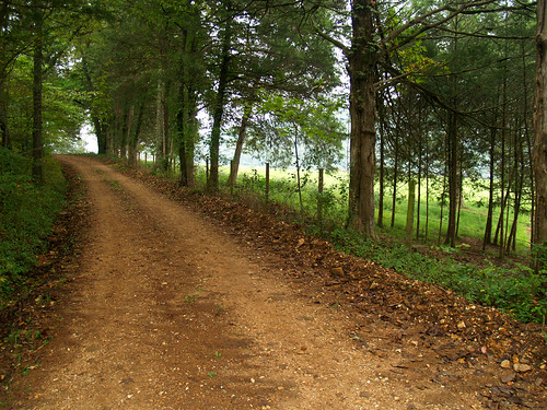
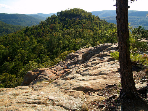
There are a few miles of trails at Sam's Throne, but we were short on time and only walked the short and level trail to the main overlook there. This shot was taken along the way there.
P9268527

Sam's Throne is actually named after someone named Sam. Back in the 1820s, there was a local man named Sam Davis. He claimed that his sister had been kidnapped by Indians, which made him a bit angry. He would then climb out onto the rocky outcrop and give fiery sermons to all of his neighbors within earshot (much to their displeasure, I'm sure). Legend also has it that Sam buried some gold on Sam's Throne. But people have been searching for it in the 160 years since then and not found anything (that we know of!).

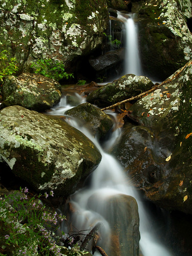
The view from the main overlook:
P9268541

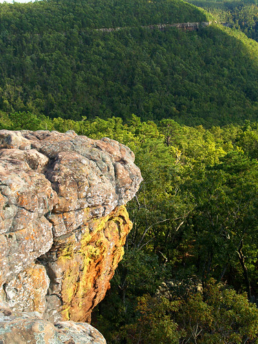
And the view looking towards Sam's Throne.
P9268576

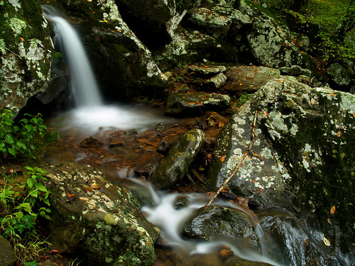
And one last shot of the nice view from up there:
P9268585

I managed to lose the lens cap to my camera up there. So if you're ever at Sam's Throne and notice an Olympus lens cap lying on the ground, please let me know!

Tuesday, September 29, 2009

Kings River Falls

So Saturday rolled around and another little photo trip was planned with Zack Andrews. This trip we were going to head up to some more spots around the Buffalo River - Kings River Falls and Sam's Throne. I had been to Kings River Falls once before, last February. It is a beautiful little waterfall, so I was interested in going to get some more pictures of it.

The only problem was the weather that day - bright and sunny. That's the worst possible weather to attempt waterfall pictures in. But we set out in the hopes that some clouds might pass through...

Kings River Falls is reached via some dirt roads up in the Ozark Mountains. The dirt roads were, thankfully, in good shape. We ended up taking a different route to the falls than what I had taken earlier this year, and found several neat old barns along the way. We stopped at one, and then was pleasantly surprised to see this cool abandoned house next to it.
P9268311

P9268313

We walked inside the door here and had a quick look around. It seemed like the house had been home to a chicken coop recently, as evidenced by the large amount of chicken poo on the floor.
P9268327

We eventually made it to the trailhead to the falls, which is located right next to an old house and barn. The trail runs through a gap between a small creek and a large field, overlooked by the old barn. The poor barn has surely seen better days. Now it looks like a bomb had gone off inside it.
P9268344
It also reminded me of Back to the Future, where Marty goes back in time and messes up his parent's falling in love. The result is that his brother and sister start to fade out of the picture he carries with him. The barn looks like it's slowly fading away to nothing. Great Scot!

The trail to the falls is short and easy. And before too long, you finally reach the 10-foot tall Kings River Falls. It was still way too bright for my pictures to turn out, but I tried my best. I had borrowed a set of ND filters from Zack, and used every single one. But still, not much luck.

Eventually I left to take some pictures along a small creek that flows into Kings River. Finally some big puffy white clouds came along, shielding everything in shade. It was temporary, the sun would pop back out after a few seconds. After awhile the clouds seemed bigger, which would mean that the light was slowly getting better. So I hurried back over to the falls and tried to get a few more shots. The falls would be shaded for only about 30 seconds, so I ended up getting only a few good shots. This is the best of them:
P9268441x

I also dropped down and got some pictures under the falls. It was shaded there from the sun, so I was able to get pictures without worrying about the light. I saw this rock, with some moss hanging down from it, sitting under part of the falls.
P9268395

The small creek that flows into Kings River had some nice little waterfalls and cascades too. Here are some shots from there, which was helped slightly by the fact that it was harder for the sun to get past the trees here.
P9268415
Lots of fallen leaves already, too...

The creek spills over this set of boulders, making a cool little waterfall:
P9268426

It was here that I turned back around to get shots of Kings River Falls again. Zack had gone up further past here and found another cool waterfall. But after taking more pictures of Kings Falls, I eventually made my way up the hill, and was taking pictures of this little waterfall when Zack was walking back down the hill.
P9268456

It was getting late in the day, so we ended up leaving after that so we'd have enough time to get lunch and check out Sam's Throne. I'm annoyed with myself for not going to see the other waterfall there. Oh well. After all, it would have just been a different spot for me to stand while getting annoyed at the sun.

Monday, September 28, 2009

A Petit Jean Pan

I meant to post this earlier, but here is a panoramic shot from Petit Jean Mountain. It's seven shots stitched together using Hug-in. The view is of the small waterfall that shoots over the rock dam that creates Lake Bailey. The creek runs over these falls and under the old Davies Bridge. The bridge was built by the Civilian Conservation Corps in 1934.
davies bridge pan

A larger view of this shot can be seen HERE.

Wednesday, September 23, 2009

Cedar Falls

If you want to get pictures of Cedar Falls without any people standing around the base, then you probably don't want to visit the falls on a Saturday. Which just happens to be the day we decided to visit the falls. I had hoped there wouldn't be too many people there as we drove through Petit Jean. It was cloudy, and still a bit early in the morning. Plus there was a big Razorback game on later in the day. I hoped that combination would keep people at home...

But we got to the parking lot at the lodge and it was packed with cars. We claimed the very last parking spot and started the hike. There was a big crowd of people on the trail, apparently because of a wedding held at the falls. The wedding was over and the wedding party was slowly making their way up the hill back to the lodge by the time we started the trail. We didn't know it was a wedding at first, but it was the sight of a woman wearing a nice white dress (not something you usually see on a hiking trail) that gave it away. At first I thought, "that sure is a fancy dress for hiking," but someone on the trail told us it was for a wedding. Cedar Falls would make an interesting spot for a wedding, except for the whole hiking up the hill part afterwards...

But the waterfalls at Petit Jean were awesome on Saturday. As the trail switchbacks down the hill, a small creek rushes and tumbles down some moss and lichen-covered boulders. With all the rain this past week, it was running unusually high.
P9198175

It's a neat little waterfall - like the appetizer for the upcoming main course of Cedar Falls.
P9198178

P9198180

There were also quite a few ferns growing by the falls too...
P9198206

Cedar Creek was running high, and we made a few quick stops there along the way...
P9198242

P9198245

We finally made it to mighty 90 foot-tall Cedar Falls. I feared it would be really crowded there, but it wasn't too bad. I did have to wait a few minutes for some people to clear out to get this shot.
P9198252

There was a group of people who decided to walk out behind the falls and pose for some pictures. It wasn't too bad - they'd end up providing some nice perspective to show how tall the falls are.
P9198257

And one with the people photoshopped out:
P9198262

And one last Cedar Falls shot:
P9198285

We didn't have much time there since I needed to eventually get back to Little Rock that afternoon. But the falls and Cedar Creek were so scenic on Saturday that we could have easily spent all day there...

Tuesday, September 22, 2009

Petit Jean

Having an addiction to waterfall photography has some strange side effects. For example, everyone at work was complaining about the week of heavy rain we just had. Comments sent across the cubicle walls included complaints about traffic, the way it messes up ones hair, and the fact that people are forgetting what the sun looks like. But I was more than thrilled about it, since we had waterfalls again. I was tempted to say that I loved this weather, but hesitated since my co-workers would just look at me like I was a crazy person. Which, come to think about it, is the look they probably give me most of the time anyways...

But we almost never have waterfalls this time of the year in Arkansas. Usually summers are dry here, and any rain is quickly soaked up by all of the vegetation. The only time we've had waterfalls this month happened was when Hurricane Gustav parked over the state last year.

So with rivers and creeks running high, it was perfect time to get some waterfall shots. So plans were made and it was another early morning as I drove to Conway to meet Zack Andrews again. This time we went to Petit Jean Mountain, where the waterfalls were spectacular.

Our first stop is the small waterfall on the old rock dam that forms Lake Bailey.
Little John
It was amazing to see that much water going over the falls...

From there we went down the Boy Scout trail that follows the creek. There were a few little cascades there, but my best shot was this fern growing on the side of lichen-covered rock.
P9198162

Walking back towards the bridge I stopped and got the traditional shot of the waterfall under the historic Davies Bridge (built in 1934). Now it's just about a requirement that one must get this shot. But it looks cool, so here's another one to add onto the pile of pictures taken of this view...
P9198165

I went looking through my old photos and this is actually the third time this year that I've taken this sort of picture. The first was in January:
Under the Bridge

And again in April:
Davies Bridge

On this visit, we left here and drove over to the lodge to begin the trek down into Cedar Falls....

Saturday, September 19, 2009

Boxley Valley

Regretfully, we drove away from Erbie. I’m still impressed by how cool it was, and definitely can’t wait to get back up there. Based on our short visit there, Erbie shoots up to one of my top three coolest places along the Buffalo River.

But Zack and I were heading off towards the coolest spot along the Buffalo River – Boxley Valley. It is a great spot, with Hawksbill Crag on one end and Lost Valley on the other. In between are a huge assortment of old barns and homes, with vast fields, swans and elk all in between. We drove through the valley, past cars parked alongside the road as their drivers sought out the elk. We made our first stop at this old barn, situated at the opposite end of a field. It was a bit hazy out that day, but a light fog appeared over the hills.
P9127993

Like the rest of the Ozarks, Boxley Valley was covered with wildflowers. These flowers grew along the fence line by the side of the road. It may have been wading through the tall grass here that I ended up getting mixed up with some poison ivy.
P9127998

This is the view of the main road through Boxley. Traffic was light that day – most people were on the other side of the valley trying to see the elk, probably.
P9128001

We drove a bit further down to a small parking area that is the trailhead for the 75-mile Buffalo River Trail. There is also the remains of an old house, some sort of old cellar (I think?) and an old barn. It is right next to a huge field that had some scattered hay bales laying around.
P9128013

This was just further down the fence, which had a little spot of damage. There were a lot of huge spiders out here - orb weaver spiders had set up webs all along the fence. When I first saw one, I said something like “Woah that spider is huge.” And then Zack said, “yeah, and so is the one right over your head.” I might have made a little girlie scream after that.
P9128021

We drove further down to the old Boxley Valley Baptist Church and walked around the historic church and cemetery. There is a dirt road that runs off past the church, further back into a field at the far end of the valley. “Where do you think that goes?” we wondered, so we took the Vibe down it as far as we could. Which wasn’t far, there was a sign saying that we were entering private property. But there were several large orb weaver spiders here as well, all of the lined up nearly side by side along the fence.
P9128028

They might have been guard-spiders, making sure that we didn’t trespass too far. I wanted to see where that road went, but I just settled on getting this shot of the road curving away past a distant barn and out of sight.
P9128030 copy

And one last view of a spider, one of many along the side of that road:
P9128034

Across the main road from the church is a neat little series of old barns, so we pulled over for a few more shots. Both Zack and I went across the street to get a shot of the old church…
P9128042

And one of the old barns – it’s amazing at how many different types of barns there are in Boxley. I like this one because it looks like it was built into the side of the hill.
P9128046

We drove further on, hoping to see the trumpeter swans in the Mill Pond. They were there, but sitting on the far shore next to some tall grass. We couldn’t really see them from the road. But we stopped at an old house by the pond, and went around to see if the swans were visible. They were, but I was more interested in this barn.
P9128049
I was taking pictures for a few minutes before realizing that the flowers were covered with some sort of bug, which I thought were bees. I’m happy they didn’t seem to mind me standing there.

The area around the barn is overgrown, with thick grass covering and obscuring everything except for this solitary old cattle trough.
P9128052

And the back side of the barn, which from here looks like it’s packed with hay.
P9128070

From here we drove over to the Beechwood Church and Cemetery, a little hidden spot that sits right off of the road to Lost Valley. This is a neat place, but there seemed to be something going on at the church when we pulled up to take pictures. Not meaning to bother anyone there, we went out to take some pictures. This is the dirt road that leads up to the church.
P9128081

The church and cemetery overlook a large field, which was beginning to get a tiny tinge of fog drifting about.
P9128082

And another neat barn, which was one of our last stops.
P9128090

And that was about it for the day. We made a few more stops but my pictures didn't turn out, and soon we were driving back home. It was a good day for photography, even if it wasn't full of waterfalls...

Thursday, September 17, 2009

Erbie

With full stomachs we drove north from Jasper, turning off onto the dirt road that leads to the Erbie put-in at the Buffalo National River. I had never been through Erbie before, so I wasn’t sure what to expect. But we were off to find a waterfall, in the slim chance that it would actually be running. Luckily the dirt road was in good shape, and no damage was made to the new car (besides getting it dusty).

The waterfall we were searching for was Liles Falls. It’s located just a short hike from the road, so we parked and bushwhacked our way past the small creek that makes the falls. The creek had just a tiny bit of water in it, and after a few minutes we finally made it to the falls. There was some water, a tiny trickle tumbling down over the bluff. It was an impressive area though, it would surely be awesome when there is water flowing through. We filed it away for a future visit, and walked back to the car.

We drove further down the dirt road, going deeper into the woods. We stopped at this one neat old barn, tucked away in the trees.
P9127885

After a few more miles of driving we made it to the river access. It was surprisingly empty for a Saturday, with no other people there either on shore or on the river (well a park ranger did drive by). We walked around some on the banks, looking for something to get pictures of. The river at Erbie is wide and lazy, with some small bluffs rising over it. I wasn’t impressed with the pictures I got, so we got back in the car and explored the camping area there. It’s set in a huge field, and looked like a nice and quiet place. There were just a few tents nestled in the grass…

Back on the dirt road, we saw a sign for a “Historic Area.” Hmmm, what could that be? So we followed the dirt road further along, finally reaching an awesome spot. It was the Parker-Hickman Farmstead (of course a place in the Ozarks would be called Hickman). The farmstead is a collection old buildings, including a well-preserved two story house, several barns and even an outhouse. This is the view from beside the largest of the barns, looking back over at the farmhouse.
P9127931

Man, it was awesome! In the woods next to the buildings were tons of wildflowers, spilling out through the old fence line.
P9127937

An old road took off from the farmstead, heading into the deep woods beyond. A sign said that it led to a cemetery.
P9127947
We nearly went down there, but it would have been a 2 mile hike there and back, so we left that for another day. Anyways, we had more places to explore at the farmstead.

The old house is well-kept and in good shape. People lived here until as late as 1978. While not the fanciest house around, it’s easy to see why people would want to live there.
P9127956

The National Park Service says that "the Parker-Hickman home is one of the oldest structures standing in the Buffalo National River. In the late 1830s, Alvin Parker and his brother Greenberry arrived from Tennessee and built a home here using the nearby red cedar trees. Joining the hand-hewed logs with half dovetail notches, the Parkers crafted one of the finest log houses in the Buffalo River valley."

"Over the years, later owners built additions to the original log house. The last owners - the J.D. Hickman family occupied this farm from 1912 to 1978 and constructed most of the outbuildings visible today."

This is the view from the front porch. Looks pretty relaxing, right? It makes me want to get a beer and a rocking chair and sit for a few hours enjoying the view. The front porch was a lot better than the back porch too, which had a hornet’s nest.
P9127962

The Park Service lets you go inside the building and look around. It’s really cool, though somewhat creepy. In one room, you could see layers of old newspapers, magazines and wallpapers that are peeling back from the walls and ceiling.
P9127975

Back in the olden days, papers like this were stuck on the wall as a form of insulation. In this room you can examine the layers here, like an archaeologist. The top layers look like modern wallpaper, but further and further down you go it reaches the old magazines and newspapers. Here is part of an old comic strip, hanging up on the wall.
P9127972
I wish I had more of the comic strip, since I'm interested to see what happens next. Why did they need the police? I thought it was pretty cool - one of most intriguing comic strips I've seen lately (well except for Garfield Minus Garfield).

We searched for a date on one of the papers, but couldn’t find one.

And a view looking back out at the barns…
P9127981

And one more. This is a beautiful place, hopefully we can go back when the trees are changing color.
P9127984

The dirt road went a bit further, heading right up to the Buffalo River. We went out to take a few shots, including this one of a hay bale nearly lost in some tall grass.
P9127989

After that we drove back the way we came, eventually heading back onto Hwy. 7. From there we decided to make a quick stop at another awesome spot along the Buffalo River – Boxley Valley.