Wednesday, December 26, 2007

A foggy Mt. Nebo and lots of Christmas lights

Christmas is a great time of the year, one small reason being that people decide to string up lights everywhere and make stuff look cooler than normal. I even strung up lights on the balcony of my apartment, hopefully bringing joy to the people in the parking lot below (probably not). One other Christmas light display is from the Bank of America building in downtown Little Rock, which puts up lights in the shape of a Christmas tree on three sides of the building. They've been doing that for as long as I remember. There is a parking deck downtown that offers some nifty views of the building so I snuck up there one night (I get worried about going up there since I'm probably trespassing), and got a few shots. It was really cold and bit rainy, so I didn't stay up there too long...
It's beginning to look a lot like Christmas

A week later the lights on the State Capitol were lit. Along with the lights, they also have a fireworks show:
Christmas fireworks

This is only the second time I've gotten shots of the fireworks there. I didn't like how my shots turned out last year since I was having tripod problems and all the shots were a bit blurry. This year was a bit of a challenge since it was packed with people (more than last year). It may have been because I was standing next to the free hot cocoa and cookie stand.
X-Mas X-plosion

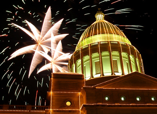
This is the big finale...
Finale

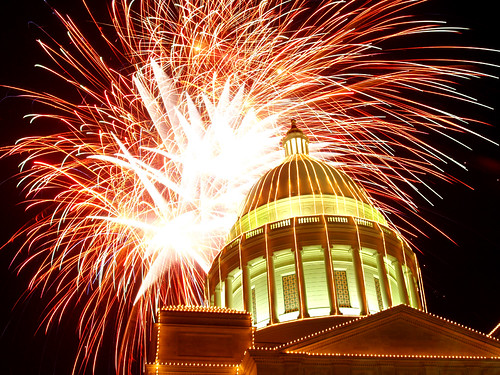
Getting shots of fireworks is a bit tricky. The hard part is timing. These shots were all 4 second exposures. So to get the best shots you have to have the camera taking a picture during the four seconds when the best fireworks are popping. The added difficulty is that my camera takes an extra four seconds to process and do noise reduction, so it's an added time to sit and wait. The shot of the finale was lucky because I started taking a picture just as the main finale fireworks were exploding. By the time the camera finished processing eight seconds later, the show was over.

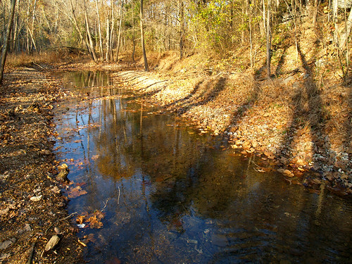
One night after work I went down to the Big Dam Bridge. The last time I had been there the water was high and moving fast, ruining any good reflection shots. The water is back down to more normal levels, and quite still at the base of the dam.
Big Dam Bridge

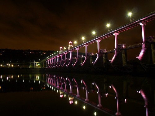
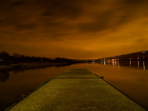
This shot was taken on some sort of concrete thing that juts out into the water. It might be for navigation or to control the river channel or just to give people a place to fish, but it also gives decent views of the bridge.

In order to get to the little concrete thing you kind of have to scramble down a rocky slope. I was making my way down there, sure I was going to tumble down the hill breaking bones and camera parts when there was this loud and creepy noise behind me. Some sort of river monster was lurking around, and it wasn't happy with my being there.

I searched the darkness and saw that it wasn't some sort of Loch Ness monster or Godzilla, but an egret. It gave me the willies though...

This is the view looking downriver from the concrete thingy. The color in the sky is from the city lights of downtown hitting the low clouds.
Also a bit spooky

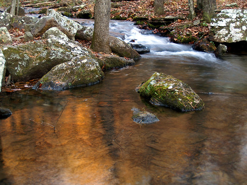
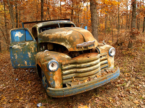
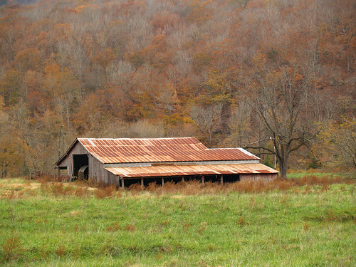
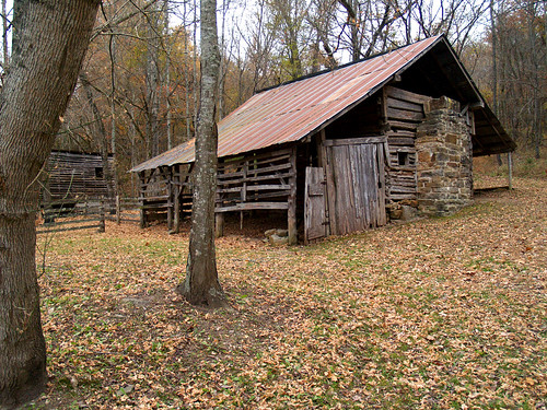
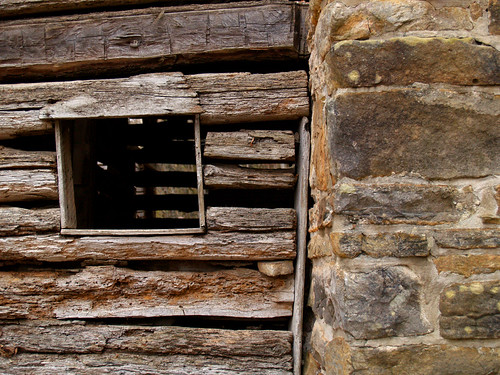
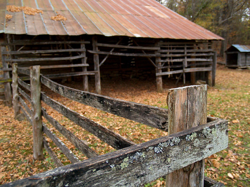
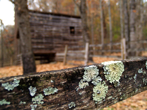
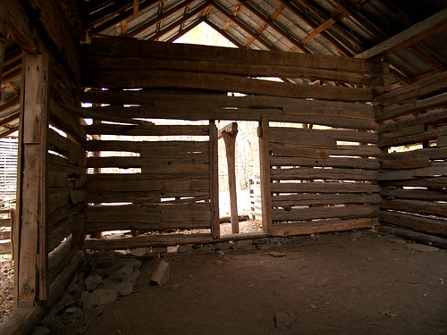
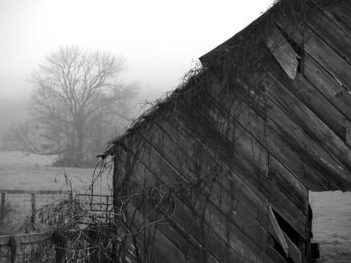
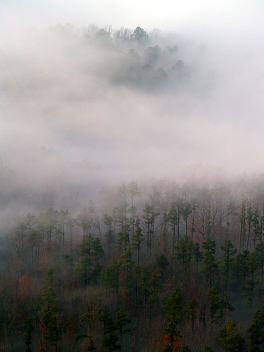
A weekend after that was one of those where it was foggy, the kind of fog that just lingers everywhere. I'm fond of fog so I grabbed the camera and headed out the door. There are a few places that I had read about that were somewhat nearby, so I headed out west along the freeway. The first place was called Goose Pond, in the Point Remove Wildlife Management Area north of Atkins. I got lost trying to find it, and in looking for a good place to turn around came upon this old barn in the fog:
Foggy Barn

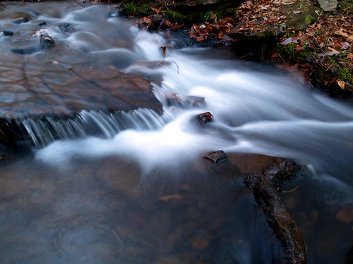
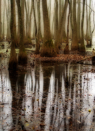
I got back to going in the right direction and finally made it to Goose Pond. The pond is really more of a swamp, with lots of cypress and tupelo trees growing in murky water. There is a bit of short trail that runs along some higher ground above the swampy area, which was good because otherwise it would have meant trying to wade through the type of mud that likes to suck in your shoe if you aren't careful.
Goose Pond

Getting closer to the water meant braving the mud, but in some places there were enough fallen leaves and pine needles that it created a bit of a carpet to walk on. I sunk in a bit but not enough to lose a shoe.

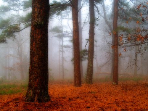
This is a shot taken close to the edge of the water. The picture has an orton effect on it, a process that gives the shot a bit of a blur while leaving some parts in focus. It used to be done by people using slide film by taking a sharp picture of something, then taking a blurry picture of the exact same thing, and then sandwiching them all together. The same thing can be done much easier in Photoshop nowadays. Now that I learned how to do the effect, I have to restrain myself from not putting it on every single picture I take.
Goose Pond

On the way back I stopped in Atkins to take pictures of a neat old church. None of the pictures of it turned out, mainly because I got mad at the town after stepping in dog crap in a little park across the street from the church.

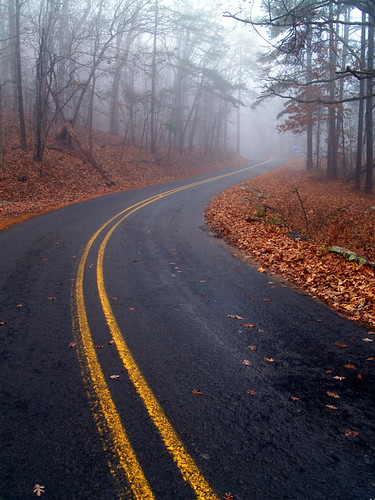
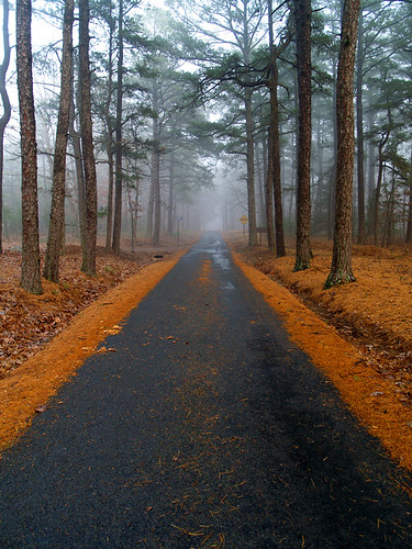
Then I went on west to Mt. Nebo State Park, south of Russellville. It was still foggy, and I thought the fog might be thick on top of the mountain. It wasn't all that foggy driving up there, but while starting up the steep and windy road to the top, a thick fog enclosed everything. I got excited because it did look really cool up there.
The Fog

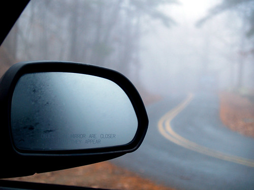
It was so foggy up there that in the few minutes I had parked the car to take a few shots, all the windows in my car fogged up as well:
Everything is fogged up

As I made my way to the top of the mountain, thinking about all the fog pictures I could take, I then saw something terrible. There was some strange orange light poking through...the sun had come out. In the span of just a few minutes, all the fog burned away. I was pissed.

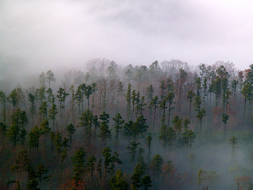
I made my way to the edge of the mountain, to an overlook called Sunset Point. The fog at the top of the mountain was gone, but down in the valley below there was still fog rolling through the small foothills at the base of Mt. Nebo.
From Sunset Point

From Sunset Point

I got back into the car and drove back around some of the roads around the park. To my amazement, the sun went away and the fog returned just as quickly as it burned up.
Fogged out

The fog was so thick in places that it was impossible to see more than 15 or 20 feet.
Foggy Mt. Nebo
That was another shot processed with the Orton effect...

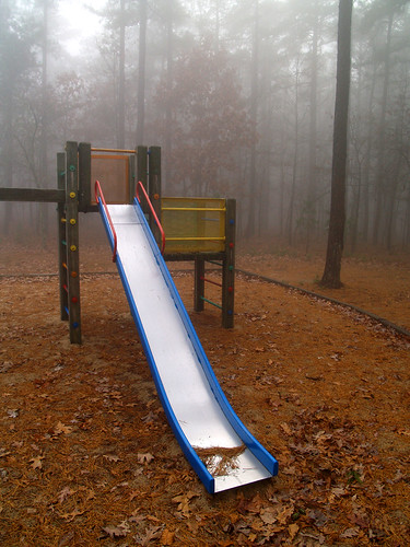
I stopped and parked at a little playground area, which was deserted because of the weather.
stop in the name of fog

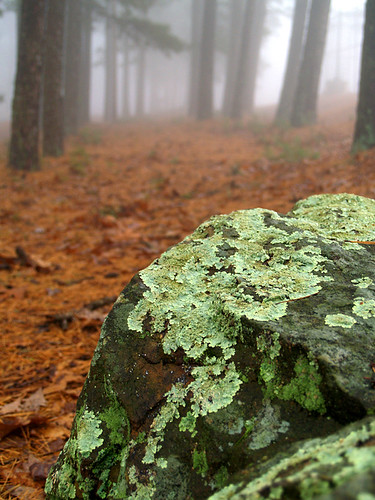
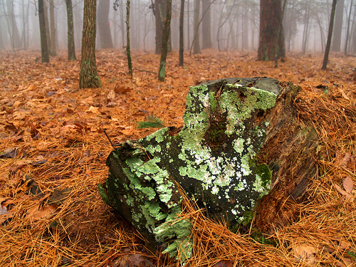
One of the ideas I had for a picture was a lichen covered rock in the foreground with a foggy forest in the background. I found it at the play area, which was cheating since the fog hides a tennis court and road...
Lichen Fog

Here is the playground. I was tempted to go down the slide but restrained myself.
Slidin' away

Foggy picnic

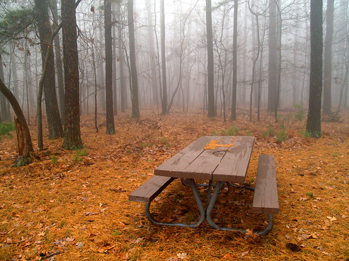
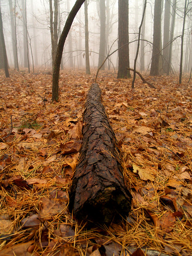
From the picnic area I went and wandered a bit in the woods. I found this fallen tree on the ground and tried to get a shot. I spent quite a bit of time there since I was focused so much on getting the tree trunk centered in the shot I failed to notice the camera strap sprawled all along the foreground. Whoops.
Fallen, and it can't get up

I walked back around to the tennis courts, where it seems some people didn't bother to pick up any stray tennis balls.
No Man's Land

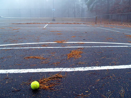
I laughed to myself a bit since it reminded me of the tennis class I took in college where the coach would always yell at me, "McCormick, you're in No Man's Land!" I never found out where No Man's Land was, but was sure I was sitting there even then taking pictures.

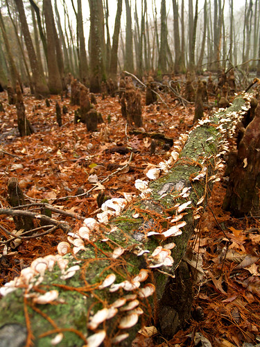
I walked back into the woods on the other side of the tennis courts and found this old downed tree covered with lichen and moss. It did look neat with the fog, so I did end up getting the shot I wanted.
Mt. Nebo

From there I went and drove back to Sunset Point. It was around sunset time and I thought that it might look neat if there was enough sun out to make a sunset, the light hitting any fog in the river valley. But it was either too foggy for the sun to come out or I missed the sunset completely, since there wasn't really anything out there. I was a bit hungry so I stopped by the park visitor center for some refreshments. I walked in and clearly disrupted the workers there having a lazy chit chat. There was a really painful awkward silence as I grabbed a Coke and candy bar and went to pay for it. I did find out that I had missed a visit from Santa Claus that afternoon at the visitor center. Damn!

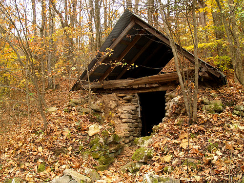
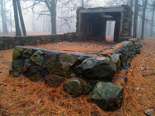
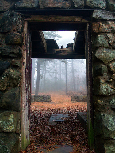
It was getting dark but I took one last drive around the mountain, and just randomly found this neat old building along the side of the road.
Finding Nebo

Open Door

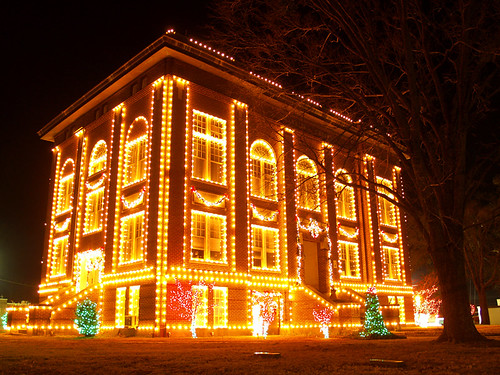
It got too dark to take pictures so I headed back down the hill and made a stop at Dardanelle. The courthouse there had Christmas lights on it, but they hadn't been turned on. I sat in the parking lot and waited, and then waited, and waited a bit more for them to come on. I got bored of staring at a dark building and ended up driving up Highway 7 to Russellville to take a look at the their courthouse. It had lights on it, but the building is too close to the road so it was hard to get a good shot of it.
Pope County Courthouse

Luckily it isn't too far to drive back to Dardanelle (maybe 10 minutes) so I headed back down the road and they finally had the lights turned back on. Guess someone remembered to plug in the light cord there.
Yell County Courthouse

I got back on the freeway and made a stop in Morrilton to see if the courthouse there had any lights on. They didn't, the jerks.

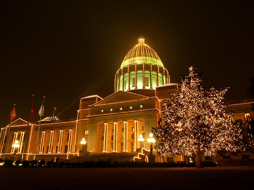
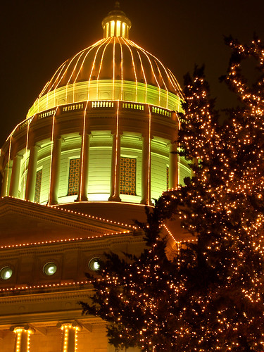
I made it back to Little Rock and headed down to the Capitol again. It looked kinda neat with some fog lingering around.
Foggy Capitol

Oh Christmas Tree

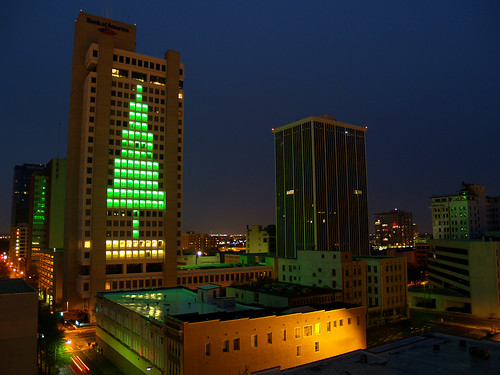
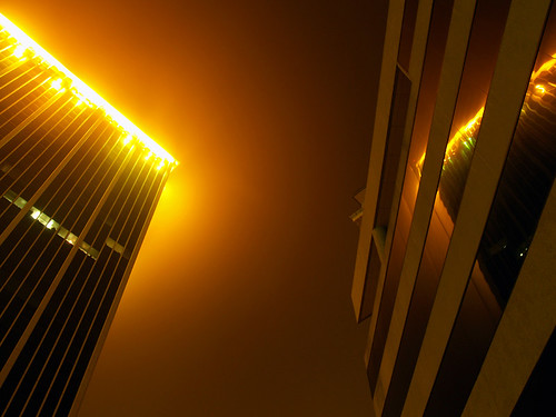
I drove down Capitol Avenue and went by the Bank of America Building again. The fog seemed thicker there and the lights of its Christmas tree looked cool in the fog...
Fogscrapers

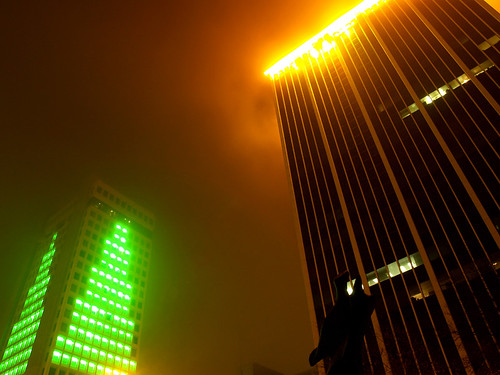
From near that same spot I got a shot of the Union Bank Building reflecting in a building across the street:
Capitol Avenue

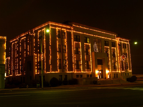
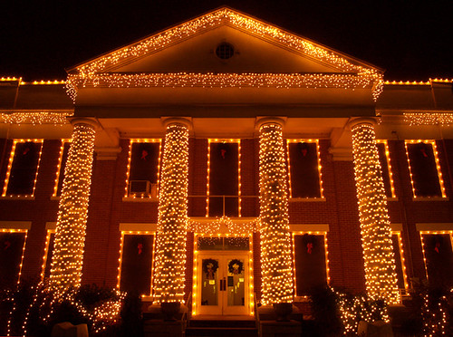
For Christmas I drove up to the small town of Charleston, Arkansas, where a lot of relatives live. After going to the candlelight service on Christmas Eve, we drove by the courthouse there that had a nice light display on it. I brought up my camera and tripod with me, so my Aunt and Dad headed back up there to take a few pictures of the courthouse. It's a nice building, built in 1923, but it was really cold out there. The sign on a bank across the street said it was above freezing, but just barely. We also had to be back to do some more family visiting, so we didn't stay out there too long...
Charleston

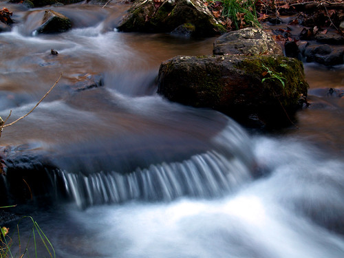
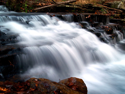
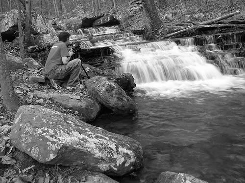
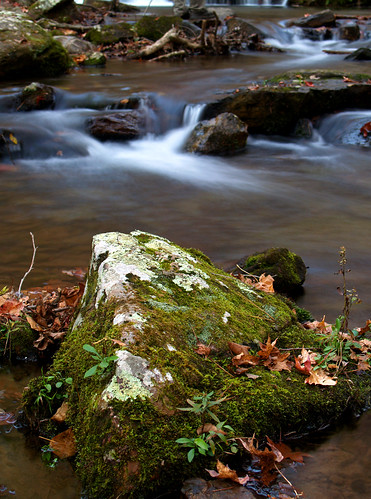
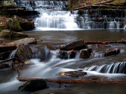
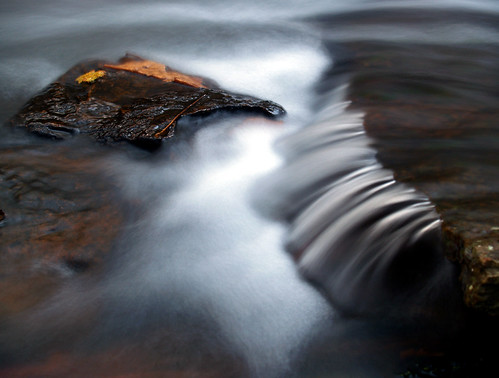
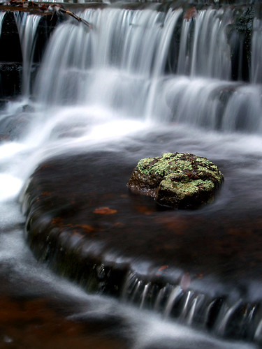
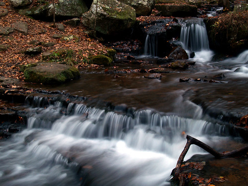
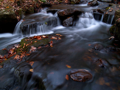
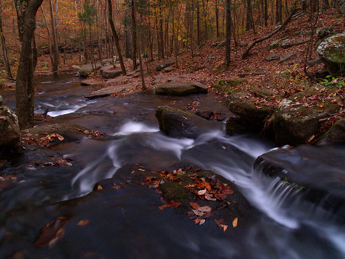
Now that it really has turned into winter, it's almost too cold to stand around taking pictures. On the other hand, with all the rain we've had the past few weeks it means that waterfalls are starting to flow again. I'll have to debate if I'll sleep in on weekends or step out into the cold some more. You'll see some pictures soon if I do....

Wednesday, December 5, 2007

The Return to Collins Creek

A week after I made a trip up to the Ozarks and to Collins Creek, I headed back up there again. This time it was with a few other photographers, which is always interesting to see how other people get shots of the same thing when you're there. I went up there, not before stopping at another BBQ place in Heber Springs for a quick lunch:
BBQ

The sandwich was from a place called Spunky Pig BBQ in Heber Springs. The food was good. It was especially good considering half of the place was a gas station. Normally you can't get a good sandwich and motor oil at the same time, but they pull it off here.

With a full stomach it was on to Collins Creek, a neat little place by Greers Ferry Lake. A few years ago it was decided that a trout habitat was needed, so the Corps of Engineers piped in cold water from the lake to flow along this little creek. It did produce a nice little area for fish, and also a nice little area for people to take pictures of waterfalls and such.

We made it to the creek, but there was one small problem: it was sunny. Sunlight is the enemy of waterfall photography. To get the best shots you need really cloudy weather, sunlight messes everything up. Sadly, with all the sun there wasn't much opportunity to get anything reallly good. I tried a few shots, but the light was just too harsh.

If we waited awhile, the sun would begin dropping below the treeline on the hill above the creek, providing some shade. This would take awhile, so about an hour or so was spent waiting out the sun. I tried to find some places that were shaded, but no real luck.

Eventually the sun sank low enough that there was some creek in the shade. Here is a shot of the creek with the background still reflecting the sunlight in the background.
Collins Creek part 2

And finally enough of the creek was shaded so it was time to get to work. These were taken while walking along the creek heading back upstream towards the parking lot:
Collins Creek

Collins Creek

Collins Creek

Collins Creek

And a bit closer view:
Collins Creek

I love this place, lots and lots of waterfalls...
Collins Creek

Although most of the creek was still in shadow, the sun was hitting the hills creating some interesting reflections in the water...
Afternoon sun on Collins Creek

Collins Creek

And finally it was back up to the main part of the creek, the area with the most little waterfalls. Here the creek tumbles over several rocks like stair steps, creating some neat little falls. The water isn't deep here but it really does have a personality.
Collins Creek

I was also happy to see that the rock I had spent so much time taking pictures of the week before was still there. I did find out from someone who went there a week after that the rock had moved, and was now sitting halfway in a small waterfall. Someone must have moved it since the water through there probably isn't strong enough to move a rock that size...or is it?
Collins Creek

When I was there last week it started getting too dark to explore the upper reaches of the creek, so I went to have a look at the waterfalls up in that area.
Collins Creek

The area above this is where the pipe bringing all the water is. The pipe really isn't the most scenic aspect of the creek, so I tried to avoid getting it into any shot. Instead I focused on some of the smaller waterfalls and such. To get to this little area, it required stepping across slick rocks to get there. One point I slipped a bit and grabbed onto a tree for support, only to find that the tree was wrapped by a thick vine of poison ivy. I tried to wash my hands in the water, and luckily didn't have any problems, yay!
Collins Creek

But it was again starting to get dark so I tried a few more shots. Here is a shot taken next to one of the waterfalls, just far enough away that the camera wasn't getting soaked by the falls...
Collins Creek

And then I packed it all up and headed on home. I really like Collins Creek, and will probably head back out there soon. It's a good place for shots of waterfalls in all conditions. It might be interesting when it gets really cold, maybe some icicles or something will be there. We'll see....

Saturday, November 24, 2007

Up to the Ozarks and falling in love with Collins Creek

The other weekend it was decided that it was time to head for the hills, so I made plans to go up to the Ozarks in an attempt to catch any remaining colors in the trees. The trees had reached their peak color a few days before, so it seemed to be the best time to head up there. Unfortunately, just as the trees peaked a hard frost came through and knocked off most of the leaves. Oh well, there isn't much needed for an excuse to leave work early on a Friday, so I went anyways.

After leaving work the plan was to head to Conway to meet a friend and head up and explore the area around Greers Ferry Lake. After getting stuck in traffic along the freeway, I finally made it to the meeting place: the new Whole Hog Cafe in Conway. A yummy BBQ sandwich might not be the best thing to load up on before sitting in the car for awhile, but it was good so no regrets...
Trail Food

The drive to Greers Ferry takes about an hour from Conway, and our first stop was Sugarloaf Mountain. The mountain sits right on the edge of Heber Springs and the Little Red River. There is a short trail that heads up the hill and ends at a rock formation at the top of the mountain.
Sugarloaf Mountain

The top of the mountain just really provided views of Heber Springs...so it was the tops of buildings and whatnot. We tried to make our way around the bluff to find a way to the other side, but really couldn't find a way though. There was one crack in the rock that someone had spraypainted "ENTER" with an area pointing up and below it "EXIT" with an arrow pointing to the ground. I took that to mean that you could possibly make your way through the break in the rock to the top, but would likely tumble down and exit with a few broken bones on the ground. I was anxious to move on so we didn't attempt any climbing, but there was probably a much easier way though.

The "ENTER" and "EXIT" signs weren't the only spraypainting done at the top of Sugarloaf, the trail seems to be popular with teenage hooligans who like to pass their time vandalizing the trail. There were lots of scrawled "420" and pot leaves and So and So Wuz Here and all that. But there also this writing, apparently left by none other than BONO!
And that's why he didn't win the Nobel Prize

Doing stuff like that probably is why he didn't end up getting the Nobel Prize. I didn't notice any writing from The Edge, however.

Since we didn't bring any spraypaint, we headed back down the trail and went down to the Little Red River. The trees there didn't really have much color...
Little Red River

But there were a few people there trying some fly fishing...
Gone fishin'

The views down at the river weren't all that great, and we were trying to decide where to go next. Then my friend came up with an awesome idea. He had heard of this place nearby that had a stream with lots of neat little waterfalls and cascades that run year round. Waterfalls? Cascades? Runs year round? It was music to my ears.

The stream is Collins Creek, which used to just be a seasonal creek that flowed through a park close to an overlook by the lake. A few years ago the Game and Fish Commission and the Corps of Engineers teamed up and piped in water from the lake to flow through the creek and into the Little Red River. All this was done in order to provide a habitat for trout. The other benefit is that it provides a steady source of water to go over neat little falls. It has been so dry here lately that it is rare to find any waterfalls. It is awesome there - I feel in love with the place so much that I even went back the next weekend.

Collins Creek...
Collins Creek

And my friend got a shot of me, in the act, taking the above picture:
Photo Sharing and Video Hosting at Photobucket

I can't say it enough, the area was amazing. Lots of water falling over moss-covered rocks...
Collins Creek

Collins Creek

Collins Creek up-close

Collins Creek

At the base of one of the falls was one lichen covered rock that was just perfectly placed. The rock is probably too big to have rolled downstream, so it was probably thrown in by someone looking for a big splash. Or specially placed there perhaps by some other photographer trying to get a shot. Whoever put it there, thanks! I really like how this one turned out. Or rather, (pun alert) I'm really lichen how this turned out...
Collins Creek

It was starting to get dark so I was losing my light, so I wasn't able to get too many more shots...
Collins Creek

To compensate for the loss of light, I had to make the exposure times longer and longer. This shot was a 4 second exposure:
Collins Creek

The shot below was also 4 seconds. This shot is also another example of what happens when you get careless about where you leave a camera bag, since mine makes an appearance in the background here. I didn't photoshop it out, so if you are bored you can try to find it there somewhere.
Collins Creek

After that it was too dark to do much. I was trying to get shots, but was having to take 14-15 second long exposures that didn't turn out at all. Oh well, I was already planning on another trip up there (stay tuned!).

After that it was time to head back to the car in the dark and head up to my next destination, my Aunt's house in Berryville.

Berryville is a little small town up by Eureka Springs. The next day we went and ate breakfast in Eureka, but I didn't have my camera with me so no shots. We went back to Berryville and grabbed cameras and headed out to one of my other favorite places - Boxley Valley.

On the way, we took a little dirt road just to see where it would go. It didn't really end up going anywhere so in a search to find a good place to turn around we came on this old truck sitting on the side of the road, rusting away.
Fixer-upper

The truck had a large assortment of beer cans strung around (mostly Busch Lite, if you're wondering). Which is odd - do people come out here and sit by this old truck and drink beer, and why? The truck also came with a handy old microwave sitting on the back, just in case it's needed...
I'm more of a Hyundai person

needs some windex

After that we finally made it down to Boxley Valley, which is just a great place. Boxley Valley is small, but is home to some of the most scenic places in the state (Hawksbill Crag, Lost Valley, etc). It is also home to tons of old buildings and barns...
Boxley barn

Hey!

This old building was taken at the trailhead to the Buffalo River Trail..
Some old building in Boxley

Along with the old buildings, Boxley Valley is home to a large herd of elk. There were probably as many people as elk parked along the side of the road trying to get pictures or just to watch...
Boxley elk

The elk had a bull, who for awhile just sat with his back to the humans standing around watching the herd. We had sat around taking pictures and were about to get up when the bull also stood up and decided to bring some stragglers back closer to the rest of the herd.
Keeping everyone in line..

And one last shot of the elk. This would have been much cooler had there been better color in the trees...
Elk at Boxley

I read a few days ago that the Park Service is going to start cracking down on people who park on the side of the road in Boxley to look at the elk. They will start giving tickets to people who don't properly park off the road, which I don't see going over very well...

From the elk we next went up to Lost Valley. We didn't go to hike, since the highlight of that trail is the waterfalls. Since Lost Valley doesn't get water piped in from a lake, the waterfalls were barely more than a trickle. We did stop there to visit some of the restroom facilities, and get this shot of the trail heading off into the valley...
Trail to Lost Valley

We did make a stop at a little place next to Lost Valley, which seems to be a bit hidden from the traffic that drives by it. It was a small old church and cemetery, located right off the road that heads to Lost Valley. The church is located off of a short little dirt road that I had driven by many times and never really noticed. I guess it really looks more like someone's driveway...
Beechwood road

But the church and cemetery were interesting to explore. There were markers there that dated back to the 1850's, and included some of the first people to settle in the Buffalo River area.
Beechwood Cemetery

Beechwood Church and Cemetery

Beechwood Cemetery

If you look closely there's a Grand Daddy Longlegs on this marker:
Grand Daddy Long Legs

One interesting thing about this cemetery is the grave markers. Most cemeteries that I've been to have the carvings with names and dates on the front of the markers facing the grave. At this cemetery, the majority of the carvings were on the back of the stone facing away from the graves. I tried to do some research on the cemetery to find out something about it, but only really found stuff like "Beechwood Cemetery is in Newton County." My (un)educated guess is that this was done on some of the older markers way back in the 1800's and that people just carried on the tradition. It was done here, on the oldest marker we saw there...
Beechwood Cemetery

From the cemetery we got back on the main road and continued the drive through the valley. We passed by one car parked on the side of the road where an older couple were standing in the road with a little camera. As we passed by them, they excitedly pointed at a barn which had a stray elk standing by it. Apparently the elk had gotten into the fence around the barn and couldn't figure out how to get back out. We quickly found a place to park and joined the couple with our cameras. By the time we got there the elk got spooked and ran off to the back of the barn, loudly calling out its frustration at not being able to get out. It did somehow figure out how to jump the fence since it was never seen again.
Boxley Valley

The old guy from the couple jumped the fence and went around to the back of the barn. He came back and said that there was a small field behind the barn and that the rest of the elk herd was back there. On the way back to the car I got this shot of the fence line looking toward the hillside, with the Buffalo River back behind the trees...
Barbed Wire by Boxley Barn

From there we went to the end of the valley, where the road crosses the Buffalo River. There is a low-water bridge there, at Ponca, that we went to. This would have been much better had it been taken a few days earlier when there was more color in the trees.
Buffalo River

Near this low-water bridge is the Villines Homestead. From the Park Service:

Abraham Villines and his children were among the first pioneer families in the Buffalo River valley. Abraham's grandson William built this log house in 1850 for his new bride, Rebecca. Four years later their son James was born here.

James Villines (1854-1948) was known as "Beaver Jim" for his renowned trapping ability. After his marriage in 1880, he moved from this home to his own farmstead across the Buffalo River.

In the mid-twentieth century, Villines family descendants used this house as a barn - with the chimney still attached. Today, the notched and hand-hewn logs recall the pioneers who carved their homes out of the Buffalo River wilderness.


Villines Homestead

The Villines family was one of the old Boxley families that are buried in the Beechwood Cemetery. It's hard to imagine how people used to live back in those days.
Villines Homestead

Villines Homestead

Villines Homestead

Villines homestead

After that it was starting to get too dark to take pictures, so we headed on back to get something for dinner. The next day we decided to do some touristy stuff around Eureka Springs, and went to the Turpentine Creek Wildlife Refuge. The refuge rescues big cats like lions and tigers and even bears (oh my! of course), and offers tours of their grounds and habitats. It was neat, but a bit expensive ($15!), though I guess it goes to a good cause. The tours were a bit of a let down since it was hard to photograph any of the animals without showing any bars or cages.
Lion Around

Lion Around again

I wonder how big the litter boxes are there?
A cougar

Wonder how big the litter boxes are there?

Not all the animals were in those sad concrete cages. The refuge has natural habitats set up, and the rest are in the cages until more habitats are built. But even in the more "natural" environment, you still have to shoot pictures through a fence. Guess the people who run the refuge aren't to keen on letting people with cameras go into the habitats with the tigers and lions, for some odd reason.
Yawn

Behind bars

From the refuge we then headed on west towards Beaver Lake and Rogers. Our next stop was Hobbs State Park - Conservation Area. We went and hiked a short and easy trail, called the Van Winkle Historical Trail. From the state park people:

The park's Historic Van Winkle Trail is a one-half-mile trail that leads hikers through a tunnel under State Highway 12 to the site of the historic Van Winkle lumber mill and home in Van Winkle Hollow on the West Fork of Little Clifty Creek. Here hikers can see the remnants of a sawmill and an antebellum garden owned by Peter Van Winkle during the 19th century. Beginning in the 1840s and continuing throughout his life, Van Winkle acquired approximately 17,000 acres of land throughout Washington, Benton, Madison and Carroll counties by filing for land patents and purchasing foreclosed land.

This shot is of the old springhouse next to what was the old antebellum mansion. This moss was growing on one of the old stones.
Mossy

To be honest, there really wasn't much to the trail. It showed signs saying that 100 years ago a building was there. But it was interesting to have a look at. Here is the creek that eventually flows into the lake.
Clifty Creek

After that it was time for me to make the 3 hour drive back home. The weekend after that I did end up going back out to Collins Creek again. I'll try to get some shots of that weekend up soon...