Wednesday, January 30, 2013

Capitol One

I had to run an errand in downtown Little Rock yesterday afternoon, and since I had the camera with me I decided to stop and take a few pictures. I ended up visiting the Old State House, which is the first capitol building in Arkansas. Construction on the Old State House ended in 1843, although it was open enough for the legislature to meet there when Arkansas became a state in 1836. It served as the capitol until 1912, when the current capitol building was completed. It's a really neat old building, and one of the few old buildings in Little Rock that was never torn down.

P1296068

The old canon here isn't just a random piece of yard decoration. The canon was brought to the city during the Civil War in 1861 via steamboat. It was placed on the north side of the State House to help defend against ships floating up the river. It was never used, and was disabled by Union troops when they took over the city in 1863. But the canon was found and repaired, and fired once during the Brooks-Baxter War in 1874. The brief Brooks-Baxter War was a conflict that occurred when one faction of the Republican party (called the Brindle Tails, or the Scalawags (seriously)) staged a coup d'état to remove the sitting governor. The fights resulted in a few armed skirmishes across Little Rock, and was resolved only when President Grant called an end to the fight and declared a governor. Since then, the canon has been left on the Old State House lawn.

One of the Old State House's biggest claim to fame is being the setting for Bill Clinton's election night victories in 1992 and 1996. During last year's election, I remembered back to 1992 when my family decided to head over to the Old State House to watch the party. But then I had the sudden realization that this happened 20 years ago, which made me feel old.

Here's one last shot of the Old State House, with the tall trees that stand in the statehouse lawn:

P1296087

Tuesday, January 29, 2013

On The Waterfront

I had the sudden realization that it had been awhile since I had picked up the camera and taken pictures.  So I headed out on Sunday night in order to rectify that.  It was after dark, but I ended up visiting Riverfront Park in North Little Rock.  My original plan was to maybe get pictures of the Broadway Bridge, since it's going to be torn down and replaced sometime soon.

But instead I stopped along the way and took a few pictures of some of the massive old trees that are growing along the River Trail. Many of the trees are huge, and must have been growing here for many decades. Here is a view of the Little Rock skyline, with a tree on the north side towering above it. It's amazing to me that these trees have survived here this long...

P1276046-2

Monday, January 14, 2013

Hiking In The Rain

So the weather forecasters were predicting that some heavy rain was to pass through the area last weekend, which would even result in some flash flooding.  Since we've been suffering under a drought for months, it was glorious news.  Finally enough rain to get waterfalls flowing again!  So I made plans to head out to the Ozarks on Saturday morning to see if the rain would indeed get waterfalls going again.

My usual hiking buddies weren't able to go, so I decided to play it a bit safe (and they'll probably laugh at my choice of waterfall destinations when, or if, they ever read this).  Since I don't have a GPS (I really need to get one of those), I wanted to go to a place where I probably wouldn't get lost out in the woods.  So I looked at a spot that I knew would be flowing even if we didn't get as much rain as predicted.  And one with established trails where I didn't have to wander off alone into the woods.

I ended up heading to Falling Water Creek.  I have been there numerous times, but hadn't been to all of the waterfalls out there.  So I decided to drive up there and hit some of the un-explored falls, and if they weren't running there would be the larger falls on the main creek (Falling Water Falls and Six Finger Falls), that would probably be running well.  I needn't to have worried, since it poured down rain that day.

The trip didn't start out as I originally planned.  When I went to sleep on Friday night, I meant to set the alarm clock to go off at 8:30 in the morning.  Which I thought would let me sleep in some, and still give me enough time to visit some waterfalls.  But in a wacky twist, I ended up setting the alarm to go off at 6:30.  Which isn't that surprising, it was out of habit since that is when I have to wake up on weekdays for work.

So 6:30 rolled around and the alarm went off, and I grumpily got out of bed and started to get ready for work.  I took me a few confused moments to realize that it was indeed Saturday, and that I wasn't expected at the office that morning.  So I gleefully went back to bed.  Unfortunately, I never did set the alarm clock back to 8:30 and I slept through my expected departure time.  I woke up at 10:30, confused again, and then rushed out the door.

I headed north, and soon began driving up Hwy. 7 into the Ozark Mountains.  The drive took longer than normal, since it was pouring down rain and the most of the drive was cloaked in a thick fog.  Luckily there wasn't much traffic out, since most sane people had decided to stay indoors that day.  I stopped at the Rotary Ann overlook, which was completely covered with fog.  This is the view from the overlook parking lot:

P1125972-2

After a bit more driving, I soon headed down the muddy dirt road towards Falling Water Creek. There wasn't any fog here, but Falling Water Falls was up and running again after all the rain. I stopped to get a few pictures, and watched a few kayakers go over the falls. I didn't stay there long, I've taken a ton of pictures here and wanted to visit some other waterfalls. And also, it started pouring down rain. Here is one shot from the brief visit:

P1125994

So I headed down Falling Water Road, which was increasingly filling with deep mud puddles. I parked the car and headed out on a horse trail that would visit a few waterfalls that I had never been to before. The rain had momentarily slacked off, so I enjoyed the hike out into the woods. I had an umbrella with me, which I had hoped would help keep me dry.

The horse trail soon became just a muddy trench filled with water. I had hoped that squishy brown mess that I was stepping in was just mud, and not anything left behind by any horses. After about a half-mile of hiking, the trail went by a creek with a small waterfall on it. The creek led to the first waterfall I wanted to see - Horsetail Falls.

To reach the falls meant leaving the trail and heading up the creek to the falls (listed as a medium bushwhack in the waterfall guidebook). It was easy to get to the falls, in the sense that you just had to follow the creek. But the terrain was steep and rocky, and I spent a good amount of time scrambling around on mossy and wet rocks (A tip to anyone who wants to go here - don't bother following the creek, head up the hillside instead). Eventually I made it to the falls, which are 70 feet tall.

P1126000

After catching my breath, I took a few pictures as it started to pour down rain again. It was here that I heard the first few claps of thunder overhead. As I slowly worked my way back to the trail, it started to rain harder.

The horse trail here is well maintained and very easy to follow. I wish I had known it existed earlier. I continued on, getting steadily more soaked. Even though I had an umbrella, I still managed to get drenched. I was thankful, yet again, that my camera bag is waterproof.

After about a mile of hiking, I eventually found the creek that is home to the next waterfall on the list - Fuzzybutt Falls. From the trail, the amusingly/disturbingly named Fuzzybutt Falls can be reached via a short hike through a very neat little canyon. It is a very short hike to the falls, which are 16 feet tall.

P1126008-2

Fuzzybutt Falls gets its unique name thanks to Tim Ernst, the photographer and author of the Arkansas Waterfalls Guidebook. In nearly all of the photos in the guidebook, he provides a photo of himself next to the waterfall in order to provide a sense of scale. But for Fuzzybutt Falls, the photo shows the author in the nude, with certain parts blurred out. When I was at the falls, I considered recreating Mr. Ernst's photo. But considering it was quite cold out, and raining, I decided against it. And also, there isn't anyone out there who would want to see that picture.

But Fuzzybutt Falls would be an ideal spot for taking pictures that day. The steep walls of the canyon provided shelter, so it was actually the only place I went that day where I didn't need to shield the camera with an umbrella.

P1126013

It is a neat little waterfall, and well worth the soaked hike to reach it. This is a view of the falls, and the roots of a tree that tried to grow above the canyon.

P1126025-2

I noticed the exposure times on my pictures growing longer, which meant it was starting to get dark. That, and the fact that lightning and thunder were ominously growing closer, meant that I should head back to the trail. It was still pouring down rain, but I headed down the short side trail that leads to Six Finger Falls. Every other time I had been to this waterfall, it had been on the opposite side of Falling Water Creek. So it was interesting to see the falls from this angle. I tried to take a few pictures, but they didn't turn out (thanks to rain drops on the lens, mostly). The water was running high and muddy. It was the highest I think I've ever seen the creek at these falls.

I hurried back up the trail, as it continued to pour down rain and random flashes of lightning lit up the woods. I was happy to get back to the car, where I cranked up the heat and enjoyed being in a spot where I wasn't getting rained on. It was starting to get dark, so I clearly didn't have enough time to hit the other waterfall I wanted to visit out there (Keefe Falls). Oh well, next time!

I headed back down the muddy Falling Water Road, but made one more stop at Falling Water Falls. In the short time I had spent hiking on the horse trail, the rain had caused the creek to rise exponentially. A few hours earlier, I had gone down below the falls to take a few pictures. But the spot I stood was now under the waters of the flooded creek. I went out, and took a few pictures in the cold rain. It isn't the best of shots. There is water on the lens, and the light is off. But it's just amazing to see the falls running with this much water again.

P1126037-2

To compare, here's a shot from the last time I took pictures here...

Falling Water

Sunday, January 6, 2013

Top 25 of 2012

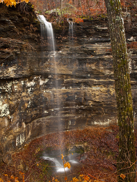
Now that it's been 2013 for a few days, it's time to look back at last year and some of the pictures taken over the last twelve months.  Perhaps the biggest story from 2012 was the weather, which impacted the amount of pictures that were taken.  A bad drought persisted throughout the year, which quickly dried up waterfalls and creeks across the state.  There definitely weren't as many waterfall pictures taken in 2012 as there had been in other years.  Hopefully we'll get some rain this year....

But without any further ado, here are some of my favorite pictures from 2012.  Hope you enjoy them!

#25:
Buffalo Point
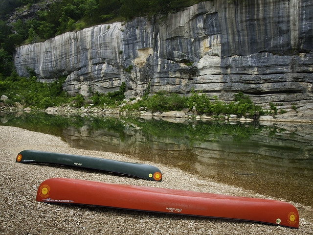
June 2: Buffalo Point, Buffalo National River, Arkansas.

My birthday is in June, and I wanted to spend it at one of my favorite places in the state - the Buffalo River. But thanks to the drought, most of the river was too low to float. The only place with enough water to support a canoe was Buffalo Point, so I headed up there with my cousin. Of course, we weren't the only ones with that idea and we found the campsite to be already full by the time we arrived. We luckily managed to snag a spot to camp, and went out to float the next day. It was actually a good day to be out on the water (meaning it wasn't 110 degrees out). And amazingly, I didn't manage to get a horrible sunburn like I usually do when I float the river. But this was taken just after dawn, with some canoes lined up along the shore waiting to be put in.

#24:
Westminster Abbey?
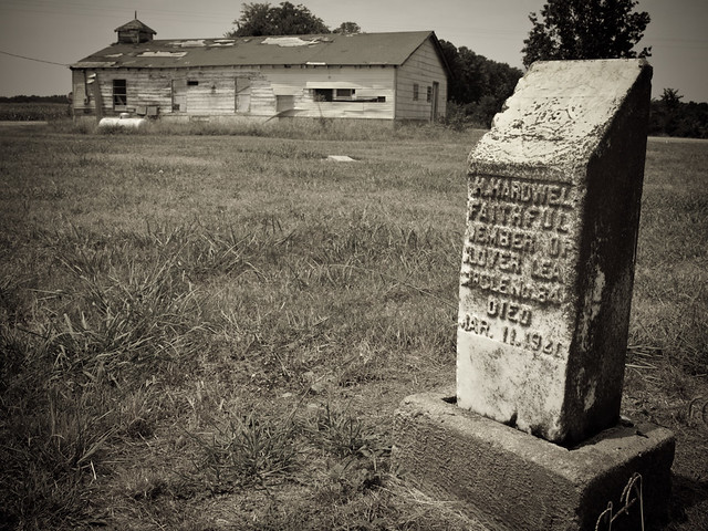
July 7: England, Arkansas

An old friend of mine had the day free (meaning he didn't have to look after his kids), so we decided to drive out into the Arkansas Delta. We passed by this old abandoned church near the town of England, which was almost bizarrely surrounded by a golf course. It was an odd contrast to have this old church and graveyard (with markers dating to the 1910s) sitting next to people playing golf.

#23:
Sunny Side Up
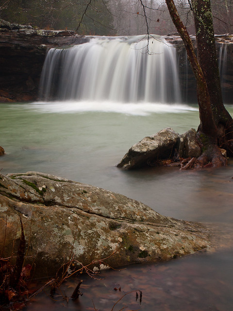
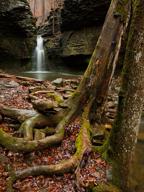
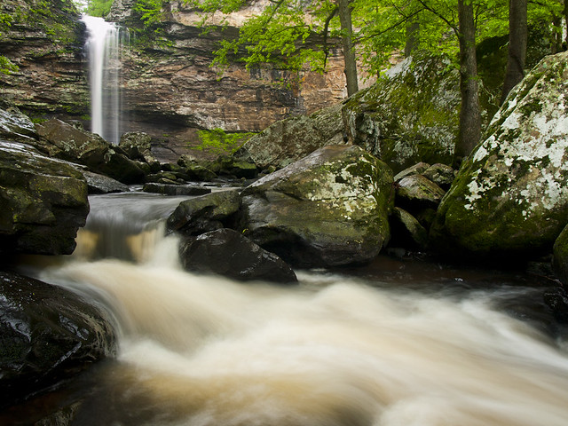
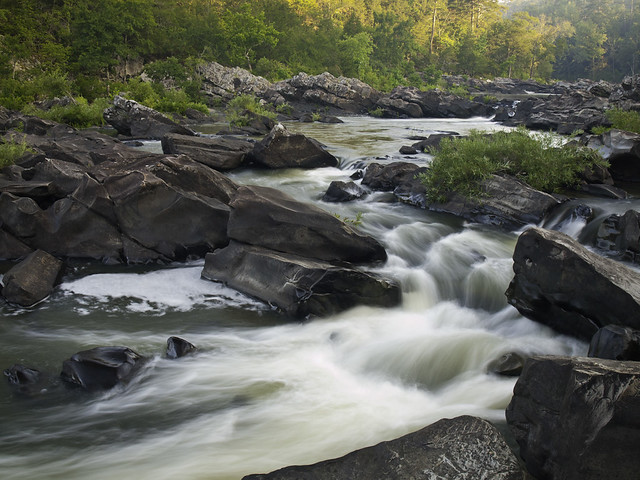
April 21: Blue Hole, Ozark National Forest, Arkansas.

A bunch of photographers met up at a cabin in the Ozarks for the annual Spring Gathering, but unfortunately most of the nearby waterfalls were just barely running thanks to the drought. We did make the long hike down to the Blue Hole, which had some water in the creek. I miss waterfalls, hopefully 2013 will be much wetter than 2012!

#22:
Boxley
August 25: Boxley Valley, Buffalo National River, Arkansas.

Boxley Valley is probably one of the most popular spots in the state for photographers. This was taken on a foggy summer day, when fog clung to the tops of the hills that ring the valley. There were elk in the field on the other side of the barn, and the road was clogged with people trying to get their picture.

#21:
On Bollie Pond
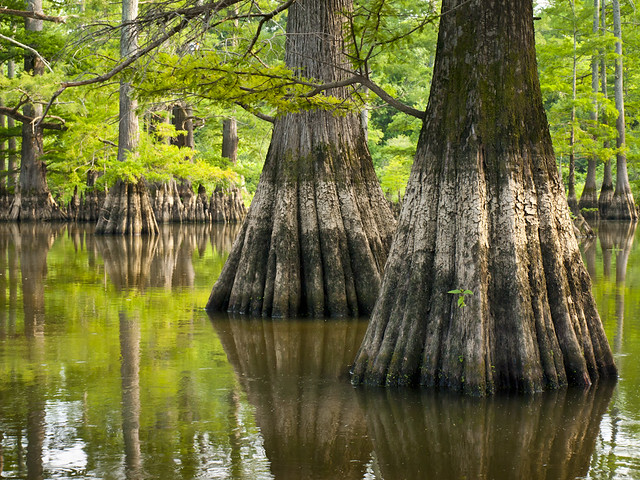
May 26: Bollie Pond, Hurricane Lake Wilderness Area, near Bald Knob, Arkansas.

This is a neat lake that is filled with cypress trees. But it was hard to get a clear shot of the lake from the shore, since the vegetation was about as thick and formidable as a brick wall. Amazingly, some people camping there offered me a quick ride on their boat, which brought about some great views of the lake (and offered some distance from any lurking snakes).

#20:
The Nars
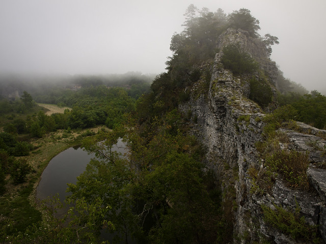
August 18: The Nars, Buffalo National River, Arkansas.

The Nars is the remnant of a mountain that once sat in between the Buffalo River and Richland Creek. The two rivers carved and eroded away much of the mountain, so all that remains is a narrow sliver of rock that is only a few feet wide in places, but about 100 feet tall. We had camped in a nearby field the night before, and we were visited a few times overnight by a few of the elk that live in the valley. While taking this shot, I could hear an elk calling out nearby, unseen in the thick fog along the river.
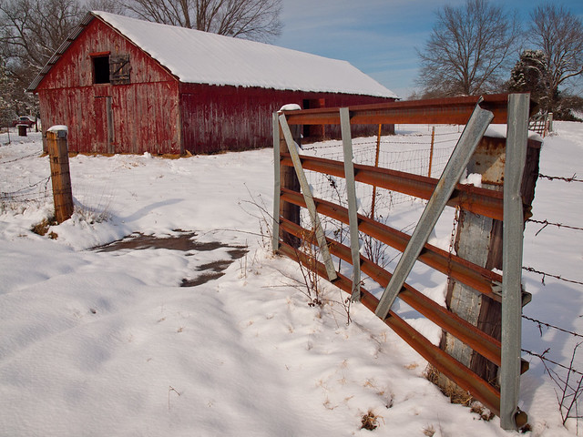
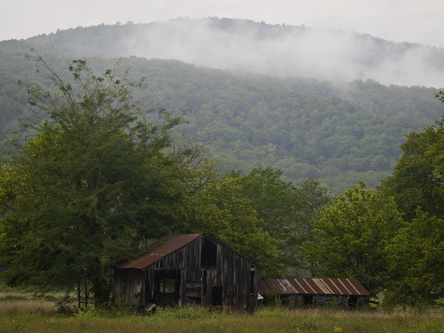
#19:
PC265808-4
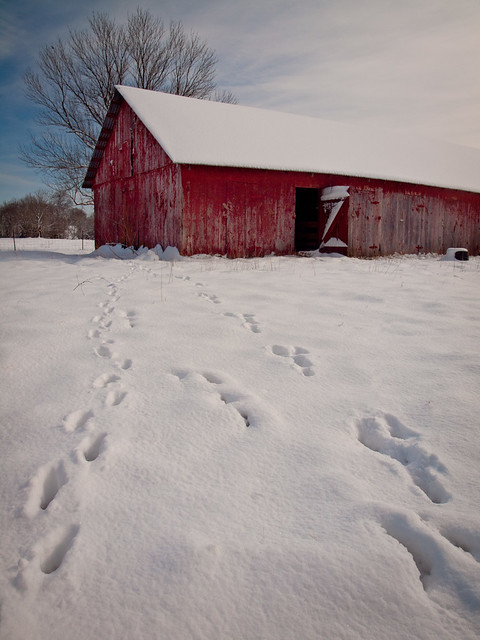
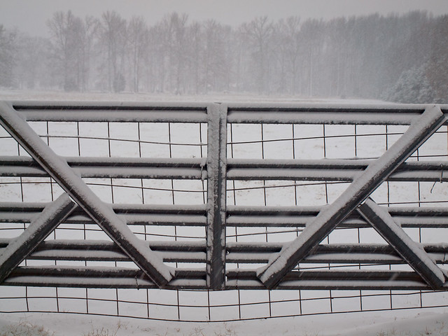
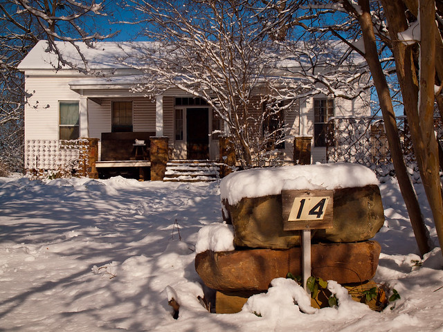
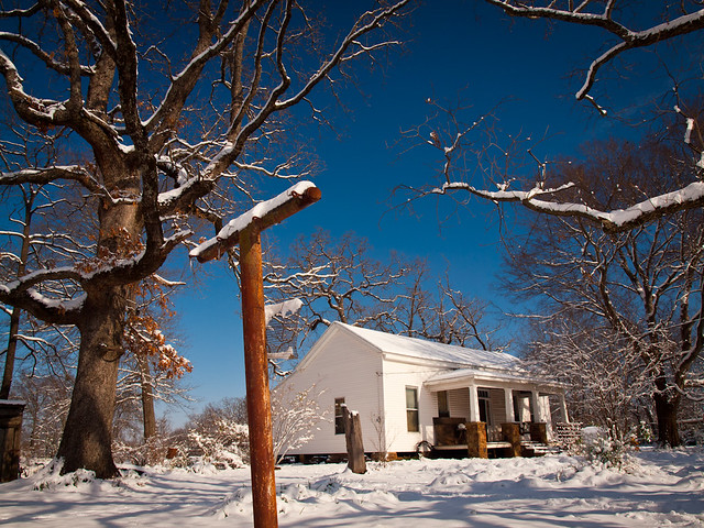
December 26: Old barn, near Charleston, Arkansas.

After it had been so dry here this year, it was surprising to get a sudden and heavy snow storm on Christmas Day. The day after the storm hit, I went out with two of my Aunts to try to get some pictures of the snow. We found this old barn, with a few tracks in the snow from the cats who call the barn home.
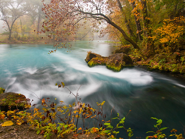
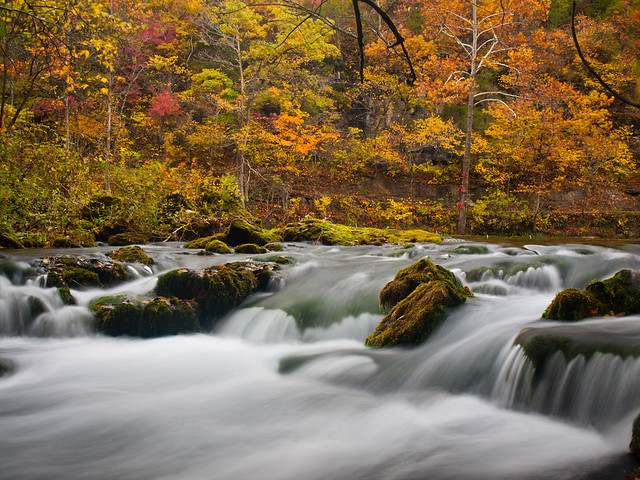
#18:
Down the road
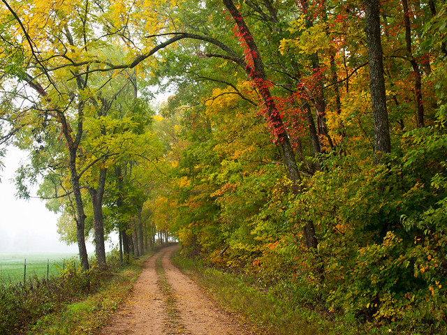
October 13: Near Blue Spring, Ozark National Scenic Riverways, Missouri.

Zack and I headed up to Missouri in October, and were amazed to find that we had somehow managed to hit the ONSR at the peak time for fall colors. This was probably my favorite trip of the year, so there will be a few more shots of Missouri on this list....

#17:
Cedar Falls
April 20: Cedar Falls, Petit Jean State Park, Arkansas.

The 95 foot-tall Cedar Falls is a spectacular spot, and I headed out there in the Spring when there was still water in the falls. It was lightly raining as I made the hike down to the falls, and I was amazed to not see anyone else there. It's rare to visit here and have the falls entirely to yourself.

#16:
Little Rock
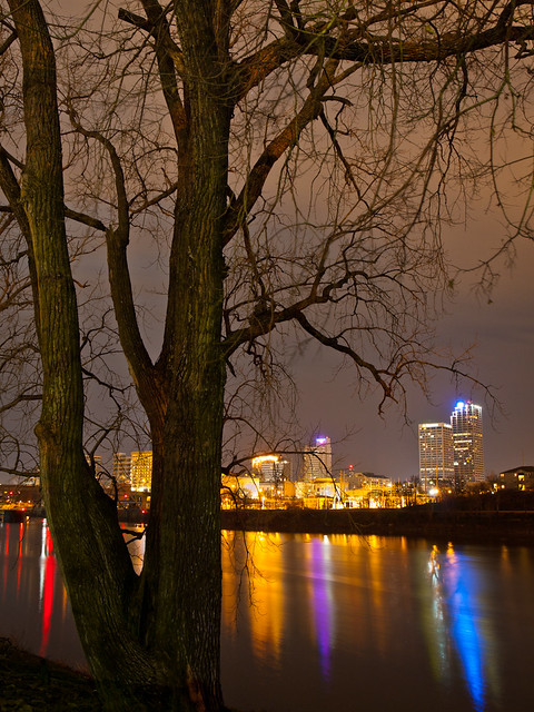
February 28: I-630, Downtown Little Rock, Arkansas.

I headed out after work to try to get a few shots of downtown. I set up on this bridge over the freeway by Children's Hospital. I was happy to be out taking pictures of the traffic on the freeway, instead of being stuck in it.

#15:
Alley Mill
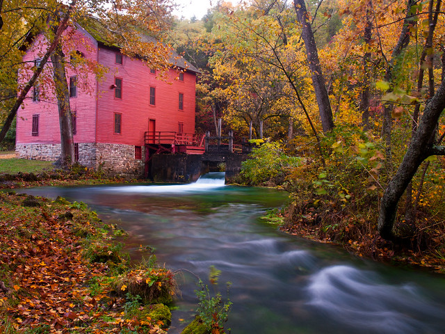
October 14: Alley Mill, Ozark National Scenic Riverways, Missouri.

This is definitely one of the prettiest places we visited in 2012. Alley Mill was built in 1894, and sits next to the 8th largest spring in the Ozarks. It was definitely worth the long five hour drive into Missouri, and the flat tire I got on the way home...
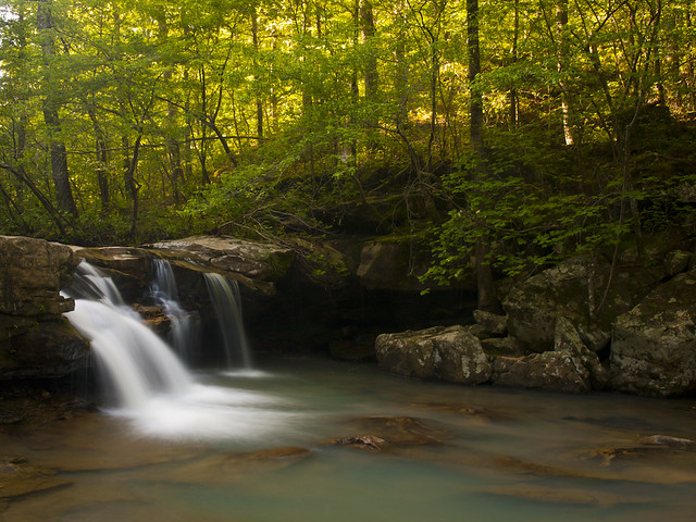
#14:
Blanchard Springs
September 8: Blanchard Springs, Ozark National Forest, Arkansas.

Even in the driest of summers, you can always count on Blanchard Springs to have some water in it. So I headed up to Blanchard with Matt and Zack to get a few shots of one of the only waterfalls that was actually running in the state.

#13:
PB105321-2
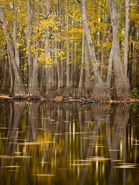
November 10: Hickson Lake, Dagmar Wildlife Management Area, Arkansas.

This is a great area to visit. The shores of the lake are lined with cypress and tupelo trees that had some nice color this fall. The area is a popular spot with hunters, so there were a few shots taken while we were out there. Luckily, the hunters were aiming at something other than the few photographers standing by the lake taking pictures.

#12:
Big Spring
October 13: Big Spring, Ozark National Scenic Riverways, Missouri.

Big Spring is aptly named, as it is fairly big. It's not only the largest spring in the Ozarks, it's also the largest in Missouri. And with a daily discharge of 286 million gallons, it's also one of the largest in the US. We managed to get there on a foggy Saturday morning, when the fall colors were right at their peak.

#11:
Blanchard
September 8: Blanchard Springs, Ozark National Forest, Arkansas.

This was taken while standing in the creek created by the springs, looking up toward one of the old stone bridges that I think was built by the CCC in the 1930s. While the water in the creek is crystal clear, it isn't exactly 100% clean. There are a lot of bats that live in the cave created by the springs, so the water is filled with bat guano. I tried not to think of what was washing over my shoes as I stood taking this picture...

#10:
Riverfest
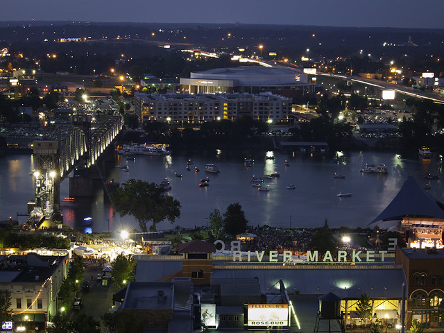
May 27: Downtown Little Rock, Arkansas.

We managed to get access to the top of one of the condo towers near the River Market in Little Rock, which we had hoped would provide a good view of the Riverfest Fireworks show. It was nice to be a good 20 floors above the massive crush of people who were crowding the streets below.

#9:
Big Creek Cave Falls
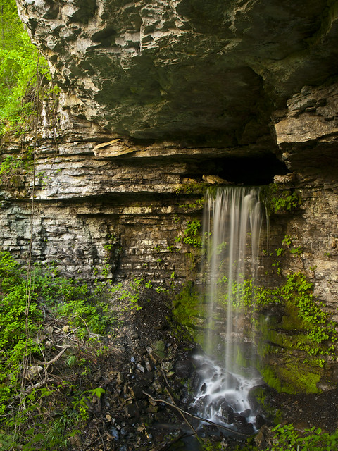
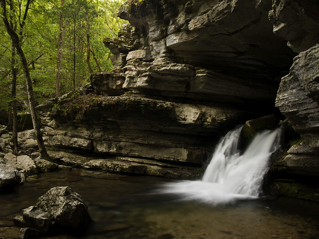
April 7: Big Creek Cave Falls, Ozark National Forest, Arkansas.

This is a really unique waterfall. A spring pours out of a cave on the side of a bluff, creating a 29 foot tall waterfall. To hike out to the falls is about three miles round trip, and is labeled as a medium bushwhack. I didn't think the hike was all that bad, the worst thing about it was the jungle-like layer of poison ivy that we had to wade through to get there. I'm amazed that I survived it without getting any itchy reactions.
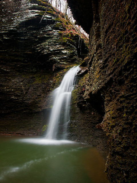
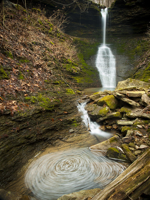
#8:
Fallen leaves at Falling Water Falls
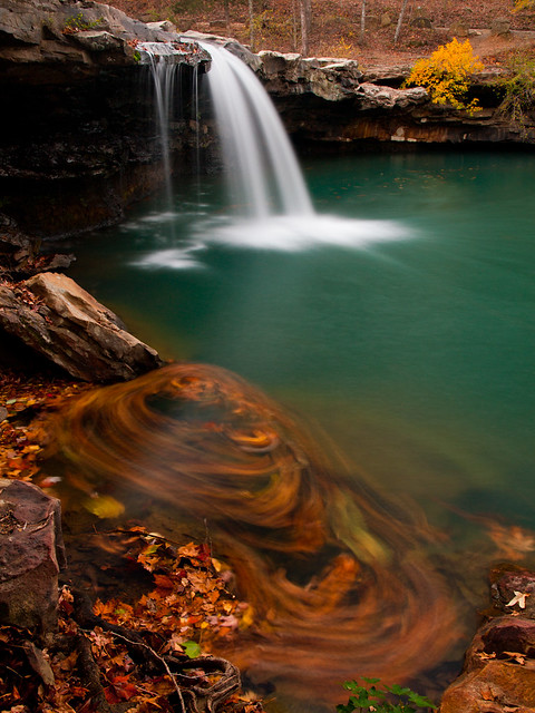
October 26: Falling Water Falls, Ozark National Forest, Arkansas.

I was able to take a few hours off from work on a Friday, and headed back to the Ozarks to try to get a few shots of the fall colors before they fell off the trees. I went by Falling Water Falls, and was amazed to see that it actually had a decent amount of water in it. Below the falls, a bunch of fallen leaves had been caught in the current, and were turned into a swirl in this 15 second exposure.

#7:
Cossatot Falls
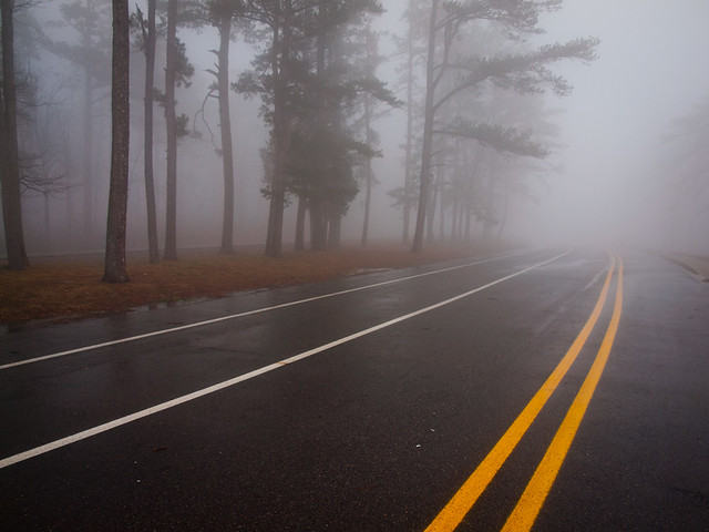
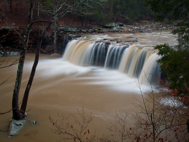
July 28: Cossatot Falls, Cossatot River State Park, Arkansas.

I had been wanting to visit the Cossatot River for awhile now, but hadn't driven out there since it's a long drive from Little Rock. But after a storm dumped a bunch of rain on the river, Zack and I decided to make the drive through the Ouachita Mountains. The river rose a few feet from the rain, which got the river back up to normal levels, if only for a brief amount of time.

#6:
High And (Not) Dry
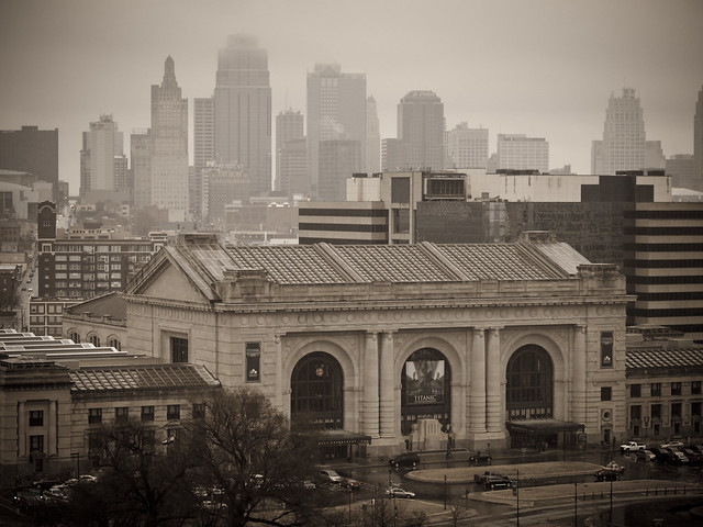
March 11: Kansas City, Missouri.

A cold and rainy view of Kansas City, taken on the first of two visits in 2012. The first visit was with my brother, in order to attend a Radiohead concert. The second visit was just two weeks later, to catch a soccer game. I'm sad to say that Sporting Kansas City did end up defeating my beloved FC Dallas in that game, 2-1. But the soccer stadium there is really nice (although the BBQ in KC isn't as good as the BBQ in Little Rock).

#5:
Alley Spring
October 14: Alley Spring, Ozark National Scenic Riverways, Missouri.

Another view from Alley Spring, where 81 million gallons of water pour out from a bluff every day. I was amazed at how beautiful this area was, and I managed to use up several gigs of memory cards out there.

#4:
Big Cloud, Little Rock
May 2: Downtown Little Rock, from Fort Roots in North Little Rock, Arkansas.

This is probably one of the best views of the Little Rock skyline, and luckily there is now a paved trail that allows easy access (without worries of any VA hospital security kicking you out, which has happened in the past).

#3:
Pinnacle Mountain Erupting
July 10: Sunset over Pinnacle Mountain, from Two Rivers Bridge, Little Rock, Arkansas.

Occasionally, if your timing is right, you can catch the sun setting right on top of Pinnacle Mountain. It had stormed a few hours before the sunset, which created a few stands of fog that drifted along the base of Pinnacle.

#2:
Falling Water Spring
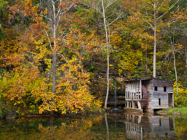
October 14: Falling Water Spring, Mark Twain National Forest, Missouri.

This is one of neatest places that I went to last year. The spring flows out from the side of a bluff, creating a waterfall next to an old mill that was built in the 1920s.
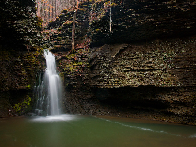
#1:
Maidenhair Falls
February 18: Maidenhair Falls, Ozark National Forest, Arkansas.

It's been months since this hike, but the memory of it still makes my legs hurt. The falls sit at the bottom of some steep hills, and of course, the only way to reach it is by hiking in. The falls were awesome, especially with this bit of a swirl that developed along the creek below the falls. The hike to Maidenhair Falls is listed as a "medium bushwhack," which I think is being a bit generous. But it was worth the hike, I think....

And thanks to all 3 of my readers, if you made it to the end of this post. Hope everyone had a good 2012, and a much better 2013!

Tuesday, January 1, 2013

White Christmas

On Christmas Eve, I drove to the small town of Charleston to celebrate Christmas with my family. So I was there on Christmas Day when the big storm blew in that gave us in Arkansas a rare White Christmas. It started sleeting in the afternoon, and soon enough, a few inches of snow started piling up on the ground.

I had the camera with me, and trudged out into the snow to try to get a few pictures. This is the view from my aunt's backyard, of a gate and a distant and snowy pasture.

PC255582

The next day, me and two of my aunts decided to head out and try to take a few pictures in the snow. Charleston only got about five or six inches of snow (nothing like the 9 or 10 inches that Little Rock got). And after scraping all the snow and ice off the car, we were soon able to get out and explore a bit. One of the stops was this old home, in the middle of town. It used to belong to family, but no one has lived in it for years.

PC265700

I went up on the front porch and saw this old thermometer nailed to the wall. It was apparently a chilly 29 degrees that day...

PC265684

Also on the front door was this faded American flag...

PC265688

And a wider view of the old house...

PC265722-2

From there we drove over the city park along Lake Charleston. We followed a trail that lead over this bridge, and off into the snowy woods.

PC265741-2

After that we drove around some more, and eventually found this old barn along the side of the road. Luckily we knew the person who owned it, so we were able to jump the fence and get a few pictures of it up close.

But we weren't the only ones around the barn. Apparently a few cats live there, and their tracks lined the way into the barn.

PC265808-4

PC265822-2

We called it quits after that, and headed back to a place to warm back up. But the next day it was time for me to head home. Luckily the roads were mostly dry and clear (and my apartment in North Little Rock had power again). I decided to take the long way home, driving along Highway 22 east through Paris and Subiaco. This is the view of the old Subiaco Abby and school, with a few cows trying to find something to eat in the snow...

PC275942

I turned down a muddy dirt road, which managed to quickly coat my car in a muddy mess, in order to find this old run-down barn.

PC275949-2

My car was happy to get back on a solid road again, as I headed back down Hwy. 22. I scanned the road trying to find more old barns in the snow, and eventually saw this one that even had a convenient place for me to pull off and park.

PC275961-2

That was about it, I got back onto the freeway and finally made it home. As I type this now, a few days later, most of the snow has finally melted. We really don't see many big snow storms here in Little Rock, let alone on Christmas Day. But the blizzard of 2012 definitely made the holiday more interesting than a lot of people were planning....