Tuesday, December 31, 2013

Last Sunset of 2013

On New Year's Eve, I headed out to downtown Little Rock to try to capture the last sunset of the year (I would try to take pictures of the first sunrise, but that would mean having to wake up early). I drove across the river and went to the Clinton Park Bridge, an old rail bridge built in 1899 by the Choctaw and Memphis Railroad. It was converted into a pedestrian bridge a few years ago, with a brand new lighting design added a few weeks ago.

PC314983

This is the view looking back towards downtown Little Rock, from under the bridge...

PC314986

And one last shot of the bridge, and for the year...Happy New Year!

PC314988

Monday, December 30, 2013

Pam's Grotto

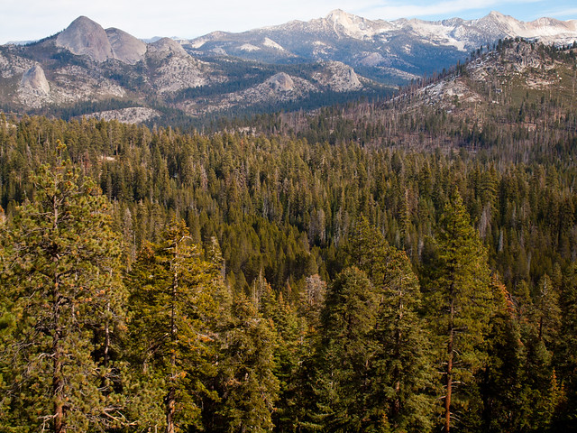
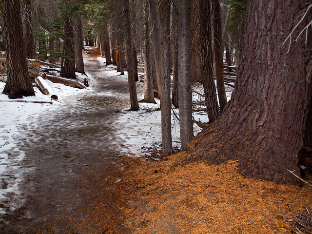
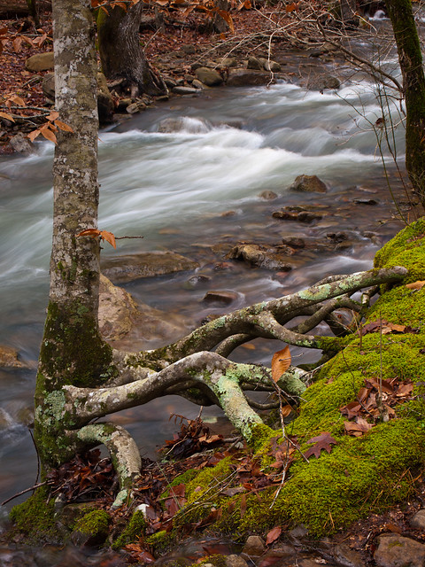
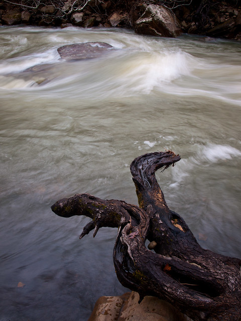
From Hwy. 123 Falls, I got back in the car and drove further up Highway 123. I think this might be one of the prettier drives in the state, especially when you can catch it after a rain. The creeks along the road were overflowing after the recent rains, and water tumbled down the hillsides. I stopped the car and followed a bumpy and rocky dirt road that ran parallel to a small creek. It was a typical Ozark stream, with cascades full of rain water. I stopped to get a few pictures of the roots of this tree, clinging on for dear life.

PC224722

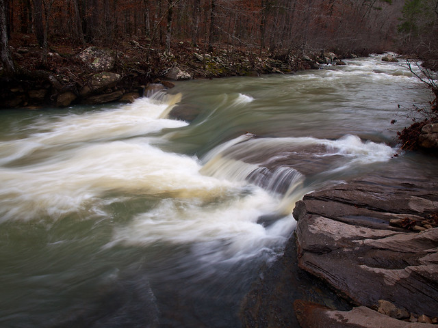
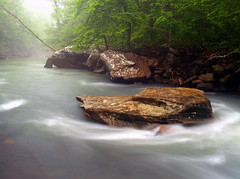
I got back on the highway and drove past the Haw Creek Falls campground, which was closed (for the season?). But I went just down the road and parked, and went out to see Haw Creek. The water was up, I don't think I've ever seen the creek with this much water.

PC224734

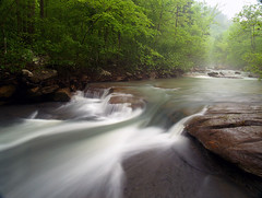
For a comparison, here is this same spot taken during the Spring:

Haw Creek

There is an old tree growing along the creek, with some weathered old roots that stretch out over the water.

PC224741

The rock in the creek, which is just barely peeking up from the water, is usually a bit more prominent. Here's another shot taken in the spring when you can see it a bit better...

Haw Creek

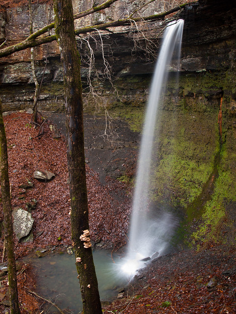
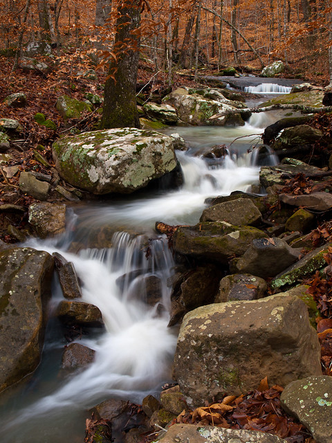
Conveniently, I was right next to the trail to one of the neater waterfalls in the state. Pam's Grotto Falls can be reached by a short (but steep) trail that starts across the road from the creek. This is the view of the creek that the waterfall is on, taken at the beginning of the hike. This area has a lot of beech trees, which add a bit of color to the drab winter landscape.

PC224750

The trail to Pam's Grotto starts off with a steep climb up a hillside. I slowly made it to the top and then had a bizarre encounter along the trail. I hesitated telling this story, since the other person involved is a photographer. But I won't use any names, just in case the person involved reads this (and if you are, hi!). I won't get into the full details of the story, but I'll just say that if you need to go to the bathroom when out hiking you should probably be sure and go away from the trail where people are hiking. Especially if you're going a #2. It's incredibly awkward for the person who is walking along the trail while you are trying to finish your business.....

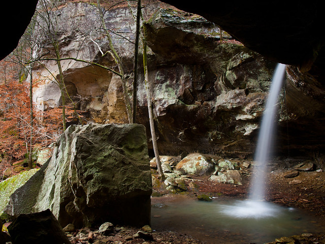
So anyways, the trail to the waterfall is short. After the steep climb up the hill, the trail runs along a bluff line. After a steep scramble down the hillside, you then make it to the falls.

PC224784-2

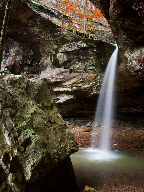
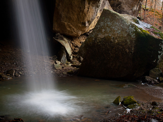
The falls are only 37 feet tall, but they drop into a spectacular grotto. Huge boulders have fallen from the roof of the grotto and now guard the falls like sentinels.

PC224791

PC224815

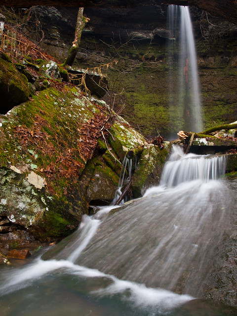
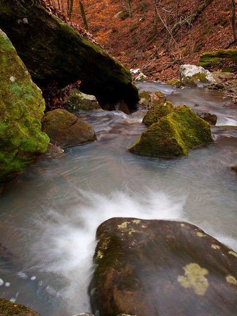
This was taken along the creek, downstream from the waterfall. The rocks and boulders along the creek were covered with moss.

PC224851-2

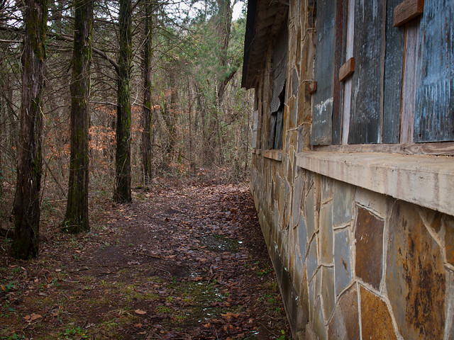
I made sure to watch my step as I headed back down the trail towards my car. I drove just a bit further down Hwy. 123 and passed by the very small town of Fort Douglas. It probably doesn't even qualify as a town anymore, since it's really just a cemetery and an old abandoned school.

PC224871

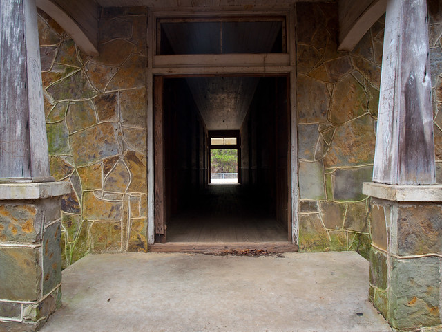
I tried to look online to see some more info about this building, but didn't have much luck. And although it's empty, the building is still in pretty good shape considering it's exposed to the elements.

PC224883

PC224893

I headed further east and crossed over the old bridge over Big Piney Creek. The bridge was built in 1931, and is still in use despite the fact that it's only one lane.

PC224940

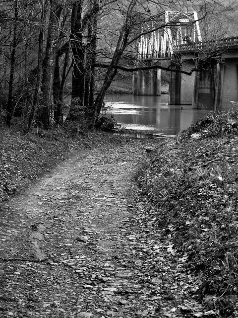
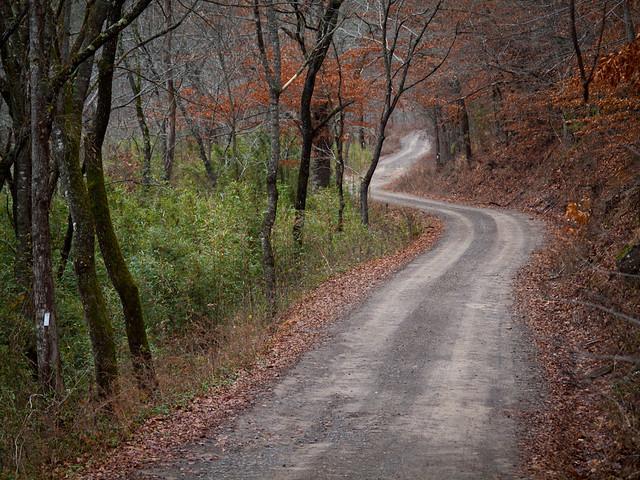
I made one last stop before heading home - this is the road that follows along Big Piney Creek and also into the Hurricane Wilderness.

PC224905

Sunday, December 29, 2013

Hwy. 123 Falls

A long and drenching rain fell last weekend, enough to finally get the waterfalls back up and running. So early Sunday morning I got in the car and headed north up into the Ozarks. There are countless waterfalls in the mountains there to explore and photograph, and the conditions on Sunday were perfect. I decided to hit up a few waterfalls in the Ozark National Forest northeast of Clarksville.

The first was the aptly named Highway 123 Falls. This waterfall gets its name because it's right next to, you guessed it, Highway 123. I was actually a little annoyed with this waterfall when I first read about it in Tim Ernt's waterfall guidebook. I had driven right by this waterfall dozens of times and never saw it. But it's so close to the road that you can see it.

PC224668-3

The falls are 47 feet tall and can be reached by a short walk from the road (there is a trail, but it's a bit of a scramble in places). This was taken just down the creek from the falls...

PC224695

Sunday, December 22, 2013

Icy

A few weeks ago, an ice storm passed over the state and dumped a few inches of sleet and freezing rain. We got enough here to shut down the city (right after everyone made the traditional run for milk and bread at the grocery store). Luckily it was enough snow to shut down the office for a day, and not enough to knock out power.

The ice storm was also bad enough to cancel the lighting ceremony and fireworks show at the state capitol. They were still switched on, and I headed out a few days later to take a few pictures. It hadn't quite warmed up enough to melt all of the snow and ice yet.

PC094534

PC094536

PC094544

Wednesday, December 18, 2013

Foggy

Still trying to get caught back up on the some old pictures....

It was really foggy one night last month, so I rushed out to get a few pictures of downtown Little Rock. The fog was thick enough that it made the lights on the state capitol look like spotlights.

PB214495-2

And I went to a parking deck to get this shot of the 40-story Metropolitan National Bank Building, which was about halfway submerged in fog.

PB214507

Monday, December 9, 2013

Apple Lake

Still working on getting caught back up....

In November, Zack and I headed out to see some of the fall colors. Instead of the Ozarks, we headed east to the swamps of the Arkansas Delta. It was cloudy as we drove towards one of my favorite places to take pictures, the Dagmar Wildlife Management Area. There are a lot of photogenic cypress and tupelo trees there, all in a relatively short drive from Little Rock.

PB104246-2

These were all taken at Apple Lake, which is just to the north of Hwy. 70. The fall colors were just about at their peak.

PB104261

PB104266

The ivory-billed woodpecker was thought to have been seen in this area a few years ago. So now all of this land has been closed off to hunting, which was good to us since we were visiting there in hunting season. No worries about getting shot while taking pictures!

PB104282

PB104291

And another good thing, since it was a little chilly outside, we didn't see any snakes out either.

PB104310

It was very quiet out there, hardly any noise except for the fish jumping out of the water.

Apple Lake

PB104366

And one last shot from the lake, which is well worth the trip if you're in east Arkansas...

PB104376-2

Wednesday, December 4, 2013

Hot Springs

I'm working on getting things caught back up now, and finally had time to work on a few pictures taken before the crazy rush of the wedding/honeymoon. In late October, I made a quick trip to Hot Springs with an old friend of mine. Hot Springs is one of my favorite places to photograph. The mixture of architecture and history is unique in the state. And now you can even get a beer on Bathhouse Row.

PA241136

This is the Quapaw Bathhouse, that was built in 1922. It re-opened a few years back and is now a spa.

PA241092

Just down Central Avenue is the Superior Bathhouse, which was just opened as a craft beer brewery and distillery. We of course had to stop in and try something. This is the view, looking out the front windows onto Central Avenue.

PA241120

And one of the old hotels that line Central Avenue...

PA241094

Saturday, November 30, 2013

San Francisco - Fort Point

The next day, we left Yosemite and headed back to San Francisco. We got back into town in the late afternoon, and went to see Fort Point. The fort was built to protect the city during the Civil War, and now sits directly below the southern approach to the Golden Gate Bridge. It is now a National Historic Site, and provides some neat views. There aren't very many places around where you have an old 19th century fort with a giant bridge looming above it.

PB033901

The fort, with the bridge towering above it, gives it a timeless feel.

PB033939-2

The first fort built in this spot was constructed by Spain in the 1790s. When the US eventually gained control over the bay, the government decided to built a few fortifications around what is now San Francisco. One of those was Fort Point.

PB034003-3

The fort never saw any action during the Civil War, and was soon replaced by more modern ways of defending the city and the Bay. The army still used the fort for storage, barracks and training. It was nearly torn down during the construction of the Golden Gate Bridge, but the plans were altered in order to save the fort.

PB034020-2

Just outside the fort, there were several people trying to surf. The water looked a little too cold...

PB034043

And one of the rusty old chains, along the fence. The fort is sitting on the left, below the bridge.

PB034095

This was our last night in San Francisco, the next day we flew back home (without any travel problems). So here is the last shot from the honeymoon trip. This was taken at dusk, as the waves crashed along the rocks in the foreground.

PB034208-2

Yosemite National Park - Taft Point and Glacier Point

The next day we headed back into Yosemite, but didn't make the drive into the valley.  Instead we headed up the road to Glacier Point, which had just re-opened after some snow a few days before.  The road closes in the winter since it climbs to the top of the mountains overlooking the valley.

PB023253

There are some hiking trails that I was interested in seeing. One was the hike to Taft Point. I thought it would be a nice and easy hike. It's only two miles round trip, and it doesn't have many steep hills to traverse. Which was true, but I forgot to take into consideration that I was hiking at a pretty high elevation.

PB023270

I'm used to Little Rock, which has an elevation of 335 feet. Taft Point, on the other hand, clocked in at around 7,500 feet. It didn't take long for me to lose my breath. But the hike was worth it, the view from Taft Point is amazing.

PB023335

From there you are about 3,000 feet above the valley below. You also have good views of El Capitan and Yosemite Falls (which weren't running). It is not a good place to go if you're afraid of heights.

PB023342-2

I inched close to the edge, but was nervous that my new wedding ring would slip off and fall down into the valley.

PB023369

There were some people walking across ropes that were strung between the fissures in the rock, thousands of feet in the air. I thought it was safer to just slowly struggle on the hike back to the trail-head.

PB023413

And from there, it was a drive further up the mountain towards Glacier Point.

PB023516-2

Glacier Point sits at an elevation of 7,214 feet (about 3,200 feet above the valley below). From here you have views of Yosemite Valley, including Half Dome, Yosemite Falls and Clouds Rest.

PB023527

There was still a little bit of snow on the rocks...

PB023645

And Half Dome, while we were waiting for the sun to set...

PB023672

It's a popular viewpoint, especially with photographers. I had claimed a spot that I liked a bit before sunset, just to make sure I wouldn't have to have a tripod fight with another photographer. As it got closer to sunset, busloads of photographers appeared. I counted at least three photography classes going on, so most of the conversation on the Point consisted of questions about filters, focusing, and why a particular camera wasn't working. By the time the sun began setting, there must have been over a hundred people gathered around with cameras on tripods.

PB023756-2

The crowd wasn't too bad, except when other photographers would stand directly in front of my camera in order to get a shot (the teacher of their class shooed them away). The sunset was amazing. The light streamed through the valley, bathing the mountains in light.

PB023784-3

PB023787

It was probably one of the most amazing sunsets that I've been lucky enough to point a camera at...

PB023827

PB023832

And one last shot from Yosemite, of dusk over Half Dome.

PB023864-2