
We left on a Saturday, and the plan was to leave as early as possible in order to allow plenty of time to stop and do some sightseeing along the way. The plan was to head west on I-40 and stop at Amarillo that night, and hopefully be able to see some old Route 66 stuff along the way. That, of course, didn't happen. We left a few hours late and ended up getting into Amarillo around 10 or so that night. The only time we were able to stop and look around was when we got gas..
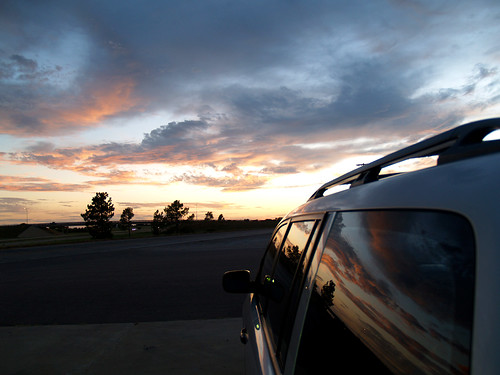
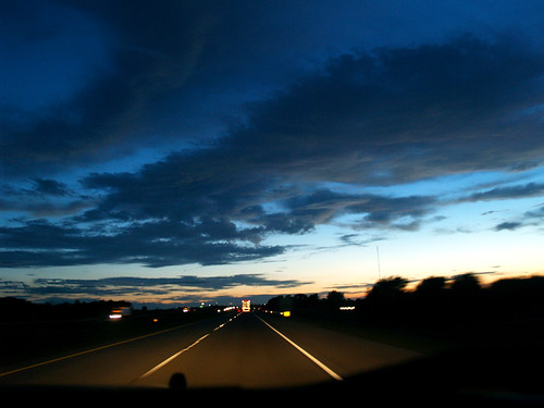
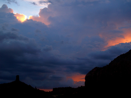
We then drove off into the sunset...
And finally made it to Amarillo. The best part of Amarillo was the hotel we stayed at. At their breakfast the next morning you could get waffles. Not just any waffles, but waffles in the shape of Texas. I was sad that there weren't other state-shaped waffles at any of the other places we went too. Get on the ball, New Mexico and Arizona!
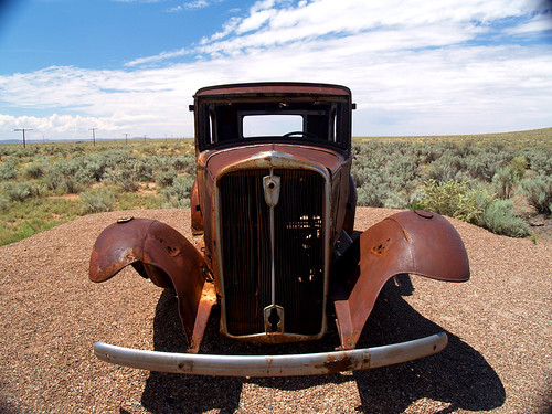
The next morning we went to the Cadillac Ranch, which is along I-40 just outside of Amarillo.
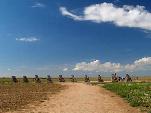
Now if you've never been, Cadillac Ranch is just a bunch of old cars set into the ground in a random field outside of Amarillo. Supposedly the angle of the cars in the ground is the same angle of the Pyramids in Egypt. Or so they say.
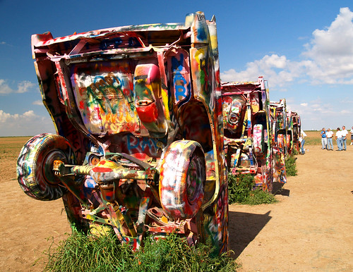
We didn't think to bring any spraypaint to add to the graffiti, but there was a group of people there painting one of the cadillacs all a solid color. It is apparently something they do every few months or so, leaving a fresh canvas for people to paint their names or favorite curse words over.
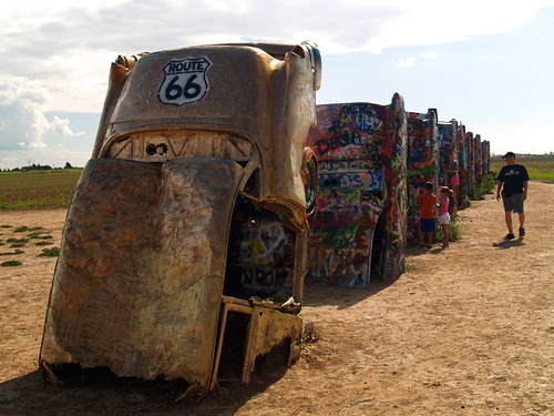
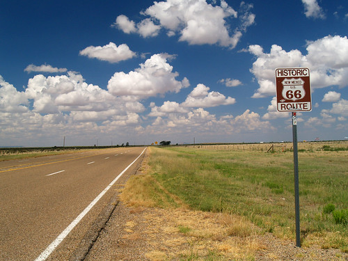
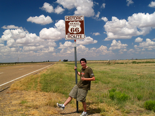
The group are part of a "Route 66" group, so being there that morning fit with the Route 66 pilgrimage we went on. After Oklahoma City, Interstate 40 runs parallel to what was old Route 66, and passes along some old tourist attractions that have been there for decades. It also passes by lots of ghost towns and ruins, so it makes for interesting stops for anyone bored with interstate driving.
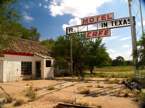
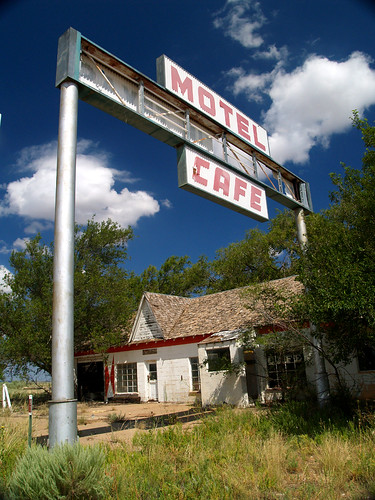
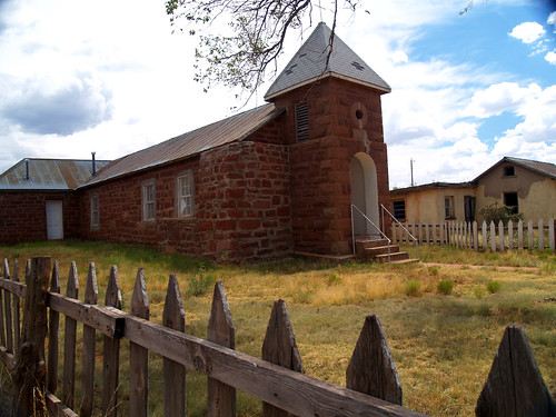
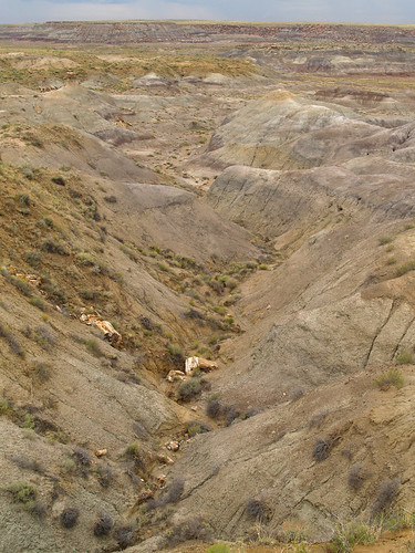
Our first Route 66 stop was the town of Glenrio, perched right on the Texas-New Mexico border. Back in the heyday of Route 66, the town wasn't that big, just about 300 people lived there. But when the interstate was built, the town was shut off and withered. Now it is a ghost town..
According to our guidebook, this was the old post office, one of the last places to close down in town...
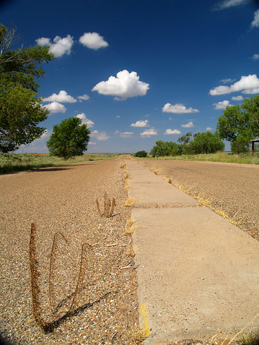
It looks like they put these little dividers in the old road, possibly to help divide traffic back when Route 66 actually got traffic. The whole time we were stopped, however, there weren't any other cars passing through Glenrio.
There was an old motel there, which used to be known for its place on the stateline. Depending on which direction you would be traveling, the sign would either announce it as the "First Motel in Texas" or the "Last Motel in Texas."
Our guidebook didn't say if they served Texas shaped waffles...
The guidebook did have this fun fact: The town's name is formed from the English "glen" for valley, and the Spanish "rio" for river, eventhough the town doesn't sit in a valley or near a river. In 1938, a film crew spent about 3 weeks filming portions of The Grapes of Wrath there.
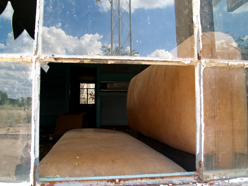
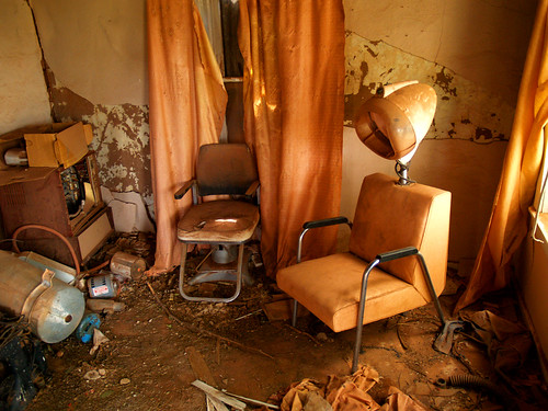
Inside the Last Stop/First Stop cafe:
Somewhere in Glenrio is the stateline, though there isn't a sign and it isn't marked. It's almost as if both states have forgotten this little town still sits here. But now that we had made it to New Mexico, we headed further on west.
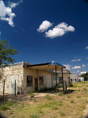
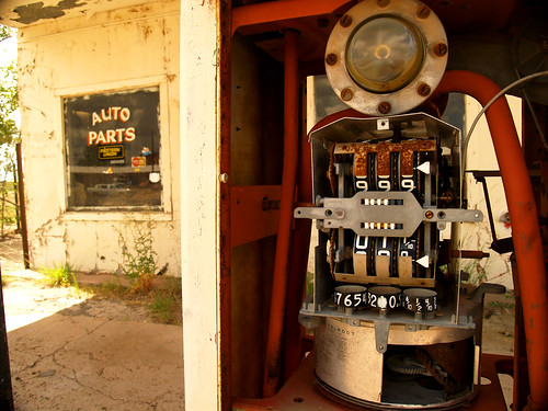
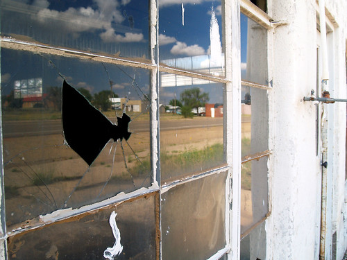
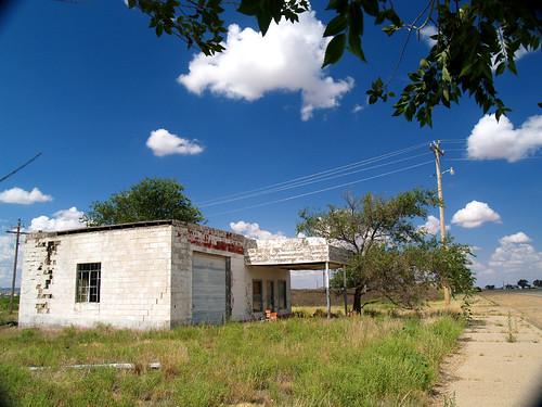
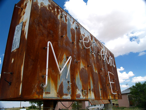
The next stop was San Jon, New Mexico. The town was in a better shape than Glenrio - it at least has people living there still - but it still had it's fair share of old abandoned gas stations along Route 66:
There were also a few old hotels that had long-since closed down, including this Western Motel:
Doesn't this make you want to rent Cars?
Sadly, most of Route 66 is gone now. Interstate 40 was built over big patches of it, and a lot of the old road is in bad shape. One place that we did drive along the old route was from San Jon to the town of Tucumcari.
Getting my kicks, on Route 66
Tucumcari is filled with lots of iconic Route 66 places, like the old Blue Swallow Motel.
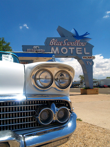
While now it sounds like a place that might charge by the hour, back in the olden days it was popular with tourists.
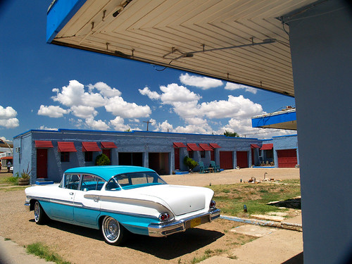
It is still popular with tourists, I guess, since it's still open. Another Route 66 icon nearby is Teepee Curios, a souvenir shop with a teepee that you walk through to get into the shop.
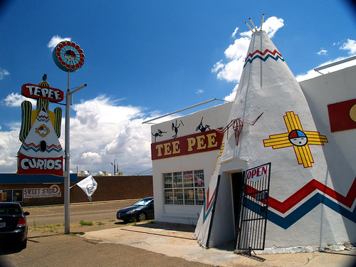
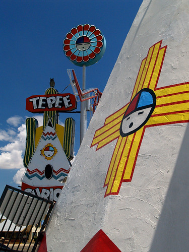
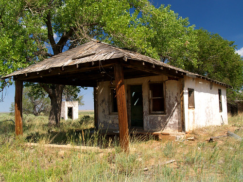
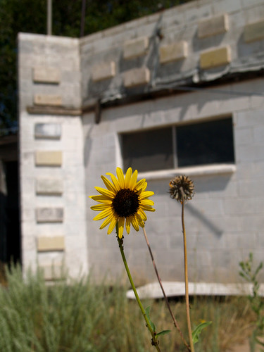
Tucumcari has a good selection of vintage old buildings like this designed to draw in tourists. They have a Mexican restaurant that has an entrance shaped like a sombrero, and lots of other old places with neon. We drove on, heading west to the town of Cuervo. This town, which is right off the freeway, had the smallest post office I'd ever seen:
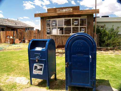
No surprise though that it is small, since the town around it is a ghost town. Unlike Glenrio, which was really just a string of old buildings, Cuervo had tons of empty buildings, including lots of houses, what looked to be a school building, and even an old church.
It's odd that the freeway runs right through town, but it feels a world apart. It was mostly abandoned, though I always had the feeling that someone was watching me while I was walking around taking pictures.
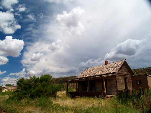
We went up and peeked into the house from the porch, it looked a bit rough on the inside:
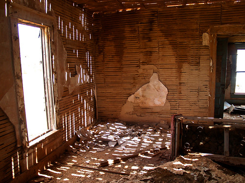
Looking in there did make me feel much better about the state of my apartment...
The church there still looked like it was in somewhat good shape:
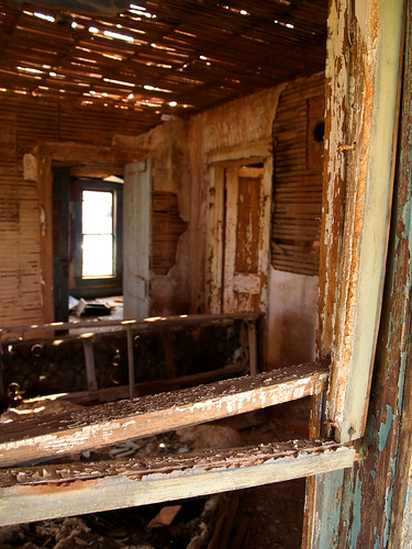
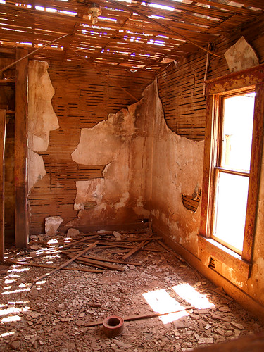
The house next to the church, on the right in the above picture, had an open front door. Or really no front door, so I invited myself inside to have a look around. It was creepy, the few rooms I looked into I expected to see someone sitting in a rocking chair with a loaded shotgun pointed at me.
Then we got onto the freeway and hurried west, eventually getting into Arizona.
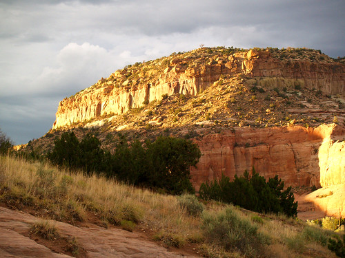
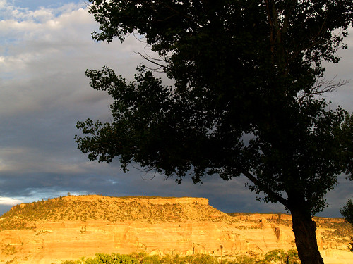
We stopped at the visitor center at the stateline to pick up some touristy stuff, but it was closed. There were some good views of the light from the sunset hitting the mountains right alongside the freeway.
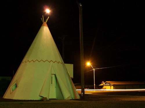
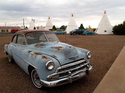
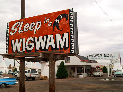
Then we continued on west towards our destination for the night, Holbrook. Holbrook is home to the Wigwam Motel, another Route 66 landmark where it has rooms shaped like, well, wigwams.
Have you slept in a wigwam lately?
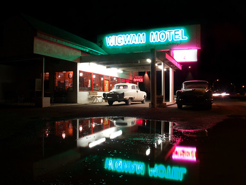
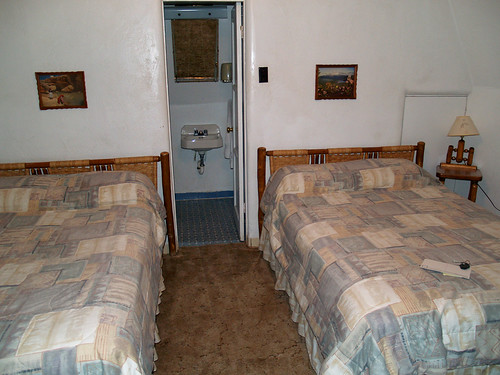
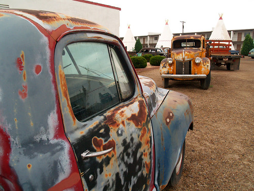
In Cars, they had a motel based off of this place. The motel has tried to cash in on the film, we were told that our wigwam was "right next to 'Mater." The parking lot around the wigwams was filled with all sorts of old cars. The rooms were ok, a bit small, but about what you'd expect of a concrete wigwam built in the 40s. The beds weren't all that comfortable, but it was a cool place to spend the night.
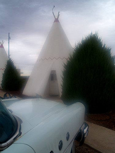
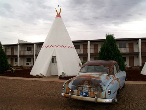
Did you know that Arizona doesn't follow Daylight Savings Time? It was odd to wake up in the morning and it be 2 hours earlier than you thought. But in the morning I got up and went out to explore the wigwams in daylight. My camera fogged up as I went out, so here is our wigwam in the "fog," along with the old car parked next to it.
And a few more shots of the wigwams:
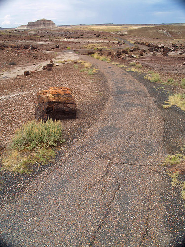
After the Wigwam Motel, we got into the car and headed east. Holbrook isn't far from the Petrified Forest National Park, and we headed in that direction. Inside the park it is a bizarre landscape of desert.
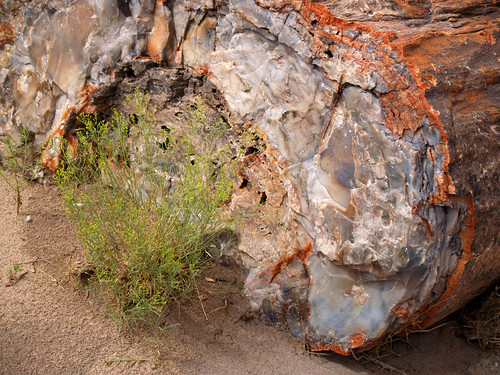
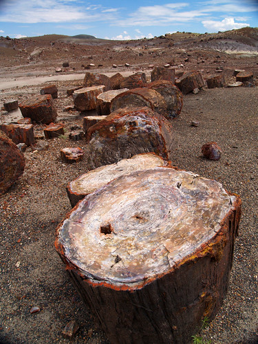
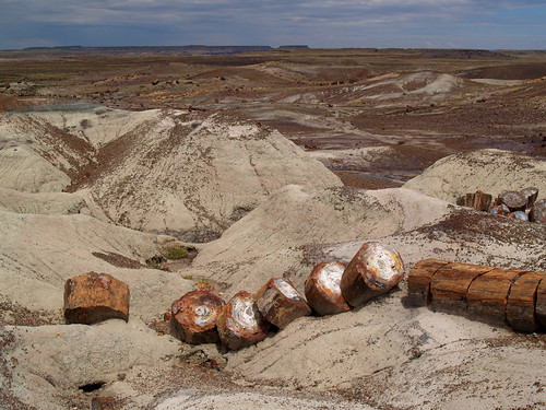
We stopped at the Crystal Forest trail, which goes through an area with lots of pieces of petrified wood laying around.
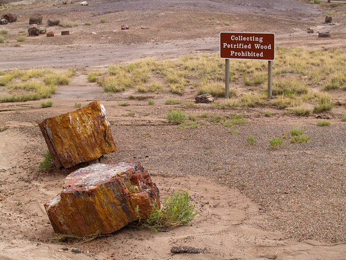
We didn't take any!
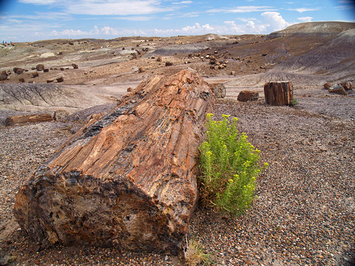
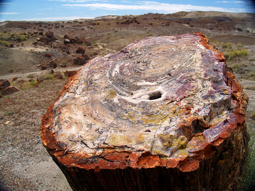
In case you were wondering, here's more about the petrified wood (from the National Park website):
"Petrified wood found in the park and the surrounding region is made up of almost solid quartz. Each piece is like a giant crystal, often sparkling in the sunlight as if covered by glitter. The rainbow of colors is produced by impurities in the quartz, such as iron, carbon, and manganese.
Over 200 million years ago, the logs washed into an ancient river system and were buried quick enough and deep enough by massive amounts of sediment and debris also carried in the water, that oxygen was cut off and decay slowed to a process that would now take centuries.
Minerals, including silica dissolved from volcanic ash, absorbed into the porous wood over hundreds and thousands of years crystallized within the cellular structure, replacing the organic material as it broke down over time. Sometimes crushing or decay left cracks in the logs. Here large jewel-like crystals of clear quartz, purple amethyst, yellow citrine, and smoky quartz formed.
Most of the petrified trees have been given the name Araucarioxylon arizonicum. Woodworthia and Schilderia are two other species occurring in small quantities in the park. Though only seven species of tree have been identified through petrified wood, over 200 species of plants have currently been identified from other Triassic fossils, such as leaves, pollen, and spores.
Petrified trees today lie strewn across clay hills and within cliff faces; each log broken into large segments. The quartz within the petrified wood is hard and brittle, fracturing easily when subjected to stress. During the gradual uplifting of the Colorado Plateau, starting about 60 million years ago, the still buried petrified trees were under so much stress they broke like glass rods. The crystal nature of the quartz created clean fractures, evenly spaced along the tree trunk, giving the appearance today of logs cut with a chainsaw."
Along the Crystal Forest trail...
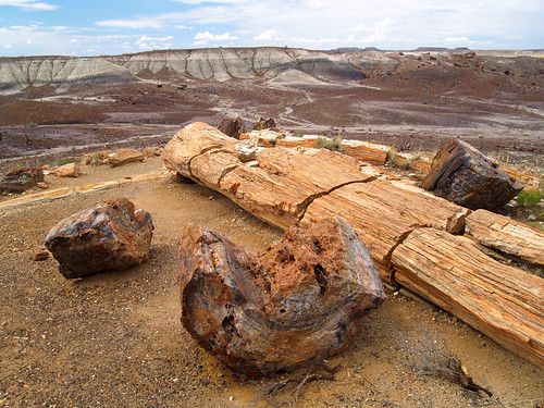
After the Crystal Forest trail we stopped at a place called the Agate Bridge. It's basically a piece of petrified wood that had been eroded under it, creating a natural bridge.
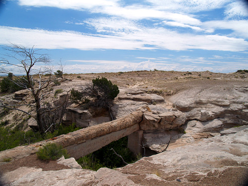
Or as the National Park says: Centuries of scouring flood waters washed out the arroyo, or gully, beneath this 110-foot petrified log to form Agate Bridge. The stone log, harder than the sandstone around it, resisted erosion and remained suspended as the softer rock beneath it washed away.
Before it was a National Park, people were worried that the petrified wood would be too unstable, so they put up concrete to support it, in 1916 I think the sign said.
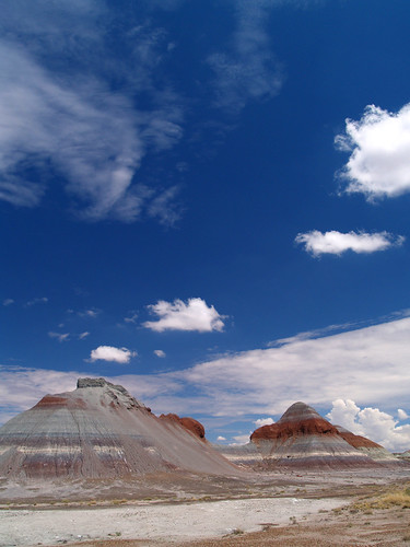
We drove along through the park, and stopped at an area called "the Teepees."
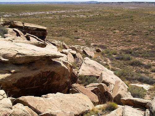
After this the landscape changed, and we came to an area that featured some old ruins that included a few petroglyphs. The ruins date to around AD 1300, and may have been home to about 200 people. The ruins today are a bit marred by the inclusion of park service bathroom nearby, but the petroglyphs are still there and still worth seeing:
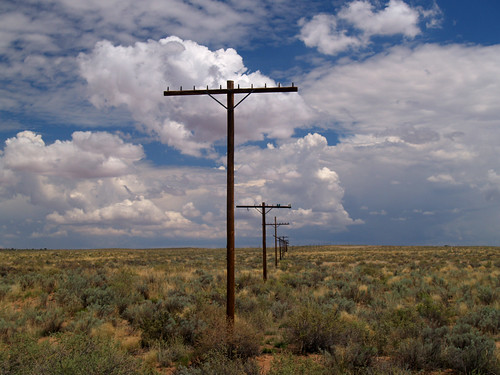
Beyond the ruins the road continues north, eventually crossing Interstate 40. Just to the north of I-40, the Park Service has a small memorial to Route 66, an old car sits by where the road passed through. The old route crossed through the park here, but the road was taken out and it's hard to make out now. The only marker are the old electric posts that still follow the road that is long gone.
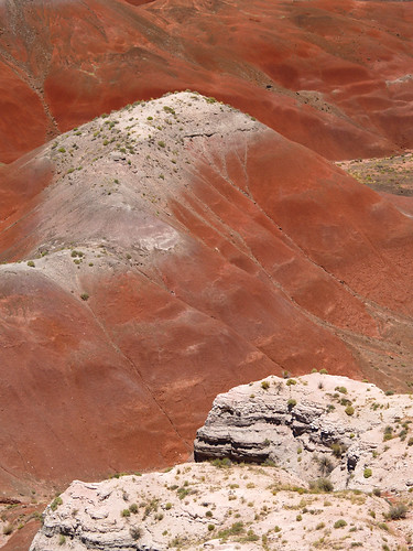
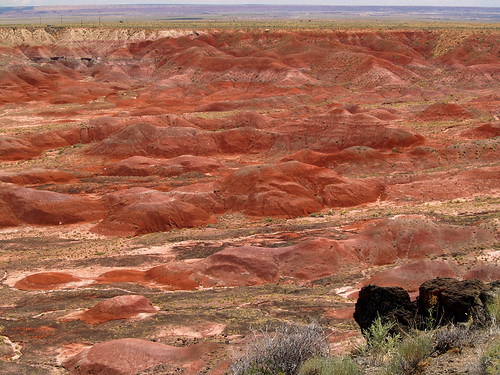
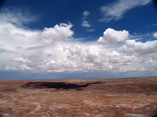
North of the freeway, the landscape takes another dramatic change. The national park road enters the Painted Desert, another awesome place.
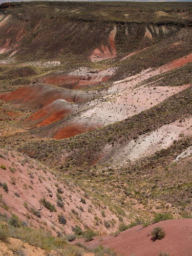
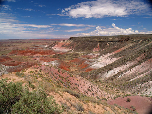
We followed the park road and came onto a beautiful overlook:
About the Painted Desert:
The desert derives its name from the multi-hued badlands of the Chinle Formation rocks that cover the park.
This scenic desert is covered by a very soft layer of earth consisting mainly of mud, sandstone and volcanic ash. Various combinations of minerals and decayed plant and animal matter contribute to the various colors seen through the park.
As the Painted Desert erodes from mineralized water flows and mineral deposits, the fossilized artifacts from the Triassic Era (220 million years ago) have become exposed, most notably the remains of an ancient conifer forest.
Today the park is still continually changing as water and wind erode the area and shift the sediment causing lower layers of fossil and petrified wood to surface.
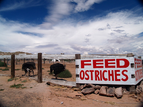
Since I didn't steal any petrified wood from the park, I wanted to buy some for souvenirs. But where to go? There is a place, along the freeway near the park that has some for sale.
Along with that, they also feature ostriches:
Lots of fake dinosaurs:
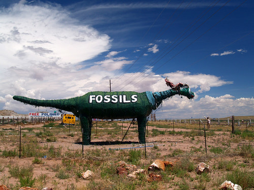
many mannequins laying around everywhere:
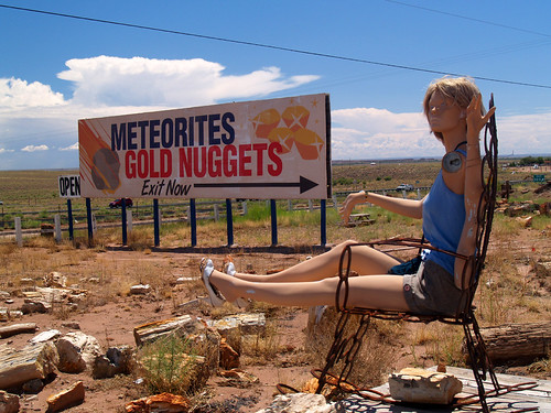
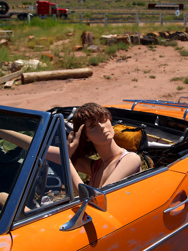
and finally - big fake dinosaurs eating mannequins:
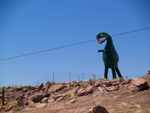
How could we not stop there?
It was a bit expensive, petrified wood ain't cheap. I did get a free sample with my purchase, but sadly didn't get to play with the ostriches.
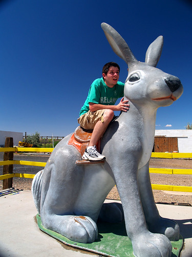
Next stop was to another old Route 66 stop - the Jack Rabbit Trading Post in Joseph City.
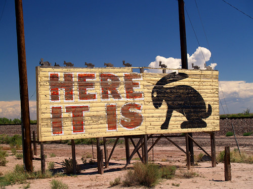
This was another place famous for its sign and for the large jack rabbit outside the store that people had their pictures taken on for decades. So of course we stopped and had our pictures taken there.
The next stop was the town of Winslow, which is somewhat famous for being mentioned in an Eagles song. You can now go and recreate that song there, thanks to a city park built in the small downtown.
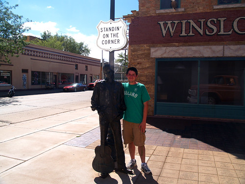
So here I am, standin' on the corner in Winslow, Arizona, such a fine sight to see.
Sadly, I didn't see a girl, my Lord, in a flatbed Ford slowing down to take a look at me. Luckily the town painted one onto the mural in the background, just in case.
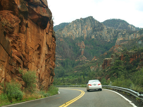
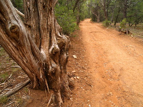
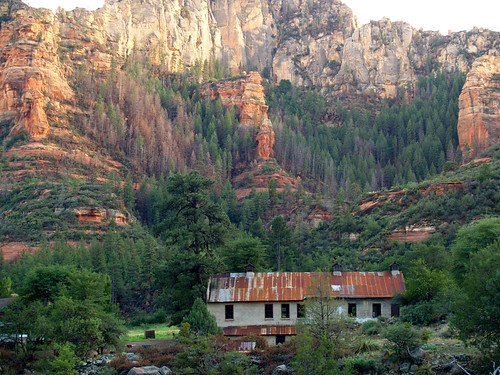
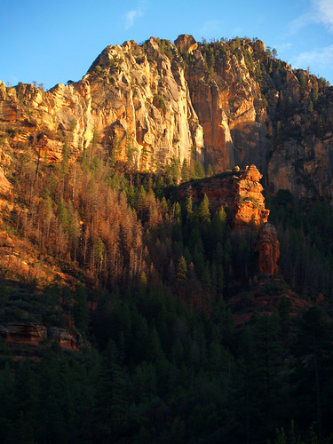
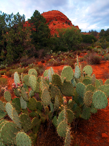
After Winslow it wasn't a long drive to Sedona, the town where we would stay for the next four days. The drive to Sedona meant leaving the freeway and going along a scenic, but very curvy road that went through Oak Creek Canyon.
Sedona is a town built in a beautiful place. It's also a place known for it's "vortexes." What is a vortex, you ask? Well according to a New-Agey website:
These vortexes are swirling centers of subtle energy coming out from the surface of the earth. This energy is not exactly electricity or magnetism, although it does leave a slight measurable residual magnetism in the places where it is strongest. There are four main energy vortexes in Sedona. The subtle energy that exists at these locations interacts with that which is inside every person. It resonates with and strengthens the Inner Being of each person that comes within about a quarter to a half mile of it.This resonance occurs because the vortex energy is very similar to the subtle energy operating in the energy centers inside each person.
If someone is at all a sensitive person, it is easy to feel the energy at these vortexes, and it can be an uplifting experience. The energy absorbed in this way can have a positive effect for days afterwards. People come from all over the world to experience this.
So if you want to get your inner energy aligned with Alpha Centauri, Sedona is the place. Unfortunately, the town built there is nothing special and takes away from the natural beauty around there. You can take vortex tours and visit all the sights that have vortex energy there, or you can be lazy and buy crystals that have been charged at the vortexes, which cost much more than the petrified wood I bought from the dinosaurs and mannequins.
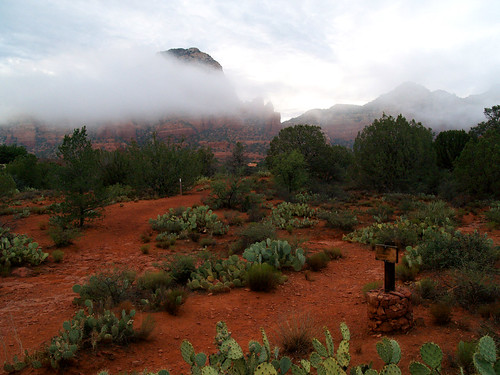
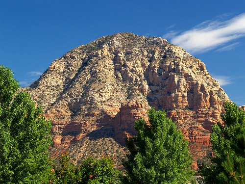
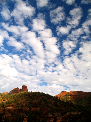
Sedona is amazingly beautiful, this was taken from a small park while driving around town:
And this was taken from the balcony of the place we stayed at:
I wish we had more time to visit the vortexes, but the next morning we got up and headed towards the Grand Canyon. We went back up through Oak Creek Canyon and past Flagstaff. The road there was just a 2-lane highway, which was closed down partway for construction. The forest service people were there and happily noted that we would have a 20-30 minute delay. "Feel free to get of your cars and have a stretch!" they added.
So we did.
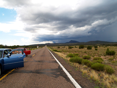
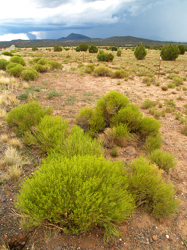
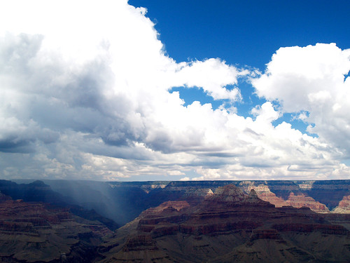
There was a massive storm following us, which drifted farther away as we got close to the Grand Canyon. A few people in the cars ahead of us rushed onto a park area on the side of the road in search of a bathroom area, I guess. I went around and took pictures.
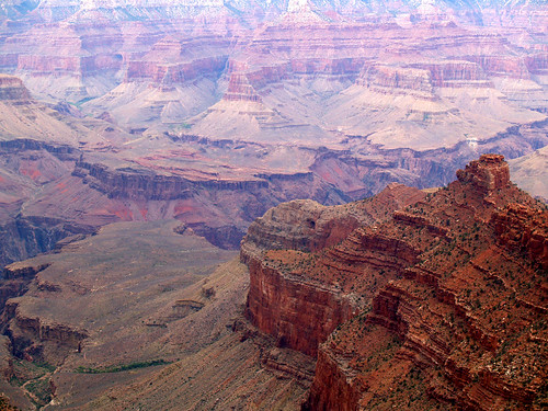
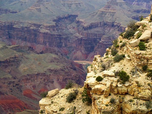
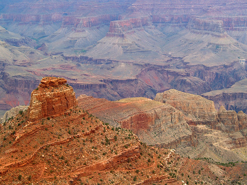
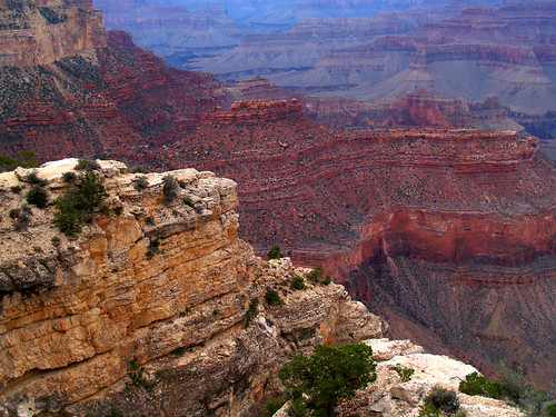
After only 10 minutes or so, we were allowed to continue on past the construction. Eventually we finally made it to the Grand Canyon, under cloudy skies that threatened rain.
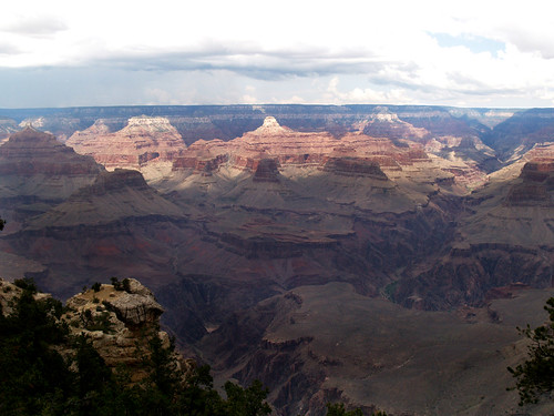
These were taken from Mather Point, which is probably the busiest of all the overlooks since it is so close to the entrance. The parking lot was full and cars were parked in any place they could find nearby.
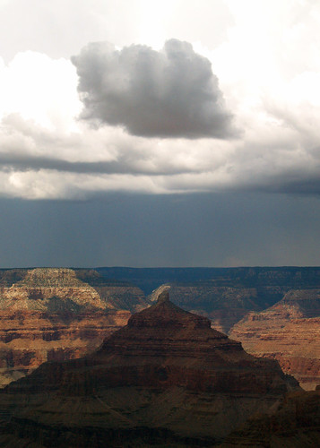
As we were out there, a thunderstorm grew out over the canyon:
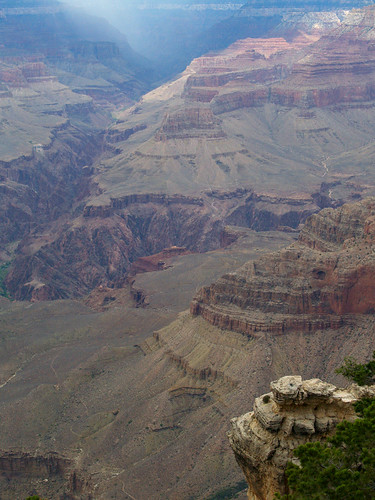
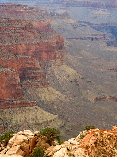
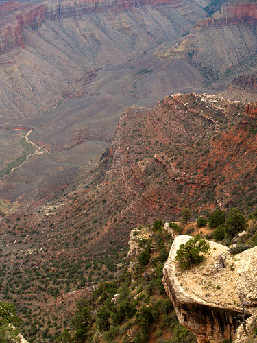
The Grand Canyon is really beautiful, one of those places that really takes your breath away. It's hard to convey it in pictures, it's just too big.
It's hard to put into words - it's just grand.
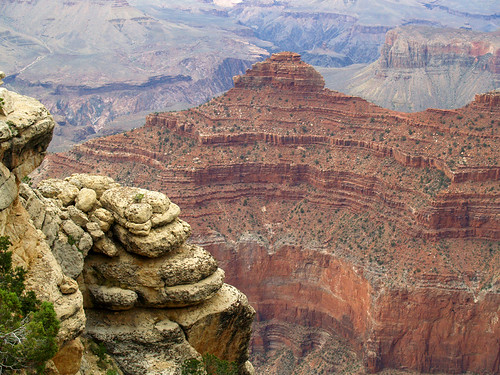
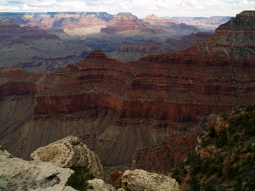
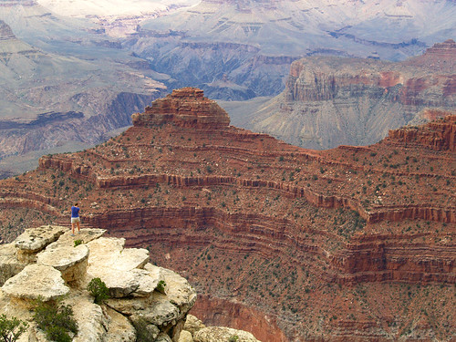
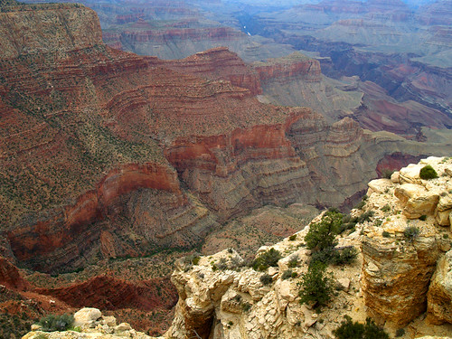
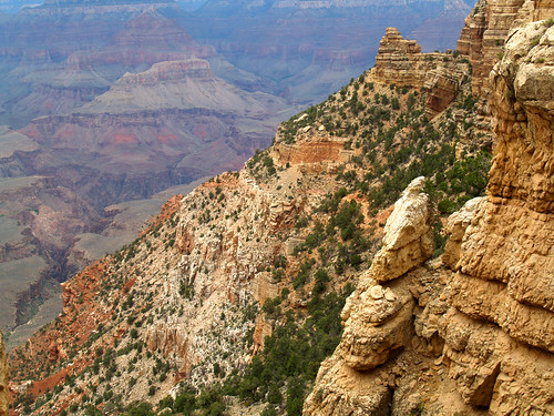
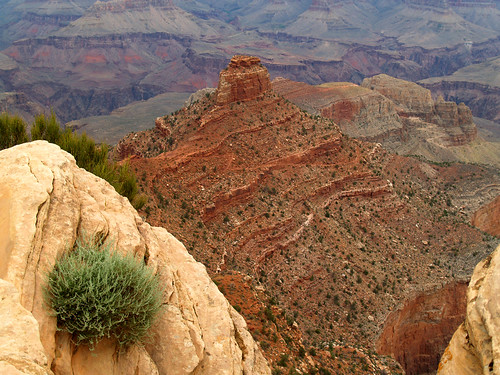
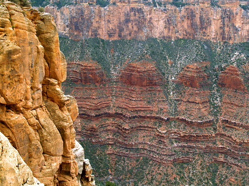
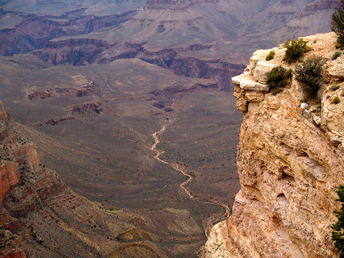
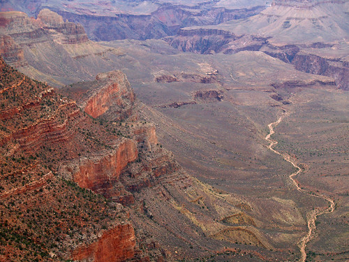
We went on to a few different overlooks, the views just kept on getting better:
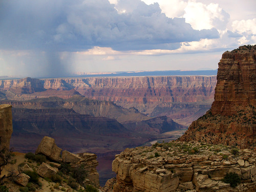
These were taken from Moran Point:
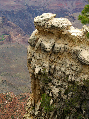
At Moran Point we managed to get there as another storm came out over the canyon. I this might be my favorite picture from the trip:
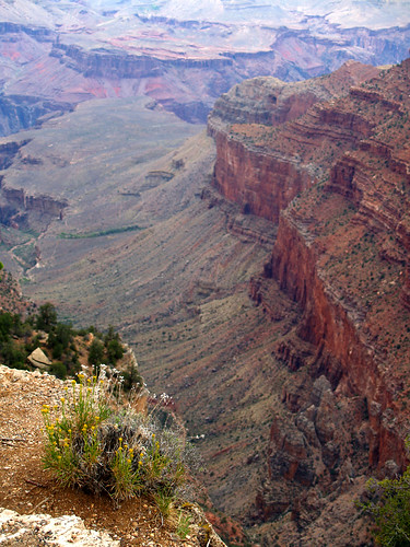
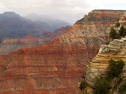
After leaving Moran Point we headed on back to Sedona. But happily we would be coming back the next day and do some hiking that would take us beyond the overlooks and other tourists.
Driving up there the next day we went through more storms. It poured down rain as we entered the park, but then stopped. We wouldn't get any rain again, though the day was cloudy and cool.
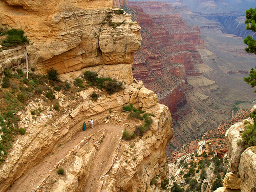
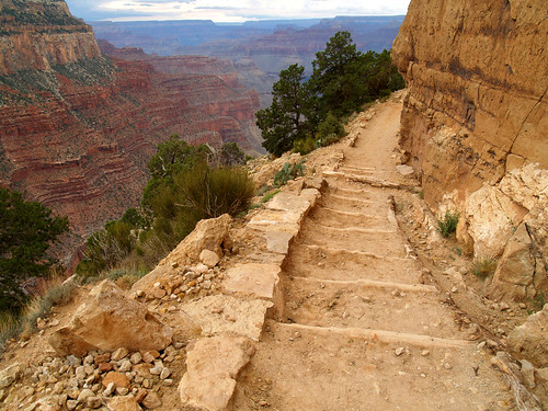
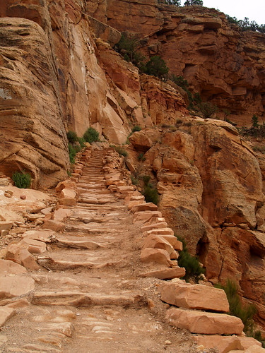
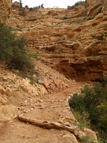
The plan for that day was to do some hiking. The trail we were looking at was the South Kaibab Trail, which took off near Yaki Point. The trail itself goes for about 7 miles from the rim to the Colorado River, dropping in elevation 4780 feet. We didn't go that far, just going a mile or so down the trail to a place called Ooh Aah Point. But I read somewhere that of the 5 million people that visit the Grand Canyon every year, only 90% ever manage to go beyond the rim. So we thought we were in good company as we headed down the trail.
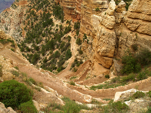
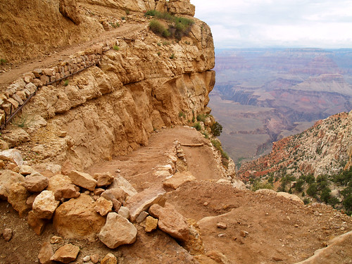
And headed down the trail we did, at the trailhead the trail switchbacked steeply downhill.
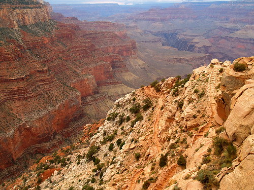
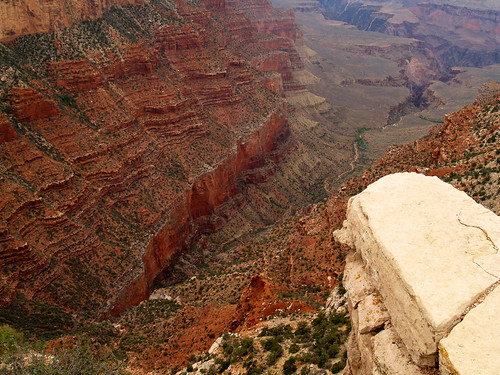
Going downhill, the views of the Canyon got better and better...
And the switchbacks got even worse:
The South Kaibab Trail is also one of the mule trails that people take to the river, so there were also lots and lots of nice deposits from the mules along the way. It was especially bad along these switchbacks, as if the mules strained taking people up there and had to "lighten the load," so to speak. It meant for interesting hiking, to say the least.
The park service likes to point out that it's best not to hike the trail to the river and back in one day, since it tends to get hot out there in the desert. Here's one of the signs they put up along the way:
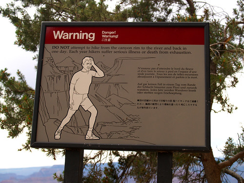
Luckily for us it wasn't that hot out there, since it was cloudy and rainy. I'd hate to see what it's like out there in the sun in the summer normally. After the switchbacks, the trail became more level and followed a ridge.
We hiked along, with views of the canyon below us and of a bluff above us, when the trail turned downhill and came upon a point....Ooh Aah Point.
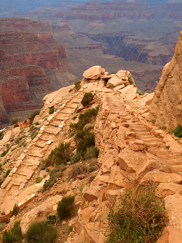
The point is called that because when people got there they'd of course go "ooh ahh." And it does live up to its name, it's awesome.
From there the trail continues on down, cutting onto the butte in the above picture. You can see it cut through a bit in the above picture, like a scar on the butte, and then zigzag down on bluff on the right. It was tempting to carry on with the trail.
And another shot of the view...
After enjoying the view, it meant it was time to head right back up the trail...
Which was still amazingly scenic. There isn't a place around the Grand Canyon that isn't beautiful.
Here's a shot of the trail as it continues on past Ooh Aah Point. It makes my legs hurt to look at it, however tempting it was to continue on...
But we had more canyon to see, and other trails to hike.
This is looking up from the bottom of the switchbacks, which seem to blend into the bluff here.
This is about halfway up the switchbacks. I admit to having to stop a lot up here, I guess because of the elevation. But having a camera with you gives you a good excuse to stop. "I'm just taking a picture!" sounds a lot better than "I can't breath, must stop."
One thing about the trailhead is that you can't drive out to it. Because it's so popular in the summer, you have to take a park service bus out to it. When we finally finished the trail, we literally saw the bus drive off. The wait was about 30 minutes before another one would come around. In the meantime, we sat and caught our breath and then explored the bluff from the trailhead.
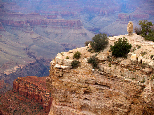
Just as soon as I went to take this picture, another bus rumbled in. So I took this quickly and ran up to make sure we wouldn't get left behind again. We went back to the visitor center by Mather Point where the car was parked. Luckily, we could drive out close to our next destination....a bit of a secret viewpoint called Shoshone Point. Here is a good tip if you're ever interested in going to the Grand Canyon.
There is a viewpoint along the South Rim that not too many know of. The park service doesn't publicize it, and the path to the overlook isn't marked. The overlook is called Shoshone Point, and is rented out for private parties or receptions. The views there are amazing though, and you're more than likely to have the entire overlook to yourself.
To get there: From the turnoff to Yaki Point, continue east on East Rim Drive for about 1.2 miles. On the north side of the road there will be a small dirt parking area, with a dirt road leading off to the woods. The dirt road will probably have a gate across it, saying "permit use only." The permit is for people who rent it, but the park service doesn't require casual hikers to get permits, so we can just go through. They do ask that we respect the privacy of any groups that may have rented the area and to not hike the trail if there are lots of cars there. From the parking area the trail is an easy and level 1 mile hike to the rim. When we went, we had the whole view to ourselves. Pretty cool.
This was taken on the trail to Shoshone Point:
And a few shots of the view from the point:
Shoshone Point is marked by a solitary hoodoo, which overlooks the Grand Canyon below.
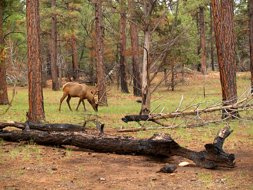
Walking back to the car, we came upon this elk grazing along the path:
After we got to the car we rushed to another viewpoint hoping to catch the Grand Canyon lit up at sunset. But it was too cloudy for any spectacular light to come through, so we just caught the Grand Canyon at dusk:
Though it was getting dark, it was hard to turn your back on the Grand Canyon. There were so many areas there that we didn't have time to explore. So many places left undiscovered. There is so much there that it would take years to see all there is to see. We barely scratched the surface of it.
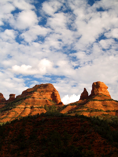
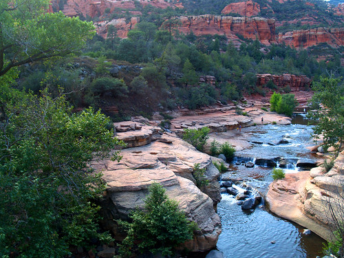
Our last day we didn't do much in Sedona, sadly. Towards the end of the day we took a drive out through Oak Creek Canyon and managed to catch it being bathed in the light before sunset.
That part of Arizona is just amazing, especially at that time of day.
We were trying to make it to a park there called Slide Rock State Park. It is supposed to be one of the best swimming holes in the country, but as we got there they started closing the park down (of course).
You can park away from the park and take a short trail that goes to a bridge overlooking the park, so we went on that and had a look.
From a website:
Slide Rock State Park, originally the Pendley Homestead, is a 43-acre historical apple farm located in Oak Creek Canyon. Frank L. Pendley, having arrived in the canyon in 1907, formally acquired the land under the Homestead Act in 1910. Due to his pioneering innovation, he succeeded where others failed by establishing a unique irrigation system still in use by the park today. This allowed Pendley to plant his first apple orchard in 1912, beginning the pattern of agricultural development that has dominated the site since that time. Pendley also grew garden produce and kept some livestock.
As one of the few homesteads left intact in the canyon today, Slide Rock State Park is a fine example of early agricultural development in Central Arizona. The site was also instrumental to the development of the tourism industry in Oak Creek Canyon.
The park is named after the famous Slide Rock, a stretch of slippery creek bottom adjacent to the homestead. Visitors may slide down a slick natural water chute or wade and sun along the creek. The swim area is located on National Forest land which is jointly managed by Arizona State Parks and the U.S. Forest Service. Together these areas have seen the making of many Hollywood movies such as Broken Arrow (1950) with James Stewart, Drum Beat (1954) with Alan Ladd and Charles Bronson, Gun Fury (1953) with Rock Hudson and Donna Reed, and a scene from Angel and the Badman (1946) with John Wayne.
We did get to see some of the park....
Then we went back to Sedona, which was bathed in the colors of the sunset.
The sunset behind some storm clouds was awesome, but it may have been helped by the Sedona vortexes, perhaps?
The next day we packed everything up, since it was time to head on home. We drove out of Oak Creek Canyon - when I realized I left my pillow behind in Sedona. We continued on, getting back onto I-40 at Flagstaff and heading east.
We went on past the Petrified Forest and the dinosaurs and mannequins at the Petrified Rock store. We made a detour and went up north into the Navajo Nation and went to Window Rock...
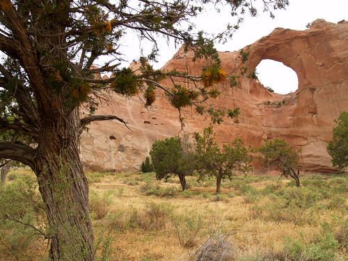
Window Rock is a natural feature that lies right in the middle of the town of Window Rock, which is the capitol of the Navajo Nation. After that we went on east, eventually stopping for the night in Santa Rosa, New Mexico. Our original plan was to make it to Amarillo that night, but we ran out of time. We got up that morning (no state-shaped waffles) and then headed east, towards Amarillo. Our change in plans did work out, since it got us to the Big Texan Steak Ranch right at lunchtime.
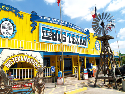
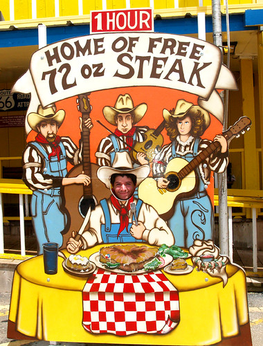
The Big Texan, if you didn't know, is the place famous for serving the huge 72 oz. steak that is free if you can eat it and a potato and salad in under an hour. We had to stop there...even if it would take out of our time getting home - when would we find ourselves in Amarillo again?
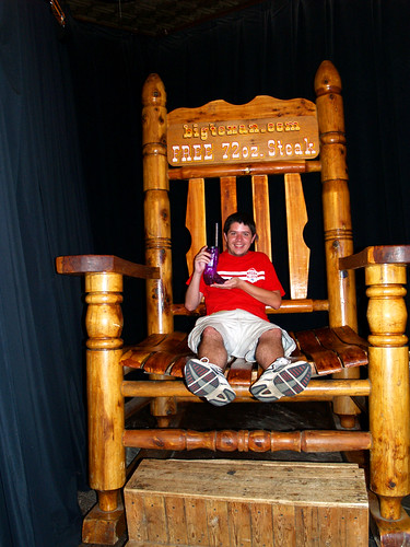
It is an interesting place. It has free limo rides to people staying around Amarillo, and the place itself is built around tourists. You can even get your picture taken sitting in an oversized rocking chair holding your souvenir Big Texan plastic boot:
Of course there is the whole steak thing, which they are quite awesome at. Do you think you could eat 72 oz. of steak, along with all the fixins', in under an hour?
I wussied out and just ordered the 8 oz. sirloin (medium rare).
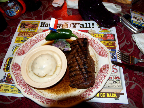
I finished off the steak, but hardly put a dent in the mashed potatoes. The steak and the beer sampler I got with it did not equal happy time for my poor stomach, but I finished what I could:
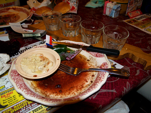
I finished what I could, and couldn't believe that people could actually eat 72 oz. of that and survive, when I wasn't feeling great with the measly 8 oz. I had. We left Amarillo after that and rushed on home. We didn't make it back to Little Rock until midnight that night, a week after we left.
It all seems so long ago now, and I really feel like it's time for another vacation. My time off magically builds back up this week, so I guess it's time for another trip.
Thanks for making it through all these pictures, I know it's a lot. I took over 1500 pictures out there (that's all!?!). Hope you liked them.
