Thursday, June 30, 2016

Hotel Pines

For over a century, the Hotel Pines has been a landmark in downtown Pine Bluff. When it opened in 1913, it was widely considered to be one of the finest and most luxurious hotels in Arkansas. But when Pine Bluff stopped getting passenger rail service, the main clientele for the hotel dried up. In 1970, the hotel closed and it has been empty ever since. There have been a few attempts at renovations in the years since, but the decades of neglect and decay have taken their toll on the building.

Hotel Pines

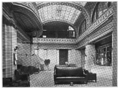
For a comparison, this is what the hotel lobby looked like in 1922:
pines1

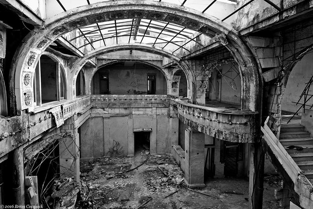
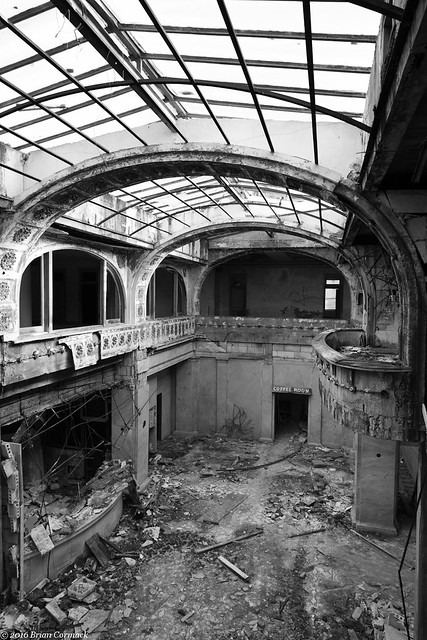
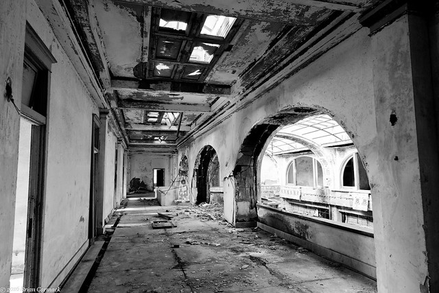
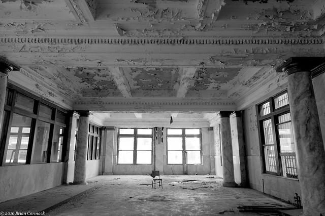
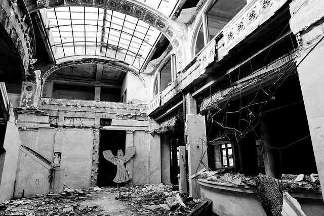
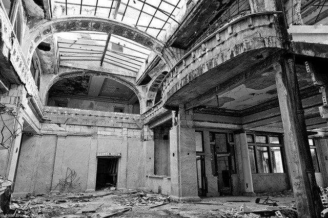
I managed to get permission to go inside the hotel and take a few pictures. Despite the advanced decay, the architecture of the lobby is still striking. The hotel was designed by George R. Mann, the architect who also designed the Arkansas State Capitol building. According to the Encyclopedia of Arkansas, the “The interior of the Hotel Pines is notable for its first-floor ceilings, which are coffered and supported by a full entablature, mounted on pink marbleized columns. Its lobby is a barrel vault supported by gray marble columns and pilasters. The lobby’s ceiling is a curved, multicolored lead stained-glass skylight. Over the main entrance to the lobby is a bowed balcony supported by a large decorative bracket. Walls are furnished in gray marble, and the floors are mosaic ceramic tile.”

The lobby is four thousand square feet, and when it opened the lobby also featured phone booths, newspaper and cigar stands and a haberdashery.

In The Pines

The hotel cost $350,000 to build, which was a considerable sum of money in the early 1900s. The hotel’s main clientele were rail travelers, and the hotel even offered porter service that carried guest’s luggage to the nearby train station.

Pines

Hotel Pines

The hotel was also an important gathering place for people in Pine Bluff. The hotel hosted civic and business meetings, banquets, dances and fancy society balls.

Pines Hotel

IMG_9594-2

IMG_9588-2

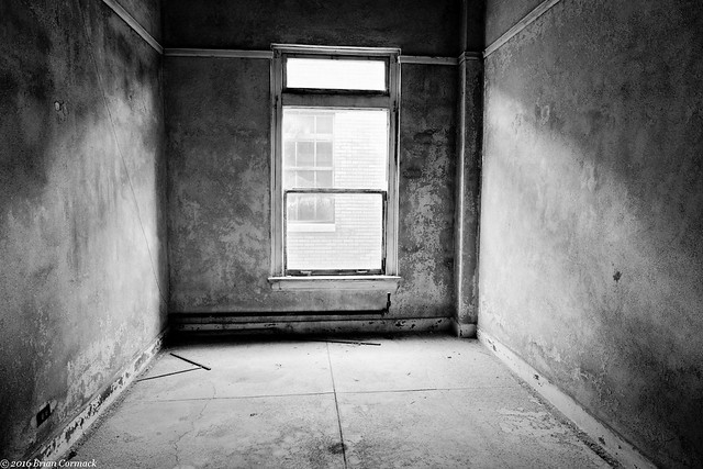
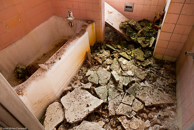
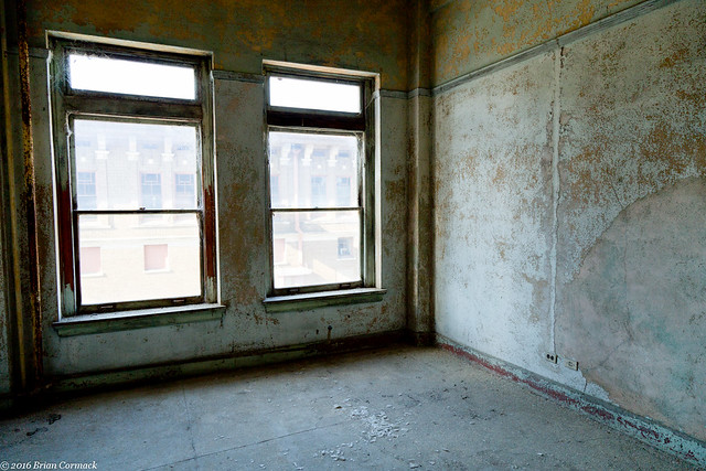
The six story hotel had 168 rooms when it opened. In 1922, it cost anywhere between $4.00 and $7.50 a night to stay there (the cost depended on how many guests were in the room, and the number of meals they would take). The rooms differed in size throughout the hotel, some were large suites while other were dorm-style rooms with a shared bathroom. This is a bathtub in one of the rooms on the second floor.

IMG_9602

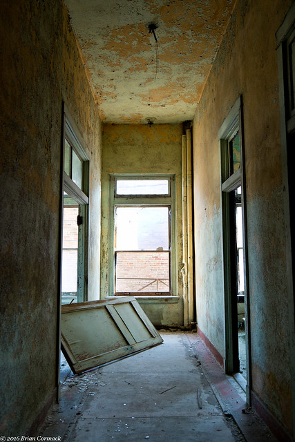
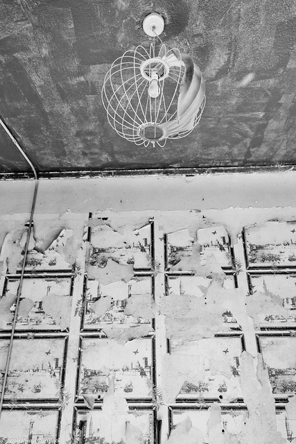
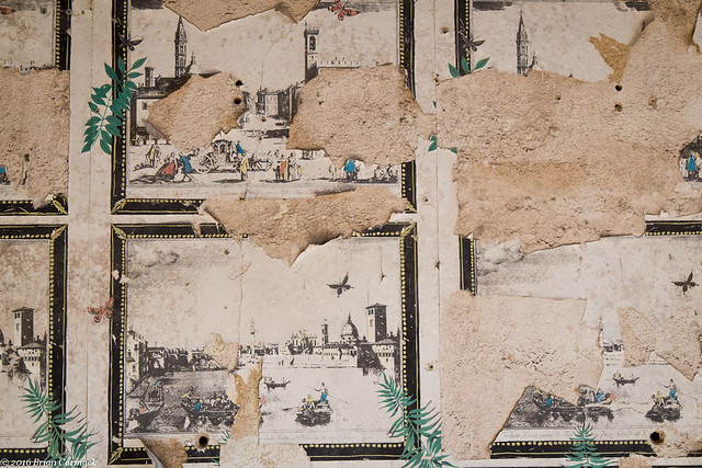
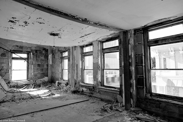
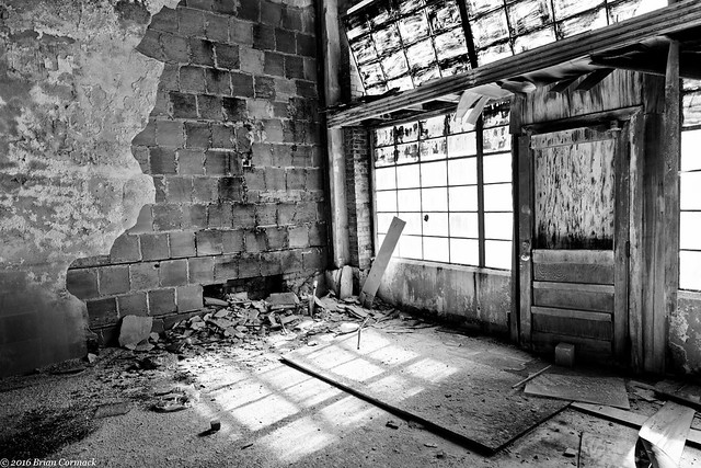
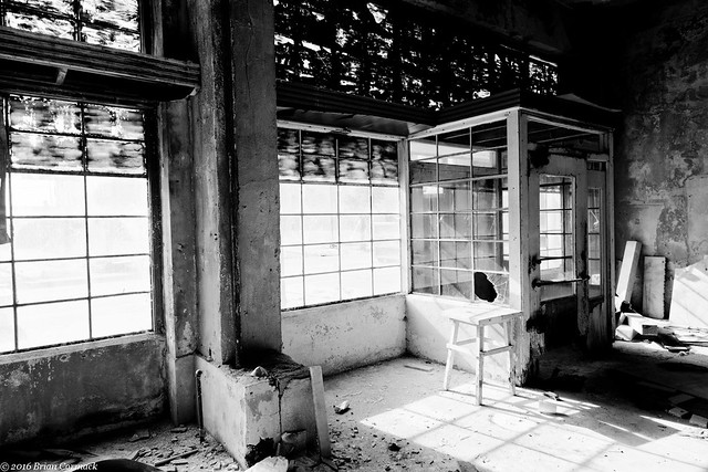
And a few more shots from the second floor:

IMG_9606-2

IMG_9610-2

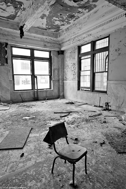
I headed back down to the first floor and went to the dining room, which is just off to the side of the lobby.

IMG_9618-3

For a comparison, this is how the dining room looked in 1922:
pines3

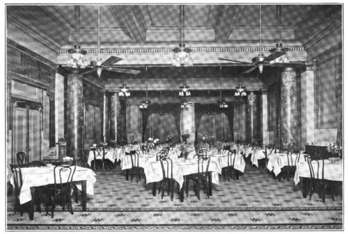
In 1922, a typical dinner at the hotel included your choice of mustard chow, cream of shrimp, fried catfish, pineapple fritters, Spanish beef stew or braised spareribs. For sides there was mashed potatoes, garden peas, steamed rice or shredded lettuce with egg. Dessert included fruit jello, hot mince meat pie or hot corn dodgers. To drink, you could wash it down with coffee, tea, milk, buttermilk or a stein of Budweiser for 20 cents.

IMG_9637-2

In 1968, passenger rail service stopped in Pine Bluff. The hotel closed two years later in 1970 and has been vacant ever since.

IMG_9656-2

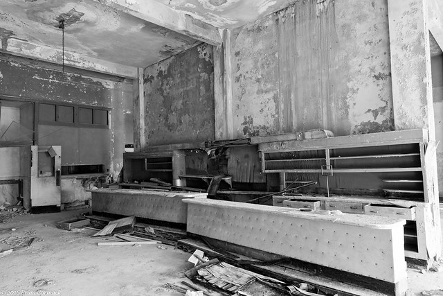
This is the bar in the coffee room, located just off of the hotel lobby.

IMG_9665-2

In 1990, the city of Pine Bluff considered tearing down the hotel. But it was saved and a nonprofit group called Citizens United to Save the Pines bought the building in 1991. They spent twelve years renovating the hotel. The stained glass in the lobby was cleaned and repaired, and the roof and all the windows were replaced.

IMG_9689-2

In 2003 the hotel was then sold to a developer who planned on spending $3 million to finish the renovations. But those plans fell through, and the hotel slid further into neglect. The glass skylight is broken, so water pours into the lobby every time it rains. Chunks of plaster have fallen from the walls and ceilings. The fine marble in the lobby is cracked and broken.

IMG_9692-2

The building is currently for sale, and reportedly there have been a few perspective buyers. One idea being floated is for the building to become part of the University of Arkansas at Pine Bluff, who would convert the hotel into dorms and for space for the art department.

IMG_9719-2

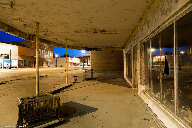
If the building isn’t going to be renovated, then maybe enough work can be done to prevent any further damage. In recent years, several buildings in downtown Pine Bluff have collapsed, including some right across the street from the Pines Hotel. If nothing is done, the hotel will join their fate, either through continued decay or from demolition. It would be a shame for Pine Bluff to lose another landmark, especially a building that has served as an anchor on Main Street for over a century.

Wednesday, June 29, 2016

Clarendon

I made another drive out into the Delta one night after work last week, finally heading east after escaping the rush hour traffic in Little Rock. Right after crossing into Lonoke County, I saw this old building and pulled over for a few shots. The roof had partially caved in, but on the inside you can still see an old rusty stove.

IMG_9040-2

When I got near Clarendon I took a small detour and headed down a very dusty dirt road. It was getting fairly close to sunset and the light cut through the dust kicked up from the car.

IMG_9098-2

This old country church was tucked away on the dirt road. According to the sign, it’s still open and holding services.

IMG_9127-2

Just north of Clarendon is the Shady Grove Cemetery, a sprawling old cemetery that has been in use since the 1840s.

IMG_9223-2

In the oldest section of the cemetery, many of the markers have been damaged over the years. Who knows what happened, maybe they got old and cracked, or accidentally knocked over. But several of the markers have been broken, and many were sprawled on the ground in pieces.

IMG_9192-2

IMG_9205-2

It was quiet and somber, and a little eerie. The only noise out there came from a train passing by on tracks located right behind the cemetery.

IMG_9215-2

IMG_9218-2

IMG_9231-2

I drove into Clarendon, which is the county seat of Monroe County and home to about 2,000 people. It’s an old town, people began living here as early as 1820. The town sat at the intersection of the White River and the old Military Road, the first road to cut through the swamps of east Arkansas and connected Memphis and Little Rock.

During the Civil War, gunboats patrolled the White River and there were several skirmishes around Clarendon. In 1864, Confederate troops attacked and sunk a Union gunboat, the USS Queen City, while it was moored in Clarendon. In retaliation, Union troops set fire to a few buildings in Clarendon that had provided shelter to the Confederates, which spread and nearly burned the entire town.

Just a few blocks from the courthouse is the old Cumberland Presbyterian Church. It was built in 1869, and it was one of the first churches to be rebuilt after the town was burned. In 1968, the building was spared from demolition and was donated to the Boy Scouts.

IMG_9258-4

The downtown core of buildings in Clarendon reflects the economic struggles that have hit the Delta in the past few decades. Many are closed and empty, with fading paint and crumbling bricks.

IMG_9319-2

Plants have taken up residence in this building, which was right across the street from the courthouse. This was the view of one of the windows.

IMG_9356-2

There are two old bridges crossing the White River in Clarendon. Trains still cross over on the old railroad bridge, which was built in 1935. A train was about to cross the bridge when this shot was taken, the light from the locomotive was shining on the metal trusses.

IMG_9441-2

The other old bridge crossing the White is the Hwy. 79 bridge, which was built in 1931. It is an impressive old bridge, which narrowly curves and rises up above the wetlands and swamps east of Clarendon and then crosses the river. You can still drive across it, but not for long. A new bridge is being built downstream to replace the old historic bridge. Plans were in place to demolish the old bridge once the new one is finished being built, which should be in a few months.

IMG_9404-2

An effort is underway to preserve the bridge, with a proposal to convert it into a pedestrian bridge. The hitch is that the bridge crosses into the Cache River National Wildlife Refuge, and the federal government is requesting that the approaches to the old bridge be demolished and the land returned to its natural state. Supporters of the bridge have a lawsuit pending, and until that is resolved the state is delaying any demolition. Hopefully something can be worked out so that it can be preserved, it’s a beautiful old bridge and it would be a shame to lose it.

IMG_9457-2

I headed back into Clarendon and went by the courthouse as it was starting to get dark. I tried to get a few shots of the courthouse, and the string of abandoned shops across the street.

IMG_9465-2x

The courthouse is a grand old building, constructed in 1911. I tried dodging the mosquitoes to get a few shots of it before heading back to the car and driving home.

IMG_9479-2x

Saturday, June 25, 2016

Return To The Delta

I’m still working on a little photo project that has been focusing on the Arkansas Delta, and I’m hurrying to try to squeeze in as many trips there as I can before the unbearable heat of the summer settles in.  I headed out one night after work, driving towards the flat fields of the Delta as soon as I could escape the rush hour traffic in Little Rock.

Eventually I drove into Stuttgart. This is a decently-sized small town (population about 10,000), but from the distance it looks like a much larger city. The numerous grain elevators and other various rice processing buildings stand out here like skyscrapers.

IMG_8524-2

From there I headed north towards Hazen, and stopped at an old cemetery along the way. The small cemetery is surrounded by fields, with crops growing right at the edge of the property line. Just off to the side are some large metal silos that shined in the bright sunshine.

IMG_8720-2

I couldn’t find any information about this cemetery online, so I don’t know how old it is. Most of the dates on the markers are from the early 20th century. The cemetery is probably one of the few remaining landmarks in what was probably a small community, which over the past century has faded and nearly disappeared like so many small Delta towns.

IMG_8652-3

In the very back of the cemetery, far away from many of the other graves, was this small marker. While many of the other markers in the cemetery had intricate Victorian-era carvings, this one only had a name written across the stone stone. I wish I knew what the history was behind this.

Delta

I headed north and went into the small town of Hazen, and stopped at this old grocery store. It's been closed for awhile, and there were a few weeds growing in the cracks of the parking lot asphalt.

IMG_8764-2

Towering over the trees in Hazen was an old rice dryer (at least that's what I think it was). It looks like it hasn't been used for awhile now, but the area around it has been taken over for some baseball fields. Sitting in the shadow of the old dryer is this field which must be for little league games. This was taken while standing behind third base.

IMG_8798-3

IMG_8821-2

Down the road, in the middle of downtown Hazen (by a neat old train station), was this old building. The windows are boarded up and it looks like it's been abandoned for quite a few years.

IMG_8863

I headed east along Hwy. 70, and decided to make a pitstop at one of my favorite places to take pictures in Arkansas. Sitting at the end of a dusty dirt road in the Dagmar Wildlife Management Area is Hickson Lake, which is surrounded by a thick forest of cypress and tupelo trees. The water was high and the lake was a little flooded, but it was still a great place to stop and take pictures.

Hickson Lake

IMG_8895-2x-2

It was starting to get dark as I drove further east into Brinkley. With a population of about 2,200, Brinkley is the most populated town in Monroe County. It was founded in 1872 and first housed workers helping to build the railroad between Little Rock and Memphis. Brinkley was first known as Lick Skillet, because "when the day’s work was completed, the railroad construction crew, mostly all immigrants from neighboring towns, cooked their supper over an open fire and returned to their homes when the last skillet was licked."

IMG_8917-3

Trains still rumble through Brinkley, there was one thundering down the nearby tracks as I took pictures of this old store. It appears to have been closed long ago, but the broken glass in the windows did reflect the blue twilight of the sky.

IMG_8927-3

I drove around for awhile trying to find a good place to take pictures of this spot, which has to be the tallest building in Brinkley and in the county. On the tower, the words "RICE OATS SOYBEANS" are painted in huge letters. I got one last shot from here before driving back home, and was amazed at how many stars you could see in the sky.

IMG_8936-2x-2

Tuesday, June 14, 2016

Riverfest Fireworks

Riverfest was a little different this year, changing the festival date to the first weekend of June instead of being over Memorial Day weekend. But they didn't change anything with the fireworks show, it still was scheduled to go on the last night of the festival. So I headed over to try to get a few shots of the fireworks with my Aunt, who was in town visiting. We got there early, and managed to grab a good spot along the river.

Finally the fireworks went off, and I got this shot. This was at the beginning of the fireworks show, when there was still a little bit of light in the sky. And it was also before all the smoke from the fireworks drifted over and tried to obscure the skyline.

Little Rock

Not all of the pictures turned out. This is what it happens when you accidentally bump your tripod during a 2.5 second exposure.

IMG_8398