Saturday, November 24, 2007

Up to the Ozarks and falling in love with Collins Creek

The other weekend it was decided that it was time to head for the hills, so I made plans to go up to the Ozarks in an attempt to catch any remaining colors in the trees. The trees had reached their peak color a few days before, so it seemed to be the best time to head up there. Unfortunately, just as the trees peaked a hard frost came through and knocked off most of the leaves. Oh well, there isn't much needed for an excuse to leave work early on a Friday, so I went anyways.

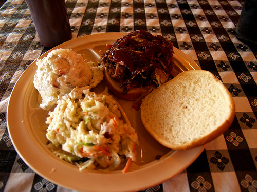
After leaving work the plan was to head to Conway to meet a friend and head up and explore the area around Greers Ferry Lake. After getting stuck in traffic along the freeway, I finally made it to the meeting place: the new Whole Hog Cafe in Conway. A yummy BBQ sandwich might not be the best thing to load up on before sitting in the car for awhile, but it was good so no regrets...
Trail Food

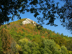
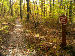
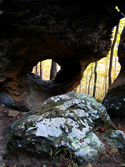
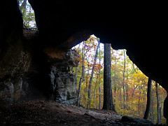
The drive to Greers Ferry takes about an hour from Conway, and our first stop was Sugarloaf Mountain. The mountain sits right on the edge of Heber Springs and the Little Red River. There is a short trail that heads up the hill and ends at a rock formation at the top of the mountain.
Sugarloaf Mountain

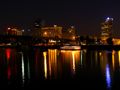
The top of the mountain just really provided views of Heber Springs...so it was the tops of buildings and whatnot. We tried to make our way around the bluff to find a way to the other side, but really couldn't find a way though. There was one crack in the rock that someone had spraypainted "ENTER" with an area pointing up and below it "EXIT" with an arrow pointing to the ground. I took that to mean that you could possibly make your way through the break in the rock to the top, but would likely tumble down and exit with a few broken bones on the ground. I was anxious to move on so we didn't attempt any climbing, but there was probably a much easier way though.

The "ENTER" and "EXIT" signs weren't the only spraypainting done at the top of Sugarloaf, the trail seems to be popular with teenage hooligans who like to pass their time vandalizing the trail. There were lots of scrawled "420" and pot leaves and So and So Wuz Here and all that. But there also this writing, apparently left by none other than BONO!
And that's why he didn't win the Nobel Prize

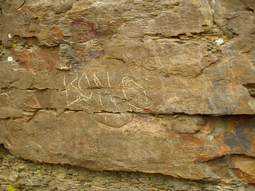
Doing stuff like that probably is why he didn't end up getting the Nobel Prize. I didn't notice any writing from The Edge, however.

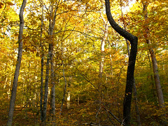
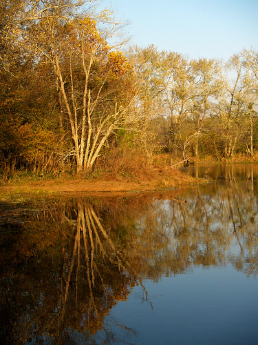
Since we didn't bring any spraypaint, we headed back down the trail and went down to the Little Red River. The trees there didn't really have much color...
Little Red River

But there were a few people there trying some fly fishing...
Gone fishin'

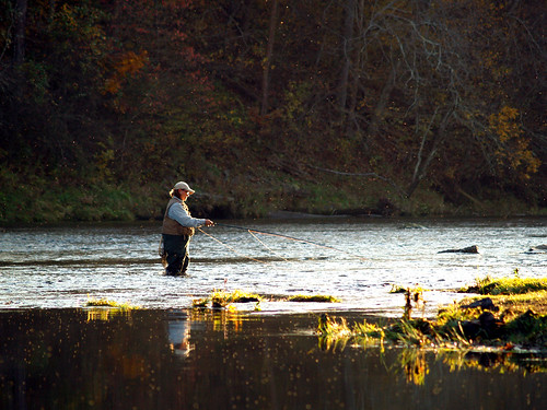
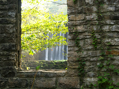
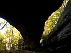
The views down at the river weren't all that great, and we were trying to decide where to go next. Then my friend came up with an awesome idea. He had heard of this place nearby that had a stream with lots of neat little waterfalls and cascades that run year round. Waterfalls? Cascades? Runs year round? It was music to my ears.

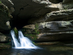
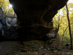
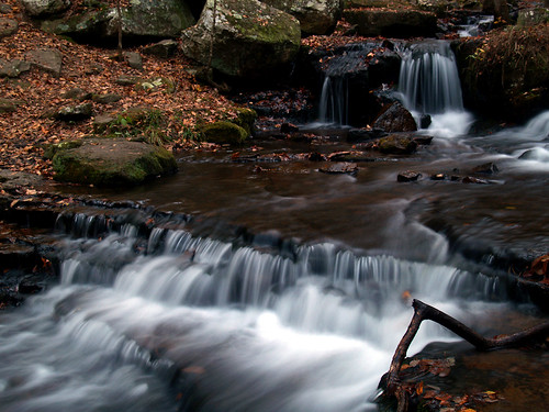
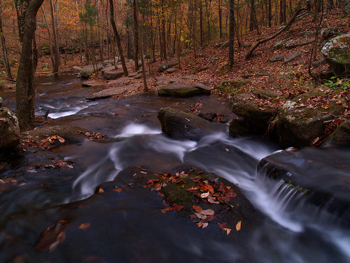
The stream is Collins Creek, which used to just be a seasonal creek that flowed through a park close to an overlook by the lake. A few years ago the Game and Fish Commission and the Corps of Engineers teamed up and piped in water from the lake to flow through the creek and into the Little Red River. All this was done in order to provide a habitat for trout. The other benefit is that it provides a steady source of water to go over neat little falls. It has been so dry here lately that it is rare to find any waterfalls. It is awesome there - I feel in love with the place so much that I even went back the next weekend.
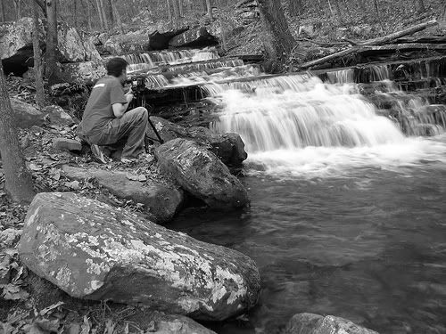
Collins Creek...
Collins Creek

And my friend got a shot of me, in the act, taking the above picture:
Photo Sharing and Video Hosting at Photobucket

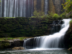
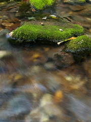
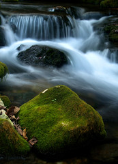
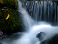
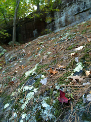
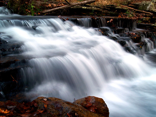
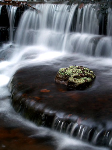
I can't say it enough, the area was amazing. Lots of water falling over moss-covered rocks...
Collins Creek

Collins Creek

Collins Creek up-close

Collins Creek

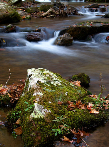
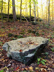
At the base of one of the falls was one lichen covered rock that was just perfectly placed. The rock is probably too big to have rolled downstream, so it was probably thrown in by someone looking for a big splash. Or specially placed there perhaps by some other photographer trying to get a shot. Whoever put it there, thanks! I really like how this one turned out. Or rather, (pun alert) I'm really lichen how this turned out...
Collins Creek

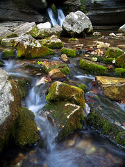
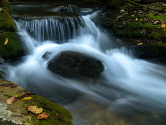
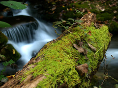
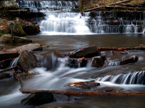
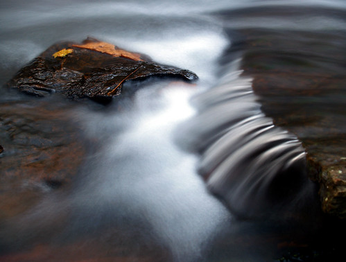
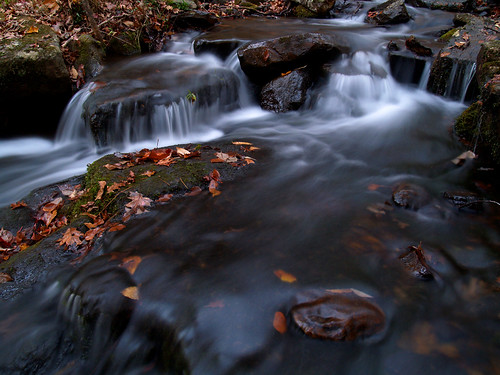
It was starting to get dark so I was losing my light, so I wasn't able to get too many more shots...
Collins Creek

To compensate for the loss of light, I had to make the exposure times longer and longer. This shot was a 4 second exposure:
Collins Creek

The shot below was also 4 seconds. This shot is also another example of what happens when you get careless about where you leave a camera bag, since mine makes an appearance in the background here. I didn't photoshop it out, so if you are bored you can try to find it there somewhere.
Collins Creek

After that it was too dark to do much. I was trying to get shots, but was having to take 14-15 second long exposures that didn't turn out at all. Oh well, I was already planning on another trip up there (stay tuned!).

After that it was time to head back to the car in the dark and head up to my next destination, my Aunt's house in Berryville.

Berryville is a little small town up by Eureka Springs. The next day we went and ate breakfast in Eureka, but I didn't have my camera with me so no shots. We went back to Berryville and grabbed cameras and headed out to one of my other favorite places - Boxley Valley.

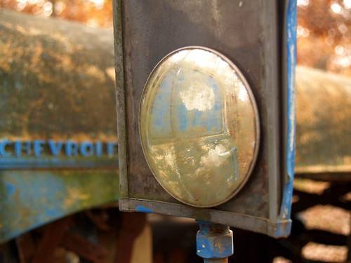
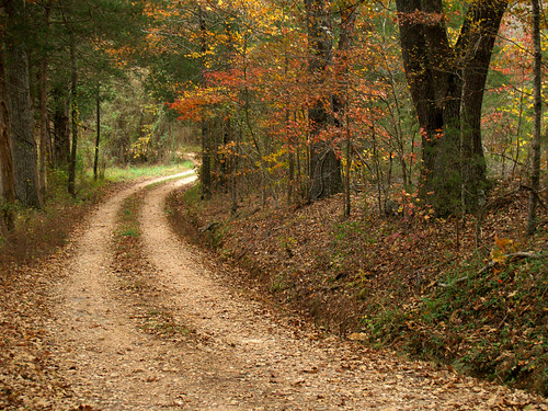
On the way, we took a little dirt road just to see where it would go. It didn't really end up going anywhere so in a search to find a good place to turn around we came on this old truck sitting on the side of the road, rusting away.
Fixer-upper

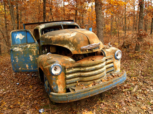
The truck had a large assortment of beer cans strung around (mostly Busch Lite, if you're wondering). Which is odd - do people come out here and sit by this old truck and drink beer, and why? The truck also came with a handy old microwave sitting on the back, just in case it's needed...
I'm more of a Hyundai person

needs some windex

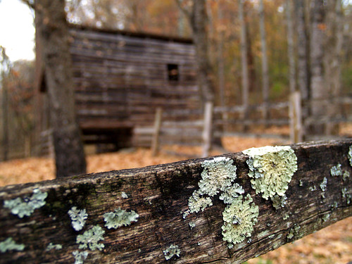
After that we finally made it down to Boxley Valley, which is just a great place. Boxley Valley is small, but is home to some of the most scenic places in the state (Hawksbill Crag, Lost Valley, etc). It is also home to tons of old buildings and barns...
Boxley barn

Hey!

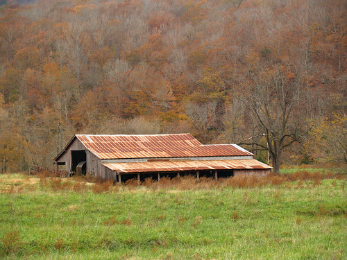
This old building was taken at the trailhead to the Buffalo River Trail..
Some old building in Boxley

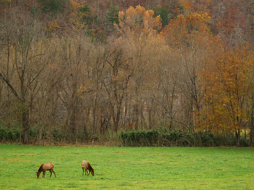
Along with the old buildings, Boxley Valley is home to a large herd of elk. There were probably as many people as elk parked along the side of the road trying to get pictures or just to watch...
Boxley elk

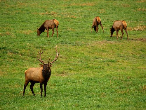
The elk had a bull, who for awhile just sat with his back to the humans standing around watching the herd. We had sat around taking pictures and were about to get up when the bull also stood up and decided to bring some stragglers back closer to the rest of the herd.
Keeping everyone in line..

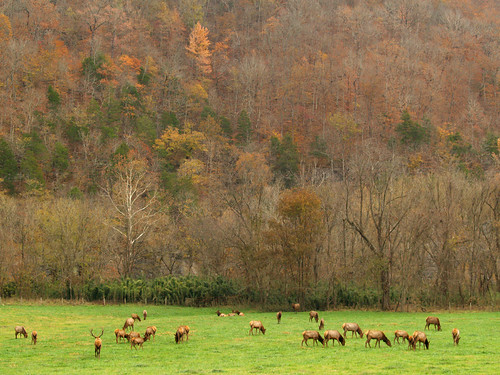
And one last shot of the elk. This would have been much cooler had there been better color in the trees...
Elk at Boxley

I read a few days ago that the Park Service is going to start cracking down on people who park on the side of the road in Boxley to look at the elk. They will start giving tickets to people who don't properly park off the road, which I don't see going over very well...

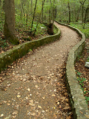
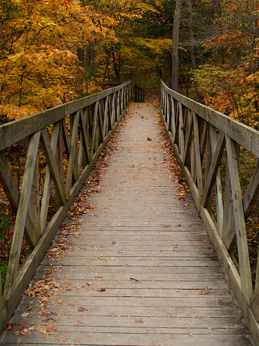
From the elk we next went up to Lost Valley. We didn't go to hike, since the highlight of that trail is the waterfalls. Since Lost Valley doesn't get water piped in from a lake, the waterfalls were barely more than a trickle. We did stop there to visit some of the restroom facilities, and get this shot of the trail heading off into the valley...
Trail to Lost Valley

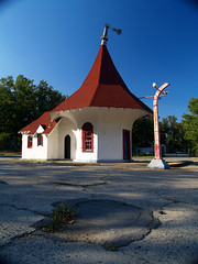
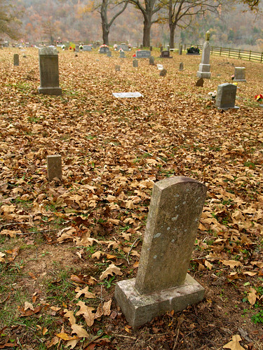
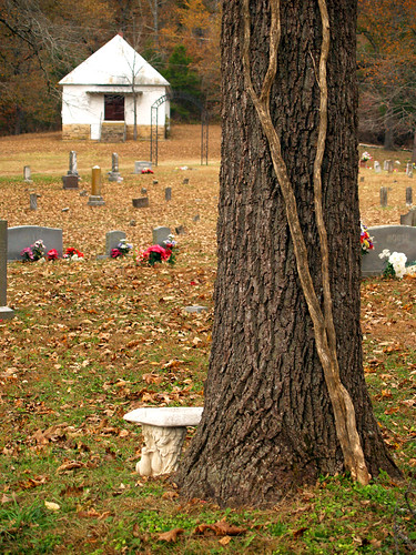
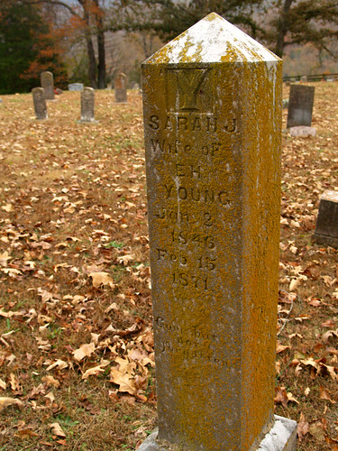
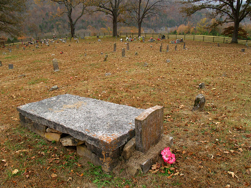
We did make a stop at a little place next to Lost Valley, which seems to be a bit hidden from the traffic that drives by it. It was a small old church and cemetery, located right off the road that heads to Lost Valley. The church is located off of a short little dirt road that I had driven by many times and never really noticed. I guess it really looks more like someone's driveway...
Beechwood road

But the church and cemetery were interesting to explore. There were markers there that dated back to the 1850's, and included some of the first people to settle in the Buffalo River area.
Beechwood Cemetery

Beechwood Church and Cemetery

Beechwood Cemetery

If you look closely there's a Grand Daddy Longlegs on this marker:
Grand Daddy Long Legs

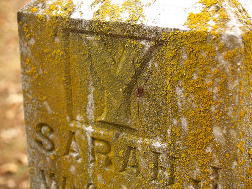
One interesting thing about this cemetery is the grave markers. Most cemeteries that I've been to have the carvings with names and dates on the front of the markers facing the grave. At this cemetery, the majority of the carvings were on the back of the stone facing away from the graves. I tried to do some research on the cemetery to find out something about it, but only really found stuff like "Beechwood Cemetery is in Newton County." My (un)educated guess is that this was done on some of the older markers way back in the 1800's and that people just carried on the tradition. It was done here, on the oldest marker we saw there...
Beechwood Cemetery

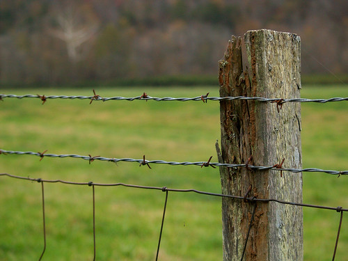
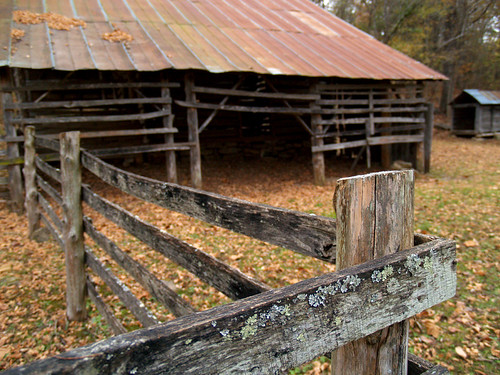
From the cemetery we got back on the main road and continued the drive through the valley. We passed by one car parked on the side of the road where an older couple were standing in the road with a little camera. As we passed by them, they excitedly pointed at a barn which had a stray elk standing by it. Apparently the elk had gotten into the fence around the barn and couldn't figure out how to get back out. We quickly found a place to park and joined the couple with our cameras. By the time we got there the elk got spooked and ran off to the back of the barn, loudly calling out its frustration at not being able to get out. It did somehow figure out how to jump the fence since it was never seen again.
Boxley Valley

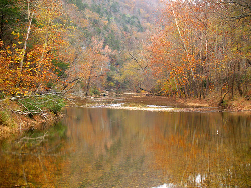
The old guy from the couple jumped the fence and went around to the back of the barn. He came back and said that there was a small field behind the barn and that the rest of the elk herd was back there. On the way back to the car I got this shot of the fence line looking toward the hillside, with the Buffalo River back behind the trees...
Barbed Wire by Boxley Barn

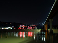
From there we went to the end of the valley, where the road crosses the Buffalo River. There is a low-water bridge there, at Ponca, that we went to. This would have been much better had it been taken a few days earlier when there was more color in the trees.
Buffalo River

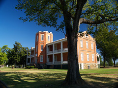
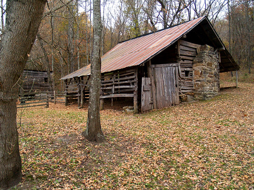
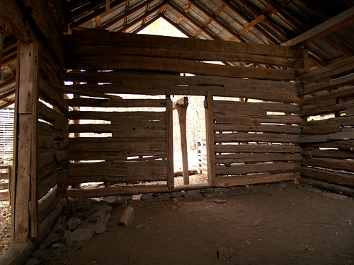
Near this low-water bridge is the Villines Homestead. From the Park Service:

Abraham Villines and his children were among the first pioneer families in the Buffalo River valley. Abraham's grandson William built this log house in 1850 for his new bride, Rebecca. Four years later their son James was born here.

James Villines (1854-1948) was known as "Beaver Jim" for his renowned trapping ability. After his marriage in 1880, he moved from this home to his own farmstead across the Buffalo River.

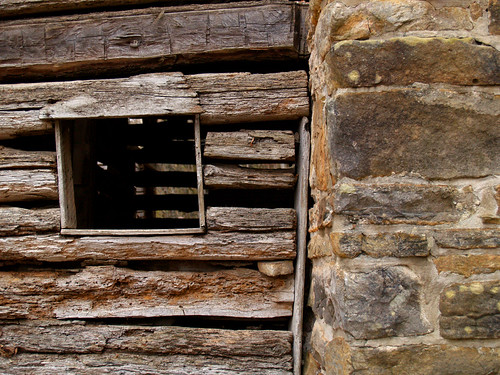
In the mid-twentieth century, Villines family descendants used this house as a barn - with the chimney still attached. Today, the notched and hand-hewn logs recall the pioneers who carved their homes out of the Buffalo River wilderness.


Villines Homestead

The Villines family was one of the old Boxley families that are buried in the Beechwood Cemetery. It's hard to imagine how people used to live back in those days.
Villines Homestead

Villines Homestead

Villines Homestead

Villines homestead

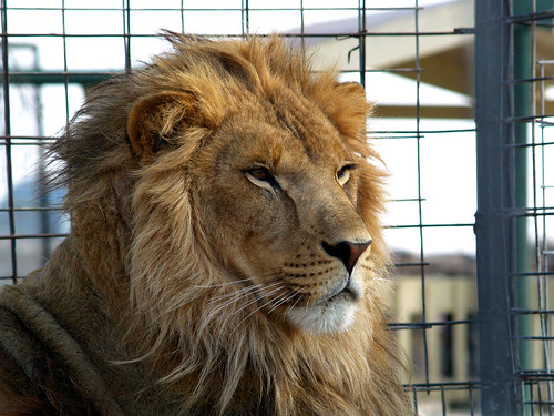
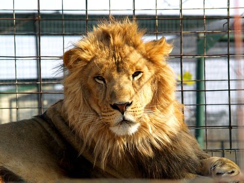
After that it was starting to get too dark to take pictures, so we headed on back to get something for dinner. The next day we decided to do some touristy stuff around Eureka Springs, and went to the Turpentine Creek Wildlife Refuge. The refuge rescues big cats like lions and tigers and even bears (oh my! of course), and offers tours of their grounds and habitats. It was neat, but a bit expensive ($15!), though I guess it goes to a good cause. The tours were a bit of a let down since it was hard to photograph any of the animals without showing any bars or cages.
Lion Around

Lion Around again

I wonder how big the litter boxes are there?
A cougar

Wonder how big the litter boxes are there?

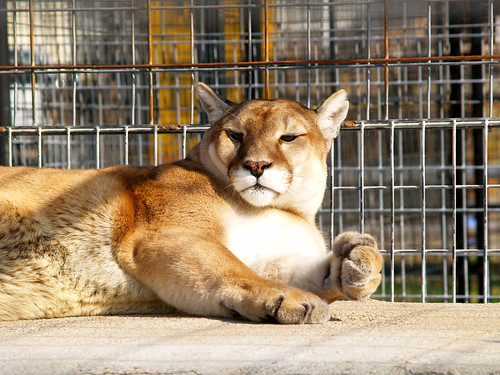
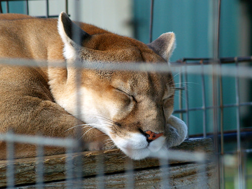
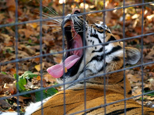
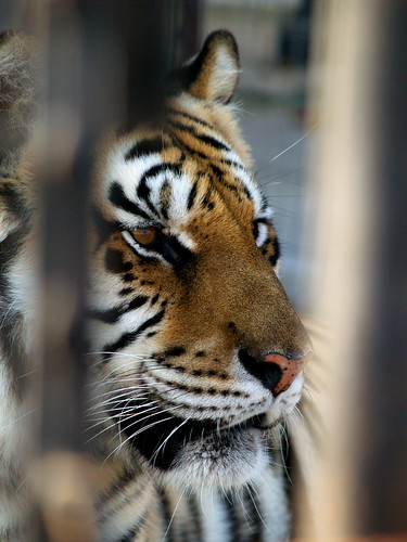
Not all the animals were in those sad concrete cages. The refuge has natural habitats set up, and the rest are in the cages until more habitats are built. But even in the more "natural" environment, you still have to shoot pictures through a fence. Guess the people who run the refuge aren't to keen on letting people with cameras go into the habitats with the tigers and lions, for some odd reason.
Yawn

Behind bars

From the refuge we then headed on west towards Beaver Lake and Rogers. Our next stop was Hobbs State Park - Conservation Area. We went and hiked a short and easy trail, called the Van Winkle Historical Trail. From the state park people:

The park's Historic Van Winkle Trail is a one-half-mile trail that leads hikers through a tunnel under State Highway 12 to the site of the historic Van Winkle lumber mill and home in Van Winkle Hollow on the West Fork of Little Clifty Creek. Here hikers can see the remnants of a sawmill and an antebellum garden owned by Peter Van Winkle during the 19th century. Beginning in the 1840s and continuing throughout his life, Van Winkle acquired approximately 17,000 acres of land throughout Washington, Benton, Madison and Carroll counties by filing for land patents and purchasing foreclosed land.

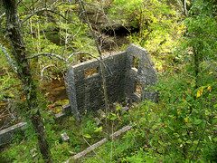
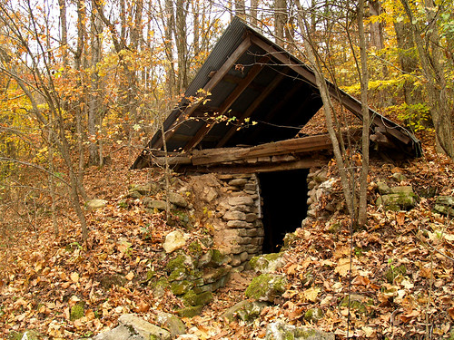
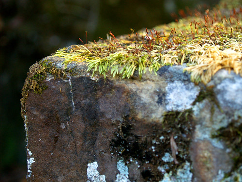
This shot is of the old springhouse next to what was the old antebellum mansion. This moss was growing on one of the old stones.
Mossy

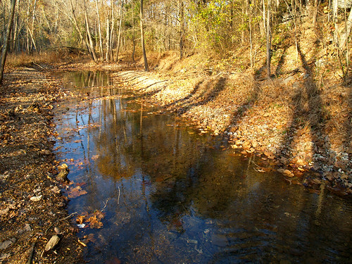
To be honest, there really wasn't much to the trail. It showed signs saying that 100 years ago a building was there. But it was interesting to have a look at. Here is the creek that eventually flows into the lake.
Clifty Creek

After that it was time for me to make the 3 hour drive back home. The weekend after that I did end up going back out to Collins Creek again. I'll try to get some shots of that weekend up soon...

Monday, November 12, 2007

Blanchard Springs and Alum Cove, and some othter pictures I’ve been too lazy to post

Things have been a bit quiet here in terms of new pictures, but with the trees changing I've gotten a backlog of pictures that I need to post here. So here are a selection of some that have been taken in the past few weeks...


These were taken awhile ago, during a bored drive through downtown Little Rock with the camera. Here's the old arsenal building in MacArthur Park:


MacArthur Park

And this is the old Roundtop Gas Station, falling apart just off the side of Hwy. 67/167 in Sherwood:


Round Top Gas Station

And of course I did make it down to the Big Dam Bridge once...


Big Dam Bridge

A few weeks ago I drove up to Blanchard Springs, which is one of my favorite places to visit around here. It has some neat ruins of an old mill, and the springs themselves which flow year round.


This is a shot of the old mill:


Mitchell Mill

Here's a description of it stolen from the Internet:


Mitchell Mill was originally a two story structure built of oak and walnut. With the mill, Steve Mitchell provided ground corn and ginned cotton from 1900 until 1928. After Mr. Mitchell died, his family sold the property to the Forest Service.


The rock foundation and walls were added by the Civilian Conservation Corps in 1942. Exquisite rock work is the hallmark of the CCC, a post Depression program to put young men to work. Their plan was to restore the mill to an operational condition, but the work was interrupted when the CCC was disbanded at the onset of World War II.


Thr mill sits along a creek and a dam, which forms a nice little lake. The dam has some neat spillways and waterfalls off of it, all of which just a few feet away from the mill building.


This is a view of a waterfall on the dam from one of the windows of the old mill...


View from Mitchell Mill

And a shot of the waterfall at the base of the dam. Since the creek here is fed by a spring, it always has water in it. It's one of the few places I've seen around here that has had any water flowing through it.


Blanchard Springs

This is a view of the mill, from ground level. The last time I was here this whole area was covered in poison ivy, but luckily there wasn't much there this time.


Mitchell Mill

And again, a close-up view of the mill...


Mitchell Mill

The springs empty out in a neat waterfall not too far from the mill. The trail to reach them is amazingly easy. It is level and paved, and follows beside the creek through a really pretty valley.


Trail to Blanchard Springs

I think its only .25 miles to reach the falls...


Blanchard Springs

The water is all from the springs, which looks really clean and clear when you first look at it. But it isn't as clean as it appears. As the water flows up underground, it passes through several caverns, several of which are home to several colonies of bats. And with the bats you also get bat poo, which makes its way into the water. There are signs at the falls saying not to drink or touch the water. Ahhh, nature!


Blanchard Springs

And a wider view of the falls...


Blanchard Springs

The falls create a really scenic stream, which tumbles over lots of moss-covered rocks. It is an amazing place to explore and photograph, but I was limited by the fact that it was getting dark and all my light was going away...


Blanchard Springs


Blanchard Springs

I was very excited about this one little leaf in the shot below. I didn't put it there to make the picture better, it was already there when I showed up. So it either blew in on its own and landed in such a helpful place for setting up pictures, or some other photographer came through earlier and put it there. Either way, thanks!


Blanchard Springs

I guess since so much water flows through here, just about everything gets covered in moss, including stuff on the bank next to the creek.


Blanchard Springs

After that it was almost too dark to shoot any more so it was back to the car and the long drive back. The next weekend I didn't take a long drive up into the hills, but managed to attempt a shot of the skyline at dusk. The streaks reflected in the river are from the Arkansas Queen riverboat paddling its way downstream.


Little Rock

The trees are slow to change around here this year (thanks, global warming). But I did take my camera to work one day and ended up going out to Pinnacle Mountain on my lunch break. The colors there had barely changed, more green than anything else still.


Pinnacle Mountain

Since the colors around here were slow, it was time to take another road trip up to the Ozarks. The trees up there always change a week or so faster than the trees here, and from what I heard they were nearing peak color. I decided to hit a place I hadn't been to since I was in high school, Alum Cove. The trail through Alum Cove is short, and visits several neat little areas - like a large natural bridge and several small caves in a bluffline.


Steep dropoffs

As I left the parking lot, I passed by an older couple sitting eating at a picnic table. They told me (as older people tend to do) that I should bring a jacket with me in case it got cold. So after I passed this sign I decided that it might indeed get cold if I stay out in the cove for awhile as it got late, so I headed back to the car. I also forgot my tripod, which would prove to be very useful out there. But as I went back to the car I noticed this one tree that had some nice color in it, which I must have passed right by earlier and not even noticed...


Finally...fall colors

As I passed by the older couple again they gave me an approving nod, noticing that I was carrying a jacket (which I never used, it was in the 70's out there). They probably told each other that back when they were my age they had to walk this trail barefoot in the snow...


But the trail goes downhill and runs up to the natural bridge...


Under the bridge

The natural bridge here has been called "one of the largest and most impressive stone arches in this part of the country." And the National Forest Service has this to say about the bridge (which may not be that reliable, since they managed to forget the correct name of the National Forest that Alum Cove is in):


The Big Piney Ranger District - Jasper Office is located within the heart of the Ozarks. Visitors can view picturesque rock bluffs and hike wooded hillsides. Outstanding among the many natural features of the Ozark Natural Forest is the huge stone arch that forms a natural bridge at Alum Cove. The natural arch is all that remains of what was a quartz sandstone cave. The arch is 130 feet long and 20 feet wide. The weathering process of wind, rain and ice formed the opening between the arch and the rock overhang.


The area offers picnic facilities and the Alum Cove National Recreation Trail for your enjoyment. This looping trail wanders past the natural arch, across a small stream and to the
bluff line with overhangs. The entire trail is 1.1 miles long and take about 1 hour to walk. Visitors may also take a short 30-minute round trip hike for 0.4 miles to view the arch. Exercise caution while hiking along the bluff line. Early settlers reportedly used this arch to move their wagons and livestock across the streambed during wet weather. Water and wind also shaped other interesting rock formations along the bluff line across the cove, including the cave (or "rooms" as they are often called) or overhangs. Native Americans used these rock overhangs for shelter while on extended hunting trips. At one time, free-roaming goats inhabited the caves, giving the formations the local name, "goat houses."


The light was really giving me problems out there that day. The sky would end up being too bright, so that it would look washed out. There was too much contrast between the dark rock and the sky that most of the shots really didn't turn out. But when life gives you sun, you might as well try to work with it. Here is a shot of the sun peeking out from the natural bridge.


Sunny

I had to do some photoshop work on this shot since I accidently managed to include my tripod and camera bag in there..


After the natural bridge, the trail continues over a stream (that was completely dry) and runs up to the opposite bluffside.


Alum Cove


Alum Cove

After I left the natural bridge, there weren't any other people on the trail. I heard lots of noises out in the woods though, which was a little creepy. The cove was filled with squirrels, running around and making lots of noise amongst the fallen leaves. Until I actually saw that it was squirrels, all I heard was some possibly sinister movements amongst the brush around me. I figured it was something a bit scarier than squirrels, and imagined hiking right in between a mama bear and her cubs. Luckily, nothing bigger that squirrels were out (that I saw).

But I got really creeped out here, for some reason. As I was set up here taking pictures, I could swear I saw something dark move at the bottom of the circular hole in the bluff. Paranoid thoughts rushed through my head....there must be someone standing right beneath there. I called out an uneasy "hello...." and got no answer, and then got up to investigate and, of course, saw no one there. Spooky.

Spooky

And here is one of the places that the tripod came in handy, a view looking out from one of the caves in the bluffline:


Goat room

The trail eventually curves away from the bluffline and heads back towards the natural bridge. Along the way, it passed by this one tree that fell across the path.


So did it make any noise when it fell?

Wonder if it made any noise when it fell?


Along the trail back to the natural bridge...


Alum Cove rocks

The colors there were just about at their peak, maybe just a few days shy. They probably hit their peak about 4 or 5 days later, just in time for a killing frost to come through and knock all the leaves off. Oh well, the fall season wasn't as great this year as it had been the past few years.


Fall at Alum Cove

I got back to the car and had an idea...the sun was still awhile from setting....and the Buffalo River really isn't that far away from Alum Cove. If I were to hurry, I could maybe hit the river in time to see the light from the setting sun hit up the trees along the river. So I got back into the car and zoomed out onto Highway 7.


Hwy. 7 is one of the most scenic drives in the state. North from Russellville, it passes by some of the great scenic areas of Arkansas - Big Piney Creek, Pedestal Rocks, Alum Cove, Richland Creek, Buffalo River, and of course Booger Hollow.


The great downside to Hwy. 7 is that you tend to get stuck behind a few drivers who perhaps aren't used to roads with hills or curves. Or worse, stuck behind a truck that seems to have broken down (or the driver is scared), so that it isn't driving so much as coasting down the hill at a fast speed of 10 mph.


Scenic 7

Which is what happened here. The truck here went sloooow for awhile, eventually pulling off the road at a small turnoff. By the time I reached the Buffalo the sun had set and the colors at the river were dull and muted.


Buffalo National River


Buffalo River

I managed to get out last weekend and get some more shots. I left work early on Friday and visited one of the best areas in Arkansas that I've been too, and then on Saturday went to the Buffalo River again. The killing frost killed off most of the color there, but it was always great to be in that part of the state. I haven't finished uploading all those shots, so this concludes our entry for today. OK, wait, I will give you a quick preview of one of the places that I went to. I fell in love with it, the place was amazing:


Collins Creek

Stay tuned!