Tuesday, October 21, 2008

Kings Bluff and Pedestal Rock

From Bayou Bluff we headed north further into the rolling Ozark Mountains. We ended up reaching the trail to Kings Bluff and Pedestal Rock a bit later then expected because of an accidental detour to the east. Turns out that we managed to somehow miss the highway signs and took the wrong road. We finally realized the mistake after driving 40 miles in the wrong direction, heading to the town of Clinton on accident.

In my defense, I wasn't the one driving. But I had just driven the same road last month, so I should have known better. As we passed by the tiny towns along the road, I did think to myself "that's weird, I don't remember driving through here before, oh well." That should have been a warning sign, but I just thought that I had forgotten about those towns in the past month or so. Whoops.

I was starving at this time, so the bright side is that we were able to stop and get some snacks for the rest of the trip. Now with a map (needed, apparently) and some good trail food (Doritos and Funyuns), we drove the 40 miles back to the road we needed to be on.

So after taking a "scenic" detour for about an hour or so, we finally made it to the trailhead. It was packed, with every available space taken. Zack nearly donated his bumper to the Ozark National Forest while trying to squeeze into a spot. But we were there, and ready to hike.

There are really two separate trails here, which both start out from the same spot. One loops around and visits Kings Bluff, the other looping around the Pedestal Rock area. Both hikes total to about four miles in length. We started out on the trail to Kings Bluff. For the parking lot to be so busy, the trail to was amazingly void of other people. We pretty much had the entire trail to ourselves. The trees along the trail hadn't managed to change as much as I had hoped. They were mostly green, with a few renegades showing some good color.
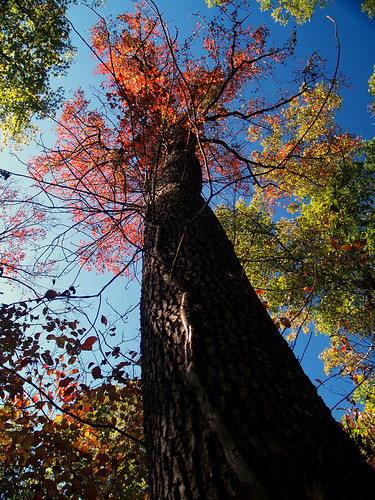
Fall at Kings Bluff

The trail heads through the woods and eventually reaches Kings Bluff. The bluff is about 115 feet tall, and even has a waterfall on it. Of course the falls only run when there has been a lot of rain. Although we did have a few days of rain earlier in the week, the falls were mostly a trickle. When they are running they are one of the tallest falls in the state. The place where there should be waterfall can be seen here:
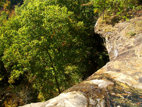
Kings Bluff falls

It was really sunny that day, perfect hiking weather. It wasn't the best photography weather though. I would have killed for some clouds, or even better, fog. Maybe not rain - it would lead to slick rocks, which probably wouldn't be the best when standing on the top of really tall bluffs.

Following the stream bed that feeds the waterfall, I found many small pools formed as the water eroded away the rock. Here is a shot of one of the pools, taken while attempting to be artsy.
Kings Bluff

There is a short but steep trail that leads to the bottom of Kings Bluff. We walked and slid down there and explored the area at the base of the bluff.
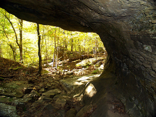
Below Kings Bluff

Under Kings Bluff

Kings Bluff

We got back onto the main trail, which hugged the bluff and revealed some interesting weathered rocks sticking out over the wilderness.
Kings Bluff

The trail is great, a lot of interesting stuff to see. There are a lot of sandstone formations and hoodoos along the bluff.
Kings Bluff

Hoodoo

Dang, I just wish the light was better!
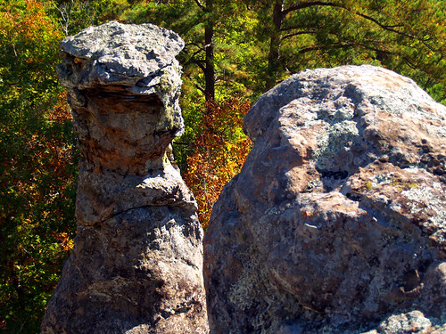
If only we had better light...

We had the trail to ourselves for nearly the entire length of the Kings Bluff hike. Near the end we ran into an older man, who made us feel much better about our accidental 80 mile detour. The poor guy walked up and said, "you haven't happened to see a set of car keys laying on the ground, have you?" Turns out that somewhere along the four miles of hiking trails there, he and his wife dropped their keys. I hadn't noticed them, but of course hadn't been looking either. He said that his wife needed to make a bathroom stop along the trail (gross - and there are bathrooms at the trailhead!), and may have dropped them there. So we should keep an eye out to the left side of the trail just in case. He gave me his cellphone number to call in case we found the keys. The area code wasn't a local one, I looked it up and the area code is for Alabama.

That is actually my biggest fear, to head out on some remote trail and then lose a wallet or car keys. Or also to be stuck in the middle of nowhere with a flat tire. But when we finished the hike I didn't see them in the parking lot, so I guess they found the keys and made it out ok.

We finished the Kings Bluff trail and started on the trail to Pedestal Rock. The trail goes through the woods and comes out to another bluff, with more rock formations. The highlight is of course, Pedestal Rock. It is where the rock has eroded away to look like, well, a pedestal.
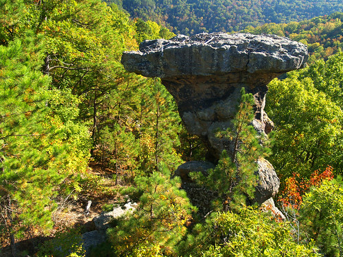
Pedestal Rock

From here you can scramble down and explore some caves in the bluff. But the unfortunate detour had eaten into our hiking time. And we also managed to find out where the huge crowd was, the trail was packed. At one point we passed by a huge group of maybe 40 people. There are a few more places that you can explore out there, but they were crowded with people. No surprise really, being a nice sunny day at one of the more popular trails in the National Forest.

But we thought our time would be better spent elsewhere, and quickly headed back to the car. The next destination would be a waterfall, which would hopefully be running and by this time be in the shade...

Monday, October 20, 2008

Bayou Bluff

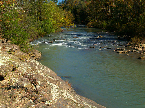
From Goose Pond we turned to the north and headed into the Ozarks. Our next stop was Bayou Bluff, a National Forest recreation area along the Middle Fork of the Illinois Bayou. It is odd that this is a bayou, since it more compares to a typical Ozarks stream (and looked the polar opposite of the murky swamp at Goose Pond). The water was clear, and it looked like a perfect place to camp and go swimming (when the water is a tad bit warmer, of course).
Bayou Bluff

I didn't have my tripod with me, thinking that the daylight wouldn't make for good water shots anyways. I regretted it immediately, and tried to take some longer exposure shots with the camera sitting on a rock, or with me trying to stay very still. None of those turned out, of course.

But we got back to the car and headed on, towards Pedestal Rock and Kings Bluff. It would turn out to be a bit of a longer drive thanks to an accidental detour...

Sunday, October 19, 2008

Goose Pond

While the trees around Little Rock really haven't changed into their fall colors yet, I heard that they were coming along nicely up in the Ozarks. Apparently this fall should be great, thanks to the unusually wet summer we've had here (or not, who knows?). But a plan was made to head up to the Ozarks and hit up a few places, and hope the trees have changed.

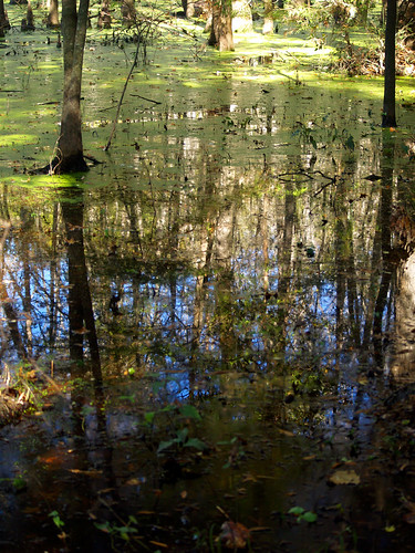
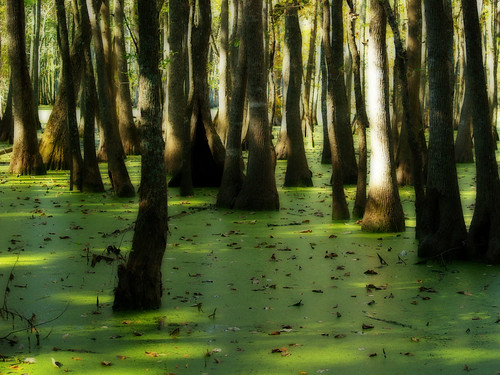
I drove to Conway and met up with Zack Andrews, and we then set off towards Atkins. The first stop of the day was Goose Pond, in the Point Remove Wildlife Management Area. The pond is really more of a swamp, filled with cypress and tupelo trees. I hoped the trees would have changed there, but they were mostly still green.
Goose Pond

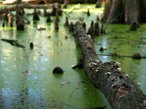
There isn't a trail here, you just have to make your way along the dry ground. Trying to not get too much swamp muck in my shoes, I got this shot of a fallen tree resting in the water.
Swampy

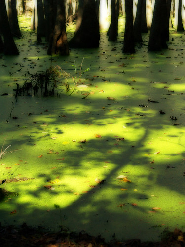
It was a sunny day, so the morning light was a bit harsh.
Goose Pond

There weren't any geese at Goose Pond, but a ton of frogs. In fact, we saw two dead frogs stuck in some unusual places. One was perched on the edge of a stump, the other sitting in the Y of a small tree. Though there is probably some logical explanation as to why they would be there (like a bird, or something), it was still a bit creepy. I got a real Blair Witch-esque vibe out there.
Goose Pond

Lucky for us, we survived. Back to the car, we headed north from Atkins towards the next destination, Bayou Bluffs...

Monday, October 13, 2008

Junction Bridge

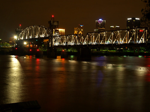
I've spent the past week or so patiently waiting for the trees to change into their fall colors. The trees here have just barely begun changing, but within the next week or so should start to look very awesome. Until then, I haven't been out to take any pictures. So I grabbed the camera on Sunday, and first drove by the Old Mill, hoping to get a few pictures. But the place was overrun with people, so I gave up on it. But later on that night I went to another place here in town. Surprise, I went to one of our many pedestrian bridges, this time the Junction Bridge.
Junction Bridge

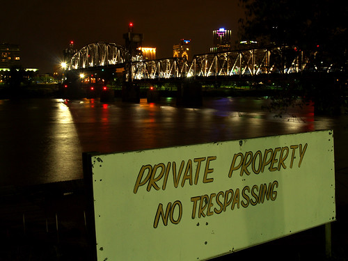
This was taken on the North Little Rock side of the river, which should provide the best views since you have the Little Rock skyline in the background. But unfortunately, the NLR side has a lot of clutter on the riverfront. Along the riverbank by the bridge are a set of old run-down boats, whose purpose being there is hard to understand. The place where I took the above shot was next to a spot where a crummy looking houseboat was moored along the river, with a giant "No Trespassing" sign next to it. Now, since I am a North Little Rock resident and a taxpayer, shouldn't I have every right to all the things stuck along a city park that my tax dollars go to maintain? Probably not, I'm sure.
Private Property

Monday, October 6, 2008

Sunday Foggy Sunday

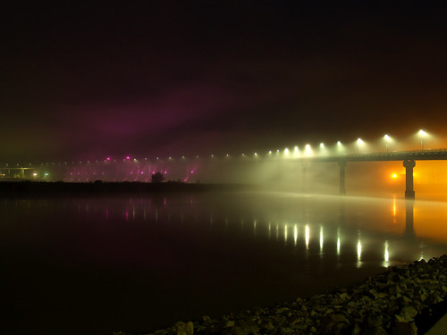
Driving home Saturday night, I noticed some nice fog drifting along the river. Thinking that it might look even more foggy in the morning, which might be a good time for picture taking, I got up to see if it was still foggy before sunrise. It was, indeed. So foggy that it nearly reached pea soup levels at my apartment. So I sleepily grabbed the camera and headed over to the Big Dam Bridge, the pedestrian bridge over the Arkansas River just a few miles from my apartment.

I was sad to see that the fog wasn't as thick there as it was at my apartment. But I set the camera up and started getting some pictures, always on the lookout for any wandering skunks who might stroll by. Eventually the fog ended up getting to be quite thick, enough that it turned the lights on the bridge to obscure points of light shining out. I think this one might be the best of the bunch, where the fog wasn't quite thick enough to totally blur out the lights on the bridge.
Sunday Foggy Sunday

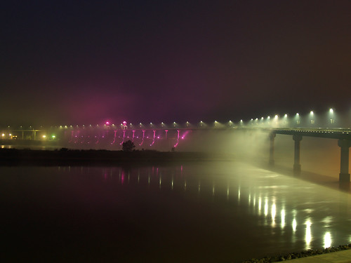
And a bit of a wider view of the foggy bridge:
Foggy Big Dam Bridge

Foggy Big Dam Bridge

The sky was beginning to lighten with the upcoming sunrise, so I headed to another spot a bit closer to the bridge. I hurried to get a shot of the bridge before the sun came out, and got this shot of the bridge with some foreground rocks along the riverbank.
Big Dam Morning

I tried to get a few more shots, even some of the sunrise, but nothing really turned out after that. So I got back to the car and headed home and to bed...