Monday, May 17, 2021

Erbie

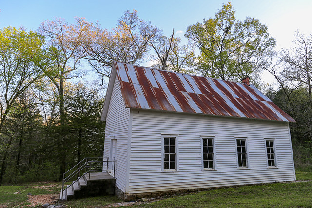
From Broadwater Hollow, we decided to take the scenic route and follow a dirt road that cut through the woods towards the Buffalo River. We ended up at Erbie, which was once a small community that sat along both sides of the Buffalo. Not much remains of Erbie now - the historic Parker-Hickman farmstead is on the south side of the river. And on the north side there still stands an old church, house and barn. The church is thought to have been built in 1896, and services were actually held here all the way until the year 2000.

IMG_0005-2

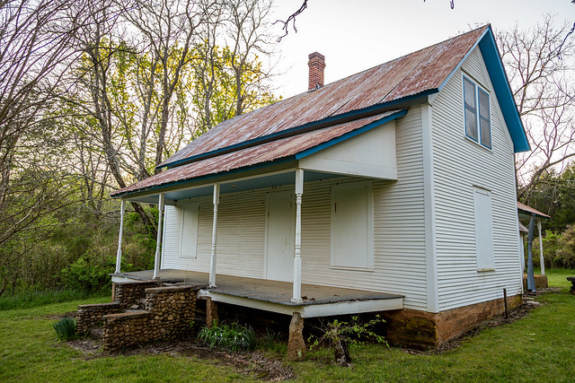
Erbie has a long history. The oldest known settlement along the Buffalo was at the Parker-Hickman farmstead in 1830. The community of Erbie would have a population of about 100 people in 1930. At that time, the town was comprised of about a dozen buildings (which included the church, a post office and a store). One of the buildings that does remain here is this old house, which was built in 1922.

IMG_0045

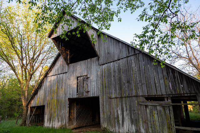
Near the house is this old barn, which was built in 1913.

IMG_0020

IMG_0023

IMG_0034

Our original plan was to cross the Buffalo River on the low-water bridge at Erbie, but the river was too high to cross (I'm no expert, but I assume that when the water is so high that there are actual waves going over the bridge that it isn't safe to cross). So instead we followed the road as it headed roughly up the hills to the east. Along the way, we passed by another old barn and got a few pictures before heading off to Jasper to pick up dinner from the Ozark Cafe....

IMG_0051

IMG_0057

Friday, May 14, 2021

Broadwater Hollow

After the hike up from Whitaker Creek, Zack and I decided to try to hit a few more waterfalls. We ended up driving over to Broadwater Hollow, which has some neat waterfalls that are reached by a short and easy hike (but the drive down there is on a really rough dirt road). The first waterfall that you see while hiking down into the hollow is Paige Falls, which is only eight feet tall but it empties into a wide pool.

IMG_9900-2

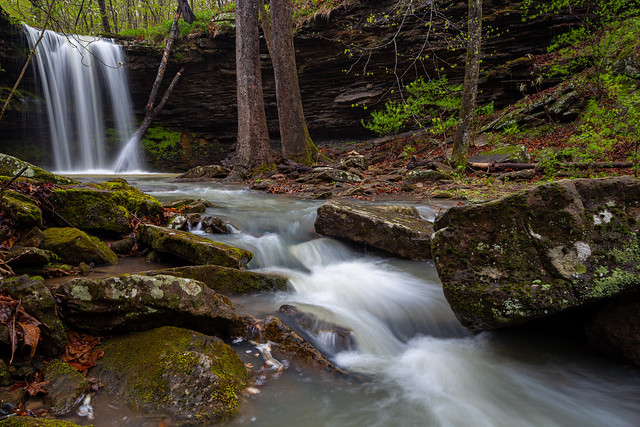
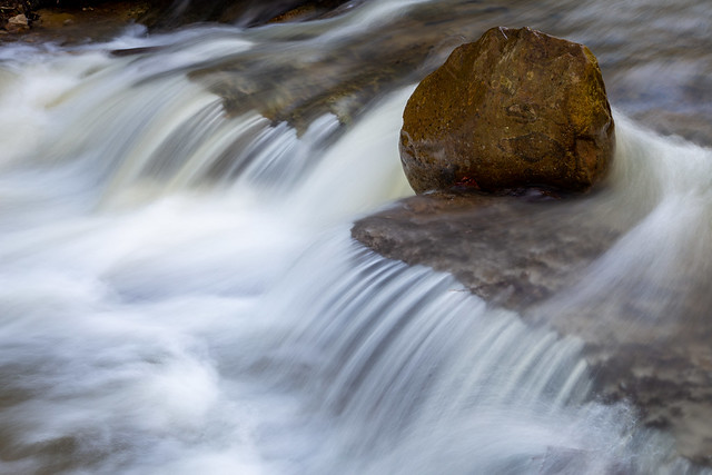
The water was up in the creek after all of the recent rains, and the water looked a little muddy. But the creek was incredibly scenic with lots of neat little photogenic places, like this spot where a huge rock stubbornly sat in the fast moving water.

IMG_9934

Further down the creek is Broadwater Hollow Falls, which is 21 feet tall (it looks a lot taller in person). The photos do not do justice of how neat this little area is.

IMG_9944-2

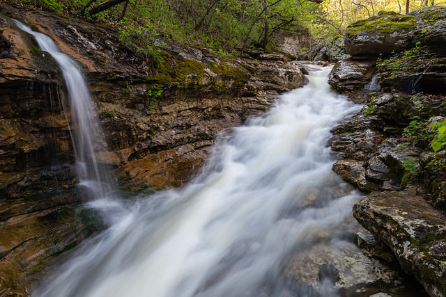
And one last shot from Broadwater Hollow, as the creek flows through a channel that has been carved through the thick rock. A little side waterfall tumbles down the hill and joins in, as the setting sun lights up the trees in the background.

IMG_9958

Sunday, May 9, 2021

Compton Double Falls

The thousands of people who hike to Whitaker Point (or Hawksbill Crag) to enjoy the view may not realize that far below them, hidden away beneath the trees, is the spectacularly scenic Whitaker Creek. The stream, which runs through the Upper Buffalo Wilderness of the Ozark National Forest, has to rank as one of the prettiest in the Ozarks. There are several waterfalls along the creek, including the gorgeous Compton Double Falls.

It had just about stopped raining by the time Zack and I arrived at the muddy parking spot for the trailhead. When Tim Ernst published his waterfall guidebook, there was no trail to the falls and you had to take a "medium bushwhack" down to the creek. In the years since, a steady torrent of people have left behind a well-trod trail. It still isn't the easiest of hikes (especially if you've gotten even more out of shape during this era of quarantines and lock-downs like me) and it is pretty steep in places.

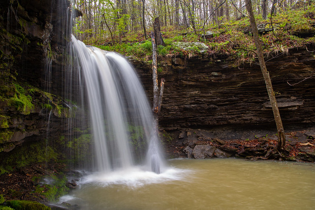
And it doesn't take long before you start seeing some waterfalls. The first is Amber Falls, which Tim Ernst named after his daughter. If you were going to choose a waterfall to name after your kid, this is a good one to pick.
IMG_9660-2

The falls are 18 feet tall, and the rocks behind it were coated with a thick carpet of moss.

IMG_9666

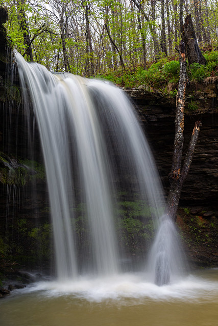
The tree here looks like it had just recently fallen into the pool by the falls. Hope there weren't any wayward hikers or photographers standing below when it decided to fall.
IMG_9672-2

IMG_9678-5

IMG_9688-2

These two large trees presented a nice little frame for the falls...

IMG_9698-3

And one last shot of Amber Falls....

IMG_9705

Several smaller creeks flow into Whitaker Creek, and many of them have their own little waterfalls. We hiked by this unnamed waterfall and stopped for a quick picture.

IMG_9711

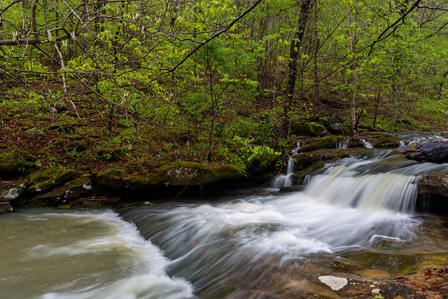
We hiked along the creek, which was slow-going because there were so many neat little spots to stop and take pictures at.

IMG_9724

IMG_9726

IMG_9735

IMG_9740

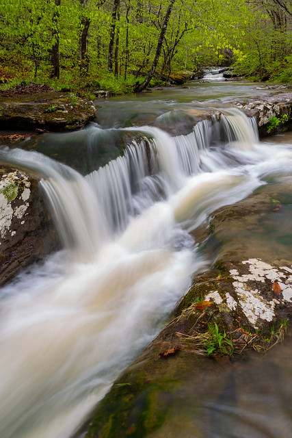
This pretty little waterfall/cascade area was right above Compton Double Falls (meaning I had to be sure to be careful not to slip and fall into the creek here).
IMG_9744-3

IMG_9736

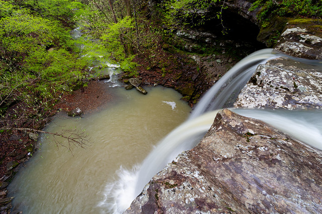
And then the view from the very top of Compton Double Falls, looking down into the pool below.
IMG_9750-2

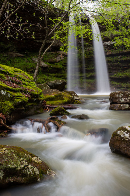
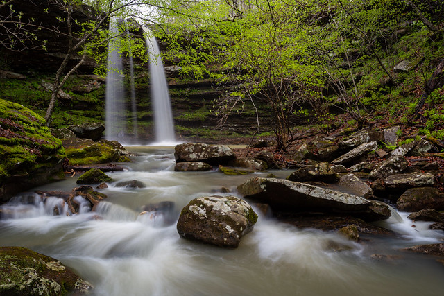
And then finally the view of Compton Double Falls from the base. The falls are 39 feet tall.

IMG_9754-Edit

The falls are named after Dr. Neil Compton, the founder of the Ozark Society. He is also credited as being one of the most instrumental people in the effort to prevent two dams being built along the Buffalo River in the 1960s. If it weren't for Dr. Compton, there probably wouldn't be a Buffalo National River.
IMG_9780-3

IMG_9783-3

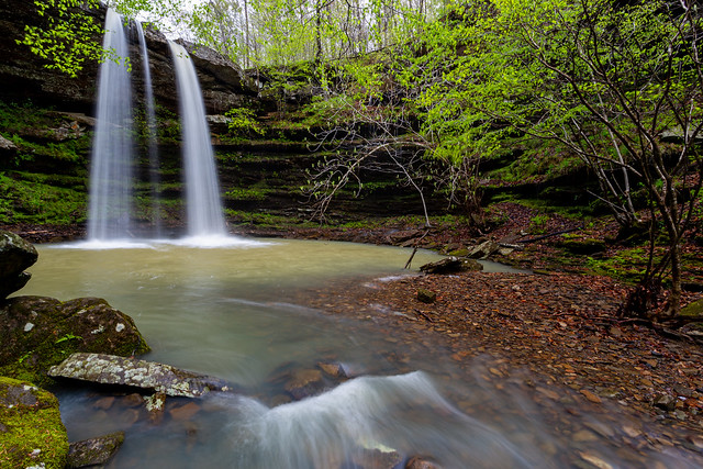
If you look closely you can see that the falls were actually a Triple Falls thanks to all the rain the night before.
IMG_9809-2

And then the view from behind the falls...

IMG_9853

From here, Whitaker Creek continues downstream past massive moss-covered rocks.

IMG_9815

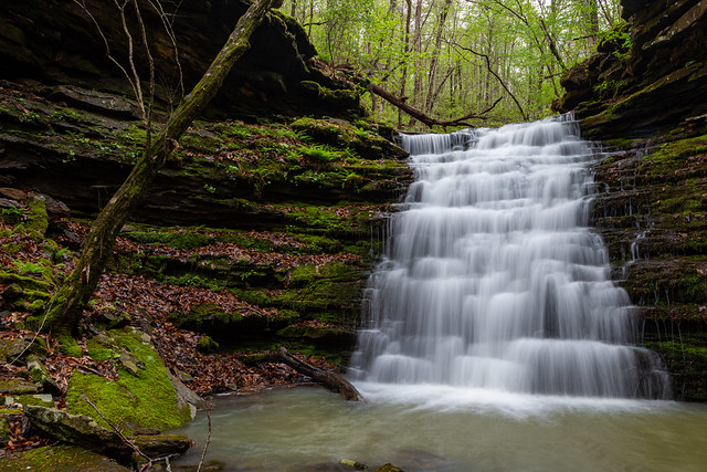
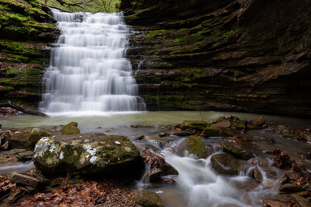
Also just downstream is another waterfall, along another creek that flows into Whitaker Creek. The falls are Owl Falls, and the hike to it from Compton Double was a real hoot.

IMG_9862

Owl Falls are about 20 feet tall. It's amazing how many different types of waterfalls are along this short section of creek.
IMG_9864-2

IMG_9869-Edit

IMG_9878-3

By then it was time to start hiking back, so we headed up the hill. It was again slow going since there were more little waterfalls along the way. The trail crossed the small creek just below these falls.

IMG_9882

And one last shot, of a smaller unnamed waterfall. This one was about 10-15 feet tall and was also a double waterfall (we joked that it was like the kid-sized version of Compton Double).

IMG_9888

Thursday, May 6, 2021

Boxley

Our next stop was Boxley Valley, which is truly one of the prettiest places in the state. It was a rainy morning, and fog and mist clung to the tops of the mountains that stand tall over the valley. We made a stop by the old grist mill that sits in the middle of the valley.

IMG_9572

The first mill here was built way back in 1840. That mill actually was the center of a small Civil War skirmish called the Battle of Whiteley's Mill. The current mill was built in 1870 and operated until the 1960s. The mill has been restored and occasionally the interior is opened for tours by the National Park Service.

IMG_9586

We then took Cave Mountain Road, which runs steeply up the side of the mountain. But we did make one stop at Hedge's Pouroff, where a creek tumbles over the bluff into the valley below. The pouroff is notoriously difficult to photograph, but the view from there is amazing. The trees were a deep and vibrant green from new Spring growth (actually had to desaturate the colors a bit in the pictures). I was careful to not get too close to the edge for this picture, since the bluff here is about 100 feet tall.

IMG_9651-2

The bluff is guarded by an ancient cedar tree, which has enjoyed this view for many many years.

IMG_9654

Monday, May 3, 2021

Out In The Woods

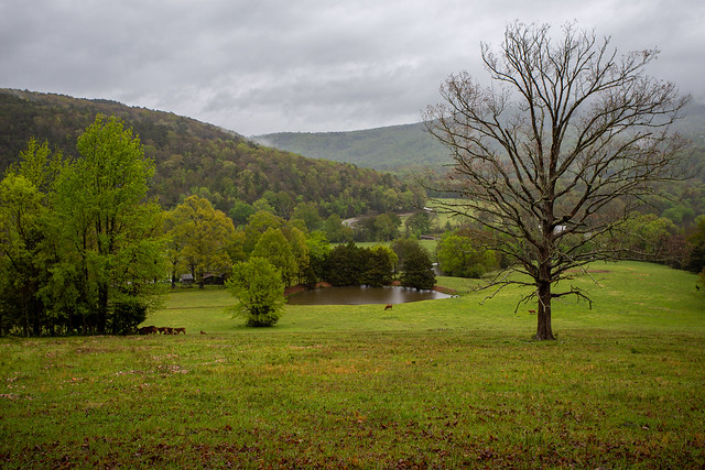
It's amazing what you sometimes find while out driving through the woods of the Ozarks. The other weekend I had met up with my good friend Zack, and we were driving off to go hiking to a waterfall. We took the scenic route, and went by this nice view of a field surrounded by mist and fog-covered mountains.

IMG_9471

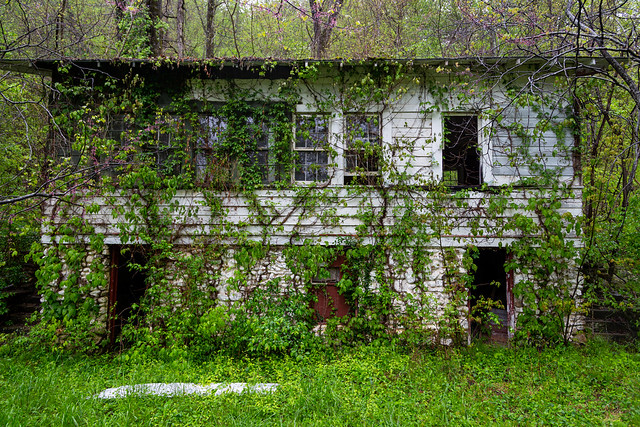
We then headed down a dirt road, and passed by a large two-story wooden structure. It was an old double-dogtrot building, with weathered and faded wooden boards that were being covered with vines.

IMG_9519

It was part of a small complex of abandoned buildings. It turns out that we were by Diamond Cave, which used to be a popular tourist attraction. The cave has been described as being a "natural wonder," with "stalactites, columns, and stalagmites running many miles into the mountain." The cave was opened for tours in 1925, and would soon be home to a hotel (which was the two-story dogtrot building), a campground, a restaurant, an outdoor pavilion and even a skating rink.

IMG_9486

IMG_9487

The cave has also been called one of the prettiest caves in the state, and it operated as a tourist attraction until the mid-1990s.

IMG_9492

IMG_9503

The land is now apparently privately-owned, and the cave is closed in order to protect its environment. It's amazing how quickly nature can assert its dominance, and how even the most popular of attractions can be left behind and forgotten.

IMG_9527