
The weekend after proved to be another good weekend for waterfall hunting. All the rain the past week should mean that the falls would have a decent amount of water flowing through. Plus the weathermen predicted it would be cloudy for most of the day. I packed up the camera gear, and woke up at the crazy early time of 6:30 am(!) and drove out to the falls.
This attempt would be a bit different, I’d be trying to take a different route to the falls. This route would be longer (about 6 miles), but would follow along the scenic Long Devil’s Fork. The considerable downside to this option being that most of the hike is rated as a "difficult bushwhack," which can prove to be a bit hard on anyone foolish enough to hike out there.
The drive up there was fairly uneventful, but as I got into the hills along Hwy. 7, there was some cool frost on the trees. The area was filled with hoarfrost, a rare form of frost that I had read about but had never seen in person before.
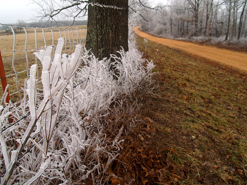
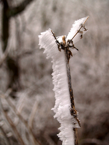
The hillsides were covered in the frost. It was a neat scene to drive through. Luckily the ice was all on the trees and not on the road.

The waterfall I was seeking is in the Richland Creek Wilderness, about 40 miles or so north of Russellville. To get there means going up Hwy. 7, then turning off onto a series of dirt roads, in varying states of ill-repair. At first the roads are well maintained, and well marked. But that changes, sadly. I ended up getting lost twice, going down the wrong dirt road. Both times ending up at a locked gate. The roads also got quite rough, something that would knock around a good sized 4x4. They were a bit much for my little Hyundai, and I am lucky I made it through. But I eventually made it to the trailhead, next to an old cemetery.
To reach the falls, you begin your journey along an old trace that heads out into the woods. I was amused to note that this old road trace that hadn’t seen any vehicle traffic in decades was in much better shape than the road I just tried to drive down.
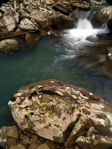
After hiking on that road trace for 1.8 miles, I crossed a nice creek. This is where the hike begins to get interesting. The road trace would continue on, but to see the falls and all the interesting stuff it meant bushwhacking time. I followed down the creek for a bit, which had some neat little waterfalls on it.
The way down was steep and rocky, but I eventually managed to make my way down to Big Devil’s Fork, which makes up part of Twin Falls. As best I could tell, there wasn’t any trail at all along the creek. The terrain included some nice features - rocks (lots of these), thorns (lots of these) and an uneven path. But it did also have some neat stuff in the creek though:
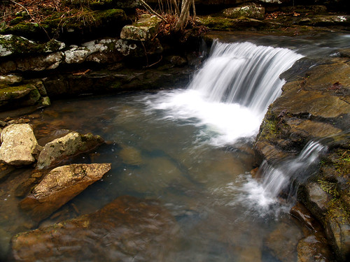
It was tough going but well worth it. After 2.3 miles of hiking I came upon this awesome little waterfall - Hamilton Falls. It’s only 12 feet high, but a nice stop along the way.
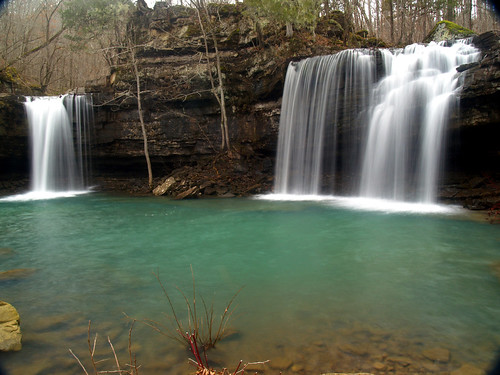
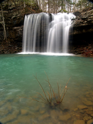
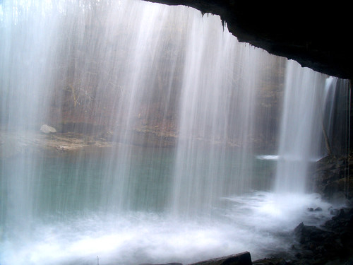
From Hamilton Falls it’s just a matter of following the creek downstream for about a half mile to reach Twin Falls. The terrain was still a bit crazy, so I ended up heading a bit uphill trying to find a good way through. I crossed a few creeks, and eventually ended up at the top of the hill. The top was flat, and the hiking was much easier. The bad part of this, however, was that I was now well above the creek so that it was out of view. This meant that I had no good idea where Twin Falls were, or if I was missing any good scenic stuff down there. Luckily the falls do make a lot of noise, so when I heard a lot of commotion coming from the creek I headed down hill to the creek. The hill was, of course, steep. Mostly it involved me stumbling and grabbing onto any tree I could find to prevent me from going downhill face first. Eventually I made it to the creek, but not quite to the falls. The last bit of effort involved a descent along a muddy area that didn’t look like it would support me if I tried. So the last part of my hike to Twin Falls involved me scooting downhill butt-first, which wasn’t pretty but it did get me there. So finally, the great Twin Falls of Devil’s Fork:
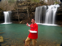
To celebrate my achievement, I took this dorky self-portrait:
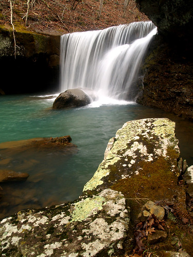
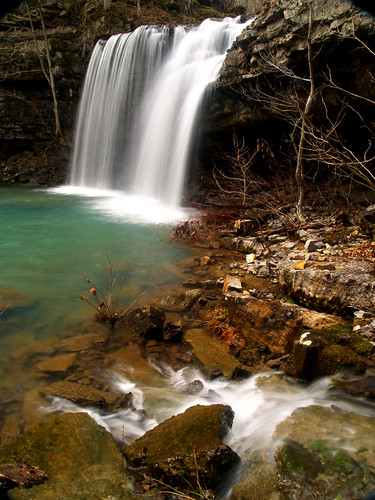
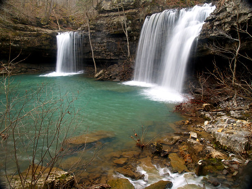
It is a really pretty area. The falls are formed by two seperate creeks, which both flow close to each other but first flow over a 15-20 foot bluff before meeting up at the base of the falls. The creek that I hiked down was Big Devil’s Fork, which makes the waterfall on the right. Here are some close-up views of the falls from Big Devil’s Fork:
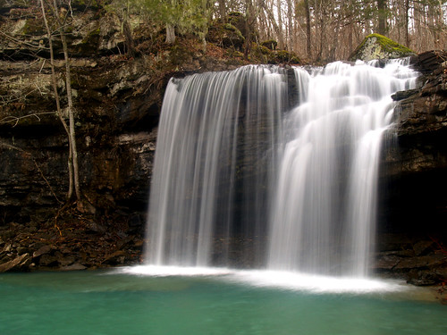
And a view of the other half of Twin Falls, the falls of Long Devil’s Fork:

Of course, after hiking all the way out there the sun decided to come out. Sunlight isn’t that great if you’re trying to take waterfall pictures, so it was a bit annoying. Luckily it was still cloudy so the sun would go and hide behind the clouds fairly often. I tried to rush around and get as many shots as I could before the sun would come back out.
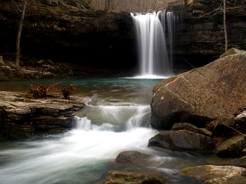
There was a neat waterfall that came down from the side of the hill, flowing down near the base of Twin Falls:
From there I went up and behind the waterfall. There wasn’t much space, but I set up the camera to get a shot looking through the water. It wasn’t the ideal place to shoot. The spray from the falls would blow back and get all over me and the camera. After every picture I’d take, I’d have to wipe water of the lens. This is the result of that, pretty much the only shot that turned out:
Then the sun came out, and stayed out. This ruined any chances for taking waterfall pictures so I decided it was time to head back. But just before I left, another group of hikers came in. They came in from the opposite direction, from Richland Creek, the way I tried and failed to come in the week before. So apparently the creek was passable now. I did note that this hiking party included a few older people (old being in that they had lots of gray hair) and some young kids. They also didn’t appear to be soaked, so they must have found a good way to cross Richland Creek. I didn’t ask them how they went, instead started heading back up the hill. I had an idea for a way back, which I thought would probably take me back to the car with the least amount of effort. Since following the creek wasn’t easy, I thought it would be best to hike up the hill to the top. There it was flat, and would be an easier hike. I could meet back up with the road trace and get back to my car quicker than trying to scramble over the rocks along the creek.
I must have forgotten how steep the hill was. I would say it was equal to Pinnacle Mountain in terms of being steep, except that here there wasn’t a trail. I trudged up there, finally making it to the top. It was level up there, thankfully. I sat and rested, drinking a bottle of water and catching my breath. The hike was easy, and I was pleased to meet up with the road trace. There were a few short hills, but the rest of the way was a nice hike.
I got back to the car, and attempted to drive my car out. The road down there isn’t one for little cars, and mine had all sorts of stuggles. Besides rocks that would scrape up the underside of the car, I had an epic battle with a mud puddle. Well I guess it wasn’t a puddle but more of just a big patch of mud with a road going through. To add to that, it was all uphill, so my car would go up a few feet and get stuck. I spent at least 20 minutes trying to figure out how to get past it.
It was a problem. No matter what I tried, I couldn’t get out. I was a good ways away from civilization, and had no cell phone reception. I considered leaving the car and hiking out to try to find a house, or anything, to get help. Just short of giving up, I made one more attempt. Backing way back down the hill to get a good start, I gunned it and finally made it past. My car was covered in mud, but I got out. Thank goodness.
I made it home before dark, happy with finally reaching the Holy Grail of Arkansas waterfalls. I haven’t been out much since then. I did go out last weekend to take some waterfall pictures, but went after one that didn’t involve any dirt roads or "difficult bushwhacks" to reach. It was a welcome change.

1 comment:
Hi
I am read your post. It is very useful information for seo services.Thanks for the sharing this Blog. It is very useful professional knowledge. Very nice work. I especially like the icons and quick links.
Flood Damage Twin Falls
Post a Comment