Showing posts with label Upper Buffalo Wilderness. Show all posts

Thursday, May 26, 2022

Paradise Falls

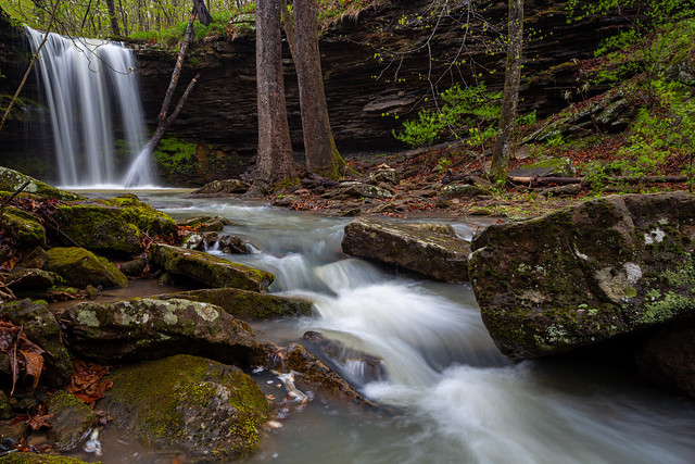
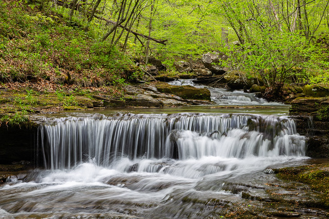
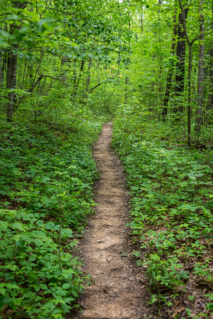
Paradise Falls definitely lives up to its name, since it is one of the prettiest waterfalls in the Ozarks. The falls sit within the Upper Buffalo Wilderness of the Ozark National Forest and can be reached by a difficult 2.5 mile hike/bushwhack. Zack and I headed out there early in the morning, and followed the trail as it dropped downhill and then followed the creek. There were several nice little waterfalls and cascades along the way.

IMG_8230-2

IMG_8237-2

IMG_8259-2

It had poured rain the night before, so we were lucky that there was a nice amount of water in the creek.

IMG_8261-3

IMG_8268-3

IMG_8277-3

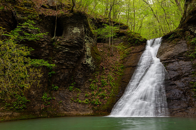
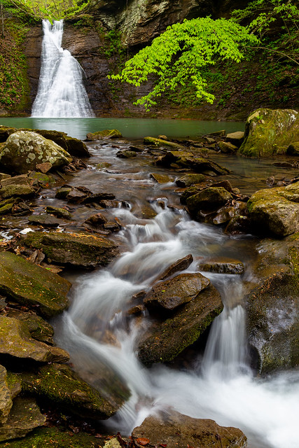
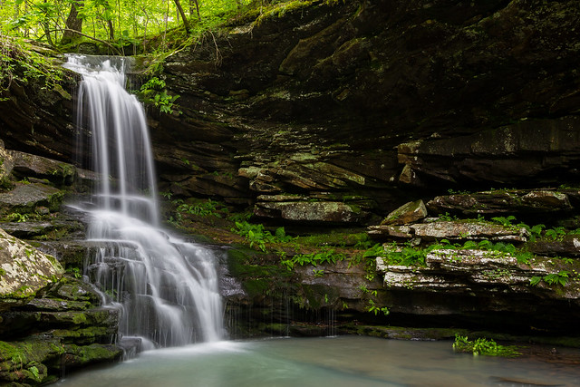
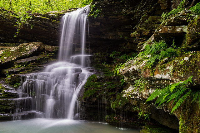
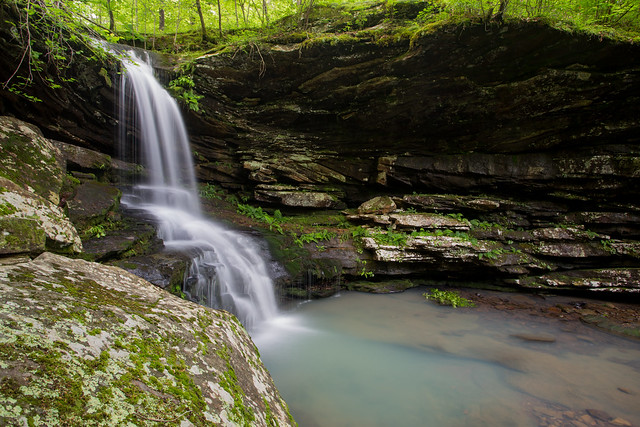
And soon enough you reach Paradise Falls, which tumbles 32 feet into a deep turqouise pool. The lush forest around the falls really does make it seem like a tropical paradise.

IMG_8295-2

IMG_8298-3

IMG_8300-3

We stayed there for awhile, taking pictures and enjoying the view (and putting off the hike back to the car).

IMG_8327-3

Sunday, May 9, 2021

Compton Double Falls

The thousands of people who hike to Whitaker Point (or Hawksbill Crag) to enjoy the view may not realize that far below them, hidden away beneath the trees, is the spectacularly scenic Whitaker Creek. The stream, which runs through the Upper Buffalo Wilderness of the Ozark National Forest, has to rank as one of the prettiest in the Ozarks. There are several waterfalls along the creek, including the gorgeous Compton Double Falls.

It had just about stopped raining by the time Zack and I arrived at the muddy parking spot for the trailhead. When Tim Ernst published his waterfall guidebook, there was no trail to the falls and you had to take a "medium bushwhack" down to the creek. In the years since, a steady torrent of people have left behind a well-trod trail. It still isn't the easiest of hikes (especially if you've gotten even more out of shape during this era of quarantines and lock-downs like me) and it is pretty steep in places.

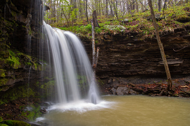
And it doesn't take long before you start seeing some waterfalls. The first is Amber Falls, which Tim Ernst named after his daughter. If you were going to choose a waterfall to name after your kid, this is a good one to pick.
IMG_9660-2

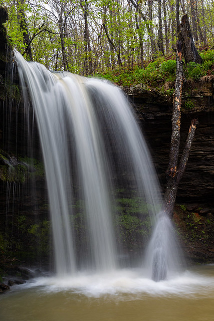
The falls are 18 feet tall, and the rocks behind it were coated with a thick carpet of moss.

IMG_9666

The tree here looks like it had just recently fallen into the pool by the falls. Hope there weren't any wayward hikers or photographers standing below when it decided to fall.
IMG_9672-2

IMG_9678-5

IMG_9688-2

These two large trees presented a nice little frame for the falls...

IMG_9698-3

And one last shot of Amber Falls....

IMG_9705

Several smaller creeks flow into Whitaker Creek, and many of them have their own little waterfalls. We hiked by this unnamed waterfall and stopped for a quick picture.

IMG_9711

We hiked along the creek, which was slow-going because there were so many neat little spots to stop and take pictures at.

IMG_9724

IMG_9726

IMG_9735

IMG_9740

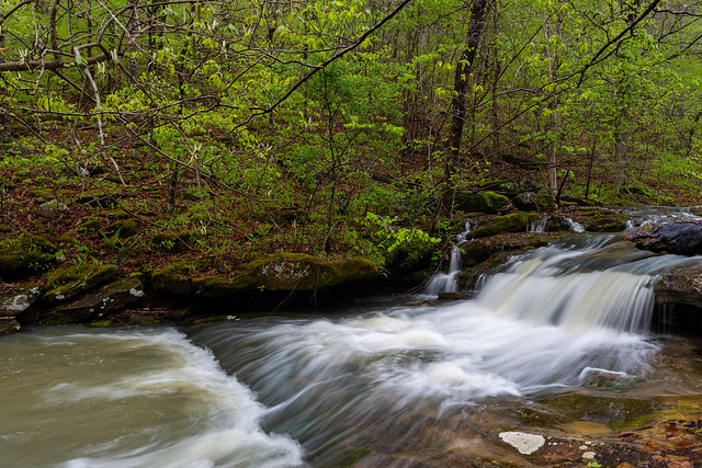
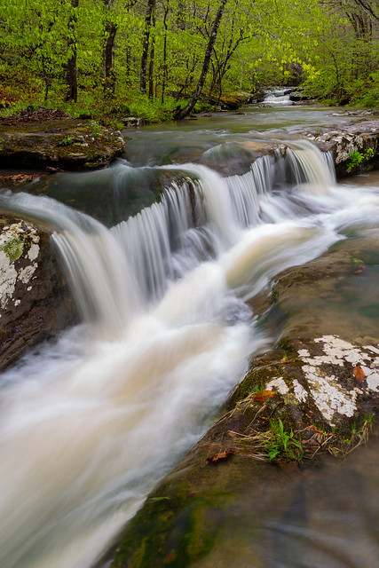
This pretty little waterfall/cascade area was right above Compton Double Falls (meaning I had to be sure to be careful not to slip and fall into the creek here).
IMG_9744-3

IMG_9736

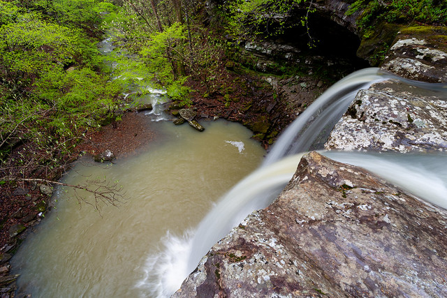
And then the view from the very top of Compton Double Falls, looking down into the pool below.
IMG_9750-2

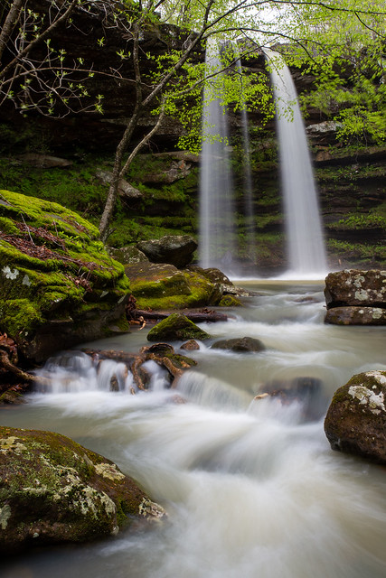
And then finally the view of Compton Double Falls from the base. The falls are 39 feet tall.

IMG_9754-Edit

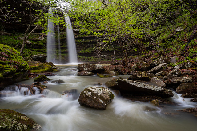
The falls are named after Dr. Neil Compton, the founder of the Ozark Society. He is also credited as being one of the most instrumental people in the effort to prevent two dams being built along the Buffalo River in the 1960s. If it weren't for Dr. Compton, there probably wouldn't be a Buffalo National River.
IMG_9780-3

IMG_9783-3

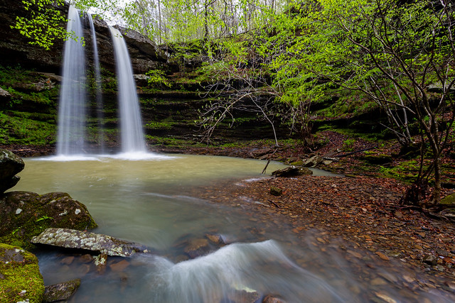
If you look closely you can see that the falls were actually a Triple Falls thanks to all the rain the night before.
IMG_9809-2

And then the view from behind the falls...

IMG_9853

From here, Whitaker Creek continues downstream past massive moss-covered rocks.

IMG_9815

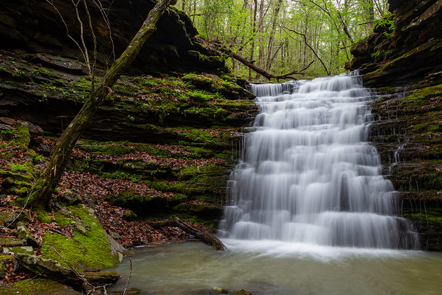
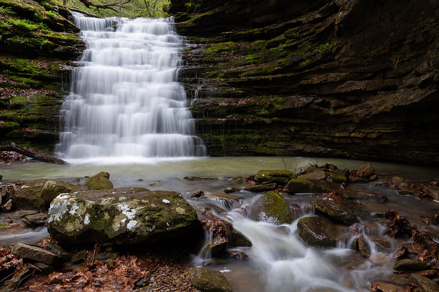
Also just downstream is another waterfall, along another creek that flows into Whitaker Creek. The falls are Owl Falls, and the hike to it from Compton Double was a real hoot.

IMG_9862

Owl Falls are about 20 feet tall. It's amazing how many different types of waterfalls are along this short section of creek.
IMG_9864-2

IMG_9869-Edit

IMG_9878-3

By then it was time to start hiking back, so we headed up the hill. It was again slow going since there were more little waterfalls along the way. The trail crossed the small creek just below these falls.

IMG_9882

And one last shot, of a smaller unnamed waterfall. This one was about 10-15 feet tall and was also a double waterfall (we joked that it was like the kid-sized version of Compton Double).

IMG_9888

Thursday, May 28, 2020

Magnolia Falls

Last weekend I wanted to try to squeeze in one last waterfall visit in before the heat of the summer sets in for good, and decided to do the hike to Magnolia Falls. The weather prediction wasn't really that great for waterfall photos, showing that it would probably be mostly cloudy all day (which meant that it would either be bright and sunny or pouring rain, probably). So I made the uncomfortable decision to do the hike right at sunrise, in the hope that even if it was sunny I could still see some waterfalls before the sun was too high to ruin pictures. But this meant I had to leave the house around 3:45 AM, and then drive up to the Ozarks (at least there wasn't any traffic!).

One other reason why sunrise seemed like an ideal time was because this was over Memorial Day weekend, which meant that all the trails would probably be crowded. I hoped the early morning start would mean there would be less people out and about (which was true, there wasn't anyone else out there). But I finally arrived shortly after sunrise, and started the hike to the falls. Maybe it was because my last hike was the long six mile trek to Smith Falls, but the hike to Magnolia was delightfully easy.

IMG_2452-2

After about a mile or so of hiking, the trail drops down to the waterfall. Magnolia Falls is small (only 26 feet), but it is amazingly beautiful. The pool around the falls was covered with vibrant moss and ferns.

IMG_2420-2

IMG_2391-3

The pool below the falls isn't very large, but it is scenic enough that you can find lots of different angles to shoot from.

IMG_2361-2

IMG_2409-2

IMG_2399-2

IMG_2416-2

Since it was still cloudy I wanted to hurry off to visit another waterfall, so I hurried back up the trail towards the car.

IMG_2497

Along the way, the trail runs alongside an old stone wall that was constructed by a pioneer family (probably in the late 1800s?).

IMG_2542-2

The wall stretches for about a quarter of a mile. The old homestead here is long gone, the only evidence that remains is this old wall. I can't imagine how difficult it must have been to dig up these rocks and place them here in such a way that it is still standing after all this time.

IMG_2534-2

Magnolia Falls sits within the Upper Buffalo Wilderness of the Ozark National Forest, and it appeared to be well taken care of. I didn't see any vandalism or litter along the trail. Hopefully we can all be good stewards of the forest and keep it that way.

IMG_2575-2

And one last shot from the trail, before making it back to the car...

IMG_2573-2

Thursday, May 21, 2020

Lower Ken Smith Falls

The Buffalo National River has recently reopened, and Zack and Matt and I decided to make a visit to the area to visit a few waterfalls. Of course we weren't the only ones with that bright idea. Boxley Valley was crowded with people who were going kayaking - there was a steady stream of cars heading off towards the Hailstone run. There was also lots of people who were standing around Cave Mountain Road trying to decide where to hike since the Lost Valley, Whitaker Point and Glory Hole trails were still all closed.

We decided that the best way to avoid the crowds (and any possible Rona exposure) would be to find a trail that was a bit more "off the beaten path." We decided to try to visit Smith and McClure Falls, which are located in Hawk Hollow in the Upper Buffalo Wilderness Area. Of course any trails up there were bound to be busy, and there were already two cars parked by the trailhead when we arrived. I say that this is "off the beaten path," but that might not necessarily be true anymore. When I last hiked this trail in 2014 while going to Bowers Hollow, it was still mostly a bushwhack. But this time there was a well-defined trail that ran off into the woods. It’s amazing how popular all these waterfalls have gotten, and just how many people are out in the woods now (which may or may not be a good thing).

The hike to Hawk Hollow is long - about six miles total. A good chunk of it is relatively easy, since the trail follows an old road trace. Since it had rained heavily the night before, the trail was soaked with water that created deep puddles and in some places flowed down the trail like a creek. When we started the hike the weather was perfect for waterfall photography - cloudy and rainy. But of course, after several miles of hiking the sun decided to break through the clouds. Brilliant blue skies shined through the gaps in the trees above.

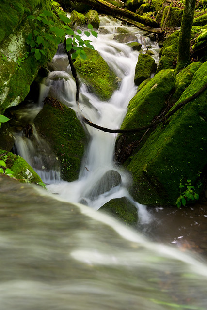
We stopped to rest at a spot where a creek crossed the trail. The creek was lined with thick green moss, so thick it was like a natural shag carpet.

IMG_2270-2

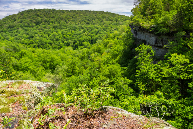
We followed the trail as it hugged the bluff line, which provided this expansive view of Hawk Hollow below. You could see part of the waterfalls from here, but to get close to them would require a steep descent into the hollow.

IMG_2268

We eventually dropped down into Hawk Hollow, which was a steep and difficult bushwhack. We somehow missed the waterfalls on our way down, and ended up following the creek all the way to where it flows into the Buffalo River (which was running high and muddy after the rains). After backtracking uphill through the hollow, we passed by this neat spot. The tree canopy was so thick that it was barely letting any light through, and the light that did break through hit the creek like light from a disco ball.

IMG_2293-2

Heading further up the stream we passed by this waterfall (which was probably about 10-15 feet tall). It was sitting in almost full-sun, but I set up the tripod and hoped that a passing cloud would cause enough shade for a few quick photos. After waiting and waiting and having no luck, I took this sunny picture anyways since it was such a neat spot.

IMG_2297-2

Further up the creek was another neat little spot, where the creek fell over a wide waterfall that was probably about 10 feet tall. A smaller waterfall flowed by next to it, tumbling over moss-covered rocks.

IMG_2315

Eventually we made it to the mighty Lower Ken Smith Falls, which clocks in an impressive 72 feet.

IMG_2321

Most of the falls were in shadow, but sunlight was hitting the top of the falls and then streaming into the pool below. Mist from the falls was caught in the beams of sunlight shining above it, like if someone was holding a flashlight above us.

IMG_2344

From there we hiked up the hollow and passed by McClure Falls, but we didn't stop for pictures since it was sitting in direct sunlight. I struggled up the hill and eventually we made it back to the trail, and then a few miles later made it back to the trailhead. It is a very beautiful spot, and one that would be worth visiting again (on a nice and cloudy day).