Thursday, April 27, 2023
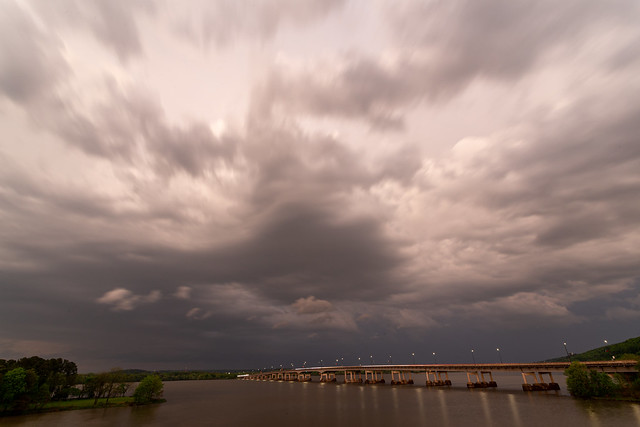
Two Rivers Sunset
Another big storm rolled through recently, but luckily without tornadoes this time. It was almost sunset when it hit, so I hurried over to Two Rivers Park in the hopes that it might produce some cool sunset colors. When I arrived the big storm clouds had already moved off to the east.


Labels:
Arkansas,
Little Rock,
Two Rivers Bridge,
Two Rivers Park
Location:
Little Rock, AR, USA
Tuesday, April 25, 2023
Mississippi - New Hope Missionary Baptist Church
As we left Destin to return home to Arkansas, I put the route into Google Maps. It would be a long drive (especially with two kids in the car), and the route that my phone picked out for us took us to Mobile and then along a series of roads that cut across Alabama and Mississippi. Luckily our toddler loves cars and doesn't seem to mind sitting in a carseat very long.
I was thrilled to see that our way home would actually pass by the town of Estill in Mississippi, which has a neat old abandoned church. And after several hours of driving, we finally arrived at the New Home Missionary Baptist Church, which was built in 1918.

The wooden Gothic Revival church has been described as "a rare example of an early twentieth century rural African American Delta church." The church survived the Great Flood of 1927, since it sits along some high ground near Deer Creek.


Like most Delta communities, Estill was once a thriving little town. But now few people live here, and the old church has been abandoned for decades. It was named as one of the 10 Most Endangered Historic Places in Mississippi in 2017. In 2019, the church was awarded a $24,500 grant from the Mississippi Heritage Trust, which added a new metal roof to the building. The roof helps keep rain water from entering the structure and causing further deterioration.
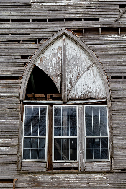
While there aren't any church services held here, some members of the old congregation have returned. There is a small cemetery next to the church, which has a few recent burials. One of those burials is from a Mrs. Rebecca "Li'l Bit" Ellis, who was born in 1892 and who passed away in 2002 at the age of 109. It's hard to imagine what all she must have seen and experienced in those years.
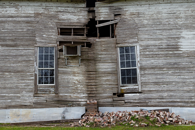
It started raining when we were there, with ominous gray clouds hanging over the horizon.

A few hours later, a tornado would rip through this part of Mississippi. Sadly, twenty-six people would be killed as the massive storm hit the towns of Rolling Fork and Black Hawk.
We drove across the river and made it into Arkansas, and actually drove through the storm cell that would later develop into tornadoes in Mississippi. It was bad then, we actually had to pull over in Dumas to wait out a heavy band of rain. We made it through the storm as we neared Pine Bluff, and saw the sun try to break through the heavy clouds. It was near sunset, so the light turned golden as it met with the dark gray storm clouds.
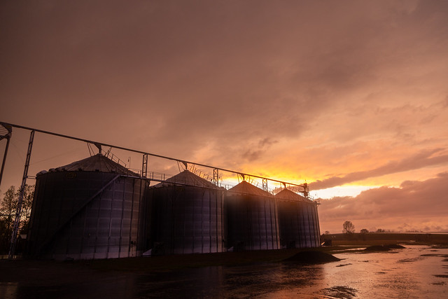
It seemed so bizarre then, to have driven through a place just hours before it would be hit by a tornado. You just never know when a bad storm will hit, and it seemed so strange to have been so close. Of course we would learn what it would be like to experience all that first-hand, when a tornado moved through our neighborhood just a few days later.
I was thrilled to see that our way home would actually pass by the town of Estill in Mississippi, which has a neat old abandoned church. And after several hours of driving, we finally arrived at the New Home Missionary Baptist Church, which was built in 1918.

The wooden Gothic Revival church has been described as "a rare example of an early twentieth century rural African American Delta church." The church survived the Great Flood of 1927, since it sits along some high ground near Deer Creek.


Like most Delta communities, Estill was once a thriving little town. But now few people live here, and the old church has been abandoned for decades. It was named as one of the 10 Most Endangered Historic Places in Mississippi in 2017. In 2019, the church was awarded a $24,500 grant from the Mississippi Heritage Trust, which added a new metal roof to the building. The roof helps keep rain water from entering the structure and causing further deterioration.

While there aren't any church services held here, some members of the old congregation have returned. There is a small cemetery next to the church, which has a few recent burials. One of those burials is from a Mrs. Rebecca "Li'l Bit" Ellis, who was born in 1892 and who passed away in 2002 at the age of 109. It's hard to imagine what all she must have seen and experienced in those years.

It started raining when we were there, with ominous gray clouds hanging over the horizon.

A few hours later, a tornado would rip through this part of Mississippi. Sadly, twenty-six people would be killed as the massive storm hit the towns of Rolling Fork and Black Hawk.
We drove across the river and made it into Arkansas, and actually drove through the storm cell that would later develop into tornadoes in Mississippi. It was bad then, we actually had to pull over in Dumas to wait out a heavy band of rain. We made it through the storm as we neared Pine Bluff, and saw the sun try to break through the heavy clouds. It was near sunset, so the light turned golden as it met with the dark gray storm clouds.

It seemed so bizarre then, to have driven through a place just hours before it would be hit by a tornado. You just never know when a bad storm will hit, and it seemed so strange to have been so close. Of course we would learn what it would be like to experience all that first-hand, when a tornado moved through our neighborhood just a few days later.
Monday, April 24, 2023
Destin
We loaded the kids in the car in New Orleans and then drove a few hours east along the Gulf Coast to Destin. It was still a bit chilly when we got there, but we soon ended up at the beach with the kids. Destin is part of the "Emerald Coast," a stretch of shoreline known for its white sands and turquoise waters. This was the view from the Henderson Beach State Park:

The white sands are like sugar, and was very bright in the sunlight. But the sand is actually fine quartz, which arrived here at the end of the last Ice Age. Quartz particles from the Appalachian Mountains were carried down to the coast by the Apalachicola River, about 20,000 years ago.

We spent a few days here with family, going to the beach and eating lots of seafood.


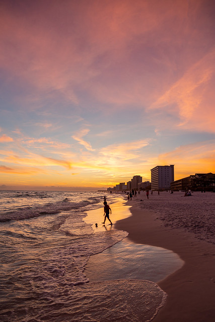
And on our last night there, we went down to the beach at sunset. It was a good way to end the trip before having to make the long drive back up to Arkansas the next day.

The white sands are like sugar, and was very bright in the sunlight. But the sand is actually fine quartz, which arrived here at the end of the last Ice Age. Quartz particles from the Appalachian Mountains were carried down to the coast by the Apalachicola River, about 20,000 years ago.

We spent a few days here with family, going to the beach and eating lots of seafood.


And on our last night there, we went down to the beach at sunset. It was a good way to end the trip before having to make the long drive back up to Arkansas the next day.

Location:
Destin, FL 32541, USA
Thursday, April 20, 2023
New Orleans - City Park
We left the busy and occasionally chaotic French Quarter and took the kids to a quiet and peaceful part of New Orleans - the City Park. Our first stop was the popular and kid-friendly Storyland, which recreates scenes from children's stories like Snow White, Pinocchio, the Three Little Pigs and Peter Pan. Here's a shot of "Willie the Whale" from Pinocchio. It seemed fitting to get a picture of Jonah in the whale...

And here is Elliott, making friends with one of the Three Little Pigs....

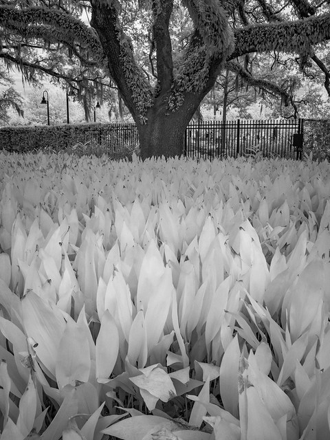
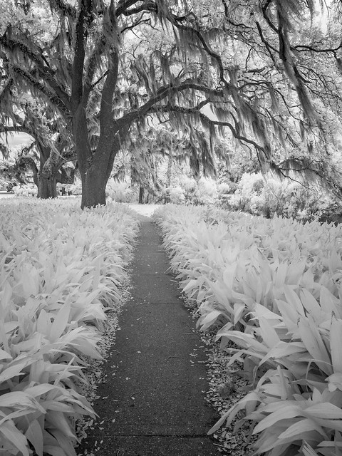
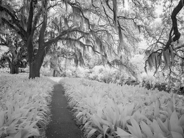
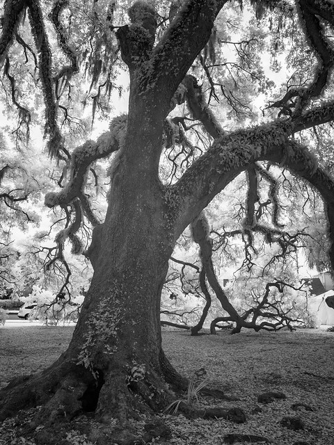
New Orleans City Park is a huge urban park, containing 1,300 acres. Besides Storyland, the park is home to the New Orleans Botanical Garden, the New Orleans Museum of Art, the Louisiana Children's Museum, the Carousel Gardens Amusement Park, a Sculpture Garden, Tad Gormley Stadium and various sports fields. It is also the site of the largest stand of mature live-oak trees in the world. One of the things I really wanted to accomplish during our visit to New Orleans was to get lots of pictures of live-oak trees with the infrared camera. So I'm going to apologize in advance for the large number of tree pictures that are about to show up.

The park is just a short drive (or trolley-ride) away from downtown and the French Quarter. Prior to French colonization, Native Americans used to live on the lands that now make up City Park. The Chapitoulas and the Houmas had trade routes along Bayou St. John, which runs through the park. The bayou was used as a short cut between the Mississippi River and Lake Pontchartrain. In the 1700s, the land was developed into a sugar plantation.


This was also back in the time when dueling was one of the ways people solved their disputes. The garden behind St. Louis Cathedral had been one of the most popular locations in the city for duels, but in the 1850s laws against dueling were being enforced so people moved their quarrel to the city outskirts. That made the bayou in what is now City Park one of the most popular spots. An article published in 1892 wrote that "Blood has been shed under the old cathedral aisles of nature. Between 1834 and 1844 scarcely a day passed without duels being fought at the Oaks. Why, it would not be strange if the very violets blossomed red of this soaked grass! The lover for his mistress, the gentleman for his honor, the courtier for his King; what loyalty has not cried out in pistol shot and scratch of steel! Sometimes two or three hundred people hurried from the city to witness these human baitings. On the occasion of one duel the spectators could stand no more, drew their swords, and there was a general melee."


In 1850, the plantation owner passed away and willed the lands to the city of New Orleans and to the city of Baltimore. After a few years the remaining land was bought by New Orleans, perhaps after a city in Maryland decided it didn't really need all that land in Louisiana? The lands here were designated as a public park, but they went undeveloped for a few decades.
Plans were made in the 1890s to develop the park, which resulted in the eventual construction of landmarks like the Peristyle in 1907 and the Museum of Art in 1911.

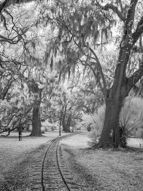

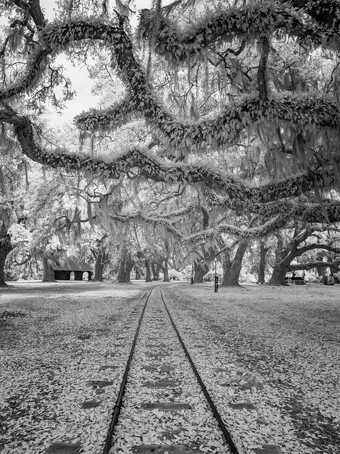
The tracks are for a miniature train that runs for two miles across the park. The train was first installed in 1898.
One of the most popular spots for pictures in the park is the old Langles Bridge, which was built in 1902. There were several people in school robes getting their graduation pictures here that afternoon.

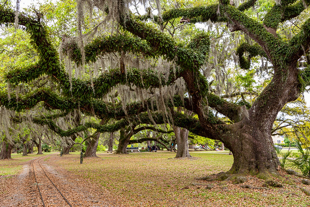
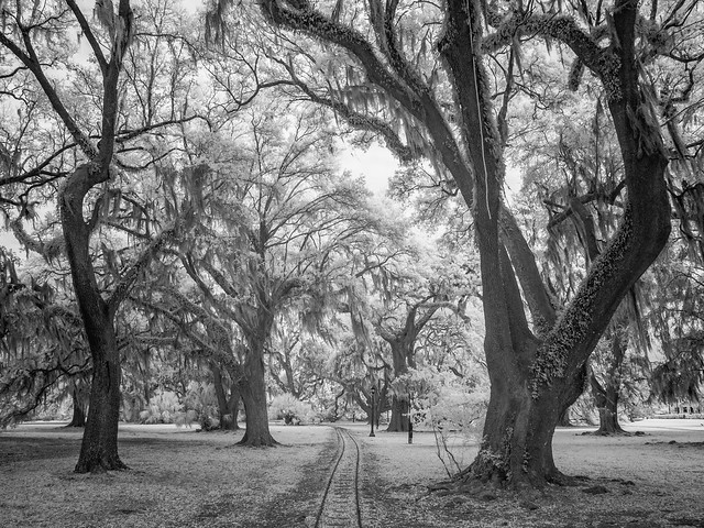
City Park is famous for its live-oak trees. The massive and unique trees are synonymous with the Deep South. Their range stretches from the Virginia coast down to Florida, then west towards Texas. They grow well in salty soils and shade, but they are confined to warmer parts of the country because they can't survive in freezing temperatures. They are also almost considered "evergreen" because they don't drop their leaves in the winter. Instead they gradually replace their leaves throughout the year.
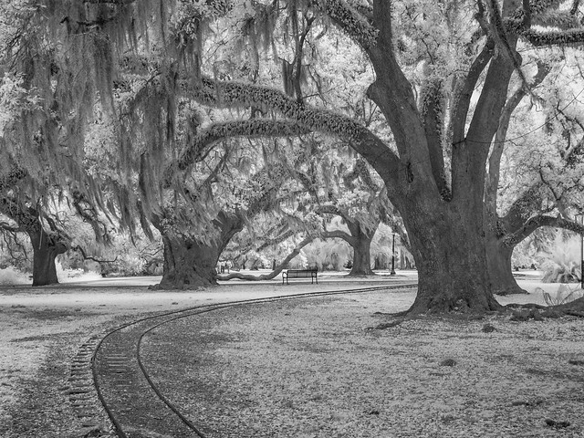
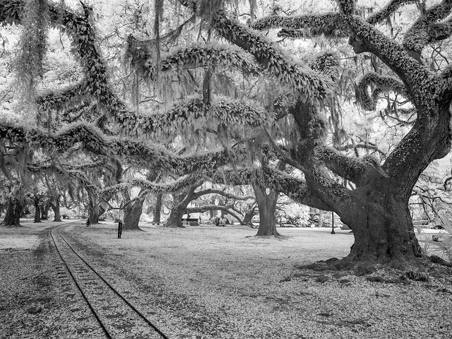
New Orleans City Park contains the largest stand of mature live-oak trees in the world, with some trees believed to be over 700-900 years old. Some of the oldest and largest trees have been named. This is the Anseman Oak, which was named after Victor Anseman. He was the first park manager and superintendent back in the 1890s. In the background of this shot, you can see the mini-train passing by.
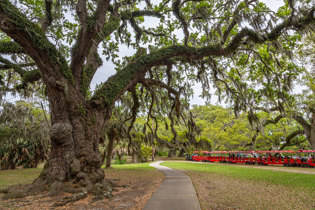
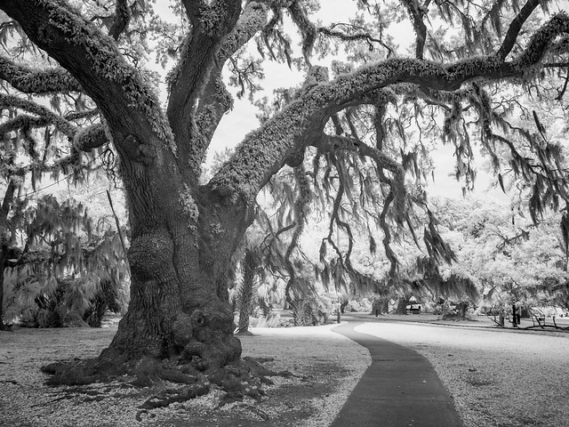
The Anseman Oak is about 700 years old, and stands over 60 feet tall with a crown spread of over 118 feet.
This is the The Butler Memorial Fountain, which depicts a water nymph named Chloe. The bronze statue here was placed in 1929.

Almost the entire park was flooded in the aftermath of Hurricane Katrina in 2005. The cost of the flooding in City Park alone was $43 million, which included damage to buildings, amusement park rides and electrical systems. Some parts of the park sat under six feet of water for several weeks, which resulted in the deaths of over 2,000 trees and the entire plant collection in the Botanical Garden.
Fortunately many of the park's famous live-oak trees survived the flooding, and the park recovered from the damage.


Here is one more shot of the Langles Bridge, taken in a brief time when it was being used for graduation or Quinceanera pictures.


And one last shot from New Orleans City Park. The next day we'd pack up the kids and drive east along the coast towards Florida.


And here is Elliott, making friends with one of the Three Little Pigs....

New Orleans City Park is a huge urban park, containing 1,300 acres. Besides Storyland, the park is home to the New Orleans Botanical Garden, the New Orleans Museum of Art, the Louisiana Children's Museum, the Carousel Gardens Amusement Park, a Sculpture Garden, Tad Gormley Stadium and various sports fields. It is also the site of the largest stand of mature live-oak trees in the world. One of the things I really wanted to accomplish during our visit to New Orleans was to get lots of pictures of live-oak trees with the infrared camera. So I'm going to apologize in advance for the large number of tree pictures that are about to show up.


The park is just a short drive (or trolley-ride) away from downtown and the French Quarter. Prior to French colonization, Native Americans used to live on the lands that now make up City Park. The Chapitoulas and the Houmas had trade routes along Bayou St. John, which runs through the park. The bayou was used as a short cut between the Mississippi River and Lake Pontchartrain. In the 1700s, the land was developed into a sugar plantation.


This was also back in the time when dueling was one of the ways people solved their disputes. The garden behind St. Louis Cathedral had been one of the most popular locations in the city for duels, but in the 1850s laws against dueling were being enforced so people moved their quarrel to the city outskirts. That made the bayou in what is now City Park one of the most popular spots. An article published in 1892 wrote that "Blood has been shed under the old cathedral aisles of nature. Between 1834 and 1844 scarcely a day passed without duels being fought at the Oaks. Why, it would not be strange if the very violets blossomed red of this soaked grass! The lover for his mistress, the gentleman for his honor, the courtier for his King; what loyalty has not cried out in pistol shot and scratch of steel! Sometimes two or three hundred people hurried from the city to witness these human baitings. On the occasion of one duel the spectators could stand no more, drew their swords, and there was a general melee."


In 1850, the plantation owner passed away and willed the lands to the city of New Orleans and to the city of Baltimore. After a few years the remaining land was bought by New Orleans, perhaps after a city in Maryland decided it didn't really need all that land in Louisiana? The lands here were designated as a public park, but they went undeveloped for a few decades.


Plans were made in the 1890s to develop the park, which resulted in the eventual construction of landmarks like the Peristyle in 1907 and the Museum of Art in 1911.


The tracks are for a miniature train that runs for two miles across the park. The train was first installed in 1898.

One of the most popular spots for pictures in the park is the old Langles Bridge, which was built in 1902. There were several people in school robes getting their graduation pictures here that afternoon.

City Park is famous for its live-oak trees. The massive and unique trees are synonymous with the Deep South. Their range stretches from the Virginia coast down to Florida, then west towards Texas. They grow well in salty soils and shade, but they are confined to warmer parts of the country because they can't survive in freezing temperatures. They are also almost considered "evergreen" because they don't drop their leaves in the winter. Instead they gradually replace their leaves throughout the year.
New Orleans City Park contains the largest stand of mature live-oak trees in the world, with some trees believed to be over 700-900 years old. Some of the oldest and largest trees have been named. This is the Anseman Oak, which was named after Victor Anseman. He was the first park manager and superintendent back in the 1890s. In the background of this shot, you can see the mini-train passing by.

The Anseman Oak is about 700 years old, and stands over 60 feet tall with a crown spread of over 118 feet.


This is the The Butler Memorial Fountain, which depicts a water nymph named Chloe. The bronze statue here was placed in 1929.


Almost the entire park was flooded in the aftermath of Hurricane Katrina in 2005. The cost of the flooding in City Park alone was $43 million, which included damage to buildings, amusement park rides and electrical systems. Some parts of the park sat under six feet of water for several weeks, which resulted in the deaths of over 2,000 trees and the entire plant collection in the Botanical Garden.
Fortunately many of the park's famous live-oak trees survived the flooding, and the park recovered from the damage.


Here is one more shot of the Langles Bridge, taken in a brief time when it was being used for graduation or Quinceanera pictures.


And one last shot from New Orleans City Park. The next day we'd pack up the kids and drive east along the coast towards Florida.

Thursday, April 13, 2023
New Orleans - Canal Street
From our hotel in the French Quarter, I made the short walk to Canal Street.

Along the way I passed by the Louisiana Supreme Court Building, which is a large and grand Beaux Arts-style courthouse that was built in 1910. It was built as a replacement to the Cabildo and Presbytère buildings as the seat of local justice in the city.

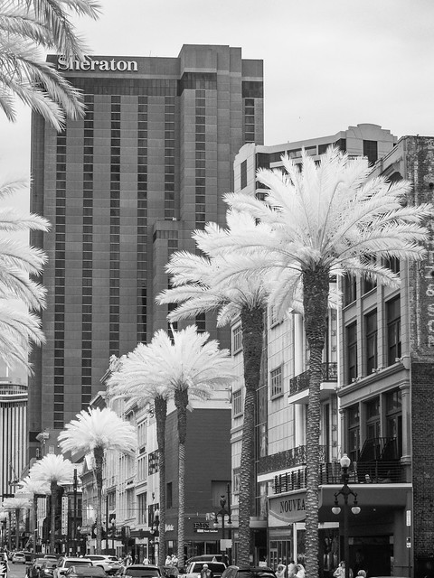
After the Louisiana Purchase, Canal Street became the dividing line that separated the French Creole who lived in the old Vieux Carré from the newer Americans who were moving into the city in droves. The street actually takes its name from a proposed canal that would have stretched from the Mississippi River to Lake Pontchartrain. The canal was never built, but the land that was set aside was turned into a wide street (171 feet) that now has room for six lanes of traffic and two streetcar lines.

Back in the olden days of New Orleans, there were some tensions between the old French Creoles and the new Americans. Canal Street became known as the "neutral ground," where both cultures could safely mix and mingle. In modern times, the term "neutral ground" now applies to all street medians in the city.

Canal Street quickly became the main shopping and entertainment district for the city. Canal Street was one of the first streets in the world to be completely lit by electric lights (joining places like London, New York and Paris). It's also believed that that the very first movie theater in the world (at least the "first business devoted specifically to showing films for profit") opened along Canal Street in 1896.
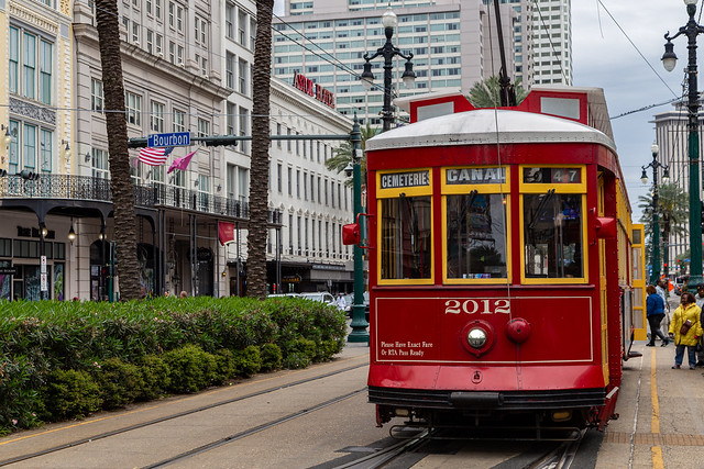
And along Canal Street you can also find the oldest continuously running street railway system in the world. The line first started operating in 1835 (back before Arkansas was even a state), and runs from Canal Street east through the Garden District, Uptown, Tulane, Audubon Park and ends in the Carrolton neighborhood. One discontinued streetcar line in New Orleans was the Desire Line. That line started out on Canal Street and then ran down Bourbon Street towards Desire Street in the Ninth Ward. There it moved over and then ran across Royal Street back to Canal Street. Although it was replaced by bus service, the line became famous thanks to the Tennessee Williams play (and later Oscar-winning movie) "A Streetcar Named Desire."
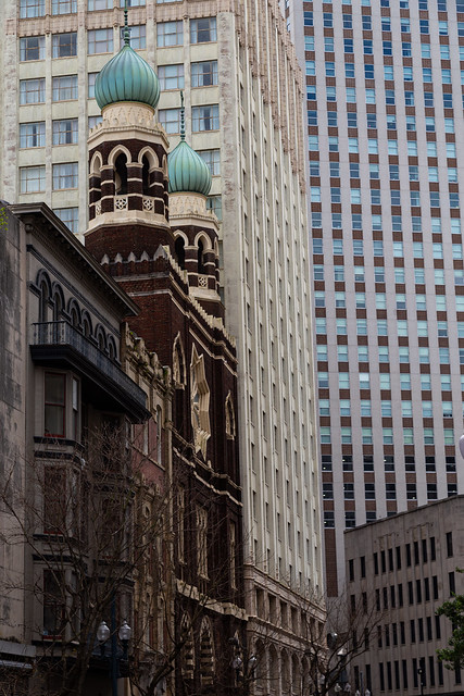
Just off of Canal Street, along Baronne Street, is the old Immaculate Conception Church. The Jesuit church was built in 1930. But it is a near duplicate of an older church that was built on the same site in 1850 that suffered foundation damage.
Nearby was this old sign for the Pearl Restaurant, which served diners for over 80 years but closed in 2015.

And one last shot, of a nearby restaurant that served another famous New Orleans delicacy.

Along the way I passed by the Louisiana Supreme Court Building, which is a large and grand Beaux Arts-style courthouse that was built in 1910. It was built as a replacement to the Cabildo and Presbytère buildings as the seat of local justice in the city.

After the Louisiana Purchase, Canal Street became the dividing line that separated the French Creole who lived in the old Vieux Carré from the newer Americans who were moving into the city in droves. The street actually takes its name from a proposed canal that would have stretched from the Mississippi River to Lake Pontchartrain. The canal was never built, but the land that was set aside was turned into a wide street (171 feet) that now has room for six lanes of traffic and two streetcar lines.

Back in the olden days of New Orleans, there were some tensions between the old French Creoles and the new Americans. Canal Street became known as the "neutral ground," where both cultures could safely mix and mingle. In modern times, the term "neutral ground" now applies to all street medians in the city.

Canal Street quickly became the main shopping and entertainment district for the city. Canal Street was one of the first streets in the world to be completely lit by electric lights (joining places like London, New York and Paris). It's also believed that that the very first movie theater in the world (at least the "first business devoted specifically to showing films for profit") opened along Canal Street in 1896.

And along Canal Street you can also find the oldest continuously running street railway system in the world. The line first started operating in 1835 (back before Arkansas was even a state), and runs from Canal Street east through the Garden District, Uptown, Tulane, Audubon Park and ends in the Carrolton neighborhood. One discontinued streetcar line in New Orleans was the Desire Line. That line started out on Canal Street and then ran down Bourbon Street towards Desire Street in the Ninth Ward. There it moved over and then ran across Royal Street back to Canal Street. Although it was replaced by bus service, the line became famous thanks to the Tennessee Williams play (and later Oscar-winning movie) "A Streetcar Named Desire."

Just off of Canal Street, along Baronne Street, is the old Immaculate Conception Church. The Jesuit church was built in 1930. But it is a near duplicate of an older church that was built on the same site in 1850 that suffered foundation damage.

Nearby was this old sign for the Pearl Restaurant, which served diners for over 80 years but closed in 2015.

And one last shot, of a nearby restaurant that served another famous New Orleans delicacy.
Labels:
Canal Street,
Digital Infrared,
Infrared,
Infrared Black and White,
Infrared Photography,
Louisiana,
New Orleans
Location:
New Orleans, LA, USA
Subscribe to:
Comments (Atom)


