Showing posts with label Delta. Show all posts

Saturday, February 28, 2026

Pickens

If you're driving southeast on Hwy. 65, you dive deep into the Arkansas Delta. You pass miles of farms and fields, which are empty and fallow this time of the year. The road passes over several rivers and creeks, which usually have cypress trees growing up in the still waters. The flat lands are occasionally punctuated by silos, or a rusting old and disused cotton gins.

IMG_1733-2

IMG_1740

Most of the people speeding down Hwy. 65 probably completely miss the small community of Pickens. This was, at one time, one of the largest cotton plantations in the state. It opened in the 1880s, and eventually contained over 20,000 acres of farmland. Here you can find an old plantation house (which was built in the 1940s, replacing one that had been built in the 1880s). And also the old cotton gin, which sits along a busy set of train tracks.

IMG_1784

IMG_1780

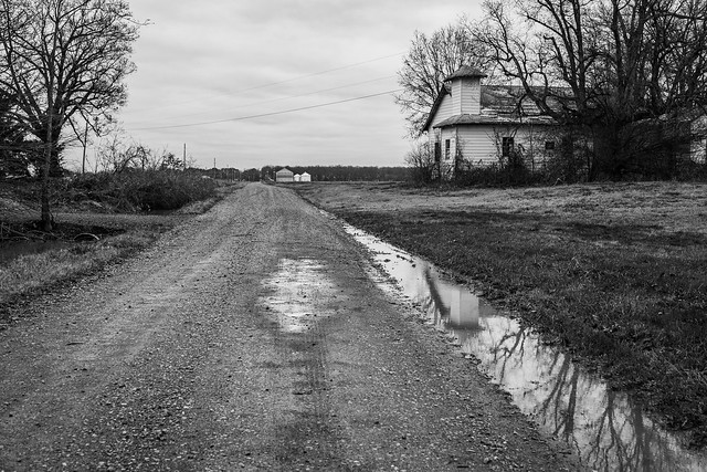
I drove through the fields around Pickens, eventually making it to the edge of Dumas. I stopped at this old building, which sat by and was nicely reflected in this huge puddle.

IMG_1807

And next to it was a spot where a house must have once stood - it's long gone except for this fireplace and chimney.

IMG_1818-2

And from there I headed back towards Pickens. Besides the old house and the cotton gin, there is also an old building that once housed a mercantile store and the commissary. It was quiet when I drove by, but the building is now home to a restaurant serving southern cooking that is so good that it's said that diners from as far as Pine Bluff and Little Rock make the drive to eat here.

Just down the road, I stopped to get a shot of these new silos sitting behind an old and weathered farm building.

IMG_1837-4

The 20,000 acres of the Pickens Plantation were harvested by tenant farmers and sharecroppers. They tilled the lands with mules, and families lived on the land in sharecropper cabins. It's hard to know how many people once lived here, but in the late 1940s there were over 400 houses on the plantation grounds.

But in the 1950s, mechanized farming was introduced to the Delta. Now a tractor could do the work of the sharecroppers, and all those homes were soon left empty as people went off to find jobs elsewhere. Of those 400 homes that once stood here, almost all of them are gone. Only one remains.

IMG_1844-2

Along a lonely and quiet dirt road sits one last sharecroppers house. The wood is worn and cracked, and the metal roof is peeling off and full of holes. 

IMG_1764

IMG_1776

IMG_1848-2

The sun was setting, and I set up the camera on the tripod. I wanted to get some star trails over the old house, so I waited by the camera as it got dark. But I wasn't alone out there. In the breeze, there was the unforgettable aroma of a skunk. I wasn't sure where it was coming from exactly, and I nervously glanced over at the old house. Could it be the new home of a skunk - one who was not happy about some rude paparazzi getting pictures of its den? At one point I heard something rustling around in the tall grass by the house. I nervously shined the flashlight on it, only to see an armadillo walking around. Thankful I wasn't about to get sprayed by a skunk, I turned off the light and the little armadillo went about its business.

Eventually it was dark enough to start taking pictures for the star trails. The camera sat out there for a little bit over two hours, continually taking photographs of the sharecroppers house and sky above. When I got home later I combined all the shots together, and got this result:

StarStaX_IMG_1877-2-IMG_2128_lighten-Edit-4

Sunday, January 16, 2022

Driving In The Delta

There are several old buildings in the flat Delta lands around Scott and Keo that I like to revisit whenever I'm able, just to see how they are doing. Just outside of Scott is this old sharecroppers home, which isn't in great shape. A storm blew off part of the roof a few years ago, and the roof has slowly deteriorated since then. It's sad to see.

IMG_4751

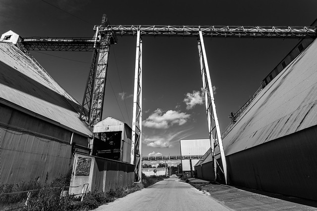
And for comparison, the same place in 2017:
Scott

This is the side of the house, with vines that have crawled up the faded woodwork.

IMG_4755

On the other side of Scott was this old building, which I'm not sure what it's purpose was. But it does look like someone tried to recently burn it, part of the outside had some scorch marks. People are awful sometimes.

IMG_4772

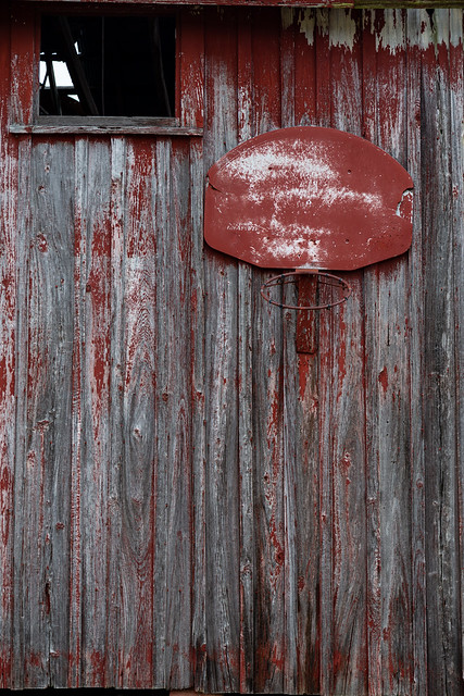
On the side of the building was this rusted old basketball hoop. Wonder how many people used to slam dunk on this back in the past.

IMG_4778

The old building is an interesting collection of colors and textures.

IMG_4790

South of Scott is an old church that I've taken pictures of many times over the years. It seems to have been abandoned for awhile. But the church is still being used. The front of the church has become an extension of the cemetary, and a few new graves have been added over the years. No one attends service at the church anymore, but the congregation is slowly returning.

P1024759

I headed down the road, and passed by the site of the former Paradise Church (as noted in the previous post on this blog). Beside the scorched ground where the church once stood was this outbuilding. Which may have been bathrooms, or maybe storage.

IMG_4826

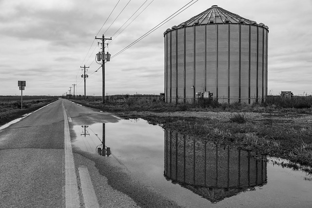
I started driving to Keo and had to stop the car to try to get a shot of this metal silo reflected in a puddle on the road. It was a cold day when this was taken, with temperatures actually below freezing. In my haste to leave, I forgot to bring a coat so I'd only be able to take a few pictures outside before having to rush back to the comfort of the heated car.

IMG_4842

I made it to the small town of Keo, and stopped at this old store that has also been left closed and abandoned. The front was reflected in a large puddle.

IMG_4846-6

And a color version of the door and one of the windows...

IMG_4852-2

While in Keo I stopped again for this old church, which also looks like it isn't open anymore.

IMG_4922-3

I went by another one more church, this one just south of Keo. I'm not sure how long this one will be standing. Part of the roof has collapsed, exposing a huge hole that is allowing rain to pour through.

IMG_4909

And finally one last shot from the church, of the closed and rusty side door that I'm guessing led to the preacher's office. There is a bit of snow on the concrete steps, joining the chill winds that blow through the empty building and its quiet sanctuary.

IMG_4868

Thursday, August 5, 2021

Out By Scott

I wanted to take the new infrared camera out for a few more pictures, so I took a few hours off work to drive through the flat Delta lands around Scott and Keo. There are lots of old abandoned structures out there, and a few swamps too. Plus the day was going to be somewhat cool (only in the 80s, much better than the nearly 100 degree temperatures that would happen later that week).

The first stop was just outside of Scott, in a spot near the old Marlsgate Plantation and Bearskin Lake.

Delta

Delta

Delta

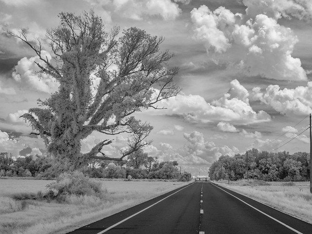
Driving further down the road, I passed by this old tree that was growing right alongside the pavement.

Delta

I turned off the main road and went onto a bumpy and dusty gravel road that cut through the middle of soybean fields.

Delta

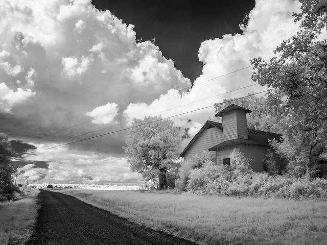
The road eventually ran by this old church, which looks to have been abandoned for quite awhile. The cornerstone on the church said that it had been built in the 1960s. There's no telling when it was abandoned.

Delta

Delta

Delta

I headed back to the main road, which then ran by this orchard of pecan trees. I pulled over for a few more pictures.

Untitled

Untitled

South of Keo was this batch of metal silos, which had a tractor parked nearby.

Delta

Just down the road was another old church, which also looks like it has been abandoned for some time. Part of the roof looks like it has collapsed, and hundreds of wasp nests guard the doors and interior (I wasn't brave enough to go inside).

Delta

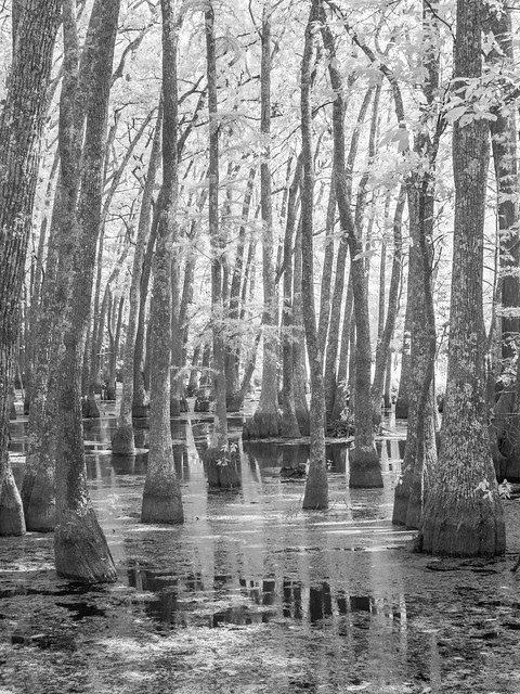
The next stop was an oxbow lake, which was once the main channel of the Arkansas River. It it's now closed off and home to thousands of tupelo and cypress trees.

Delta

Untitled

Since I was in the neighborhood, I decided to drive over to Pecan Alley, a stretch of road that is lined with century-old pecan trees. Unfortunately, it looks like a recent storm did some significant damage on the trees here. Several trees had been knocked down, and many had lost big limbs.

Pecan Alley

Just down the road is another abandoned church, one that I've been taking pictures of for many years. So I made one more stop, and got this view from under a large tree that casts shade over a few graves in a small cemetery.

Delta

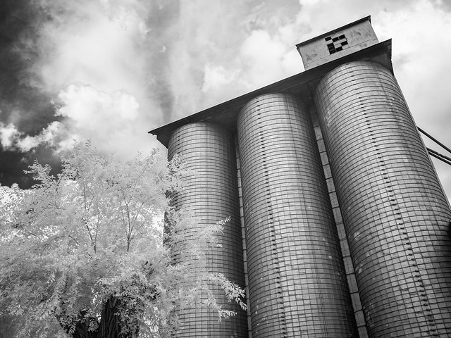
I drove by another set of silos, the same ones that I took a star trail picture at earlier this year. The silos were surrounded by grass and soybean fields.

Delta

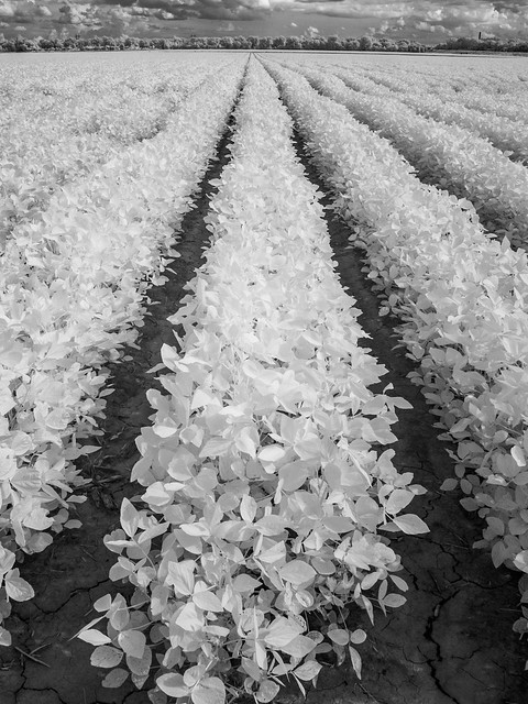
The soybean fields stretched off towards the horizon, which looked kinda neat in infrared.

P7120379-2

It was time to head back home, but I made one last stop at the old silo which seems to tower over all the old buildings in Scott.

P7120402

Thursday, September 17, 2020

Helena

From Elaine, I headed north through the flat Delta lands and made it to the city of Helena-West Helena. Helena is another city that bears the burden of the modern Delta. It is an old city, but a place that most people in Arkansas seem to have forgotten about. Helena has a deep history: It was an important city during the Civil War (but is overshadowed by Vicksburg downriver), and it was one of the places that helped birth the Blues (but is overshadowed by Mississippi, which soaks up most of the attention dedicated to musical heritage).

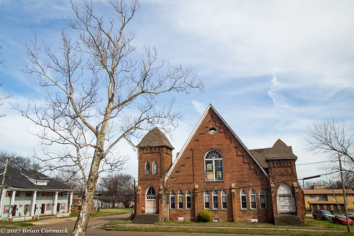
There are lots of historic buildings here. But like so many other places in the Delta, Helena-West Helena has struggled economically. There are unfortunately many old buildings in downtown Helena that are empty, abandoned and crumbling. These buildings are fragile, and many of them were severely damaged by a storm earlier this year. One of the victims, tragically, was the old Centennial Baptist Church.

IMG_4823-2

The church was built in 1905 and is listed on the National Register of Historic Places. The Gothic Revival church had been a vital centerpiece to the African American culture of the city, and efforts had been made to renovate the church. It’s hard to imagine what could be savaged, but hopefully the old church can somehow be preserved. Here’s a view of the church from a few years ago...

Centennial Baptist Church

From there I drove by through the old industrial section of the city, which is populated with some old factories and mills. Some of the buildings were abandoned, including this one sitting beneath a tower that stretched up like a skyscraper.

IMG_4840-2

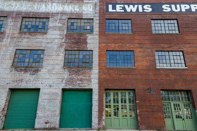
The road passed between these two buildings, which probably aren’t being used anymore.

IMG_4847

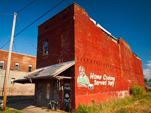
Closer to downtown was the old Bullock’s Soul Food Cafe, which is unfortunately closed and the building is abandoned. I wish the restaurant was open because it probably had some amazingly good food.

IMG_4860-2

Vines have covered most of the side of the building, which proclaims “Home Cooking Served Daily.”

IMG_4861

And a picture of the same building from a few years ago. The older buildings across the street that were in the background of this picture have been torn down (one of those buildings used to house an old blues joint called The Kit Kat Club that Robert Johnson played at in the olden days. It’s a vacant lot now).

Bullock's

The city of Helena was laid out in 1820, at a spot where the low hills of Crowley’s Ridge met the Mississippi River. The city was formally incorporated in 1833, and would grow to become an important spot for steamboats on the river since it sits between Memphis and Vicksburg. In his book “Life on the Mississippi,” Mark Twain would describe Helena as being “one of the prettiest situations on the Mississippi.”

By 1860, Helena was the largest city in Arkansas along the Mississippi River. As a river town, Helena was known as a wild town with its fair share of crime, gambling, prostitution and violence. During the Civil War, US troops quickly captured the city in 1862 because of its strategic location along the Mississippi River. In 1863, Confederate troops tried to retake the city but suffered significant losses. The city remained in Union control for the rest of the War, and it became home to significant numbers of freed and escaped slaves.

In the early days of the city, most of the commercial district was along Water Street. But the street lived up to its name - in 1867 a major flood washed away most of the buildings. The waters of the Mississippi eroded the riverbank until Water Street was itself underwater. By 1880, the core of the city’s commercial district moved to Cherry Street.

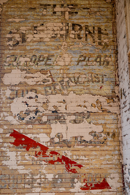
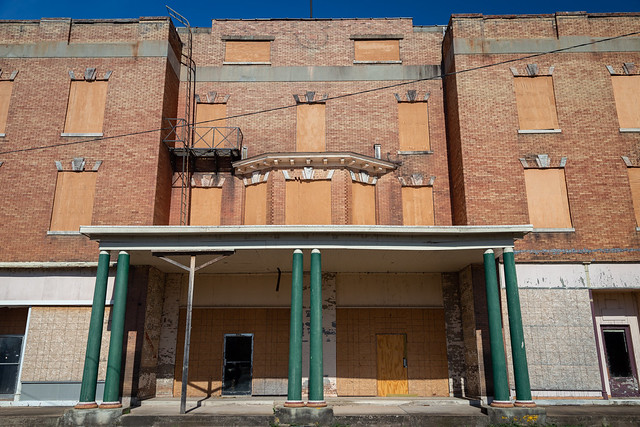
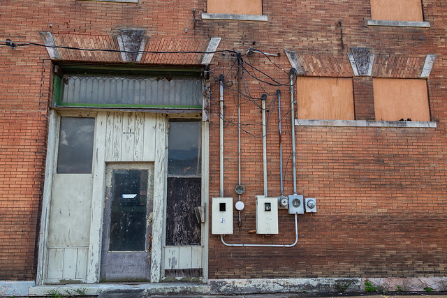
Today, old buildings line Cherry Street for several blocks. One of the most prominent is the old Cleburne Hotel, which was built in 1905. The hotel is empty now, and the windows are boarded up. But if you look close, you can still see an old sign promoting the hotel’s services (which includes a European Plan and even a breakfast for just 25 cents).

IMG_4865-2

IMG_4871-2

And a wider shot of the front of the hotel. I would love to be able to go inside to take pictures.

IMG_4875-2

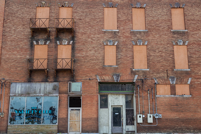
And the side of the hotel, where it looks like there used to be a space for a variety club.

IMG_4881-2

IMG_4898-2

IMG_4892-2

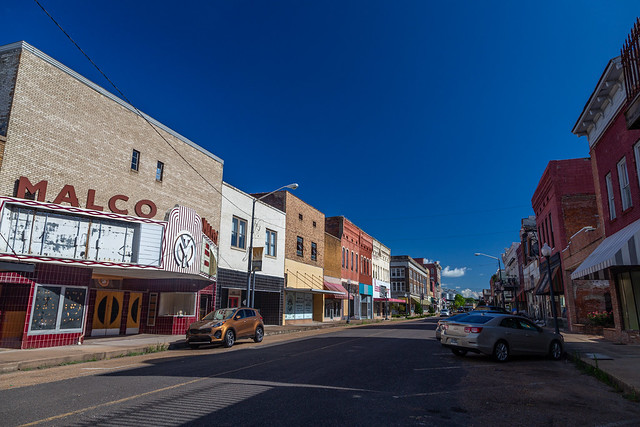
And the view looking down Cherry Street, where unfortunately a few of the older buildings were damaged in the storm a few months ago.

IMG_4906-2

Between Cherry Street and the Mississippi River levee is this old building, which looks to have been abandoned for several years. Vines have shrouded much of the exterior of the building.

IMG_4921-2

IMG_4930-2

A few blocks away was this building, where it appears half of it is disused while the other half is used and open (for a quaint looking coffee-shop). The mix of the two kinda looks like a building version of Twoface from Batman.

IMG_4943-2

Further down the road is the intersection of Cherry and Missouri Streets. It was a quiet afternoon when I was there, with little traffic cruising through the summer heat. But that was not the case a century ago, when a tragic incident occurred here. The Encyclopedia of Arkansas History states: “On December 23, 1920, in what one newspaper called ‘One of the most dreadful tragedies that the Negroes of the City of Helena has [sic] ever been called on to witness,’ Professor J. W. Gibson was killed by a night watchman in Helena (Phillips County). Depending on how the word “lynching” is interpreted, this may have been an incident of police brutality, or Professor Gibson may in fact have been lynched.” For more on this, click HERE.

IMG_4950-2

If you travel down Cherry Street you will soon reach the historic Phillips County Courthouse. The courthouse was built in 1915.

IMG_4968

In the park across the street from the courthouse is a new memorial to the victims of the Elaine Massacre of 1919.

IMG_4962-2

There are also signs in the park commemorating the seven Confederate Civil War generals who were from Helena. What is not commemorated was another piece of history - a lynching that occurred in this park. In 1921, the body of a man was taken from an ambulance and burned in this park. The Encyclopedia of Arkansas again has all the gruesome details HERE.

A few blocks away was this sign, still promoting a store that seems to have shut down long ago.

IMG_4984-2

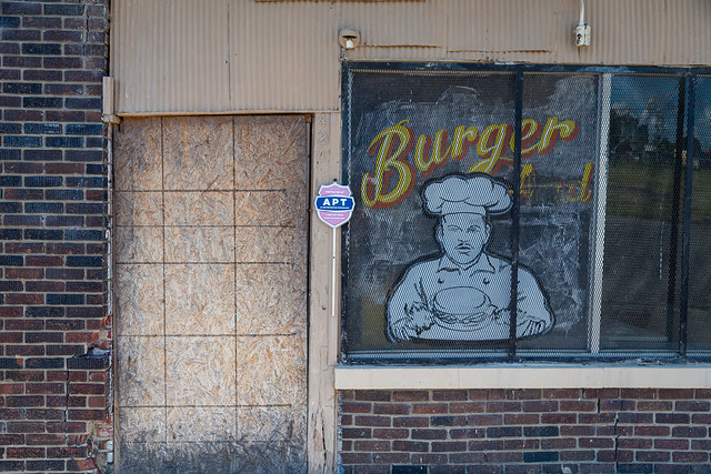
And a few last shots, before heading back home. I drove by this old restaurant, which was unfortunately closed. It made me really hungry for a burger.

IMG_4988-2

IMG_4995