Monday, June 10, 2019

Triple Falls

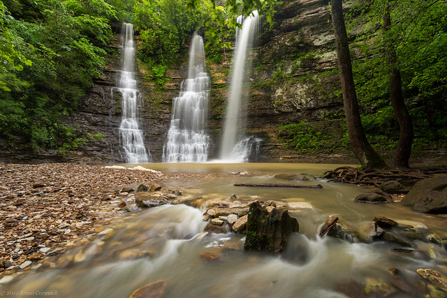
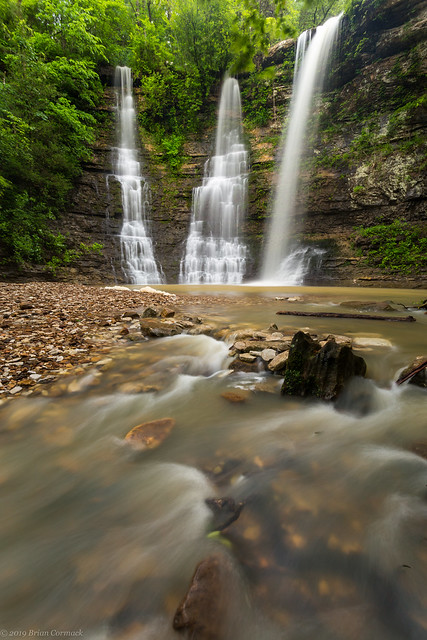
Triple Falls might be one of the most popular waterfalls in the state. It's easy to see why - they are incredible scenic, and relatively easy to reach (the trail is very very short, but the drive down the mountain is steep and bumpy and could require a 4-wheel drive vehicle). The falls are almost 50 feet tall, and can be quite beautiful if you catch them with a lot of water.

Triple Falls

I've not had the best of luck at this waterfall over the years. I've made several visits here, but had only been here once before when there was any water in the falls. All the other times, the falls were just barely running. They could rename it Trickle Falls since that is what it usually looked like. But last week a heavy storm dumped a lot of rain in the area, and it got the falls (and the nearby Buffalo River) up and running again. I managed to get there in time to catch the falls while they were still running and managed to get a few shots....

Three's Company

Triple Falls

Triple Falls

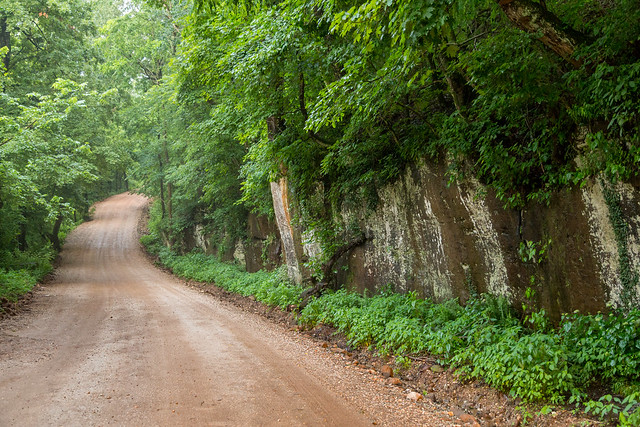
It was starting to get dark so I made the short hike back to the car and made the steep ascent up the mountain. The road was a bit muddy in parts after the rains, but my little car made it up successfully. I did stop along the way, and got one last shot from the road:

Untitled

Thursday, June 6, 2019

Arkansas River Flooding

Heavy rains struck Oklahoma last month, which overwhelmed the lakes there. In order to avoid damage to the dams, they began releasing significant amounts of water into the Arkansas River, which has since made its way downriver to us here in Arkansas. This has resulted in some extreme flooding, which has set records across the state. But it has been a slow moving disaster, with the water slowly moving from Fort Smith to Ozark to Dardanelle to Morrilton to Conway to Little Rock and now on towards Pine Bluff and Pindleton and then eventually the Mississippi River (which is also flooded).

This is a shot of the swollen Arkansas River, at the base of the Clinton Presidential Library in downtown Little Rock. The small bridge here usually connects to a small island, which was completely underwater. This was taken before most of the flood waters made it to Central Arkansas. When the river crested yesterday in Little Rock, that bridge was fully submerged.

Flooded

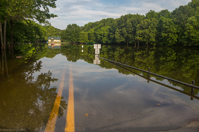
Flooding didn't just occur along the Arkansas River, other streams and rivers that flow into the Arkansas were flooded with back-flow. The Little Maumelle River was flooded, and completely inundated Pinnacle Mountain State Park. This calm lake is actually usually a field, along with a parking lot and playground. Everything was under several feet of water.

Lake Pinnacle

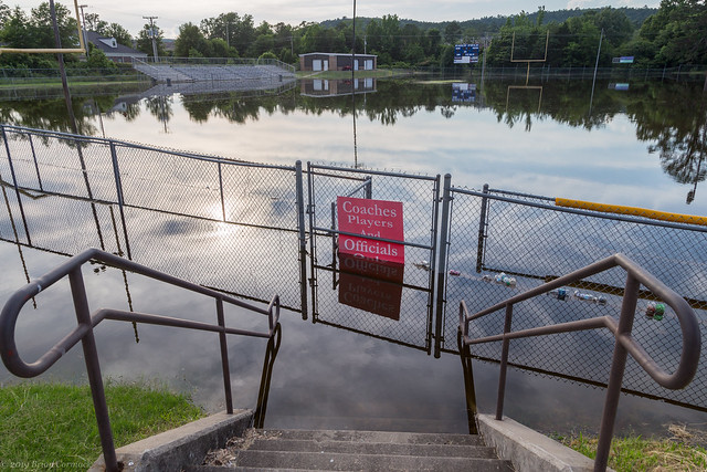
The Little Maumelle River also flooded a few other places in west Little Rock, including the football field at the Arkansas Baptist Preparatory School.

Ark Baptist

Ark Baptist

And the baseball fields, also completely flooded:

Soaked

The flooding was strange, in that it is a statewide disaster but one so closely and narrowly confined. Last weekend I took Jonah to visit the Funland Amusement Park at Burns Park in North Little Rock, which was open despite over half of Burns Park being closed due to the flooding. It's weird to see a disaster, but then once you get to higher ground there doesn't seem to be anything wrong.

In downtown North Little Rock, the river was taking over Riverfront Park (which wasn't really riverfront anymore, I guess it should be River-under Park).

Riverfront Park

Not really Riverfront anymore...

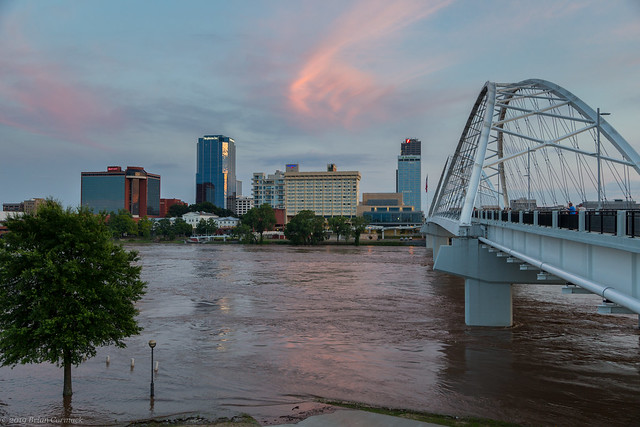
This is the view looking towards the Little Rock skyline by the Broadway Bridge.

Little Rock

And for a comparison, here's a shot taken from about the same spot a few years back, when the river wasn't as high:

Little Rock

And a closer view of the muddy waters passing under the bridge:

Broadway

There was a pretty nice sunset, as the sun dropped below a large thunderstorm off in the distance (but unfortunately, the storm was actually over the Dardanelle area, where a levee along the river had breached a few days before).

Untitled

The sunset lit up the sky above the downtown skyline, with a soft pink that was reflected in the muddy floodwater.

Untitled

The Junction Bridge remained open during the flooding, which provided a great and up-close view of the flood waters. It was a little unnerving having the river be that high and that close to the bridge. You could definitely hear a dull roar coming from the swiftly flowing water.

Flooded

For another comparison, here's a shot taken in April from the bridge. The river was much calmer back then.

Little Rock

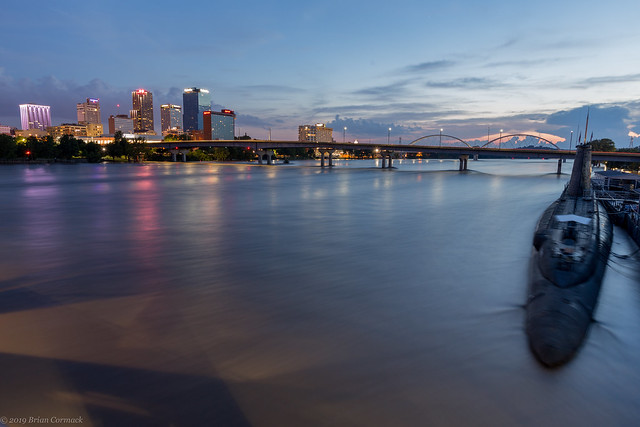
The high waters rushed by the USS Razorback submarine, which looks slightly blurry in this shot since it moved so much during the long exposure.

Untitled

The submarine is part of the Arkansas Inland Maritime Museum, which was obviously closed as it was slowly engulfed by the river. The foreground of this shot is the parking lot, which was under several feet of water. It was reassuring to see that the seawall in North Little Rock was keeping the floodwater from stretching further into Argenta.

Untitled

A few nights later, I headed back downtown to get a few shots right before the river crested. I drove behind Little Rock City Hall and went by the Broadway Bridge again.

Broadway

And for another comparison, a view of the Broadway Bridge back at normal river levels:

Broadway

And a wider shot, as the flood waters swamped the trees that grow along the riverbank.

Untitled

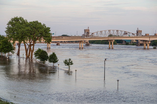
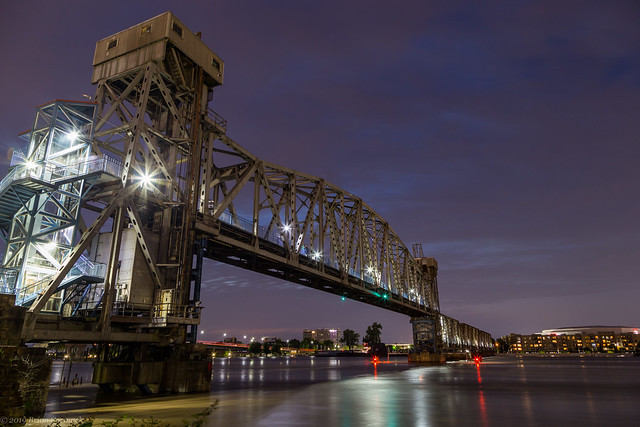
And then a view of the floodwaters at the Junction Bridge, taken just after sunset.

Junction Bridge

And for comparison, a shot taken from nearly the same spot last year. The barge bumpers by the bridge are completely submerged, with the red lights on the far bumpers still shining even though they are nearly underwater now.

Blues

And another view of the bridge, which was not showing a light display during the flooding.

Flooded

And another comparison view, of a shot taken a few years ago. You can see the barge bumpers here which are still underwater.

Junction

And one last shot - of the trees along the riverbank. They are usually rooted in solid ground, but were being immersed in floodwater. I got a few pictures while being attacked by mosquitoes, which unfortunately were not carried away by the floodwaters.

Flooded

Friday, May 31, 2019

Scott and England

Last weekend my friend John had to run an errand in Scott, so I was happy to tag along. The flat and swampy lands around Scott and England contain a plethora of neat things to point the camera at, including several old and abandoned churches. This one, south of Scott, was flanked by two overgrown bushes. The front door was guarded by thick clouds of wasps, so I didn’t dare step any closer.

Delta

The church is surrounded by fields, which were being tilled for planting (guess the rainy Spring delayed them getting the fields ready?).

Delta

Delta

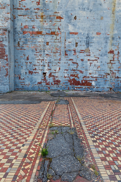
We drove to the small town of England, which has a population of about 2,800 (people, not mosquitoes). In the center of town was this vacant lot, which still retained a few hints of the building that used to stand here. This stretch of tile remains, sitting in the shade below a faded blue wall.

England

Delta Blues

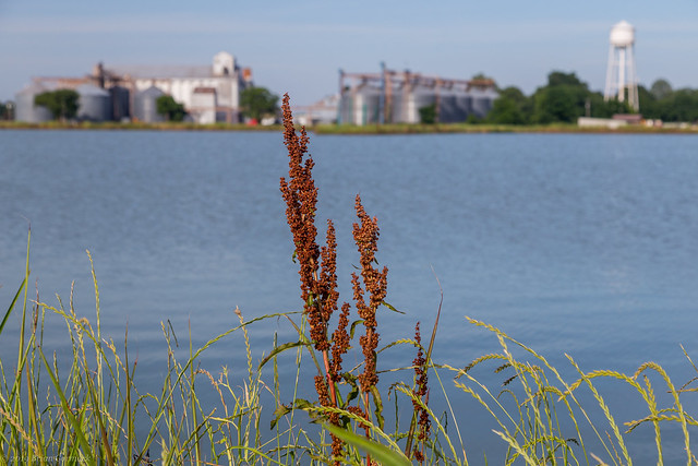
We stopped and tried to get a few shots of the England skyline - these huge elevators that tower over a small fishing lake.

Delta

And one last shot – on the way back home we passed by this car that was slowly being consumed by weeds (it was parked on the edge of a salvage yard).

Door Ajar

Wednesday, May 29, 2019

Ireland - 20 Years Ago

I know this is about to make me sound really old, but it was exactly twenty years ago that I was nearing the end of one of the greatest trips that I've ever been lucky enough to experience. It was a study abroad trip to Ireland, taken while I was just a wee young lad (or really just after finishing my sophomore year of college at the University of the Ozarks). I went through a grand total of forty rolls of film on the trip, all taken with my trusty Pentax ZX-50. Looking back, it's amazing how much photography has changed in the last two decades. I remember buying a bunch of film in bulk before the trip, then worrying if they were all going to be ruined by airport X-rays. When I got home, I went to get the film developed and it cost about $8 per roll, so I ended up spending over $300 before I could even see if any of the pictures turned out.

I've spent the past few weeks going through all my old negatives and scanning them, which is a bit tedious but it's been interesting to look back at some of these old pictures. So here are a few pictures from Ireland in 1999, along with our little bonus excursion to Paris and London (to see more, I did a much more detailed write-up of the trip in 2009 HERE HERE HERE HERE and HERE).

May 21, 1999: On our first full day in Ireland we headed north and visited Newgrange, and then the Hill of Tara. This is a view of sheep grazing at the Hill of Tara, which was the home of the ancient High Kings of Ireland from around the 1st through the 12th centuries (there are also Neolithic passage tombs here that date back to 2500 BC). This was taken while standing on the site of Teach Chormaic (or Cormac's House). Cormac mac Airt was one of the most famous of the High Kings of Ireland, and is credited with building many of the historic sites at the Hill of Tara (and is also possibly a distant relative?).

Hill of Tara

While there we also went by this neat old church, which was built in the 1820's. It's now used as the Hill of Tara's visitor center.
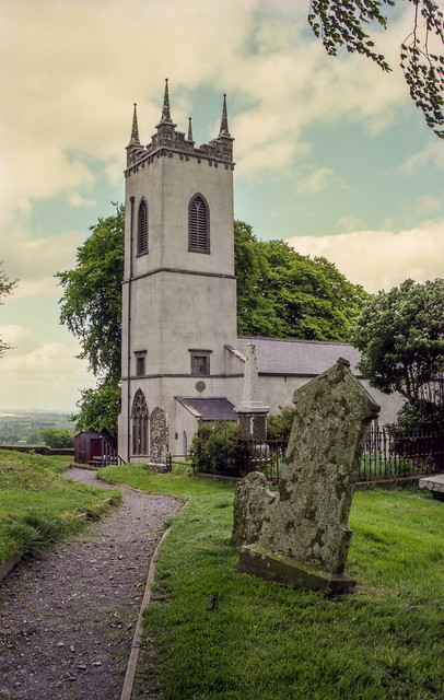
Hill of Tara

May 22, 1999: We did a tour of Dublin, and went by a few landmarks. This is the stately Custom House along the River Liffey. I wish I could have gotten a better view for this, but it was taken from the window of a bus.

Custom House

This granite archway sits at the entrance to St. Stephen's Green. The arch was built in 1907, and through it you can see the busy traffic around Grafton Street.
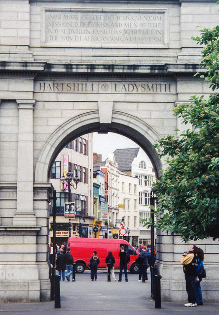
Fusiliers' Arch

May 23, 1999: Our group did a day trip south to the historic city of Kilkenny, which dates back to the 6th century.
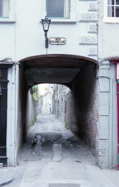
Kilkenny

We walked to St. Canice's Cathedral, which was built in the 13th century. The 100 foot tall Round Tower next to it was actually built sometime in the 9th century (you can usually go to the top but it was closed when we were there).

Kilkenny

May 24, 1999: We again drove south and visited the ruins at Glendalough, which was one of the highlights of the trip. Glendalough contains the ruins of an old monastic settlement that was first established in the 6th century. This is the view looking up at the century-old Round Tower, which is amazingly well preserved. I used up several rolls of film here.

Glendalough

And a small path, cutting through the woods at Glendalough. I've spent the past twenty years trying to imagine just where this path leads (hopefully not just to the maintenance shed or something like that).
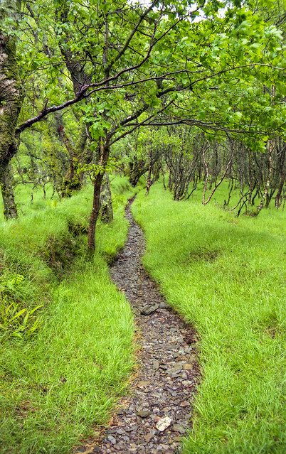
Glendalough

May 25, 1999: We headed to Limerick and did a tour of King John's Castle, which was built in the early 13th century. This is the view from beside the castle, as the River Shannon flows by an old bridge and a Gothic church which were both built in the 1830s.
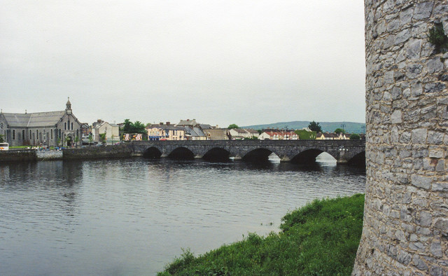
Limerick

May 26, 1999: Our bus somehow navigated the narrow roads around the Dingle Peninsula, which juts out into the Atlantic Ocean in the southwestern corner of Ireland.

Dingle

I love this place. It has been twenty years, but this is still one of the most breathtakingly beautiful places I've ever visited.
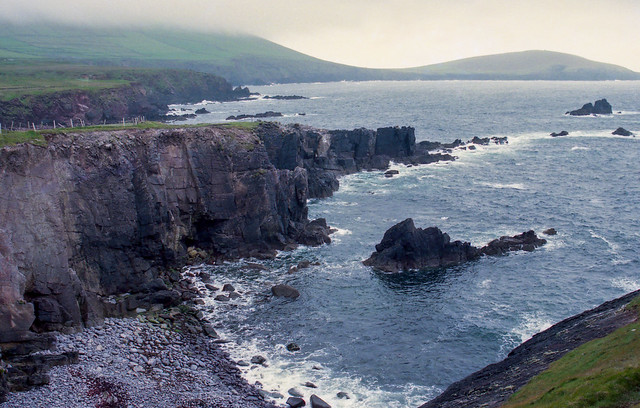
Dingle Peninsula

Whenever we win the lottery, we're getting a cottage here.

Dingle

May 27, 1999: We spent the morning at Bunratty Castle, which was built in the 1400s. This is the view from one of the castle towers, looking towards the Ralty River.
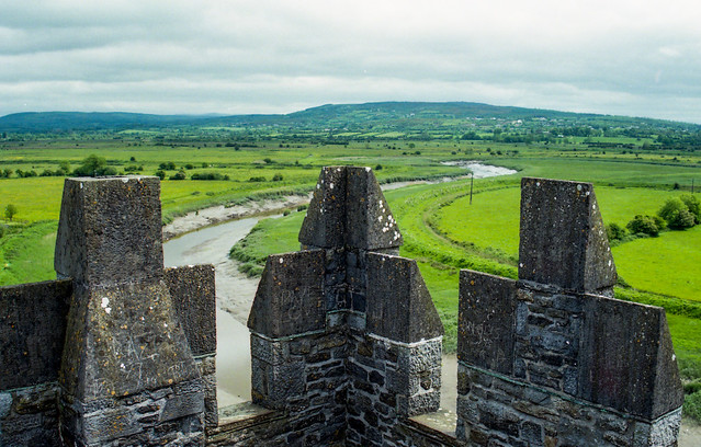
Bunratty Castle

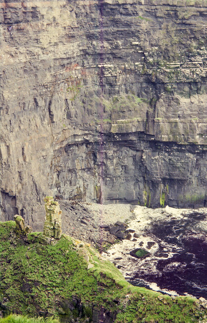
And then we went and visited the Cliffs of Moher, which were amazing. The cliffs are so massive (about 700 feet high) that you can't even hear the sound of the waves crashing into the rocks below.
Cliffs of Moher

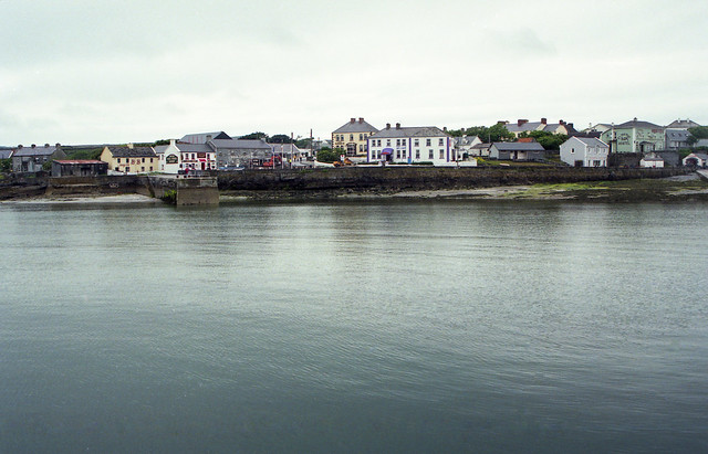
May 28, 1999: Our group next boarded a ferry and headed to Inishmore, which is the largest of the three rocky and windswept Aran Islands. The Aran Islands are known for their isolation and culture, and also because you can still find many people who still speak Gaelic. Our minibus driver who took us around the island taught us some Gaelic, which was mostly curse words (for example, Póg mo thóin means “kiss my arse”). This is the view of the village of Kilronan, the largest settlement on the island.
Inishmore

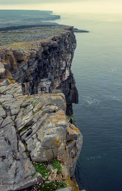
We went by Dún Aonghasa, which is a prehistoric stone fort that was built sometime in the 2nd century BC. Since I live in a place where the oldest building is from the 1820s, it was amazing to be standing in a place that has been around for that many centuries. The stone fort, which is very well preserved, sits atop these tall bluffs and enjoys a great view of the ocean.
Dún Aonghasa

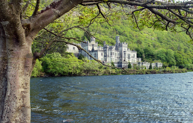
May 29, 1999: We next headed north, and stopped at the stately Kylemore Abbey. The abbey was built in 1868 and is now used as a school by Benedictine Nuns.
Kylemore Abbey

And a shot of the road, taken while we headed north towards Sligo.
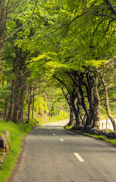
Ireland

May 30, 1999: The next day we drove from Sligo to Dublin (which still amazes me that you can drive across an entire country in just one morning). We toured St. Patrick's Cathedral and then walked along O'Connell Street, passing by the General Post Office. The GPO was built in 1818, and was nearly destroyed in 1916 during the Easter Rising.

GPO

Nearby is the Ha'Penny Bridge, a pedestrian bridge over the River Liffey that was constructed in 1816. This is the view looking east...

Ha'Penny Bridge

And the view looking west...

Ha'Penny Bridge

May 31, 1999: Unfortunately, this is was the end of our time in Ireland. But a few of us managed to tack on a few extra days on our trip and added a side trip to Paris and London. So on this morning we flew from Dublin to London, then took the Chunnel train to Paris. We checked into the hotel, then walked towards the River Seine.
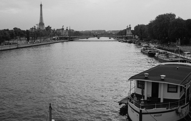
Paris

June 1, 1999: We had lousy luck when we were in Paris. Our visit there was at the same time that half the city was on strike. Most touristy places were closed (like the Louvre and the Arc de Triomphe), but one of the few places that was open was the Eiffel Tower, and we managed to get tickets to go up to the top just before sunset.
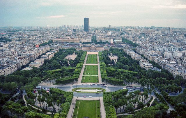
img137-2

img098-2

June 3, 1999: We had travelled back across the Channel and were back in London. Looking back I wish we were able to see more of London, but we did manage to see Trafalgar Square:

img138

And Parliament:

img139-2

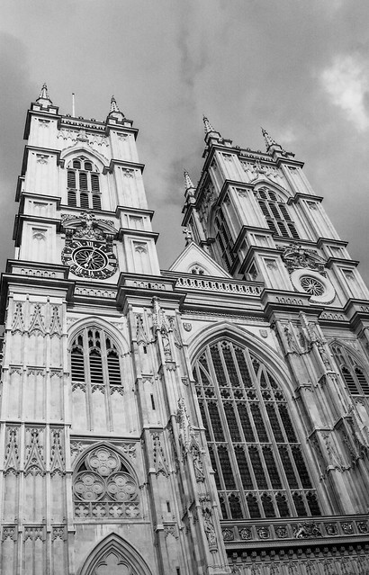
And Westminster Abbey:

img143

June 4, 1999: And one last shot from the trip, from Buckingham Palace. Unfortunately, the Queen did not invite us in for tea, for some reason.

img145-2

It's been way too long since I've taken these pictures, which means that it's the perfect time to make a return trip, right? How much are plane tickets to Dublin????