Monday, February 25, 2008

Trying to reach the great Twin Falls of Richland Creek

There is one waterfall that has long been on my list of places that I need to visit. It is supposed to be one of the more spectacular falls in the state. The falls aren't that tall, but are quite scenic. They are also incredibly difficult to reach. The falls are the Twin Falls of Devil's Fork, located in the Richland Creek Wilderness Area of the Ozark National Forest. The falls are where two separate creeks flow right next to each other and then shoot over a 20 foot tall cliff, finally meeting up and then flowing into Richland Creek. There are two ways to reach the falls, one is shorter and slightly easier, but it requires you to cross two creeks. The other is longer but more scenic. Both are rated as a "difficult bushwhack." There really isn't a set trail to reach the falls, so any attempt to reach it involves a bushwhack through some rough terrain. The view once you get there is worth it, apparently. I opted to do the shorter trail.

It had been a bit dry around here for a few weeks, and my last attempt at chasing waterfalls found them running a bit low. I made plans to head up to the falls anyways, counting on some rain to help get some volume in the falls. I was right that there would be plenty of water. It just turned out there was a bit too much.

Richland Creek is located about 40 miles north of Russellville. So I woke up early (very early for me) and headed west. It had indeed started raining, which I wasn't too worried about. I carry an umbrella with me to shield the camera, and don't mind hiking all that much when it's raining. The radio was predicting some heavy storms, though not until the afternoon. I thought I could get up there, hike to the falls and get out before it started raining too hard. That didn't quite work out.

From Russellville, you head up Highway 7 to reach Richland Creek. On the way I stopped and got a picture of this carwash in the small town of Dover...
Mr. T's Kwik Wash
I pity the fool who don't use my carwash!

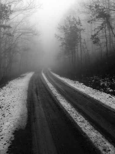
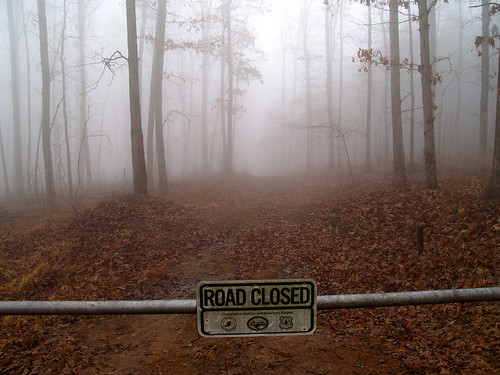
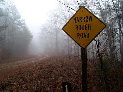
It was raining steadily on the drive up Hwy. 7, and the mountains up there were covered in fog. I stopped at an overlook, which was pointless since there was a thick fog everywhere. This was from the overlook parking lot:
Foggy crossing

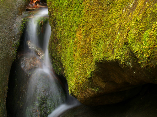
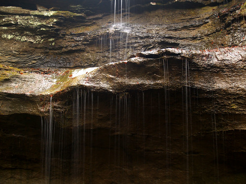
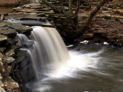
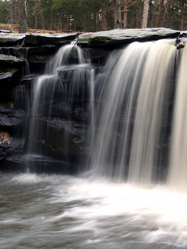
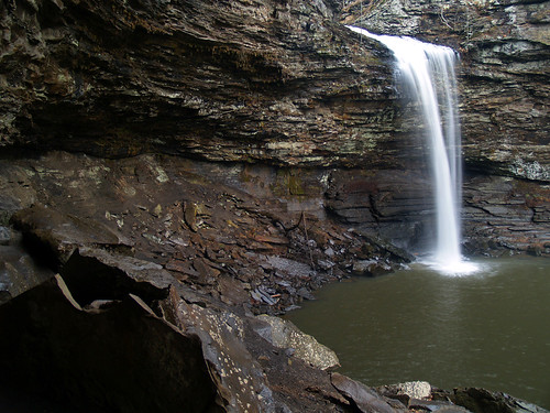
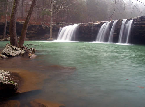
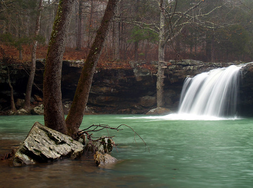
On the way to Richland Creek, the road runs by an awesome creek with some neat waterfalls on it. The creek is called Falling Water Creek, and the first really great waterfall is the aptly named Falling Water Falls.
Falling Water Falls

These falls are only about 12 feet tall, but look great.
Falling Water Falls

Another view of Falling Water Falls

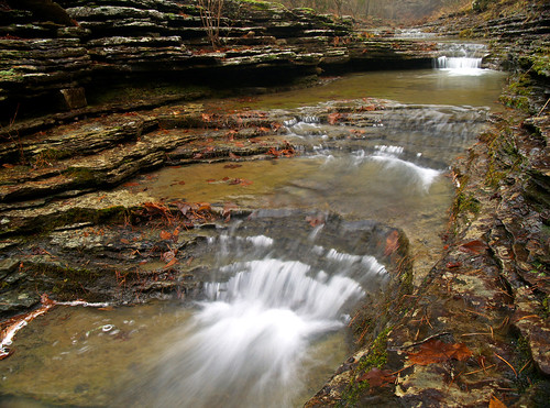
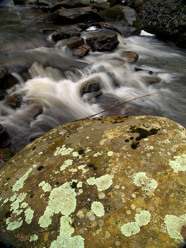
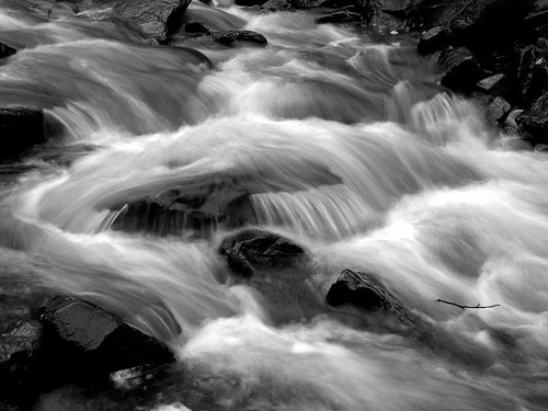
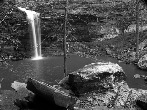
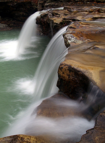
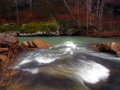
There are some great smaller waterfalls just down from the falls, so I slid around on the wet rocks and found this view:
Falling Water Falls

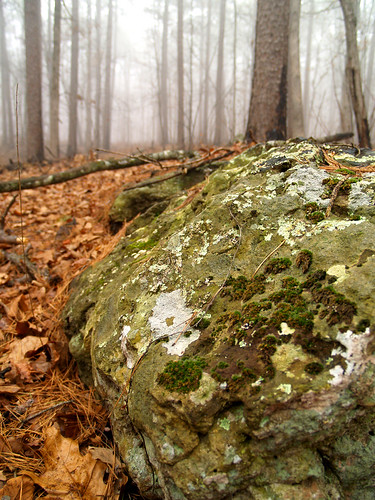
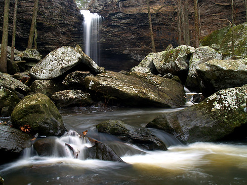
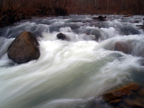
I got back in the car and headed up the road alongside Falling Water Creek. There were lots of huge rocks in the water, and lots of neat places to stop and take pictures.
Falling Water Creek

The water was high and looked cold. This did concern me, since one of the two creeks that I would have to cross to reach Twin Falls was of course, Falling Water Creek.
Falling Water Creek

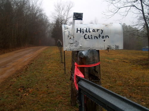
Driving on the road I came on this mailbox, with an interesting name written on it. I thought they lived in New York? Maybe this would be site of some future Presidential library?
Arkie White House

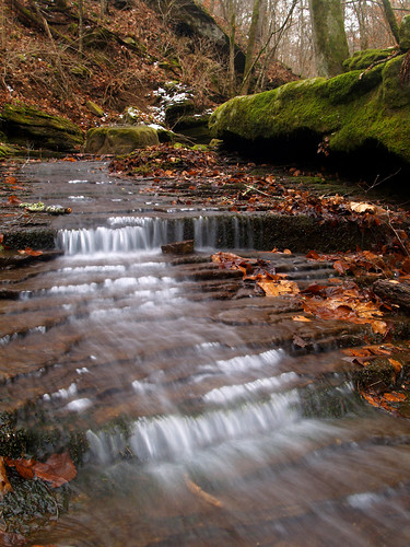
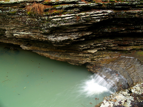
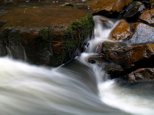
Falling Water Creek has all sorts of neat waterfalls on it. This one was very small but stretched across the entire width of the creek:
Falling Water Creek

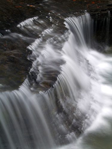
Up the road from there is another neat waterfall, called Six Finger Falls. It's called that because the water slices through the rock in six channels, which look like a hand with six fingers. I was really only able to get a view with just three of the fingers. If I waded across the creek in some fairly shallow water I could have gotten a better view. At the time I hesitated, which now seems silly since I'd end crossing this same creek in deeper water later on.
Six Finger Falls

There are also two other waterfalls that are located near these falls, Keefe Falls and the oddly named Fuzzybutt Falls. To reach Fuzzybutt Falls would require crossing the creek, and Keefe Falls had a mile hike to reach it, so I continued on towards my ultimate goal, Twin Falls. There is a primitive trail that actually runs to Twin Falls - primitive meaning that it isn't maintained or blazed. The trail starts out at the campground, which is situated right above the creek.
Richland Creek

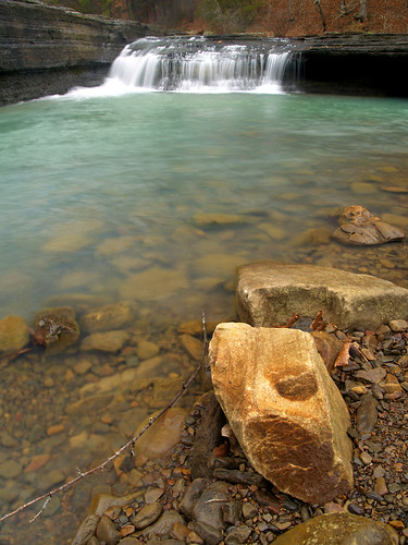
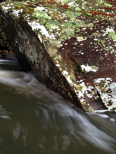
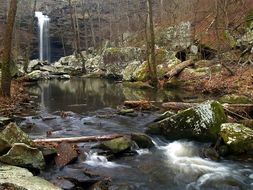
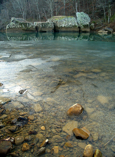
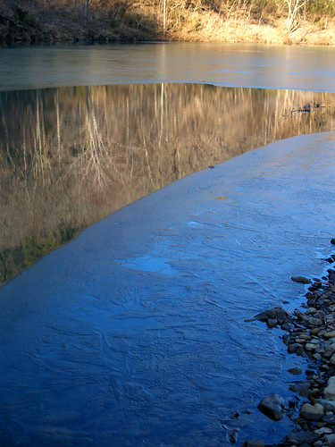
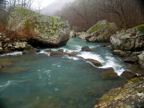
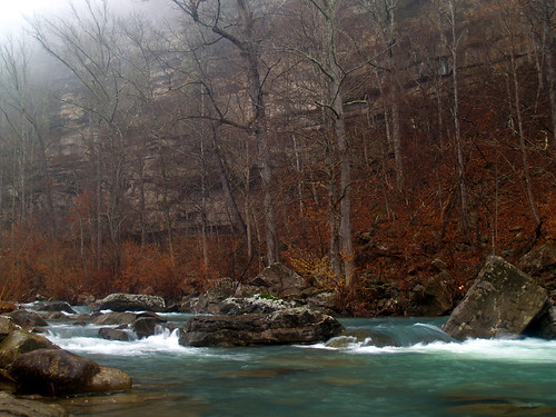
The first creek crossing is just as you start out on the primitive trail. I hiked up to it to try and judge how deep the water is. It looked deep, maybe too deep to cross. I took this shot just downstream from the crossing, and is where Falling Water Creek flows into Richland Creek. The area where you have to cross was luckily much calmer and not as rocky as this area was.
Meeting of the Waters

Not sure if I could cross the creek or not, I went back to my car to consider my options. The other route to the falls would be a longer hike, and I wouldn't have enough time to hike that before it got dark. There were a few other waterfalls that I could try to reach, however. What to do!? I noticed a group of hikers setting up in the parking lot, shouldering big packs. They looked like they were going to attempt the hike. So I approached them and asked if they were going to the falls. Sort of, they said. They were going camping near Twin Falls. I asked if they thought it would be ok to cross the creek. Sure! It'd be deeper than normal, and cold, but still passable. They offered to let me tag along with them if I wanted. So throwing out all common sense, I agreed to follow them on the trail.

The first task was to cross the creek. I did come prepared for this. I wore those pants with the removable legs that turn into shorts. I also brought along some flipflops and a towel. My thinking was that I could cross the creek in shorts and flipflops, then dry off and change back into the shoes. I started my crossing, the water was up above my knees, so it ended up getting the pants wet. Then I managed to drop one of the pant legs in the creek as I crossed, so they got wet as well. All that didn't matter much since it started pouring down rain, so I ended up getting soaked anyways.

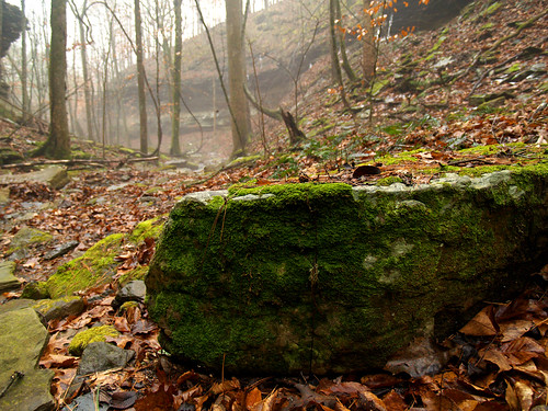
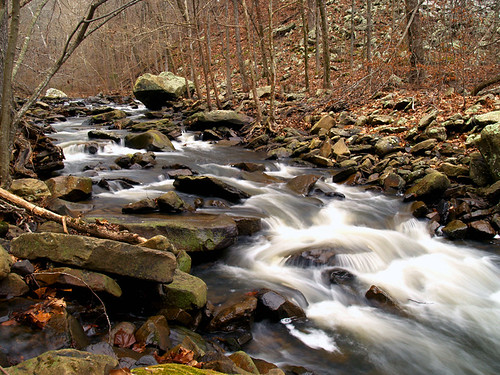
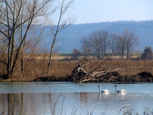
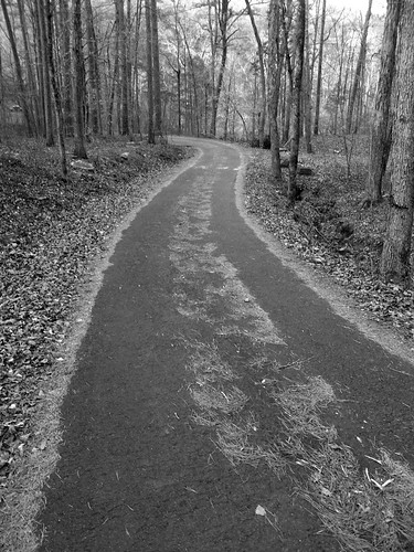
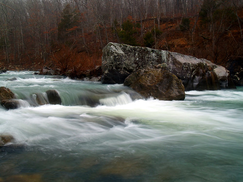
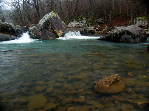
The primitive trail first starts out heading up a hill, then running alongside the creek. The trail would fade out every once in awhile, so I was happy to have people in front of me who knew where they were going. It really is a beautiful area. Richland Creek is very pretty, with some huge boulders and little waterfalls along its run.
Richland Creek

Rainy Richland Creek

It was slow going on the trail. Mostly because I would stop to take pictures. It was hard to resist it, there seemed to be something awesome on every turn. But it was taking longer than I anticipated, and it was still pouring down rain. I began worrying that I might run out of daylight out there.
Richland Creek

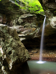
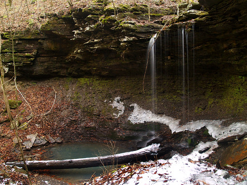
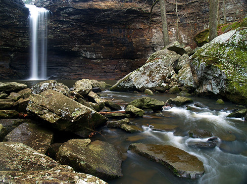
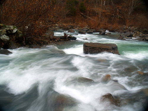
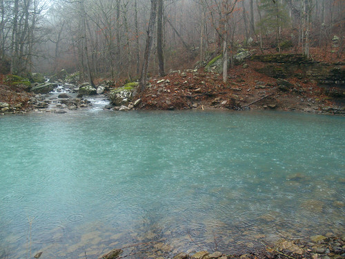
After about two hours of hiking we finally made it to the second creek crossing. The water looked deep - it was deeper than the crossing on Falling Water Creek. One of the hikers told me that last time they crossed the creek there, the water was waist deep. But now the water looked at least a foot deeper. He said the place he began to cross then was now well under water. Here is the place where you should cross. Twin Falls forms the creek that empties into Richland Creek here:
Faraway (so close!)

Well crap. So not really wanting to swim across the creek with my camera, I turned back. I was a bit upset since I was so close to Twin Falls but couldn't quite reach it. The falls are only a half mile from there. There is another neat waterfall nearby, Richland Falls, that I could hike to but decided at the time that it wasn't worth it. It was raining hard, with lighting and thunder popping up every once in awhile. I didn't want to leave too late and get stuck on the trail when it got dark. Also it was raining so hard I didn't want to try to cross Falling Water Creek in the higher water. Now I regret not going to see Richland Falls, which would have looked awesome in that high water. Oh well.

So I headed back on the trail. It was slick going, with deep mud on the trail. I ended up slipping and falling a few times. One of the falls I dropped my tripod, breaking it. A little bit later I slipped again and broke off another part of the tripod. I was pissed that my tripod was now just a fancy walking stick.

I made it back to the crossing of Falling Water Creek. Still mad that I broke my tripod and tired of hiking in the rain, I didn't bother changing out of my shoes and ended fording the creek without changing anything. The water seemed a bit deeper than before, though it could have been my imagination. It was still very cold, but not a bad crossing. It would have been much more uncomfortable had the water been a few inches higher (you know what I'm talking about, lads).

Luckily the creek crossing wasn't that far from where I parked my car, so I didn't have to walk far in my soaked shoes. I was counting on some extra clothes that have accumulated amongst the random junk in my car to change into out of my wet clothes. I found a few shirts, but realized the flaw in my plan. I didn't have any spare pants. It was time to make do without....

So I changed and then made the drive home wearing a fleece pullover, flipflops and boxer shorts (sexy!). I'm happy I didn't have a flat tire or get pulled over. "No officer, I haven't been drinking. Wacky story, actually...."

Rain and cloudy weather are the best times to get waterfall pictures, but I guess only when you can actually make it to see the waterfalls. I just had the joy of hiking when nature decided to dump buckets of rain. There is a website that monitors rainfall and water levels in and around the Buffalo National River. I looked at it the day after my hike and saw that the Buffalo rose nearly 10 feet from all that rain.
Photobucket

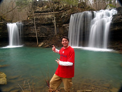
So after getting so close and turning back, I became a man on a mission. I would try my hardest to get back out there and actually make it to those damn falls. I bought a new tripod, and set out last weekend for one more attempt. I choose this time to try the longer route to the falls, the one that didn't require a creek crossing to reach it. Will your brave and heroic narrator make it there?


OK, spoiler alert: I made it:
Success!

Friday, February 15, 2008

Into the Wild (sort of) in the Ozark National Forest....

The other day I finished reading the book, Into the Wild. The book centers around the true story of Chris McCandless, who gave all of his savings to charity, burned the rest of his money, abandoned his car and most of his possessions, hitchhiked across the country, and eventually walked alone into the Alaskan wilderness. He fancied himself as an outdoorsman, and thought he could handle everything, but the story didn't have a happy ending. The book follows his life as he traveled across the country, and the last few months of his life while he wasted away in an abandoned bus in the middle of nowhere.

Whether or not you agree with what he did, it is a haunting book. I can understand why he did what he did, but don't think I'd ever do anything similar to that. I'm too big of a fan of air conditioning (and eating), to make any foolhardy trips into the wilderness by myself. Plus, I'm a wuss and probably wouldn't last a day.

In one chapter of the book, it gives the stories of other people who went alone into the woods, with the same dire results. One story hit a little close to home. It's the story of Carl McCunn, an amateur photographer who set out alone to a remote lake in Alaska. He chartered a plane to deliver him, along with 500 rolls of film, a few guns and 1400 pounds of provisions. His mistake was that he forgot to charter a plane to come pick him up when his expedition was over.

For months he lived out in the woods, and when it came time to go home he sat and waited and waited. When his food was nearly gone, he thought he was saved when a small plane saw his camp and buzzed overhead. He rushed out to get the pilots attention, waving an orange sleeping bag in the air. The pilot couldn't land there, but McCunn thought that help would soon be on its way. After no plane came, McCunn saw on the back of his hunting license that the signal he gave was incorrect. He waved one fist in the air, which is actually the signal that everything is ok. The correct signal for SOS/distress is to wave both arms in the air (remember that, just in case). Sadly, it was another story without a happy ending.

So why bring up all this morbid and depressing talk? Well, the book is pretty good. Plus the other weekend (before I read the book), I sat out hiking alone in the woods. Luckily, Arkansas is a bit different than Alaska. The place I was going at wasn't that remote, though it was deserted since I decided to do my hiking on Superbowl Sunday.

My plan was to hit up Haw Creek Falls. It's a small waterfall, only about six feet tall. But it is located in a beautiful area, with several other neat little waterfalls nearby. Haw Creek Falls aren't that far from Clarksville, and I used to visit the falls often when I went to college there. Of course, I never knew about any of the other waterfalls around there. So now that I do I have been trying to get back up there and explore it a bit more. Last year I went to one of the best waterfalls in the state, located just up the road from Haw Creek Falls that I had never known about before. The falls are Pam's Grotto Falls, and are awesome:
Pam's Grotto Falls

So my plan was to hike around a few waterfalls, and leave with enough time to make it to a Superbowl Party later on. The plan mostly worked, I just missed the first quarter. No big deal, I wasn't too interested in the game anyways (it's not a FC Dallas game, who cares?).

So after waking up way too early for a weekend, I drove up the freeway and made it to Haw Creek Falls. I was a bit sad to see that the falls were running low, but they are scenic even without much water.
Haw Creek Falls

There wasn't much water, but there was some snow still on the ground. It had snowed in that area a few days before and I was really surprised that there was still some on the ground. It wasn't enough to build a snowman, but it was a nice sight anyways.

Here's another view of the falls, taken as it started to lightly rain:
Haw Creek Falls

One of the waterfalls I was hunting is just a short hike from the falls. It only requires finding a small creek that runs into Haw Creek, and following it upstream. The creek itself was quite scenic, flowing in cascades over moss-covered rocks.
On the way to Pack Rat Falls

This is a small cascade along the creek. Right below here the creek emptied in a large pool, guarded by a overhanging rock (the pictures didn't turn out). But there is a little bit of snow up at the top of the shot...
Cascade by Pack Rat Falls

After hiking about .25 of a mile up the creek, I finally found the waterfall. It's called Pack Rat Falls, and is about 25 feet tall.
Pack Rat Falls

I made my way back down the creek and to the car, and headed off to a few more waterfalls. These falls are on the Ozark Highlands Trail, and the best way to reach them is just under 10 miles from the Haw Creek Falls campground. It had stopped raining, but as the road curved around on the hills, it entered some really thick fog. I had to head down a bumpy and muddy dirt road, which was just cased in with fog.
In the middle of nowhere

Damn, I am so happy I didn't get a flat tire or lock my keys in the car out there!
Happy I didn't lock my keys in the car

Road Closed

After driving for about 4 miles I finally found the trail. It was still incredibly foggy, and a bit eerie. To add to it, the Forest Service did a controlled burn of this forest last year and most of the trees still looked burned. The burned and foggy forest was just a creepy combination.
Along the Ozark Highlands Trail

The forest seemed to be recovering ok after the burning. This stuff (whatever it is) was growing on a few downed trees along the trail:
Fun guys

The trail runs downhill, and after about a mile heads into a valley alongside Cedar Creek. The creek runs into a neat little area, where it cascades down into a large emerald pool:
Cedar Creek

Cedar Creek

If there was one part of the trail where I'd be likely to fall and hurt myself, it'd be there. There was thin layer of ice on the rock where I stood to take the above pictures. I tried to find a way down to get a different view of the waterfall, but the rock stood about ten feet above the creek. I looked but really couldn't find a good way to get down there. It would probably involve hiking farther down the creek and backtracking up there. I'll save that trip for some other time.

But the trail continued on down the creek, actually crossing it after about a half mile. The Ozarks Highland Trail continued on, but I went into a neat little valley that is home to two waterfalls. They are called Hobo Falls, because there had been old hobo camps found there before. I thought that was a bit odd, why would hobos want to go all the way out here in the middle of the woods? Unless they were following the same ideals that led people out in the middle of Alaska? Who knows, and I have no real clue. But of course all I know about hobos is the cartoon version of old guys with all their stuff bundled in a handkerchief on a stick, who ride the rails everywhere...

There were no hobos out that day, and not much water in the waterfalls. It's hard to tell here, but these falls are actually 23 feet tall.
Hobo Falls East

I can understand why people would want to camp out there, it was an amazing little area:
No hobos here

You can't see either of the Hobo Falls in this shot. The one pictured above is off to the right, and the other falls are ahead and around the bend.

Here is a shot of the western Hobo Falls, which are 27 feet tall and would look much better with more water...
Hobo Falls West

Here is another shot of the little valley, which was just filled with mossy rocks.
More moss

After that it was time to head on home. The trail to the falls is ranked as a medium difficulty, all because the return hike from the creek is all uphill. After having to take a few stops to catch my breath, I finally made it back up to my car. The road was still covered by a dense fog, and I was happy that I wasn't trying to drive back in the dark.

I drove by this sign on the way in and stopped to get a shot of it as I was leaving. Luckily I didn't have to drive down there, I don't think my Hyundai could handle it.
Narrow Rough Road

Luckily for the Hyundai's sake we made it to paved road and were on the way home. I managed to survive my trek into the wild, yay! But as I write this I am planning on taking another trip tomorrow. The weather guys say it will be rainy - perfect waterfall weather. Wish me luck...

Thursday, February 7, 2008

Swans and armadillos, dodging falling icicles and another trip to Petit Jean...

Winter really isn't the time when most people decide to go out into the woods, with it being cold and all. But it does have some benefits. There aren't usually many other people out, there might be some water in the waterfalls, no bugs and no snakes. When the weather was just right - cloudy - it was time to head out into the woods, along with a camera...

One weekend in January I took a trip up to Petit Jean Mountain with Will and Jenny, with the plan of hiking down to Cedar Falls. It had rained not too long before then, and there was a lot of standing water in the fields on the way up there. A good sign since that meant the ground is saturated and that all that rain water should be flowing through Cedar Creek.

On the way to the trailhead to Cedar Falls, we stopped at this one waterfall that is on the dam that makes Lake Bailey. There was a decent amount of water flowing through:
Out on a limb

Lake Bailey falls

Petit Jean Mountain is a great place. It's very scenic and located just about an hour or so from Little Rock. Because of that it's also very popular, I've been there dozens of times and have taken tons of pictures of the waterfalls there. So it's a bit of challenge to find a new way to get a shot that hasn't been done before.
Petit Jean zoomed in

I crawled up on the rocks on the side of the waterfall and found this leaf barely hanging onto the edge of the falls. This was a bit dicey since the rocks were super-slippery (no surprise there, since they're right next to a waterfall). It was an effort to keep from slipping and taking an accidental dive. The leaf would have enjoyed watching that, no doubt.
Hanging On

These falls are right next to a bridge built by the Civilian Conservation Corps in 1934. It was recently rennovated (when I came through Petit Jean last year the bridge was closed). But according to the park it is one of only eight masonry arches in the state, and the only one to feature finished rather than rustic stone (whatever that means).
Davies Bridge

This might look somewhat familiar since the state uses a similar picture to promote the state parks. The view of the falls from under the arch is a popular composition for photographers. In the past I've been a bit reluctant to try to get a shot like this, figuring that it had "been done." But I kinda like how it turned out, guess it works to follow in other's footsteps...

We finally went to the trail to Cedar Falls, following the switchbacks downhill. The trail eventually crosses Cedar Creek and the trail runs alongside the creek. I was happy to see that the water was running, it can be sad to hike down there and see that the falls are just a trickle of water running down.
Cedar Creek

Cedar Creek

Cedar Creek

I'm a bit addicted to taking pictures of waterfalls, so please bear with me. I like Cedar Creek because not only does the water run and dip over rocks, but there are also great collections of moss and lichen growing everywhere.
Cedar Creek

I tried to stop at every neat spot along the creek, probably annoying Will and Jenny along the way.
Cedar Creek

And then we finally made it to Cedar Falls. It wasn't very crowded at the base of the falls, but there was a family set up on some rocks just to the side of this shot. The rocks were really slick here - no surprise, duh, they're next to a creek. So I slipped and scrambled out to get this shot. After waiting for a family to finish taking pictures and get out of the way, I got this view:
Cedar Falls

There is a path that leads up along the side of the bluff, which people use to walk up to the falls. I went up there a bit trying to get a different view of the falls:
Cedar Falls

Cedar Falls

There is one view of the falls that I like to go back to every time I hike the trail. A rock sits out in the creek, which provides a perfect place for someone to set up a tripod to get a shot of the waterfall in the background with a little waterfall in the foreground. The rock even works as a chair, so you can lean back and relax while taking pictures. The rock was wet and kinda yucky that day so it was hard to take that much of a break on it...
Cedar Falls

While I was taking that shot, Jenny moved on down the trail and found a large rock to climb up, which provided an awesome view of the falls. I copied her and made my way up there too, stealing her idea (sorry!).
Cedar Falls

Then we headed back, going on the only bad part of Petit Jean: the return hike from Cedar Falls. The trail heads steeply up the hill, reminding you of just how out of shape you are. On the way back we did stop at the overlook by Petit Jean's grave, where there the sun was breaking through the clouds. It formed some great Jacob's ladders (which I learned last year is what those are called, I just thought it was a movie). The pictures I took of it didn't turn out, but we stuck around there waiting to see if there would be a neat sunset. There wasn't, the sun dipped behind the clouds and it just ended up getting dark so we headed on home...

Then a few weeks ago we headed back out to take more pictures. The destination that Saturday was Holla Bend National Wildlife Refuge, which is the new home to some trumpeter swans.
Trumpeter Swans

According to the news:
Thirteen more young trumpeter swans were released Thursday at Holla Bend National Wildlife Refuge along the Arkansas River, a few miles downstream from Dardanelle. The hope is these young swans will return to Holla Bend next winter and, within a few years, bring their families. They were released on an oxbow lake off the river, near the refuge's observation tower.

Biologists from the Iowa Department of Natural Resources, National Park Service, the U.S. Fish and Wildlife Service and the Arkansas Game and Fish Commission were on hand when the big birds from Iowa were released. Trumpeters may weigh up to 35 pounds and have 8-foot wingspans.

The process behind the release is called "reverse migration imprinting." The idea is to bring south young birds that never have migrated and let them use their instincts to return to Iowa.

"The DNR has been releasing captive produced young swans on state wetlands since 1995," said Ron Andrews, wildlife biologist with the Iowa DNR. "The goal of these efforts has been to reestablish a wild, free flying population of trumpeter swans to Iowa. So far, the program has been successful to the point that we were able to inventory 30 successful nesting pairs in Iowa during 2007."

Andrews said that Iowa's trumpeter swan population is nearing a "threshold level" and will soon achieve self-sustaining numbers. In the meantime, biologists continue to bolster the flock with annual releases of more captive produced birds. Scientists have noted, however, that young swans raised by wild, free-flying parents are enjoying a much higher survival than birds released from captivity.

"Trumpeter swans are extremely hardy birds and don't normally head south until really severe weather sets in," said Andrews. "Birds produced in the wild have the benefit of parental supervision. Families stick together through the winter and the adults lead the way south. By contrast, captive-reared youngsters are out there on their own. When wetlands begin to freeze tight, they're forced to sort things out on their own. Without knowing where to go, many of those birds end up in trouble."

"These young-of-the-year birds have been brought south, and we'll see if they can get back," said Karen Rowe, AGFC nongame migratory bird program coordinator. "We are using places that are not hunted, yet waterfowl-friendly."

During the next three years, Andrews said, the Iowa DNR hopes to send more than 100 young swans to Arkansas wetlands. The cygnets are marked with green neck collars with white numbers that will help biologists keep tabs on the swans as they travel the flyways.


There were also swans released at Magness Lake (by Heber Springs) and at Boxley Valley in the Buffalo National River. There are already swans at both of those places, I got this shot of the swans at Boxley last year:
Boxley Valley

The swans at Holla Bend were a bit camera shy. They stayed a bit far out in the water so it was hard to get a really good view of them. But Holla Bend is also home to over 230 other species of birds, many of which spend their winter at the refuge. There are usually even some bald eagles there this time of year. We didn't see any eagles, but did see about 7 or 8 armadillos running around.
Holla Back Girl

I must be a city kid since I thought it was awesome to see one of these guys up close. This was taken looking through the window of my car, so they weren't too concerned with having humans around.

From Holla Bend it seemed like a good idea to try to get to one more place before it got too dark. The Longpool camping area isn't that far away, just a bit of a drive up Hwy. 7. Longpool is a camping area on Big Piney Creek, but it has a short trail that leads to the 45 foot-tall Longpool Falls.

It had been cold the past few days, and there was a layer of ice on Big Piney Creek:
Ice on Big Piney

Big Piney Ice

It was above freezing that day, and sunny, so the ice was melting. There were huge icicles on the hill opposite the shoreline and they were loudly crashing down. But if there were icicles on the hill, it would probably mean that there would be ice around the waterfall as well. Yay!

So we set out on the trail to the waterfall, with me accidentally taking the more "scenic" route which involved a narrow trail that clings onto a hillside, while Big Piney Creek sits below. The main trail is actually not as steep and safer, but hey, the views aren't as nice...

Before you get to the falls there is another small waterfall, which was completely covered in ice.
Icy waterfalls

Along the Longpool trail

Long(ice)pool

The bluff was covered in ice, with huge icicles hanging down...
More ice...

Icicles

The trail to Longpool Falls just sort of ends around here, the rest of the way is a scramble to the waterfall. It's a bit tricky going through there since there isn't a set path, sending you over rocks that tend to be slick and pointy. The added bonus this day was that most of the rocks were also covered in ice....

Now there might be a perfectly easy way to get there, but I didn't see it. I ended up following the creek and went under these two huge downed trees, then scrambled onwards. I'm extra careful around here because last time I went to Longpool I slipped on some rocks and landed painfully on my back (the camera was ok). I got a nasty cut on my elbow, and still have the scar...
Choose your path...

Finally slid around and made it up to the falls. There was this one tree that got hit by water falling from the bluff, forming these cool icicles (or treecicles):
Treecicles

And finally Longpool Falls:
Longpool Falls

Since the ice was melting, the icicles would break off and crash down with a scary thud. I tried my best to not stand directly under one, just in case. The waterfall wasn't running much, just really a trickle coming down. But the ice was a nice touch anyways.
Longpool Falls

Since it was starting to get late we decided to head on home. On the way back I got this shot of the road through the Longpool campground:
The Long(pool) and Winding Road

That was pretty much it for that trip. Although it would have been great to see more water in the falls, all that ice was great. I ended up going out the weekend after, and found a few more waterfalls and even some snow. More about that later....